National Register of Historic Places listings in Taunton, Massachusetts
List of Registered Historic Places in Taunton, Massachusetts, which has been transferred from and is an integral part of National Register of Historic Places listings in Bristol County, Massachusetts
|
Barnstable | Berkshire | Bristol | Dukes | Essex | Franklin | Hampden | Hampshire | Middlesex | Nantucket | Norfolk | Plymouth | Suffolk | Worcester |
This National Park Service list is complete through NPS recent listings posted October 20, 2023.[1]
| [2] | Name on the Register[3] | Image | Date listed[4] | Location | City or town | Description |
|---|---|---|---|---|---|---|
| 1 | Charles R. Atwood House | 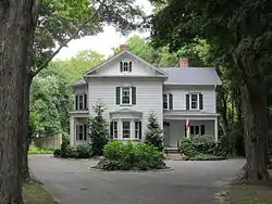 Charles R. Atwood House |
July 5, 1984 (#84002087) |
30 Dean St. 41°54′14″N 71°04′59″W |
Taunton | Occupied. |
| 2 | Barnum School | 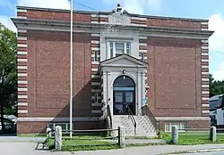 Barnum School |
July 5, 1984 (#84002088) |
25 Barnum St. 41°53′40″N 71°05′45″W |
Taunton | Occupied. |
| 3 | J.C. Bartlett House | 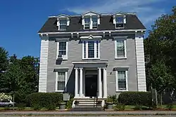 J.C. Bartlett House |
July 5, 1984 (#84002089) |
12 Walnut St. 41°53′47″N 71°05′50″W |
Taunton | Occupied. |
| 4 | C.J.H. Bassett House | 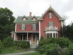 C.J.H. Bassett House |
July 5, 1984 (#84002091) |
20 Chestnut St. 41°54′12″N 71°05′25″W |
Taunton | Occupied. |
| 5 | W.C. Beattie House | 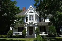 W.C. Beattie House |
July 5, 1984 (#84002092) |
289 W. Brittania St. 41°55′07″N 71°06′24″W |
Taunton | Occupied. |
| 6 | Bristol County Courthouse Complex |  Bristol County Courthouse Complex |
March 28, 1978 (#78000427) |
9, 11, 15 Court St. 41°54′09″N 71°05′42″W |
Taunton | |
| 7 | Brow's Tavern | 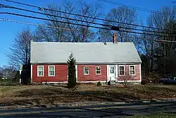 Brow's Tavern |
July 5, 1984 (#84002094) |
211 Tremont St. 41°54′42″N 71°07′29″W |
Taunton | Occupied. |
| 8 | Henry G. Brownell House | 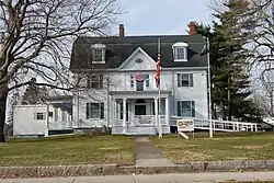 Henry G. Brownell House |
July 5, 1984 (#84002095) |
119 High St. 41°53′58″N 71°05′49″W |
Taunton | Demolished in March 2014 |
| 9 | Buildings at 80 and 88 W. Brittania St. |  Buildings at 80 and 88 W. Brittania St. |
July 5, 1984 (#84002097) |
68 and 80 88 W. Brittania St. 41°54′48″N 71°06′07″W |
Taunton | Occupied. |
| 10 | George Capron House | 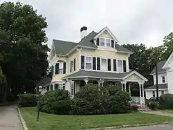 George Capron House |
July 5, 1984 (#84002099) |
6 N. Pleasant St. 41°54′24″N 71°05′52″W |
Taunton | Occupied. |
| 11 | Central Fire Station | 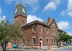 Central Fire Station |
July 5, 1984 (#84002101) |
Leonard and School Sts. 41°54′14″N 71°05′32″W |
Taunton | 3rd oldest occupied fire station in the nation. |
| 12 | Church Green | 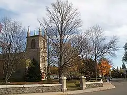 Church Green |
December 16, 1977 (#77000168) |
U.S. 44 and MA 140 41°54′05″N 71°05′17″W |
Taunton | |
| 13 | Cohannet Mill No. 3 | 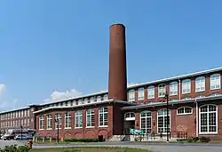 Cohannet Mill No. 3 |
November 29, 2006 (#06001088) |
120 Ingell St. 41°53′14″N 71°05′13″W |
Taunton | Restored as Robertson on the River Apartments. |
| 14 | Samuel Colby House | 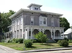 Samuel Colby House |
July 5, 1984 (#84002103) |
74 Winthrop St. 41°53′50″N 71°05′55″W |
Taunton | |
| 15 | Abiezar Dean House | 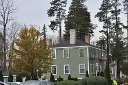 Abiezar Dean House |
July 5, 1984 (#84002104) |
57 Summer St. 41°54′00″N 71°05′17″W |
Taunton | |
| 16 | George Dean House | 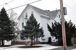 George Dean House |
July 5, 1984 (#84002105) |
135 Winthrop St. 41°53′42″N 71°06′16″W |
Taunton | |
| 17 | Jonathan Dean House | 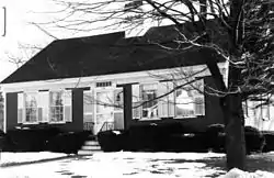 Jonathan Dean House |
July 5, 1984 (#84002106) |
175 Dean St. 41°54′23″N 71°04′04″W |
Taunton | Demolished in mid-1990s. |
| 18 | Lloyd Dean House | 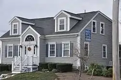 Lloyd Dean House |
July 5, 1984 (#84002107) |
164 Dean St. 41°54′22″N 71°04′09″W |
Taunton | |
| 19 | Theodore Dean House | 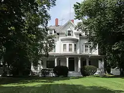 Theodore Dean House |
July 5, 1984 (#84002108) |
26 Dean St. 41°54′13″N 71°05′02″W |
Taunton | |
| 20 | Dean-Barstow House | 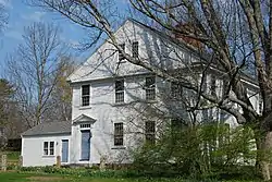 Dean-Barstow House |
July 5, 1984 (#84002109) |
275 Williams St. 41°52′58″N 71°02′58″W |
Taunton | |
| 21 | Dean-Hartshorn House | 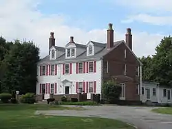 Dean-Hartshorn House |
July 5, 1984 (#84002111) |
68 Dean St. 41°54′14″N 71°04′52″W |
Taunton | |
| 22 | East Taunton Fire Station | 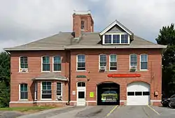 East Taunton Fire Station |
July 5, 1984 (#84002112) |
Middleboro Ave. 41°52′56″N 71°02′01″W |
Taunton | |
| 23 | Eldridge House | 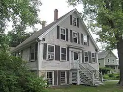 Eldridge House |
July 5, 1984 (#84002114) |
172 County St. 41°53′45″N 71°04′38″W |
Taunton | |
| 24 | Fairbanks-Williams House | 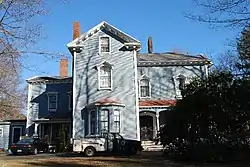 Fairbanks-Williams House |
July 5, 1984 (#84002116) |
19 Elm St. 41°54′13″N 71°05′10″W |
Taunton | |
| 25 | Albert Field Tack Company | 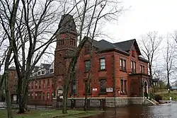 Albert Field Tack Company |
July 5, 1984 (#84002117) |
19 Spring St. 41°53′57″N 71°05′29″W |
Taunton | |
| 26 | Fuller-Dauphin Estate | 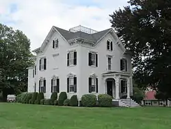 Fuller-Dauphin Estate |
July 5, 1984 (#84002118) |
145 School St. 41°54′33″N 71°05′22″W |
Taunton | |
| 27 | Gen. George Godfrey House | 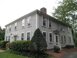 Gen. George Godfrey House |
July 5, 1984 (#84002119) |
125 County St. 41°53′46″N 71°04′43″W |
Taunton | |
| 28 | Richard Godfrey House | 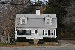 Richard Godfrey House |
July 5, 1984 (#84002121) |
62 County St. 41°53′49″N 71°04′51″W |
Taunton | |
| 29 | Harris Street Bridge | 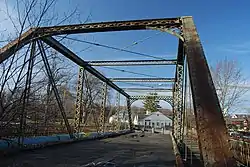 Harris Street Bridge |
July 5, 1984 (#84002123) |
Spans Taunton River at Dean and Harris Sts. 41°54′20″N 71°04′12″W |
Taunton | |
| 30 | Sarah A. Haskins House |  Sarah A. Haskins House |
July 5, 1984 (#84002124) |
18 Harrison St. 41°53′49″N 71°05′38″W |
Taunton | |
| 31 | Higgins-Hodgeman House |  Higgins-Hodgeman House |
July 5, 1984 (#84002128) |
19 Cedar St. 41°54′15″N 71°05′25″W |
Taunton | |
| 32 | Hodges House |  Hodges House |
July 5, 1984 (#84002130) |
41 Worcester St. 41°55′10″N 71°09′01″W |
Taunton | |
| 33 | Hopewell Mills District |  Hopewell Mills District |
July 5, 1984 (#84002133) |
Bay St. and Albro Ave. 41°54′57″N 71°05′42″W |
Taunton | |
| 34 | Hopewell School | 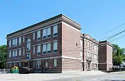 Hopewell School |
July 5, 1984 (#84003859) |
Monroe St. 41°55′11″N 71°05′40″W |
Taunton | |
| 35 | Kilmer Street Fire Station | 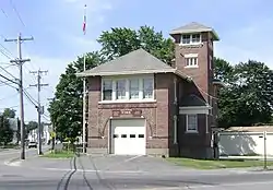 Kilmer Street Fire Station |
July 5, 1984 (#84002138) |
Oak and Kilmer Sts. 41°53′58″N 71°06′25″W |
Taunton | |
| 36 | King Airfield Hangar | 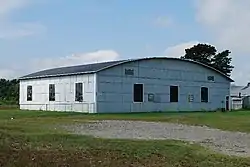 King Airfield Hangar |
July 5, 1984 (#84002141) |
Middleboro Ave. 41°52′51″N 71°01′14″W |
Taunton | |
| 37 | Job Knapp House | 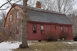 Job Knapp House |
July 5, 1984 (#84002150) |
81 Shores St. 41°54′07″N 71°06′49″W |
Taunton | |
| 38 | William Lawrence House | 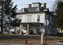 William Lawrence House |
July 10, 1985 (#85001531) |
101 Somerset Ave. 41°53′36″N 71°05′36″W |
Taunton | |
| 39 | Leonard School | 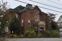 Leonard School |
July 5, 1984 (#84002155) |
W. Brittania St. 41°55′03″N 71°06′32″W |
Taunton | |
| 40 | James Leonard House | 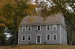 James Leonard House |
July 5, 1984 (#84002152) |
3 Warren St. 41°54′51″N 71°06′28″W |
Taunton | |
| 41 | Ambrose Lincoln Jr. House | 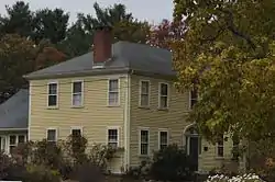 Ambrose Lincoln Jr. House |
July 5, 1984 (#84002157) |
1916 Bay St. 41°54′50″N 71°05′37″W |
Taunton | |
| 42 | Asa Lincoln House |  Asa Lincoln House |
July 5, 1984 (#84002159) |
171 Shores St. 41°54′03″N 71°07′29″W |
Taunton | |
| 43 | Gen. Thomas Lincoln House | 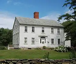 Gen. Thomas Lincoln House |
July 5, 1984 (#84002162) |
104 Field St. 41°57′24″N 71°05′56″W |
Taunton | |
| 44 | Lord-Baylies-Bennett House |  Lord-Baylies-Bennett House |
July 5, 1984 (#84002165) |
66 Winthrop St. 41°53′52″N 71°05′50″W |
Taunton | Commonly known as the Masonic Lodge |
| 45 | Lothrop Memorial Building-G.A.R. Hall |  Lothrop Memorial Building-G.A.R. Hall |
July 5, 1984 (#84002168) |
Washington and Governor Sts. 41°54′13″N 71°06′29″W |
Taunton | |
| 46 | H.B. Lothrop Store |  H.B. Lothrop Store |
July 5, 1984 (#84002166) |
210 Weir St. 41°53′46″N 71°06′14″W |
Taunton | |
| 47 | Calvin T. Macomber House |  Calvin T. Macomber House |
July 5, 1984 (#84002174) |
312 W. Brittania St. 41°55′06″N 71°06′25″W |
Taunton | |
| 48 | Theodore L. Marvel House |  Theodore L. Marvel House |
July 5, 1984 (#84002176) |
188 Berkley St. 41°52′46″N 71°05′23″W |
Taunton | |
| 49 | N. S. Mason House |  N. S. Mason House |
July 5, 1984 (#84002178) |
58 Tremont St. 41°54′18″N 71°06′24″W |
Taunton | |
| 50 | McKinstrey House | 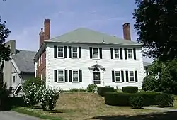 McKinstrey House |
July 5, 1984 (#84002181) |
115 High St. 41°53′58″N 71°05′50″W |
Taunton | |
| 51 | Morse House | 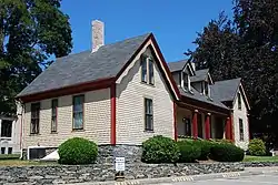 Morse House |
July 5, 1984 (#84002185) |
6 Pleasant St. 41°54′14″N 71°05′41″W |
Taunton | |
| 52 | Henry Morse House | 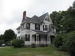 Henry Morse House |
July 5, 1984 (#84002183) |
32 Cedar St. 41°54′13″N 71°05′26″W |
Taunton | |
| 53 | Mount Pleasant Cemetery | 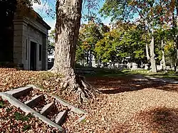 Mount Pleasant Cemetery |
December 5, 2002 (#02001474) |
Crocker, Cohannet, and Barnum Sts. 41°53′42″N 71°05′59″W |
Taunton | |
| 54 | Neck of Land Cemetery | 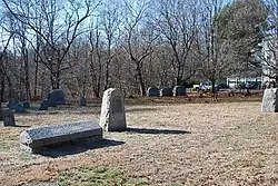 Neck of Land Cemetery |
July 10, 1985 (#85001530) |
Summer St. 41°53′52″N 71°05′09″W |
Taunton | |
| 55 | North Taunton Baptist Church | 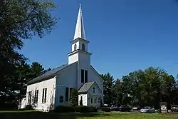 North Taunton Baptist Church |
July 5, 1984 (#84002188) |
1940 Bay St. 41°54′52″N 71°05′41″W |
Taunton | |
| 56 | Old Colony Iron Works-Nemasket Mills Complex | 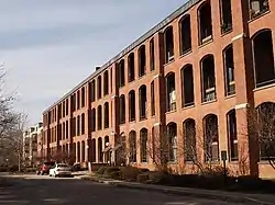 Old Colony Iron Works-Nemasket Mills Complex |
July 5, 1984 (#84002190) |
Old Colony Ave. 41°53′09″N 71°01′38″W |
Taunton | |
| 57 | Old Colony Railroad Station | 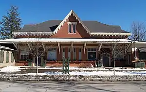 Old Colony Railroad Station |
July 5, 1984 (#84002192) |
40 Dean St. 41°54′16″N 71°04′56″W |
Taunton | |
| 58 | Old Weir Stove Company | 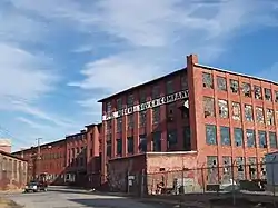 Old Weir Stove Company |
July 5, 1984 (#84002194) |
W. Water St. 41°52′57″N 71°05′34″W |
Taunton | |
| 59 | Alfred Paull House | 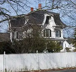 Alfred Paull House |
July 5, 1984 (#84002196) |
467 Weir St. 41°53′20″N 71°05′26″W |
Taunton | |
| 60 | Pilgrim Congregational Church | 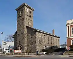 Pilgrim Congregational Church |
July 5, 1984 (#84002199) |
45 Broadway 41°54′14″N 71°05′39″W |
Taunton | |
| 61 | Reed and Barton Complex |  Reed and Barton Complex |
July 5, 1984 (#84002207) |
W. Brittania and Danforth Sts. 41°55′05″N 71°06′06″W |
Taunton | |
| 62 | M.M. Rhodes and Sons Co. |  M.M. Rhodes and Sons Co. |
August 29, 2016 (#16000570) |
12 Porter St. 41°53′54″N 71°05′57″W |
Taunton | |
| 63 | St. Mary's Complex | 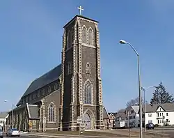 St. Mary's Complex |
July 5, 1984 (#84002211) |
Broadway and Washington St. 41°54′27″N 71°05′39″W |
Taunton | |
| 64 | St. Thomas Episcopal Church | 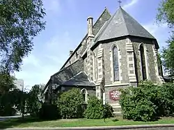 St. Thomas Episcopal Church |
July 5, 1984 (#84002213) |
115 High St. 41°53′50″N 71°05′27″W |
Taunton | |
| 65 | School Street School | 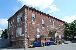 School Street School |
July 5, 1984 (#84002214) |
School and Fruit Sts. 41°54′12″N 71°06′03″W |
Taunton | |
| 66 | Sylvanus N. Staples House | 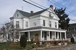 Sylvanus N. Staples House |
July 5, 1984 (#84002217) |
21 Second St. 41°53′11″N 71°05′37″W |
Taunton | |
| 67 | Stone House | 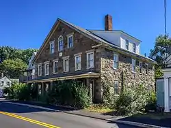 Stone House |
July 5, 1984 (#84002219) |
15-17 Plain St. 41°53′05″N 71°05′17″W |
Taunton | |
| 68 | Albert Sweet House | 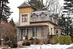 Albert Sweet House |
July 5, 1984 (#84002221) |
179 Highland St. 41°53′34″N 71°06′58″W |
Taunton | |
| 69 | Taunton Alms House | 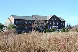 Taunton Alms House |
July 5, 1984 (#84002223) |
Norton Ave. 41°55′07″N 71°07′57″W |
Taunton | |
| 70 | Taunton Green Historic District | 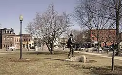 Taunton Green Historic District |
March 1, 1985 (#85000547) |
Broadway, Taunton Green, Main and Court Sts. 41°54′08″N 71°05′40″W |
Taunton | |
| 71 | Taunton Public Library | 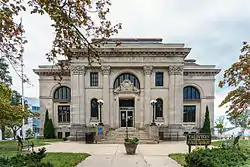 Taunton Public Library |
July 5, 1984 (#84002225) |
Pleasant St. 41°54′12″N 71°05′41″W |
Taunton | |
| 72 | Taunton State Hospital | 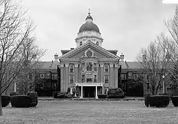 Taunton State Hospital |
January 21, 1994 (#93001484) |
W bank of the Mill R. at Danforth St. 41°54′42″N 71°06′06″W |
Taunton | Partially destroyed by fire |
| 73 | H.P. Thomas House | 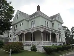 H.P. Thomas House |
July 5, 1984 (#84002228) |
322 Somerset Ave. 41°53′16″N 71°05′39″W |
Taunton | |
| 74 | Tisdale-Morse House |  Tisdale-Morse House |
July 5, 1984 (#84002231) |
17 Fayette Pl. 41°54′15″N 71°05′28″W |
Taunton | |
| 75 | Union Congregational Church | 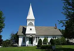 Union Congregational Church |
July 5, 1984 (#84002232) |
W. Brittania and Rockland Sts. 41°55′10″N 71°06′20″W |
Taunton | |
| 76 | Union Mission Chapel-Historical Hall | 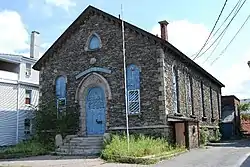 Union Mission Chapel-Historical Hall |
July 5, 1984 (#84002235) |
Cedar St. 41°54′13″N 71°05′30″W |
Taunton | |
| 77 | US Post Office-Taunton Main | 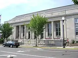 US Post Office-Taunton Main |
October 19, 1987 (#86003476) |
37 Taunton Green 41°54′06″N 71°05′41″W |
Taunton | |
| 78 | Capt. David Vickery House |  Capt. David Vickery House |
July 5, 1984 (#84002254) |
33 Plain St. 41°53′04″N 71°05′13″W |
Taunton | |
| 79 | Vickery-Baylies House | 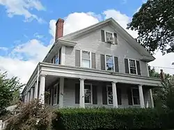 Vickery-Baylies House |
July 5, 1984 (#84002252) |
56 Summer St. 41°53′59″N 71°05′15″W |
Taunton | |
| 80 | Walker School | 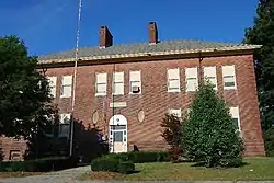 Walker School |
July 5, 1984 (#84002257) |
Berkley St. 41°52′56″N 71°03′11″W |
Taunton | |
| 81 | Peter Walker House | 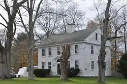 Peter Walker House |
July 5, 1984 (#84002256) |
1679 Somerset Ave. 41°51′26″N 71°06′55″W |
Taunton | |
| 82 | Samuel Washburn House | 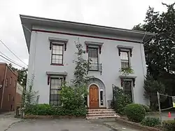 Samuel Washburn House |
July 5, 1984 (#84002258) |
68 Winthrop St. 41°53′50″N 71°05′52″W |
Taunton | |
| 83 | Washington School | 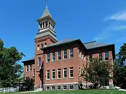 Washington School |
July 5, 1984 (#84002261) |
40 Vernon St. 41°53′45″N 71°06′22″W |
Taunton | |
| 84 | Weir Engine House | 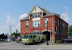 Weir Engine House |
July 5, 1984 (#84002263) |
530 Weir St. 41°53′15″N 71°05′23″W |
Taunton | |
| 85 | Westville Congregational Church | 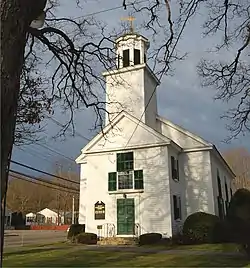 Westville Congregational Church |
July 5, 1984 (#84002266) |
Winthrop and N. Walker Sts. 41°53′08″N 71°08′17″W |
Taunton | |
| 86 | William L. White Jr. House | 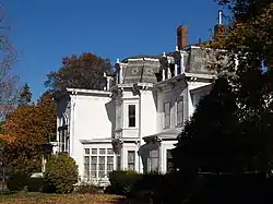 William L. White Jr. House |
July 5, 1984 (#84002268) |
242 Winthrop St. 41°53′24″N 71°06′55″W |
Taunton | |
| 87 | Whittenton Fire and Police Station | 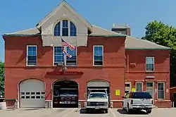 Whittenton Fire and Police Station |
July 5, 1984 (#84002271) |
Bay St. 41°55′14″N 71°05′49″W |
Taunton | |
| 88 | Whittenton Mills Complex | 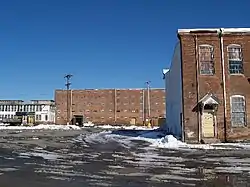 Whittenton Mills Complex |
July 5, 1984 (#84002275) |
Mill River and Whittenton St. 41°55′27″N 71°06′21″W |
Taunton | |
| 89 | Abiathar King Williams House | 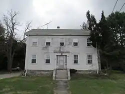 Abiathar King Williams House |
July 5, 1984 (#84002278) |
43 Ingell St. 41°53′36″N 71°05′02″W |
Taunton | |
| 90 | Enoch Williams House | 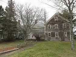 Enoch Williams House |
July 5, 1984 (#84002280) |
616 Middleboro Ave. 41°52′57″N 71°01′26″W |
Taunton | |
| 91 | Francis D. Williams House | 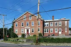 Francis D. Williams House |
July 5, 1984 (#84002282) |
3 Plain St. 41°53′07″N 71°05′21″W |
Taunton | |
| 92 | N.S. Williams House | 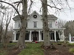 N.S. Williams House |
July 5, 1984 (#84002285) |
1150 Middleboro Ave. 41°52′55″N 71°00′03″W |
Taunton | |
| 93 | Joseph Willis House | 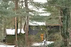 Joseph Willis House |
July 5, 1984 (#84002286) |
28 Worcester St. 41°54′59″N 71°08′51″W |
Taunton | |
| 94 | Winslow Congregational Church | 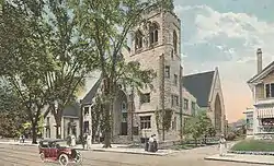 Winslow Congregational Church |
July 5, 1984 (#84002288) |
61 Winthrop St. 41°53′55″N 71°05′50″W |
Taunton | Demolished late 1990s. |
| 95 | Winthrop Street Baptist Church | 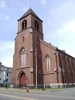 Winthrop Street Baptist Church |
July 5, 1984 (#84002291) |
39 Winthrop St. 41°54′01″N 71°05′46″W |
Taunton | |
| 96 | William Woodward House | 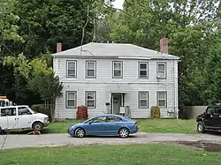 William Woodward House |
July 10, 1985 (#85001529) |
117 Arlington St. 41°54′17″N 71°04′57″W |
Taunton |
See also
Wikimedia Commons has media related to National Register of Historic Places in Taunton, Massachusetts.
References
- National Park Service, United States Department of the Interior, "National Register of Historic Places: Weekly List Actions", retrieved October 20, 2023.
- Numbers represent an alphabetical ordering by significant words. Various colorings, defined here, differentiate National Historic Landmarks and historic districts from other NRHP buildings, structures, sites or objects.
- "National Register Information System". National Register of Historic Places. National Park Service. April 24, 2008.
- The eight-digit number below each date is the number assigned to each location in the National Register Information System database, which can be viewed by clicking the number.
| Topics |  | ||||||||||||||||
|---|---|---|---|---|---|---|---|---|---|---|---|---|---|---|---|---|---|
| Lists by county | |||||||||||||||||
| Lists by city |
| ||||||||||||||||
| Other lists | |||||||||||||||||
This article is issued from Wikipedia. The text is licensed under Creative Commons - Attribution - Sharealike. Additional terms may apply for the media files.