National Register of Historic Places listings in Warren County, Ohio
This is a list of the National Register of Historic Places listings in Warren County, Ohio.
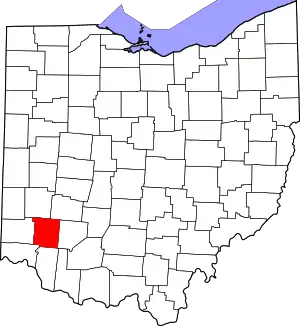
Location of Warren County in Ohio
This is intended to be a complete list of the properties and districts on the National Register of Historic Places in Warren County, Ohio, United States. The locations of National Register properties and districts for which the latitude and longitude coordinates are included below, may be seen in an online map.[1]
There are 54 properties and districts listed on the National Register in the county, including 1 National Historic Landmark.
This National Park Service list is complete through NPS recent listings posted October 20, 2023.[2]
Current listings
| [3] | Name on the Register[4] | Image | Date listed[5] | Location | City or town | Description |
|---|---|---|---|---|---|---|
| 1 | Armco Park Mound I | May 29, 1975 (#75001550) |
Along Shaker Creek at Greentree Corners[6] 39°27′46″N 84°16′10″W |
Turtlecreek Township | ||
| 2 | Armco Park Mound II | May 29, 1975 (#75001551) |
Along Shaker Creek at Greentree Corners[6] 39°27′45″N 84°16′10″W |
Turtlecreek Township | ||
| 3 | Bone Mound II |  Bone Mound II |
July 15, 1974 (#74001643) |
Northwestern quarter of the southwestern quarter of Section 9 of Wayne Township, northwest of Oregonia[7]: 27 39°28′54″N 84°07′20″W |
Wayne Township | |
| 4 | Bone Stone Graves |  Bone Stone Graves |
July 15, 1974 (#74001644) |
Northwestern quarter of the southwestern quarter of Section 9 of Wayne Township, northwest of Oregonia[7]: 27 39°28′53″N 84°07′19″W |
Wayne Township | |
| 5 | Charles Butler House |  Charles Butler House |
April 29, 1982 (#82003664) |
13 E. Jackson St. 39°33′51″N 84°17′59″W |
Franklin | |
| 6 | Goldsmith Coffeen House | 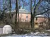 Goldsmith Coffeen House |
October 10, 1984 (#84000165) |
419 Cincinnati Ave. 39°25′47″N 84°12′55″W |
Lebanon | |
| 7 | Corwin Council House and Jail | 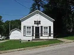 Corwin Council House and Jail |
May 30, 2001 (#01000589) |
946 Harveysburg Rd. 39°31′29″N 84°04′40″W |
Corwin | |
| 8 | Thomas Corwin House | 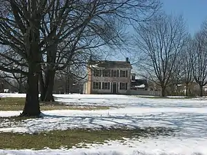 Thomas Corwin House |
October 10, 1984 (#84000166) |
1255 State Route 48 39°27′16″N 84°12′19″W |
Lebanon | |
| 9 | Corwin-Bolin House | 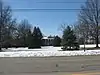 Corwin-Bolin House |
October 10, 1984 (#84000167) |
1443 State Route 48 39°27′20″N 84°12′18″W |
Lebanon | |
| 10 | Jonathan Crane Farm | 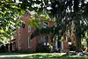 Jonathan Crane Farm |
February 17, 1978 (#78002202) |
South of Franklin on State Route 741 39°29′11″N 84°15′09″W |
Clearcreek Township | |
| 11 | Crossed Keys Tavern | 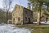 Crossed Keys Tavern |
October 21, 1976 (#76001542) |
East of Lebanon on State Route 350 39°24′24″N 84°06′12″W |
Turtlecreek Township | |
| 12 | Daniel L. Deardoff House | 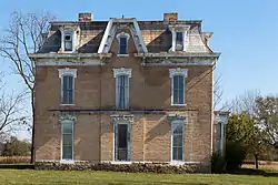 Daniel L. Deardoff House |
May 31, 1984 (#84003810) |
4374 Union Rd., south of Franklin 39°30′26″N 84°18′57″W |
Franklin Township | |
| 13 | Henry Decker Farmstead | 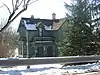 Henry Decker Farmstead |
September 8, 2000 (#00001063) |
2595 W. Lower Springboro Rd., southwest of Springboro 39°32′47″N 84°14′41″W |
Clearcreek Township | |
| 14 | East End Historic District | 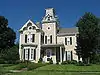 East End Historic District |
October 10, 1984 (#84000419) |
Roughly bounded by South, Mound, Pleasant, and Cherry Sts. 39°26′04″N 84°12′07″W |
Lebanon | |
| 15 | John Ferney House | 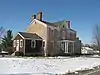 John Ferney House |
October 10, 1984 (#84000423) |
475 Glosser Rd. 39°25′40″N 84°13′33″W |
Lebanon | |
| 16 | Floraville Historic District | 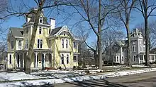 Floraville Historic District |
October 10, 1984 (#84002102) |
Roughly bounded by Cincinnati and Orchard Aves. and East and Keever Sts. 39°25′46″N 84°12′32″W |
Lebanon | |
| 17 | Fort Ancient |  Fort Ancient |
October 15, 1966 (#66000625) |
State Route 350, east of Lebanon 39°24′29″N 84°05′21″W |
Washington Township | |
| 18 | Franklin Historic District | May 1, 2023 (#100008886) |
Roughly Bounded by West 1st, South. Main, and Sixth Sts., and the Great Miami R. 39°33′36″N 84°18′18″W |
Franklin | ||
| 19 | Glendower | 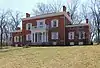 Glendower |
November 10, 1970 (#70000521) |
U.S. Route 42 (Cincinnati Ave.) 39°25′47″N 84°12′36″W |
Lebanon | |
| 20 | Golden Lamb | 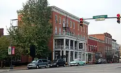 Golden Lamb |
January 12, 1978 (#78002204) |
27-31 S. Broadway 39°26′01″N 84°12′30″W |
Lebanon | |
| 21 | Elizabeth Harvey Free Negro School | 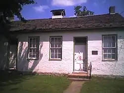 Elizabeth Harvey Free Negro School |
November 17, 1977 (#77001089) |
North St. 39°30′12″N 84°00′25″W |
Harveysburg | |
| 22 | Hatton Farm | 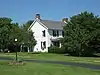 Hatton Farm |
March 29, 1978 (#78002203) |
East of central Harveysburg on State Route 73 39°30′01″N 84°00′02″W |
Harveysburg | |
| 23 | Hill-Kinder Mound |  Hill-Kinder Mound |
November 5, 1971 (#71000657) |
Northeast of downtown Franklin[6] 39°34′29″N 84°16′40″W |
Franklin | |
| 24 | Hunt-Forman Farm | 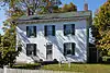 Hunt-Forman Farm |
June 16, 2004 (#04000607) |
2945 N. State Route 741, south of Franklin 39°28′56″N 84°15′17″W |
Turtlecreek Township | |
| 25 | Kern Effigy (33WA372) |  Kern Effigy (33WA372) |
July 21, 1986 (#86001922) |
Along the Little Miami River on the grounds of YMCA Camp Kern, 5291 State Route 350[8] 39°24′19″N 84°06′21″W |
Turtlecreek Township | |
| 26 | Ahimaaz King House | 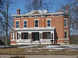 Ahimaaz King House |
December 19, 2008 (#08001199) |
1720 E. King Ave. in Kings Mills 39°21′29″N 84°14′44″W |
Deerfield Township | |
| 27 | Landen Mounds I and II | 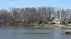 Landen Mounds I and II |
May 27, 1975 (#75001549) |
Near Socialville-Foster Rd. by the northern side of Landen Lake, west of Foster[7]: 29–30 39°19′16″N 84°16′29″W |
Deerfield Township | |
| 28 | Lebanon Academy | 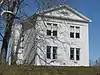 Lebanon Academy |
October 10, 1984 (#84000427) |
190 New St. 39°26′20″N 84°12′17″W |
Lebanon | |
| 29 | Lebanon Cemetery Entrance Arch | 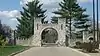 Lebanon Cemetery Entrance Arch |
October 18, 1984 (#84000157) |
Hunter St. 39°26′13″N 84°12′49″W |
Lebanon | |
| 30 | Lebanon Cemetery Superintendent's House | 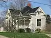 Lebanon Cemetery Superintendent's House |
October 18, 1984 (#84000159) |
416 W. Silver St. 39°26′09″N 84°12′49″W |
Lebanon | |
| 31 | Lebanon Commercial District | Lebanon Commercial District |
October 10, 1984 (#84000429) |
Roughly Broadway, Mechanic, Silver, Mulberry, and Main Sts. 39°26′02″N 84°12′29″W |
Lebanon | |
| 32 | Mackinaw Historic District | 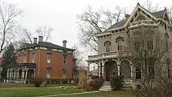 Mackinaw Historic District |
July 21, 1980 (#80003242) |
Off State Route 123 39°33′50″N 84°18′26″W |
Franklin | |
| 33 | Maplewood Sanitorium | 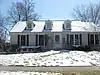 Maplewood Sanitorium |
October 10, 1984 (#84000432) |
Maple and Deerfield Sts. 39°25′31″N 84°12′25″W |
Lebanon | |
| 34 | Moses McKay House | 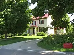 Moses McKay House |
February 17, 1978 (#78002207) |
East of Waynesville, on New Burlington Rd. 39°32′37″N 84°00′57″W |
Wayne Township | |
| 35 | Miami Monthly Meeting Historic District | 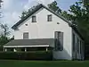 Miami Monthly Meeting Historic District |
September 18, 1998 (#98001180) |
Vicinity of 4th and High Sts. 39°31′46″N 84°05′27″W |
Waynesville | |
| 36 | Moar Mound and Village |  Moar Mound and Village |
January 1, 1976 (#76001543) |
Back a lane on the northern side of Lebanon-Union Rd., west of Morrow[7]: 29 39°21′49″N 84°11′45″W |
Hamilton Township | |
| 37 | Mohrman-Jack-Evans House | 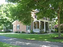 Mohrman-Jack-Evans House |
October 10, 1984 (#84000433) |
342 Columbus Ave. 39°26′16″N 84°11′56″W |
Lebanon | |
| 38 | North Broadway Historic District | 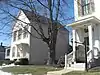 North Broadway Historic District |
October 10, 1984 (#84000435) |
Roughly Broadway, Warren, Pleasant, New, and Mechanic Sts. 39°26′13″N 84°12′26″W |
Lebanon | |
| 39 | Old Log Post Office | 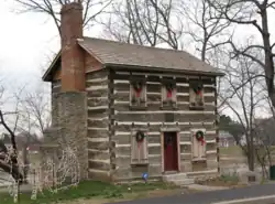 Old Log Post Office |
March 17, 1976 (#76001541) |
5th and River Sts. 39°33′35″N 84°18′24″W |
Franklin | |
| 40 | Peters Cartridge Company | 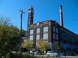 Peters Cartridge Company |
October 10, 1985 (#85003115) |
1915 Grandin Rd., southeast of Kings Mills 39°21′01″N 84°14′33″W |
Hamilton Township | |
| 41 | Edmund Robinson House | 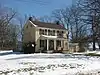 Edmund Robinson House |
April 16, 1979 (#79001974) |
North of Lebanon at 3208 State Route 48 39°29′04″N 84°12′03″W |
Clearcreek Township | |
| 42 | John Satterthwaite House | 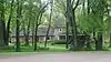 John Satterthwaite House |
March 30, 1988 (#88000239) |
498 N. 3rd St. 39°32′09″N 84°04′56″W |
Waynesville | |
| 43 | Smith-Davis House | 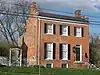 Smith-Davis House |
February 6, 1985 (#85000245) |
206 W. Silver St. 39°26′09″N 84°12′40″W |
Lebanon | |
| 44 | Springboro Historic District | 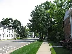 Springboro Historic District |
August 10, 1999 (#99000914) |
Roughly bounded by Main, East, and Mill Sts., and Central Ave. 39°33′18″N 84°13′57″W |
Springboro | |
| 45 | Stanton Farm | 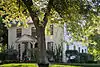 Stanton Farm |
May 29, 1980 (#80003243) |
Northeast of Downtown Springboro on Tanglewood Drive south of West Lytle-Five Points Road. 39°34′22″N 84°13′34″W |
Clearcreek Township | |
| 46 | Benjamin A. Stokes House | 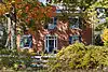 Benjamin A. Stokes House |
July 18, 1983 (#83002064) |
5587 State Route 48, north of Lebanon 39°31′01″N 84°11′10″W |
Clearcreek Township | |
| 47 | Stubbs Earthworks | 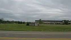 Stubbs Earthworks |
April 4, 1978 (#78002205) |
Campus of Little Miami High School[9] 39°21′26″N 84°09′37″W |
Hamilton Township | |
| 48 | Taylor Mound and Village Site |  Taylor Mound and Village Site |
March 31, 1978 (#78002206) |
Just south of the confluence of Caesar's Creek and the Little Miami River[6][10] 39°29′22″N 84°06′04″W |
Wayne Township | |
| 49 | Trevey Mound (33WA193) | June 20, 1986 (#86001345) |
Address Restricted |
Morrow | ||
| 50 | Waynesville Engine House and Lockup | 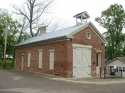 Waynesville Engine House and Lockup |
January 21, 1999 (#98001643) |
260 Chapman St. 39°31′56″N 84°05′08″W |
Waynesville | |
| 51 | Waynesville Greek Revival Houses | 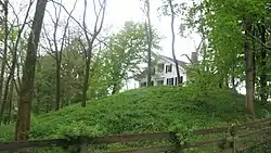 Waynesville Greek Revival Houses |
August 8, 1979 (#79001976) |
5303 and 5323 Wilkerson Lane 39°31′30″N 84°05′34″W |
Waynesville | |
| 52 | Waynesville Main Street Historic District | 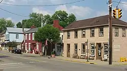 Waynesville Main Street Historic District |
March 20, 2002 (#02000220) |
Main St. 39°31′48″N 84°05′11″W |
Waynesville | |
| 53 | West Baptist Church | 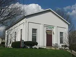 West Baptist Church |
October 18, 1984 (#84000161) |
500 W. Mulberry St. 39°26′06″N 84°12′51″W |
Lebanon | |
| 54 | Dr. Aaron Wright House | 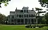 Dr. Aaron Wright House |
August 3, 1979 (#79001975) |
155 W. Central Ave. 39°33′27″N 84°14′18″W |
Springboro |
Former listings
| [3] | Name on the Register | Image | Date listed | Date removed | Location | City or town | Description |
|---|---|---|---|---|---|---|---|
| 1 | Lukins-Plummer House |  Lukins-Plummer House |
June 5, 1974 (#74002342) | Unknown | W of Harveysburg off Middletown Rd. |
Harveysburg |
See also
Wikimedia Commons has media related to National Register of Historic Places in Warren County, Ohio.
- List of National Historic Landmarks in Ohio
- Listings in neighboring counties: Butler, Clermont, Clinton, Greene, Hamilton, Montgomery
- National Register of Historic Places listings in Ohio
References
- The latitude and longitude information provided in this table was derived originally from the National Register Information System, which has been found to be fairly accurate for about 99% of listings. Some locations in this table may have been corrected to current GPS standards.
- National Park Service, United States Department of the Interior, "National Register of Historic Places: Weekly List Actions", retrieved October 20, 2023.
- Numbers represent an alphabetical ordering by significant words. Various colorings, defined here, differentiate National Historic Landmarks and historic districts from other NRHP buildings, structures, sites or objects.
- "National Register Information System". National Register of Historic Places. National Park Service. April 24, 2008.
- The eight-digit number below each date is the number assigned to each location in the National Register Information System database, which can be viewed by clicking the number.
- Location derived from Mills, William C. Archeological Atlas of Ohio. Columbus: Ohio State Archeological and Historical Society, 1914, page 83 and plate 83. The NRIS lists the site as "Address Restricted".
- Koleszar, Stephen C. An Archaeological Survey of Southwestern Ohio. Columbus: Ohio Historical Society, 1970, 29.
- Location derived from this article in Cincinnati Magazine, and address derived from the camp website; the NRIS lists the site as "Address Restricted"
- Location derived from this Ohio Historical Society webpage; the NRIS lists the site as "Address Restricted"
- Location derived from Brady-Rawlins, Kathleen. The O.C. Voss Site: Reassessing What We Know about the Fort Ancient Occupation of the Central Scioto Drainage and Its Tributaries. Diss. Ohio State University, 2007, 175. The NRIS lists the site as "Address Restricted".

Municipalities and communities of Warren County, Ohio, United States | ||
|---|---|---|
| Cities | Map of Ohio highlighting Warren County | |
| Villages | ||
| Townships | ||
| CDPs | ||
| Unincorporated communities |
| |
| Ghost towns | ||
| Footnotes | ‡This populated place also has portions in an adjacent county or counties | |
This article is issued from Wikipedia. The text is licensed under Creative Commons - Attribution - Sharealike. Additional terms may apply for the media files.