National Register of Historic Places listings in Berkeley County, West Virginia
This is a list of the National Register of Historic Places listings in Berkeley County, West Virginia.
This is intended to be a complete list of the properties and districts on the National Register of Historic Places in Berkeley County, West Virginia, United States. The locations of National Register properties and districts for which the latitude and longitude coordinates are included below, may be seen in an online map.[1]
There are 120 properties and districts listed on the National Register in the county, 1 of which is a National Historic Landmark.
This National Park Service list is complete through NPS recent listings posted October 20, 2023.[2]
Barbour - Berkeley - Boone - Braxton - Brooke - Cabell - Calhoun - Clay - Doddridge - Fayette - Gilmer - Grant - Greenbrier - Hampshire - Hancock - Hardy - Harrison - Jackson - Jefferson - Kanawha - Lewis - Lincoln - Logan - Marion - Marshall - Mason - McDowell - Mercer - Mineral - Mingo - Monongalia - Monroe - Morgan - Nicholas - Ohio - Pendleton - Pleasants - Pocahontas - Preston - Putnam - Raleigh - Randolph - Ritchie - Roane - Summers - Taylor - Tucker - Tyler - Upshur - Wayne - Webster - Wetzel - Wirt - Wood - Wyoming |
Current listings
| [3] | Name on the Register[4] | Image | Date listed[5] | Location | City or town | Description |
|---|---|---|---|---|---|---|
| 1 | Abell-Kilbourn House | 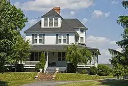 Abell-Kilbourn House |
November 21, 1994 (#94001290) |
1018 Winchester Ave. 39°26′48″N 77°58′47″W |
Martinsburg | |
| 2 | Apollo Theatre | 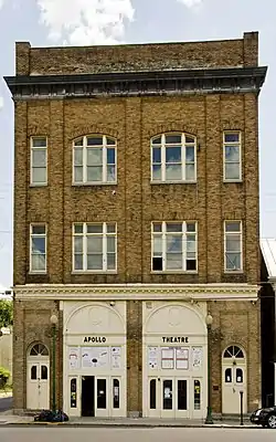 Apollo Theatre |
October 11, 1979 (#79002569) |
128 E. Martin St 39°27′29″N 77°57′45″W |
Martinsburg | |
| 3 | Ar-Qua Springs | 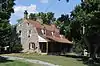 Ar-Qua Springs |
December 12, 1976 (#76001929) |
County Route 37 39°25′27″N 78°02′18″W |
Arden | |
| 4 | Aspen Hall | 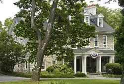 Aspen Hall |
December 10, 1980 (#80004882) |
405 Boyd Ave.[6] 39°27′47″N 77°57′54″W |
Martinsburg | |
| 5 | Baldwin-Grantham House | 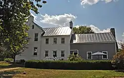 Baldwin-Grantham House |
November 21, 1994 (#94001296) |
County Route 18 east of Shanghai 39°26′14″N 78°07′08″W |
Shanghai | |
| 6 | Baltimore and Ohio and Related Industries Historic District |  Baltimore and Ohio and Related Industries Historic District |
December 10, 1980 (#80004415) |
Roughly bounded by the Baltimore & Ohio railroad line from the southern side of the Burke St. underpass to the northern side of the B&O and Pennsylvania Railroad bridge 39°27′43″N 77°57′45″W |
Martinsburg | |
| 7 | Baltimore and Ohio Railroad Martinsburg Shops | 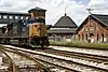 Baltimore and Ohio Railroad Martinsburg Shops |
July 31, 2003 (#03001045) |
300 E. Martin St. 39°27′39″N 77°57′34″W |
Martinsburg | |
| 8 | William Boggs Farm | March 7, 2001 (#00001310) |
WV 7 39°32′25″N 78°01′32″W |
Hedgesville | ||
| 9 | Boomtown Historic District | 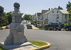 Boomtown Historic District |
December 10, 1980 (#80004414) |
Roughly along Winchester Ave. to Arden Rd., W. King St. to Red Hill Rd., W. Stephen, W. Addition St., and Raleigh Sts. 39°27′06″N 77°58′44″W |
Martinsburg | |
| 10 | Boyd Avenue Historic District | 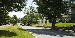 Boyd Avenue Historic District |
August 3, 2007 (#07000781) |
Eastern and western sides of Boyd Ave., north of Queen St. 39°27′50″N 77°57′53″W |
Martinsburg | |
| 11 | Boydville | 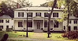 Boydville |
October 15, 1970 (#70000649) |
601 S. Queen St. 39°27′05″N 77°58′05″W |
Martinsburg | |
| 12 | Boydville Historic District | 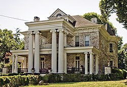 Boydville Historic District |
December 10, 1980 (#80004413) |
Roughly bounded by W. Stephen, S. Spring, and S. Queen Sts., including the grounds of Boydville 39°27′06″N 77°58′01″W |
Martinsburg | |
| 13 | Thomas Brown House | 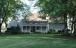 Thomas Brown House |
January 16, 1986 (#86000202) |
County Route 30 39°23′40″N 78°02′55″W |
Inwood | |
| 14 | Bunker Hill Historic District |  Bunker Hill Historic District |
December 10, 1980 (#80004412) |
Junction of U.S. Route 11 and WV 26 39°19′56″N 78°03′13″W |
Bunker Hill | |
| 15 | James Nathanial Burwell House | 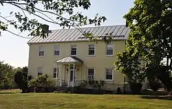 James Nathanial Burwell House |
May 16, 1991 (#91000553) |
East of U.S. Route 11, north of West Virginia state line 39°17′36″N 78°04′27″W |
Ridgeway | |
| 16 | Campbellton | 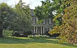 Campbellton |
December 10, 1980 (#80004411) |
Address Unknown 39°24′20″N 78°04′16″W |
Gerrardstown | |
| 17 | Citizens National Bank | August 29, 2023 (#100009139) |
110 West King St. 39°27′23″N 77°57′52″W |
Martinsburg | ||
| 18 | Clary's Mountain Historic District | 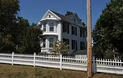 Clary's Mountain Historic District |
April 15, 2004 (#04000314) |
Hammond's Mill Rd. 39°33′25″N 77°59′22″W |
Hedgesville | |
| 19 | Edward Colston House | 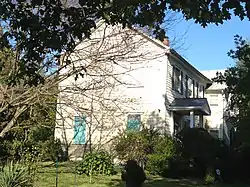 Edward Colston House |
May 1, 2003 (#03000347) |
1598 Tice Rd. 39°35′26″N 77°55′15″W |
Falling Waters | |
| 20 | Continental Clay Brick Plant | 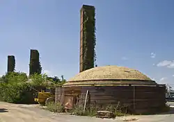 Continental Clay Brick Plant |
December 10, 1980 (#80004439) |
Southeast of Martinsburg on WV 9 39°25′59″N 77°57′31″W |
Martinsburg | |
| 21 | Cool Spring Farm | 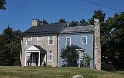 Cool Spring Farm |
November 21, 1994 (#94001292) |
Runnymede Rd. (WV 26) south of Gerrardstown 39°19′53″N 78°06′23″W |
Gerrardstown | |
| 22 | Samuel Cunningham House |  Samuel Cunningham House |
December 12, 1976 (#76001930) |
Southeast of Hedgesville off WV 9 39°31′45″N 77°58′46″W |
Hedgesville | |
| 23 | Darkesville Historic District | 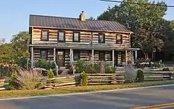 Darkesville Historic District |
December 10, 1980 (#80004410) |
U.S. Route 11 at Middle Creek 39°22′27″N 78°01′25″W |
Darkesville | |
| 24 | Charles Downs II House | 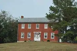 Charles Downs II House |
May 17, 1991 (#91000554) |
County Route 1, west of U.S. Route 11 39°34′19″N 77°53′36″W |
Marlowe | |
| 25 | Downtown Martinsburg Historic District | 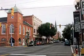 Downtown Martinsburg Historic District |
December 10, 1980 (#80004416) |
Roughly bounded by W. Race, Water, Stephen, and Charles Sts. 39°27′28″N 77°57′59″W |
Martinsburg | |
| 26 | John Drinker House | 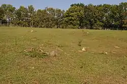 John Drinker House |
December 10, 1980 (#80004409) |
Sam Mason Rd. 39°19′06″N 78°04′48″W |
Bunker Hill | |
| 27 | East Martinsburg Historic District | 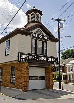 East Martinsburg Historic District |
December 10, 1980 (#80004417) |
Roughly bounded by the Baltimore & Ohio railroad right-of-way, N. Queen St., Moler Ave., and High St. 39°27′40″N 77°57′19″W |
Martinsburg | |
| 28 | Edgewood | 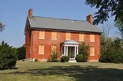 Edgewood |
December 10, 1980 (#80004431) |
Address Unknown 39°19′49″N 78°03′29″W |
Bunker Hill | |
| 29 | John Evans House | 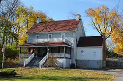 John Evans House |
March 22, 2006 (#06000168) |
2298 Winchester Ave. 39°25′44″N 77°59′17″W |
Martinsburg | |
| 30 | Faraway Farm | December 10, 1980 (#80004432) |
WV 8 39°32′55″N 77°56′23″W |
Martinsburg | ||
| 31 | Federal Aviation Administration Records Center | 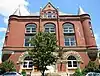 Federal Aviation Administration Records Center |
September 10, 1974 (#74001995) |
300 W. King St. 39°27′55″N 77°58′00″W |
Martinsburg | |
| 32 | Teter Myers French House | 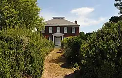 Teter Myers French House |
December 10, 1980 (#80004434) |
Junction of Routes 1 and 3 39°33′57″N 77°58′00″W |
Hedgesville | |
| 33 | Gerrardstown Historic District | 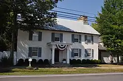 Gerrardstown Historic District |
August 5, 1991 (#91001008) |
Roughly along WV 51 and Virginia Line Rd. 39°22′07″N 78°05′51″W |
Gerrardstown | |
| 34 | Washington Gold House | 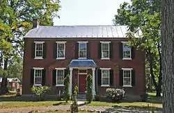 Washington Gold House |
January 12, 1984 (#84003470) |
South of Gerrardstown on County Route 51/2 39°21′12″N 78°06′35″W |
Gerrardstown | |
| 35 | Green Hill Cemetery Historic District | 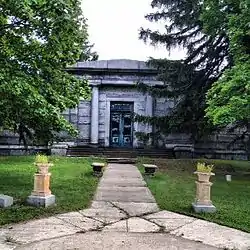 Green Hill Cemetery Historic District |
December 10, 1980 (#80004433) |
486 E. Burke St. 39°27′13″N 77°57′20″W |
Martinsburg | |
| 36 | Harlan Spring Historic District | 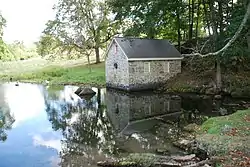 Harlan Spring Historic District |
December 10, 1980 (#80004435) |
Harlan Spring 39°32′59″N 77°57′21″W |
Hedgesville | |
| 37 | Harmony Cemetery | 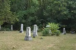 Harmony Cemetery |
December 10, 1980 (#80004436) |
Route 1/1 39°35′13″N 77°52′54″W |
Marlowe | |
| 38 | Hays-Pitzer House | November 21, 1994 (#94001294) |
Middle Creek Rd. (WV 45) north of Inwood 39°25′00″N 78°03′53″W |
Martinsburg | ||
| 39 | Hays-Gerrard House | 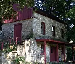 Hays-Gerrard House |
September 16, 1985 (#85002409) |
Congress St. 39°22′10″N 78°05′50″W |
Gerrardstown | |
| 40 | Hedges Chapel | 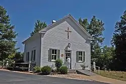 Hedges Chapel |
December 12, 2002 (#02001520) |
668 Mountain Lake Rd. 39°33′27″N 78°05′31″W |
Hedgesville | |
| 41 | Decatur Hedges House | 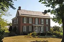 Decatur Hedges House |
January 12, 1984 (#84003473) |
WV 9 39°30′48″N 77°58′20″W |
Hedgesville | |
| 42 | Owen Tudor Hedges House | 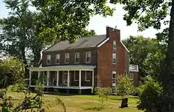 Owen Tudor Hedges House |
November 21, 1994 (#94001293) |
County Route 8 east of Hedgesville 39°32′22″N 77°56′44″W |
Hedgesville | |
| 43 | Samuel Hedges House | December 12, 1976 (#76001931) |
County Route 9/10 39°31′40″N 77°59′52″W |
Hedgesville | ||
| 44 | Hedges-Lemen House | 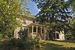 Hedges-Lemen House |
May 2, 1991 (#91000556) |
County Route 4, 0.7 miles north of its junction with WV 9 39°32′31″N 77°58′47″W |
Hedgesville | |
| 45 | Hedges-Robinson-Myers House | 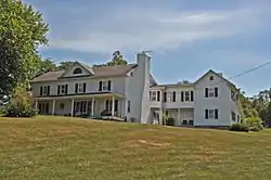 Hedges-Robinson-Myers House |
December 10, 1980 (#80004418) |
Route 3 39°33′27″N 77°58′27″W |
Hedgesville | |
| 46 | Hedgesville Historic District | 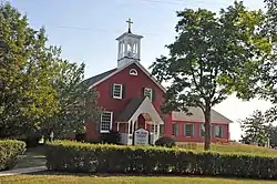 Hedgesville Historic District |
December 10, 1980 (#80004419) |
Roughly bounded by N. and S. Mary St., and E. and W. Main St. 39°33′12″N 77°59′39″W |
Hedgesville | |
| 47 | George Washington Hollida House | 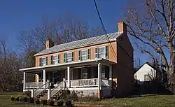 George Washington Hollida House |
February 11, 2004 (#04000031) |
4781 Scabble Rd. 39°29′03″N 77°50′02″W |
Shepherdstown | |
| 48 | Hughes-Cunningham House |  Hughes-Cunningham House |
July 8, 1985 (#85001518) |
Harlan Springs Rd. 39°32′10″N 77°57′38″W |
Hedgesville | |
| 49 | Jones Mill Run Historic District |  Jones Mill Run Historic District |
December 10, 1980 (#80004421) |
Address Unknown 39°29′15″N 77°49′44″W |
Martinsburg | |
| 50 | Kearfott-Bane House |  Kearfott-Bane House |
July 8, 1985 (#85001520) |
WV 36/1 39°26′02″N 77°55′09″W |
Baker Heights | |
| 51 | Elizabeth Kunkel House |  Elizabeth Kunkel House |
May 17, 1991 (#91000557) |
Western side of U.S. Route 11, 2.4 mi (3.9 km) north of Martinsburg 39°29′14″N 77°56′49″W |
Martinsburg | |
| 52 | Lee-Throckmorton-McDonald House | 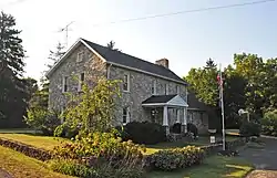 Lee-Throckmorton-McDonald House |
April 14, 2004 (#04000312) |
2101 Arden-Nolville Rd. 39°23′25″N 78°02′52″W |
Inwood | |
| 53 | Lick Run Plantation | 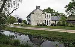 Lick Run Plantation |
January 12, 1984 (#84003476) |
Off U.S. Route 11 39°31′10″N 77°54′02″W |
Bedington | |
| 54 | Maidstone Manor Farm | 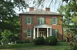 Maidstone Manor Farm |
December 10, 1980 (#80004408) |
County Route 1/4 39°35′14″N 77°54′32″W |
Hedgesville | |
| 55 | Maidstone-on-the-Potomac | 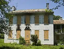 Maidstone-on-the-Potomac |
April 15, 2004 (#04000311) |
12 Temple Dr. 39°35′59″N 77°50′21″W |
Falling Waters | |
| 56 | Marlowe Consolidated School | 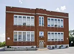 Marlowe Consolidated School |
March 22, 2006 (#06000169) |
9580 Williamsport Pike 39°35′19″N 77°51′36″W |
Marlowe | |
| 57 | Martinsburg Mining, Manufacturing & Improvement Co. Historic District | 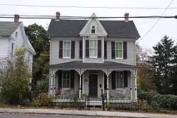 Martinsburg Mining, Manufacturing & Improvement Co. Historic District |
December 16, 2002 (#02001519) |
New York, Virginia, West Virginia, Maryland, Florida, and Faulkner Avenues 39°26′59″N 77°58′26″W |
Martinsburg | |
| 58 | James Mason House and Farm | November 15, 2006 (#06001044) |
856 Little Georgetown Rd. 39°34′33″N 77°57′20″W |
Hedgesville | ||
| 59 | Gilbert and Samuel McKown House | 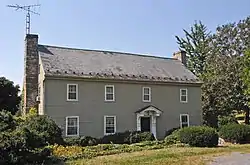 Gilbert and Samuel McKown House |
January 12, 1984 (#84003477) |
WV 51 39°22′02″N 78°05′23″W |
Gerrardstown | |
| 60 | Mill Creek Historic District | 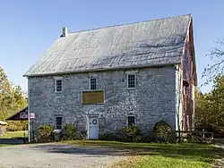 Mill Creek Historic District |
December 10, 1980 (#80004420) |
Runs along Mill Creek extending both east and west of Bunker Hill 39°20′45″N 78°03′41″W |
Bunker Hill | |
| 61 | Miller Tavern and Farm | 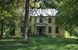 Miller Tavern and Farm |
March 22, 2006 (#06000167) |
Eastern side of Golf Course Rd. 39°25′19″N 77°52′55″W |
Martinsburg | |
| 62 | Morgan Chapel and Graveyard | 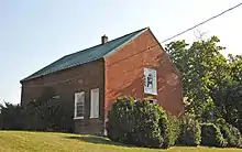 Morgan Chapel and Graveyard |
January 12, 1984 (#84003480) |
Northern side of County Route 26 west of its junction with U.S. Route 11 39°20′01″N 78°03′28″W |
Bunker Hill | |
| 63 | William G. Morgan House | 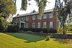 William G. Morgan House |
January 12, 1984 (#84003489) |
On County Route 24, south of its junction with County Route 26 39°19′53″N 78°05′53″W |
Bunker Hill | |
| 64 | Morgan-Gold House | 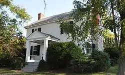 Morgan-Gold House |
July 8, 1985 (#85001519) |
WV 26 39°19′56″N 78°04′40″W |
Bunker Hill | |
| 65 | Mt. Pleasant School | 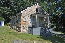 Mt. Pleasant School |
September 18, 2008 (#08000928) |
Abiding Way 39°21′49″N 78°07′28″W |
Gerrardstown | |
| 66 | Mount Zion Baptist Church | 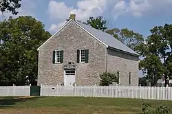 Mount Zion Baptist Church |
December 10, 1980 (#80004422) |
Opequon Lane 39°23′19″N 77°55′25″W |
Martinsburg | |
| 67 | George W. F. Mulliss House | 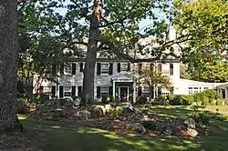 George W. F. Mulliss House |
May 2, 1991 (#91000549) |
Western side of U.S. Route 11, 1 mi (1.6 km) south of Martinsburg 39°25′50″N 77°59′16″W |
Martinsburg | |
| 68 | Myers House | December 10, 1980 (#80004423) |
Union Corner at the end of Route 37/1 39°30′17″N 77°55′25″W |
Martinsburg | ||
| 69 | Moses Nadenbousch House | February 11, 2004 (#04000032) |
2540 Butler's Chapel Rd. 39°32′06″N 77°59′30″W |
Martinsburg | ||
| 70 | Newcomer Mansion | 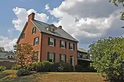 Newcomer Mansion |
March 22, 2006 (#06000170) |
1735 Douglas Grove Rd. 39°25′13″N 77°56′17″W |
Martinsburg | |
| 71 | Opequon Golf Club | 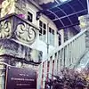 Opequon Golf Club |
April 28, 1995 (#95000417) |
Golf Club Rd. east of Opequon Creek 39°26′30″N 77°55′19″W |
Martinsburg | |
| 72 | Orndoff-Cross House | 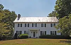 Orndoff-Cross House |
July 28, 2010 (#08001403) |
6 Winebrenner Rd. 39°26′09″N 77°51′38″W |
Martinsburg vicinity | |
| 73 | Overlook | 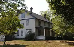 Overlook |
April 15, 2004 (#04000310) |
2910 Harlan Spring Rd. 39°32′48″N 77°57′28″W |
Martinsburg | |
| 74 | Parks's Gap Bridge | 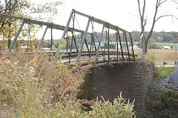 Parks's Gap Bridge |
November 4, 1994 (#94001299) |
Route 6 over Back Creek 39°30′45″N 78°02′11″W |
Martinsburg | |
| 75 | Elias Pitzer House |  Elias Pitzer House |
January 8, 2003 (#02001689) |
1076 Clyde Borum Rd. 39°25′29″N 78°01′15″W |
Martinsburg | |
| 76 | Power Plant and Dam No. 4 | 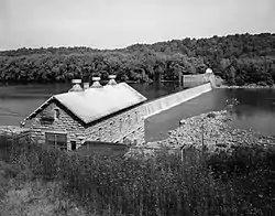 Power Plant and Dam No. 4 |
December 10, 1980 (#80004437) |
On the Potomac River north of County Route 5 at Scrabble 39°29′42″N 77°49′34″W |
Shepherdstown | |
| 77 | Power Plant and Dam No. 5 |  Power Plant and Dam No. 5 |
December 10, 1980 (#80004438) |
On the Potomac River west of Marlowe 39°36′22″N 77°55′23″W |
Marlowe | |
| 78 | Rauch House |  Rauch House |
November 4, 1994 (#94001298) |
Off WV 9, south of Martinsburg 39°25′20″N 77°58′06″W |
Martinsburg | |
| 79 | Redbud Hollow |  Redbud Hollow |
December 10, 1980 (#80004424) |
Address Unknown 39°23′42″N 78°04′32″W |
Martinsburg | |
| 80 | John, David, and Jacob Rees House | 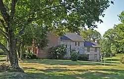 John, David, and Jacob Rees House |
January 12, 1984 (#84003495) |
Off U.S. Route 11 39°18′47″N 78°05′53″W |
Bunker Hill | |
| 81 | Morris Rees III House | 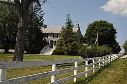 Morris Rees III House |
January 8, 2003 (#02001681) |
WV 24, 0.2 mi (0.32 km) south of WV 51 39°21′26″N 78°05′06″W |
Gerrardstown | |
| 82 | Ridge Road Historic District | December 10, 1980 (#80004429) |
South along Ridge Rd. from Nollville 39°26′23″N 78°01′59″W |
Nollville | ||
| 83 | Robinson-Tabb House | 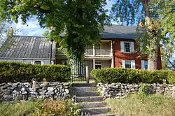 Robinson-Tabb House |
February 11, 2004 (#04000028) |
377 Holden Dr. 39°30′50″N 77°59′07″W |
Martinsburg | |
| 84 | Baker Ropp House | December 12, 2002 (#02001522) |
2301 Harlan Spring Rd. 39°32′17″N 77°56′49″W |
Martinsburg | ||
| 85 | R.C. Ropp House | December 12, 2002 (#02001523) |
2199 Harlan Spring Rd. 39°32′10″N 77°56′54″W |
Martinsburg | ||
| 86 | Rosemont Historic District | 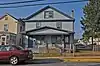 Rosemont Historic District |
December 12, 2002 (#02001524) |
Tennessee, Illinois, Georgia, and Kentucky Aves. 39°27′27″N 77°58′39″W |
Martinsburg | |
| 87 | Rush-Miller House | 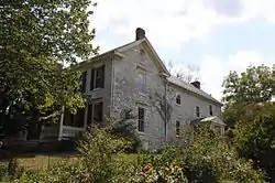 Rush-Miller House |
July 8, 1985 (#85001521) |
On WV 45 39°27′14″N 77°54′09″W |
Smoketown | |
| 88 | George Schlack House | 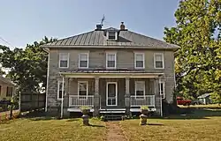 George Schlack House |
September 18, 2008 (#08000927) |
212 Speck's Run Rd. 39°17′45″N 78°03′51″W |
Ridgeway | |
| 89 | Scrabble Historic District | 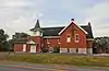 Scrabble Historic District |
March 22, 2006 (#06000171) |
Scrabble Rd. and Dam No. 4 Rd. 39°29′11″N 77°49′59″W |
Scrabble | |
| 90 | Henry J. Seibert II House | 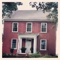 Henry J. Seibert II House |
July 8, 1985 (#85001526) |
Off WV 45 39°26′11″N 78°00′43″W |
Martinsburg | |
| 91 | Smoketown School | December 1, 1994 (#94001345) |
County Route 45/4, east of Martinsburg 39°27′32″N 77°54′20″W |
Martinsburg | ||
| 92 | Snodgrass Tavern |  Snodgrass Tavern |
April 24, 1973 (#73001896) |
West of Hedgesville on WV 9 39°33′25″N 78°01′00″W |
Hedgesville | |
| 93 | Benjamin H. Snyder House |  Benjamin H. Snyder House |
February 11, 2004 (#04000029) |
1925 Douglas Grove Rd. 39°25′17″N 77°56′21″W |
Martinsburg | |
| 94 | South Water Street Historic District |  South Water Street Historic District |
December 10, 1980 (#80004430) |
Roughly bounded by East John, South Water, and East Burke Sts., and Baltimore & Ohio railroad line 39°27′20″N 77°57′39″W |
Martinsburg | |
| 95 | Peter Speck House | December 12, 2002 (#02001526) |
1149 Ben Speck Rd. 39°32′51″N 77°58′57″W |
Martinsburg | ||
| 96 | Spring Mills Historic District |  Spring Mills Historic District |
April 15, 2004 (#04000308) |
Portions of Hammonds Mill Rd. and Harlan Spring Rd. 39°33′36″N 77°57′12″W |
Martinsburg | |
| 97 | Adam Stephen House | 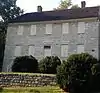 Adam Stephen House |
October 15, 1970 (#70000650) |
309 E. John St. 39°27′16″N 77°57′39″W |
Martinsburg | |
| 98 | Stone House Mansion |  Stone House Mansion |
November 21, 1994 (#94001297) |
Off WV 9, southeast of Martinsburg 39°23′52″N 77°55′09″W |
Martinsburg | |
| 99 | Strayer-Couchman House | November 21, 1994 (#94001291) |
Warm Springs Rd. east of Martinsburg 39°26′25″N 77°54′13″W |
Martinsburg | ||
| 100 | Strode-Morrison-Tabler House and Farm | 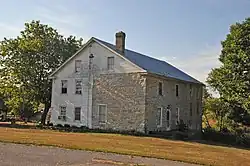 Strode-Morrison-Tabler House and Farm |
March 22, 2006 (#06000173) |
1270 Jacobs Rd. 39°30′42″N 77°52′34″W |
Hedgesville | |
| 101 | Stuckey House | May 17, 1991 (#91000555) |
County Route 7/8, along Wilson Ridge 39°29′11″N 78°05′02″W |
Jones Springs | ||
| 102 | Swan Pond | 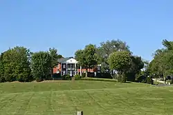 Swan Pond |
July 29, 1977 (#77001372) |
County Route 5/3 39°28′15″N 77°52′25″W |
Martinsburg | |
| 103 | Swan Pond Manor Historic District | 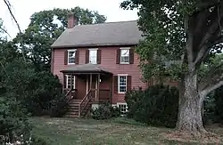 Swan Pond Manor Historic District |
December 10, 1980 (#80004425) |
Swan Pond 39°28′18″N 77°51′57″W |
Martinsburg | |
| 104 | Edward Tabb House | 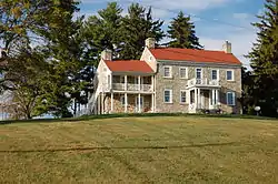 Edward Tabb House |
January 12, 1984 (#84003500) |
On County Route 4 south of its junction with WV 9 39°30′55″N 78°00′05″W |
Hedgesville | |
| 105 | Tabler's Station Historic District | 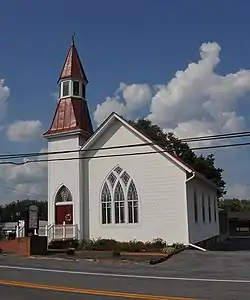 Tabler's Station Historic District |
April 14, 2004 (#04000306) |
Portions of Tabler's Station Rd. and Carlton Dr. 39°23′56″N 78°00′39″W |
Martinsburg | |
| 106 | Thunder Hill Farm | 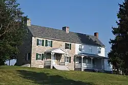 Thunder Hill Farm |
November 21, 1994 (#94001295) |
County Route 30 north of Inwood 39°22′59″N 78°03′19″W |
Inwood | |
| 107 | Tomahawk Spring | 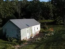 Tomahawk Spring |
December 1, 1994 (#94001344) |
County Route 7/2 39°31′52″N 78°03′27″W |
Tomahawk | |
| 108 | Priscilla Strode Turner House | 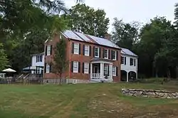 Priscilla Strode Turner House |
December 12, 2002 (#02001527) |
347 Carlyle Rd. 39°31′12″N 77°52′55″W |
Bedington | |
| 109 | Tuscarora Creek Historic District | 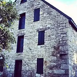 Tuscarora Creek Historic District |
December 10, 1980 (#80004426) |
Roughly bounded by N. Tennessee Ave., south on Old Mill Rd., to County Route 15 39°28′10″N 77°59′08″W |
Martinsburg | |
| 110 | Union Bryarly's Mill | December 10, 1980 (#80004440) |
Address Unknown 39°22′16″N 78°01′41″W |
Darkesville | ||
| 111 | Van Metre Ford Stone Bridge | 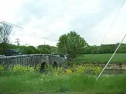 Van Metre Ford Stone Bridge |
August 22, 1977 (#77001373) |
East of Martinsburg across Opequon Creek on Golf Course Road 39°26′42″N 77°55′40″W |
Martinsburg | |
| 112 | Jacob VanDoren House | 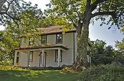 Jacob VanDoren House |
January 12, 1984 (#84003504) |
1 mi (1.6 km) southwest of the junction of County Routes 40 and 45/3 39°25′37″N 77°53′25″W |
Martinsburg | |
| 113 | John VanMetre House | 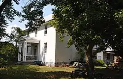 John VanMetre House |
February 11, 2004 (#04000033) |
177 Elsie Dr. 39°24′58″N 77°56′13″W |
Kearneysville | |
| 114 | Nathan VanMetre House | 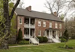 Nathan VanMetre House |
November 4, 1994 (#94001289) |
Dry Run Rd. (County Route 13) north of Martinsburg 39°29′09″N 77°59′16″W |
Martinsburg | |
| 115 | Thomas VanMetre House | 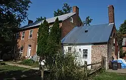 Thomas VanMetre House |
December 30, 2009 (#09001189) |
3093 Golf Course Rd. 39°25′55″N 77°54′05″W |
Martinsburg | |
| 116 | Watkins Ferry Toll House | December 10, 1980 (#80004427) |
Route 11 39°35′50″N 77°50′23″W |
Martinsburg | ||
| 117 | West Martinsburg Historic District | 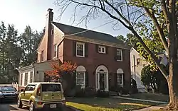 West Martinsburg Historic District |
December 13, 2010 (#07001414) |
Roughly bounded by North St., N. & S. Tennessee Ave., West King St., and N. & S. Alabama Ave. 39°27′44″N 77°58′42″W |
Martinsburg | Historic Residential Suburbs in the United States, 1830-1960 MPS |
| 118 | White Bush | 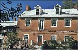 White Bush |
December 10, 1980 (#80004428) |
Routes 11/3 39°34′08″N 77°52′19″W |
Falling Waters | |
| 119 | Mary Park Wilson House | 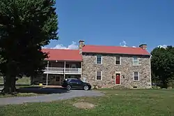 Mary Park Wilson House |
July 8, 1985 (#85001524) |
Destiny Drive 39°22′18″N 78°06′30″W |
Gerrardstown | |
| 120 | William Wilson House | 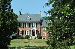 William Wilson House |
January 12, 1984 (#84003508) |
WV 51 39°22′33″N 78°06′20″W |
Gerrardstown |
See also
References
- The latitude and longitude information provided in this table was derived originally from the National Register Information System, which has been found to be fairly accurate for about 99% of listings. Some locations in this table may have been corrected to current GPS standards.
- National Park Service, United States Department of the Interior, "National Register of Historic Places: Weekly List Actions", retrieved October 20, 2023.
- Numbers represent an alphabetical ordering by significant words. Various colorings, defined here, differentiate National Historic Landmarks and historic districts from other NRHP buildings, structures, sites or objects.
- "National Register Information System". National Register of Historic Places. National Park Service. April 24, 2008.
- The eight-digit number below each date is the number assigned to each location in the National Register Information System database, which can be viewed by clicking the number.
- Street address derived from this community website; the NRIS lists the address as "End of Boyd Ave."
| Topics | ||
|---|---|---|
| Lists by county |
| |
| Other lists | ||
| ||
Municipalities and communities of Berkeley County, West Virginia, United States | ||
|---|---|---|
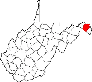
| City | Map of West Virginia highlighting Berkeley County | |
| Town | ||
| CDPs | ||
| Unincorporated communities |
| |
| Ghost town | ||