List of listed buildings in Fettercairn, Aberdeenshire
List
| Name | Location | Date Listed | Grid Ref. [note 1] | Geo-coordinates | Notes | LB Number [note 2] | Image |
|---|---|---|---|---|---|---|---|
| Fettercairn Village Two Houses (Norie), The Cross, North West Side Of Square | 56°51′07″N 2°34′30″W | Category B | 9476 |  Upload Photo | |||
| Fettercairn Village Kirkhill Farm Houses And Steading Buildings The Cross, South-East Side Of Square | 56°51′06″N 2°34′29″W | Category C(S) | 9479 | Upload Photo | |||
| Fettercairn Village Fettercairn Church Hall | 56°51′05″N 2°34′28″W | Category C(S) | 9480 | Upload Photo | |||
| Fettercairn Village, Sir John S Forbes Fountain | 56°51′06″N 2°34′31″W | Category B | 9485 | Upload Photo | |||
| Fettercairn Village, House (Robertson), Ramsay Square | 56°51′04″N 2°34′36″W | Category B | 9490 | Upload Photo | |||
| Fettercairn Village, Laurel Villa, Burnside | 56°51′01″N 2°34′25″W | Category C(S) | 9492 | Upload Photo | |||
| The Burn, Gatelodges, Gatepiers, Gardener's House, Public Shelter And Screen Wall With Moulded Footgate Linking To Gannochy Bridge | 56°49′41″N 2°39′22″W | Category B | 9501 | Upload Photo | |||
| Fasque, St Andrew's Episcopal Chapel | 56°52′12″N 2°34′32″W | Category B | 9505 | Upload Photo | |||
| Fettercairn Village, Gordon Villa | 56°51′01″N 2°34′22″W | Category C(S) | 9468 | Upload Photo | |||
| Fasque, Nos 1, 3, 4, 5 And 6 Old Mains Cottages | 56°52′04″N 2°34′09″W | Category C(S) | 51385 | Upload Photo | |||
| Fettercairn Village Fettercairn Bakery | 56°51′05″N 2°34′30″W | Category C(S) | 9482 | Upload Photo | |||
| Fettercairn Village, Bridge Over Burn Of Cauldcots At Royal Arch | 56°51′04″N 2°34′32″W | Category C(S) | 9487 | Upload Photo | |||
| Mains Of Balbegno Farmhouse, Screen Wall And Outbuildings At South-West | 56°50′51″N 2°35′20″W | Category B | 9498 | Upload Photo | |||
| Fettercairn House Garden Wall | 56°51′21″N 2°33′54″W | Category B | 9508 | Upload Photo | |||
| Fettercairn Village Parish Church And Churchyard Of Fettercairn | 56°51′06″N 2°34′25″W | Category B | 9509 | Upload Photo | |||
| Gannochy Bridge | 56°49′40″N 2°39′24″W | Category B | 9471 | 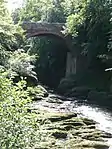
| |||
| Loups Suspension Bridge Over River North Esk | 56°50′06″N 2°39′58″W | Category B | 9473 | Upload Photo | |||
| Fasque, Apple House And Walled Garden With Garden House | 56°51′57″N 2°34′42″W | Category B | 51382 | Upload Photo | |||
| Fettercairn Village "The Corner" (Mrs Jolly, Mrs Murray) The Cross, South West Corner Of Square | 56°51′07″N 2°34′30″W | Category B | 9475 | Upload Photo | |||
| Balbegno Castle Garden And Terrace Walls And Gatepiers | 56°50′48″N 2°35′34″W | Category A | 9495 | Upload Photo | |||
| Balbegno Castle Stable Block And Coachhouses | 56°50′48″N 2°35′40″W | Category B | 9496 | Upload Photo | |||
| The Burn, Mansionhouse And Stable Block | 56°50′05″N 2°39′37″W | Category B | 9500 | Upload Photo | |||
| Fasque, Parsonage Of Fasque Including Gate | 56°51′46″N 2°34′15″W | Category C(S) | 9506 | Upload Photo | |||
| Fettercairn Village, Inchdowrie House And Gatepiers | 56°50′50″N 2°34′09″W | Category C(S) | 9470 | Upload Photo | |||
| Balbegno Castle | 56°50′49″N 2°35′34″W | Category A | 6754 | Upload Photo | |||
| Fasque, Home Farm Bothy | 56°52′23″N 2°34′48″W | Category C(S) | 51387 | Upload Photo | |||
| Fasque, The Octagon | 56°51′59″N 2°35′08″W | Category C(S) | 51388 | Upload Photo | |||
| Capo Farmhouse | 56°47′16″N 2°36′40″W | Category B | 9502 | Upload Photo | |||
| Fasque House, Stable Block | 56°52′19″N 2°34′52″W | Category B | 9504 | Upload Photo | |||
| Torwood House, Outbuildings | 56°50′02″N 2°38′15″W | Category C(S) | 13229 | Upload Photo | |||
| Fettercairn Village And House And Shop (Rw Kerr) And House (Mrs Scott) The Cross, North-East Side Of Square | 56°51′08″N 2°34′27″W | Category B | 9478 | Upload Photo | |||
| Fettercairn Village, Ramsay Arms Hotel | 56°51′03″N 2°34′34″W | Category B | 9488 | Upload Photo | |||
| Fettercairn Village, Arch Cottage And Former Store | 56°51′04″N 2°34′34″W | Category C(S) | 9489 | Upload Photo | |||
| Arnhall House Garden And Retaining Walls | 56°48′40″N 2°38′05″W | Category C(S) | 9494 | Upload Photo | |||
| Fasque, South Lodge, Gatepiers, Gates And Quadrant Walls | 56°51′32″N 2°34′24″W | Category B | 51383 | Upload Photo | |||
| Fasque, Bogendollo | 56°52′31″N 2°34′13″W | Category C(S) | 51386 | Upload Photo | |||
| Fettercairn Village, Royal Arch | 56°51′04″N 2°34′33″W | Category B | 9483 | Upload Photo | |||
| Fettercairn Village, Bridgend Cottage | 56°51′11″N 2°34′25″W | Category C(S) | 9469 | Upload Photo | |||
| Fettercairn, Market Cross Of Fettercairn | 56°51′07″N 2°34′29″W | Category A | 6755 | Upload Photo | |||
| Fettercairn Village Cottage (Daul) North-West Side Of Square Adjoining Above | 56°51′08″N 2°34′29″W | Category C(S) | 9477 | Upload Photo | |||
| Fettercairn Village, Burnside Villa, Burnside | 56°51′02″N 2°34′27″W | Category C(S) | 9491 | Upload Photo | |||
| Arnhall House | 56°48′42″N 2°38′06″W | Category B | 9493 | Upload Photo | |||
| Balbegno Castle, Dovecot | 56°50′49″N 2°35′29″W | Category A | 9497 | Upload Photo | |||
| Mains Of Balbegno Farmsteading | 56°50′53″N 2°35′22″W | Category C(S) | 9499 | Upload Photo | |||
| Fasque, Mains Of Fasque House Including Ancillary Buildings And Gates | 56°51′47″N 2°34′14″W | Category C(S) | 51384 | Upload Photo | |||
| Torwood House | 56°50′01″N 2°38′16″W | Category B | 13228 | Upload Photo | |||
| Tillyfoghills Farmhouse | 56°50′12″N 2°36′58″W | Category B | 9474 | Upload Photo | |||
| Fettercairn Village Post Office And House (J G Robertson) Fettercairn | 56°51′05″N 2°34′29″W | Category C(S) | 9481 | Upload Photo | |||
| Fettercairn Village, Glengowan | 56°51′05″N 2°34′32″W | Category C(S) | 9484 | Upload Photo | |||
| Fettercairn Village, Public Hall | 56°51′06″N 2°34′32″W | Category C(S) | 9486 | Upload Photo | |||
| Fasque House Including Court Of Offices And Sundial | 56°52′11″N 2°34′43″W | Category A | 9503 | Upload Photo | |||
| Fettercairn House | 56°51′22″N 2°33′58″W | Category B | 9507 | Upload Photo | |||
| Gannochy Tower | 56°49′31″N 2°39′11″W | Category C(S) | 9472 | Upload Photo |
Key
The scheme for classifying buildings in Scotland is:
- Category A: "buildings of national or international importance, either architectural or historic; or fine, little-altered examples of some particular period, style or building type."[1]
- Category B: "buildings of regional or more than local importance; or major examples of some particular period, style or building type, which may have been altered."[1]
- Category C: "buildings of local importance; lesser examples of any period, style, or building type, as originally constructed or moderately altered; and simple traditional buildings which group well with other listed buildings."[1]
In March 2016 there were 47,288 listed buildings in Scotland. Of these, 8% were Category A, and 50% were Category B, with the remaining 42% being Category C.[2]
Notes
- Sometimes known as OSGB36, the grid reference (where provided) is based on the British national grid reference system used by the Ordnance Survey.
• "Guide to National Grid". Ordnance Survey. Retrieved 12 December 2007.
• "Get-a-map". Ordnance Survey. Retrieved 17 December 2007. - Historic Environment Scotland assign a unique alphanumeric identifier to each designated site in Scotland, for listed buildings this always begins with "LB", for example "LB12345".
References
- All entries, addresses and coordinates are based on data from Historic Scotland. This data falls under the Open Government Licence
- "What is Listing?". Historic Environment Scotland. Retrieved 29 May 2018.
- Scotland's Historic Environment Audit 2016 (PDF). Historic Environment Scotland and the Built Environment Forum Scotland. pp. 15–16. Retrieved 29 May 2018.
This article is issued from Wikipedia. The text is licensed under Creative Commons - Attribution - Sharealike. Additional terms may apply for the media files.