List of listed buildings in Glasgow/2
List
| Name | Location | Date Listed | Grid Ref. [note 1] | Geo-coordinates | Notes | LB Number [note 2] | Image |
|---|---|---|---|---|---|---|---|
| 85 West George Street, 79 Nelson Mandela Place And West Nile Street | 55°51′43″N 4°15′17″W | Category B | 33221 | 
| |||
| 215-221 (Odd Nos) West George Street And 110-116 (Even Nos) West George Lane | 55°51′45″N 4°15′39″W | Category B | 33229 |  Upload Photo | |||
| 239-247 (Odd Nos) West George Street | 55°51′46″N 4°15′42″W | Category B | 33231 | Upload Photo | |||
| 19-30 (Excluding Nos 23, 23A, 23B, 26A) St Vincent Crescent And 21 Corunna Street | 55°51′48″N 4°17′00″W | Category A | 33128 | Upload Photo | |||
| 31-70 (Excluding Nos 35A,36A,37A,39A) St Vincent Crescent And 30 Corunna Street | 55°51′51″N 4°17′20″W | Category A | 33129 | Upload Photo | |||
| 67-79 (Odd Nos) St Vincent Street, 10-14 (Even Nos) Drury Street | 55°51′40″N 4°15′21″W | Category B | 33133 | 
| |||
| 101-103A (Odd Nos) St Vincent Street And 19-25 (Odd Nos) Renfield Street And 4, 6 And 6A St Vincent Lane | 55°51′41″N 4°15′26″W | Category B | 33136 | 
| |||
| 185, 187 St Vincent Street | 55°51′43″N 4°15′43″W | Category B | 33145 | Upload Photo | |||
| 217-245A (Odd Nos) St Vincent Street And 79 Blythswood Street, 128 St Vincent Lane | 55°51′43″N 4°15′47″W | Category B | 33149 | Upload Photo | |||
| 200 St Vincent Street | 55°51′44″N 4°15′39″W | Category A | 33162 | 
| |||
| 260-280 (Even Nos) St Vincent Street, 95-101 (Odd Nos) Douglas Street And 124 Pitt Street | 55°51′45″N 4°15′52″W | Category B | 33167 | Upload Photo | |||
| 1-27 (Inclusive Nos) Sandyford Place (Sauchiehall Street), 141-149(Odd Nos) Elderslie Street Including Low Wall With Railings Between Service Road To Sandyford Place And Sauchiehall Street | 55°51′56″N 4°16′48″W | Category B | 33169 | Upload Photo | |||
| 183-209 (Even Nos) Kent Road With 998-1004 (Even Nos) Argyle Street | 55°51′50″N 4°16′50″W | Category B | 33079 | Upload Photo | |||
| 8-20 (Even Nos) Minerva Street And 995-1017 (Odd Nos) Argyle Street (Finnieston) | 55°51′49″N 4°16′56″W | Category B | 33085 | Upload Photo | |||
| 1-17 (Inclusive Nos) Newton Terrace, Sauchiehall Street, 128 Elderslie Street And 33 Granville Street | 55°51′57″N 4°16′29″W | Category B | 33092 | Upload Photo | |||
| 206 - 212 (Even Nos) Old Dumbarton Road, Former Bishop Mills | 55°52′06″N 4°17′57″W | Category B | 33096 | Upload Photo | |||
| 221 Renfrew Street, Garnetbank Primary School And Janitor's House | 55°51′59″N 4°16′02″W | Category B | 33107 | 
| |||
| 23, 25 Rose Street, St Aloysius' Church (Roman Catholic) | 55°51′59″N 4°15′42″W | Category A | 33115 | 
| |||
| 41-47 (Odd Nos) Rose Street And 29, 31 Buccleuch Street | 55°52′02″N 4°15′41″W | Category B | 33116 | Upload Photo | |||
| 1-24 (Inclusive Nos) Royal Crescent With 1 North Claremont Street And 36 Kelvingrove Street | 55°51′57″N 4°16′59″W | Category B | 33120 | 
| |||
| 2-30 (Even Nos) St George's Road, 540-546 (Even Nos) Sauchiehall Street And 357,359 Renfrew Street, Charing Cross Mansions | 55°52′00″N 4°16′14″W | Category A | 33127 | 
| |||
| 11-27 (Odd Nos) Elmbank Street | 55°51′49″N 4°16′07″W | Category B | 33021 | Upload Photo | |||
| 1-17 (Inclusive Nos) Fitzroy Place And 85 Claremont Street (Sauchiehall Street) | 55°51′56″N 4°16′51″W | Category B | 33023 | Upload Photo | |||
| 1-25 (Odd Nos) Carfrae Street And 164 And 172 Yorkihill Street, Former Pearson Hall | 55°51′53″N 4°17′38″W | Category B | 33024 | Upload Photo | |||
| 1-9 (Odd Nos) Gordon Street And 101-111 (Odd Nos) Buchanan Street | 55°51′37″N 4°15′17″W | Category B | 33025 | Upload Photo | |||
| 71, 97, 99 Gordon St, And 16, 18, 50 Hope St, Central Station & Hotel, (Former Caledonian Railway Station) With 229-263 (Odd Nos) & 194-240 (Even Nos) Argyle St, 15-19 (Odd Nos) & 12-24 (Even Nos) Midland Street & 9-17 (Odd Nos) Clyde Place | 55°51′35″N 4°15′31″W | Category A | 33029 | _Central_Station%252C_Glasgow.jpg.webp)
| |||
| 72-80 (Even Nos) Gordon Street, Grosvenor Building | 55°51′39″N 4°15′28″W | Category A | 33034 | Upload Photo | |||
| Granville Street, Berkeley Street And Kent Road Mitchell Theatre, Formerly St Andrew's Halls | 55°51′53″N 4°16′24″W | Category A | 33036 | Upload Photo | |||
| 80, 82 Hill Street | 55°52′02″N 4°15′53″W | Category C(S) | 33042 | 
| |||
| 102-112 (Even Nos) Hill Street, And 37, 39 Garnethill Street, Peel Terrace | 55°52′03″N 4°15′57″W | Category A | 33044 | Upload Photo | |||
| 15, 17 Hope Street | 55°51′32″N 4°15′34″W | Category B | 33048 | Upload Photo | |||
| 67 Hope Street (Known As No 55) | 55°51′36″N 4°15′34″W | Category B | 33051 | Upload Photo | |||
| 91-115 (Odd Nos) Hope Street, 2-14 (Even Nos) Waterloo Street And 1-13 (Odd Nos) Bothwell Street | 55°51′38″N 4°15′34″W | Category A | 33052 | Upload Photo | |||
| 307-335 (Odd Nos) Hope Street And 91, Cowcaddens Street, Mcconnel's Building | 55°52′00″N 4°15′25″W | Category B | 33055 | 
| |||
| 160-166 (Even Nos) Hope Street And West Regent Street | 55°51′47″N 4°15′27″W | Category C(S) | 33058 | Upload Photo | |||
| 170, 172 Hope Street, Lion Chambers | 55°51′49″N 4°15′26″W | Category A | 33059 | 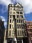
| |||
| 226-228 (Even Nos) Hope Street, And 55 Renfrew Street, Hope Street Post Office | 55°51′55″N 4°15′24″W | Category B | 33060 | 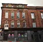
| |||
| Kelvingrove Park, Kelvingrove Art Gallery And Museum | 55°52′07″N 4°17′26″W | Category A | 33071 | _(3839582240).jpg.webp)
| |||
| 13 Kelvinhaugh Street, Sandyford-Henderson Memorial Church | 55°51′53″N 4°17′09″W | Category B | 33075 | 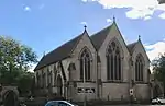
| |||
| 202-218 (Even Nos) Bath Street, 121 Douglas Street, Adelaide Place (North) | 55°51′54″N 4°15′52″W | Category B | 32968 | Upload Photo | |||
| 34-56 (Even Nos) Bentinck Street And 46 Gray Street | 55°52′01″N 4°17′10″W | Category B | 32972 | Upload Photo | |||
| 53-91 (Odd Nos) Berkeley Street, 108, 110 Elderslie Street And 13-17 (Odd Nos) Granville Street | 55°51′54″N 4°16′28″W | Category B | 32973 | Upload Photo | |||
| 1-7 (Inclusive Nos) Blythswood Square And 112 Douglas Street | 55°51′51″N 4°15′48″W | Category B | 32975 | 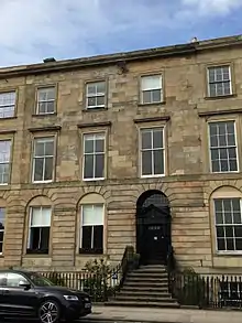
| |||
| 21-26A (Inclusive Nos) Blythswood Square, 268 West George Street And 177 West Regent Street | 55°51′48″N 4°15′52″W | Category B | 32978 | 
| |||
| 15-25 (Odd Nos) Bothwell Street | 55°51′39″N 4°15′35″W | Category B | 32979 | Upload Photo | |||
| 81-107 (Odd Nos) Bothwell Street, 80 Blythswood Street, And 89 West Campbell Street, Scottish Legal Life Assurance Society | 55°51′40″N 4°15′45″W | Category B | 32982 | 
| |||
| 2-28 (Even Nos) Bothwell Street, 123 Hope Street | 55°51′41″N 4°15′32″W | Category A | 32983 | Upload Photo | |||
| 54-64 (Even Nos) Broomielaw, 5, 9 Oswald Street | 55°51′24″N 4°15′37″W | Category B | 32988 | Upload Photo | |||
| 46-60 (Even Nos) Buccleuch Street And 53 Dalhousie Street | 55°52′04″N 4°15′47″W | Category B | 32990 | Upload Photo | |||
| 71-79 (Odd Nos) Buchanan Street | 55°51′35″N 4°15′17″W | Category B | 32995 | Upload Photo | |||
| 87, 89 Buchanan Street | 55°51′36″N 4°15′17″W | Category B | 32997 | 
| |||
| 2-13 (Excluding No 4) Clairmont Gardens | 55°52′00″N 4°16′40″W | Category B | 33009 | Upload Photo | |||
| 71, 73 Claremont Street And 178 Berkeley Street, Henry Wood Hall, (Sno Centre), Former Trinity Congregational Church | 55°51′55″N 4°16′50″W | Category B | 33010 | Upload Photo | |||
| 24 Elliot Street And 93 Houldsworth Street (Known As 93 Houldsworth Street) | 55°51′44″N 4°16′45″W | Category B | 33017 | 
| |||
| 1F Gilmorehill, University Of Glasgow, Chemistry Building (Including Inorganic, Physical, And Organic Chemistry) Former "Institute Of Chemistry" | 55°52′19″N 4°17′36″W | Category A | 32918 | 
| |||
| 1 Gilmorehill, University Of Glasgow, Hunter Memorial | 55°52′19″N 4°17′18″W | Category B | 32920 | 
| |||
| 1-13 (Inclusive) Professors' Square And Principal's Residence, University Of Glasgow | 55°52′18″N 4°17′27″W | Category B | 32926 | 
| |||
| 321-333 (Odd Nos) Argyle Street | 55°51′31″N 4°15′43″W | Category C(S) | 32939 | Upload Photo | |||
| 1185-1263 (Odd Nos) Argyle Street, Franklin Terrace | 55°51′56″N 4°17′14″W | Category B | 32946 | Upload Photo | |||
| 1058-1100 Excluding No 1070 (Even Nos) Argyle Street And 4-8 (Even Nos) Kelvingrove Street | 55°51′53″N 4°17′01″W | Category B | 32954 | Upload Photo | |||
| 2 And 4 Dumbarton Road, Kelvingrove Park, Sunlight Cottages | 55°52′14″N 4°17′30″W | Category B | 32883 | Upload Photo | |||
| 34-52 (Even Nos) Lawrence Street, 45-49 (Odd Nos) Dowanhill Street, 29-47 (Odd Nos) Havelock Street, 86-90 (Even Nos) Hyndland Street | 55°52′24″N 4°18′01″W | Category B | 32885 | Upload Photo | |||
| 1-17 (Inclusive Nos) Lilybank Gardens, University Of Glasgow | 55°52′28″N 4°17′30″W | Category C(S) | 32886 | 
| |||
| 1-4 (Inclusive Nos) Lilybank Terrace, Laurel Park School | 55°52′28″N 4°17′24″W | Category B | 32887 | 
| |||
| 62-70 (Even Nos) Oakfield Avenue And 63 Gibson Street, Hillhead | 55°52′23″N 4°17′09″W | Category C(S) | 32888 | 
| |||
| 72-80 (Even Nos) Oakfield Avenue And 70 University Avenue, Hillhead | 55°52′22″N 4°17′11″W | Category C(S) | 32889 | Upload Photo | |||
| 10-18 (Even Nos) Queen Margaret Drive, 75-81 (Odd Nos) Hamilton Drive And 11, 13 Buckingham Street | 55°52′41″N 4°17′16″W | Category C(S) | 32901 | Upload Photo | |||
| 53-63 (Odd Nos) Southpark Avenue | 55°52′25″N 4°17′11″W | Category B | 32905 | 
| |||
| Southpark Terrace,1-15 (Inclusive Nos) | 55°52′29″N 4°17′10″W | Category B | 32908 | 
| |||
| 44 Oakfield Avenue And 37 Southpark Avenue, Hillhead High School And Entrance Lodge | 55°52′28″N 4°17′07″W | Category B | 32909 | 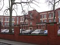
| |||
| 5-11 (Odd Nos) Turnberry Road With Gatepiers | 55°52′32″N 4°18′24″W | Category B | 32910 | Upload Photo | |||
| 13, 15 Turnberry Road | 55°52′32″N 4°18′25″W | Category B | 32911 | Upload Photo | |||
| 1-16 (Inclusive Nos) Buckingham Terrace, 2, 4 Buckingham Street, 1, 3 Ruskin Place (Great Western Road) With Retaining Wall And Piers To Great Western Road | 55°52′38″N 4°17′13″W | Category A | 32850 | Upload Photo | |||
| 24-31 (Inclusive Nos) Buckingham Terrace, 2 Queen Margaret Drive, 1, 3, 5 Buckingham Street | 55°52′40″N 4°17′18″W | Category B | 32851 | Upload Photo | |||
| 62 Church Street, 10C Dumbarton Road, Western Infirmary, Outpatients And Dispensary | 55°52′20″N 4°17′20″W | Category B | 32857 | Upload Photo | |||
| 33, 35 Dumbarton Road, Partick Sewage Pumping Station | 55°52′11″N 4°17′45″W | Category B | 32862 | 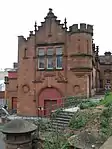
| |||
| 271-285 (Odd Nos) Dumbarton Road | 55°52′14″N 4°18′16″W | Category B | 32863 | Upload Photo | |||
| 383-405 (Odd Nos) Dumbarton Road, 2-10 (Even Nos) Vine Street And 1 Merkland Street | 55°52′14″N 4°18′31″W | Category B | 32865 | Upload Photo | |||
| 2-8 (Even Nos) North Gardner Street And 28-30 (Even Nos) Partickhill Road | 55°52′27″N 4°18′19″W | Category B | 32868 | Upload Photo | |||
| 2-28 (Even Nos) Granby Terrace, Hillhead Street | 55°52′34″N 4°17′13″W | Category B | 32870 | 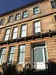
| |||
| 1-33 (Odd Nos) Hamilton Drive, Kelvinside | 55°52′36″N 4°17′00″W | Category B | 32873 | Upload Photo | |||
| 35-51 (Odd Nos) Hamilton Drive (1-9 Inclusive Nos) Northpark Terrace, Kelvinside | 55°52′39″N 4°17′09″W | Category A | 32874 | Upload Photo | |||
| 53-67 (Odd Nos) Hamilton Drive And 6 Buckingham Street With Boundary Walls, Gatepiers, Garden Steps And Balustrading | 55°52′39″N 4°17′11″W | Category B | 32875 | Upload Photo | |||
| 2-30 (Even Nos) Hamilton Drive And 21 Hamilton Park Avenue | 55°52′38″N 4°17′00″W | Category C(S) | 32876 | Upload Photo | |||
| 45-67 (Odd Nos) Queen Street, The Guild Hall | 55°51′33″N 4°15′10″W | Category B | 32815 | Upload Photo | |||
| 73-87 (Odd Nos) Queen Street Including 77 A-D Queen Street (South Exchange Court) And 85 A-D Queen Street (Royal Exchange Court) | 55°51′35″N 4°15′10″W | Category B | 32817 | Upload Photo | |||
| 46-48 (Inclusive Nos) St Andrews Square | 55°51′17″N 4°14′37″W | Category B | 32832 | Upload Photo | |||
| 17-29 (Odd Nos) St Vincent Place, Scottish Provident Institution | 55°51′39″N 4°15′10″W | Category A | 32836 | 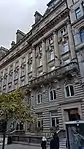
| |||
| 31-39 (Odd Nos) St Vincent Place | 55°51′39″N 4°15′12″W | Category B | 32837 | 
| |||
| 12-16 (Even Nos) St Vincent Place, Anchor Building | 55°51′41″N 4°15′08″W | Category A | 32839 | 
| |||
| 24 St Vincent Place, Citizen Building | 55°51′41″N 4°15′10″W | Category A | 32840 | 
| |||
| 30-40 (Even Nos) St Vincent Place, Known As 30 St Vincent Place | 55°51′41″N 4°15′11″W | Category A | 32841 | 
| |||
| 1-37 (Odd Nos) Banavie Road | 55°52′31″N 4°18′43″W | Category B | 32847 | Upload Photo | |||
| 97 Hutcheson Street And 14 Garth Street | 55°51′34″N 4°14′53″W | Category B | 32730 | Upload Photo | |||
| 223-229 (Odd Nos) Ingram Street And 89 Miller Street | 55°51′35″N 4°15′03″W | Category B | 32737 | Upload Photo | |||
| 10-20 (Even Nos) Ingram Street And 19-23 (Odd Nos) College Street | 55°51′34″N 4°14′31″W | Category C(S) | 32738 | Upload Photo | |||
| 98 Ingram Street, Ramshorn Theatre, Former St Paul's And St David's Church, (Church Of Scotland) And Churchyard And Boundary Railings | 55°51′35″N 4°14′42″W | Category A | 32740 | 
| |||
| 3-39 (Odd Nos) Trongate 2 Saltmarket 5-7 (Odd Nos) Chisholm Street | 55°51′23″N 4°14′41″W | Category B | 32768 | Upload Photo | |||
| 71 Trongate, Tron Steeple | 55°51′25″N 4°14′44″W | Category A | 32769 | 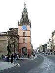
| |||
| 79-83 (Odd Nos) Trongate And 5-11 (Odd Nos) King Street | 55°51′25″N 4°14′46″W | Category B | 32771 | Upload Photo | |||
| 167 Trongate | 55°51′25″N 4°14′55″W | Category B | 32778 | Upload Photo | |||
| 173-187 (Odd Nos) Trongate And 17-43 (Odd Nos) Stockwell Street And 118-122 (Even Nos) Osborne Street | 55°51′25″N 4°14′57″W | Category B | 32779 | 
| |||
| 20-46 (Even Nos) Trongate And 2-58 (Even Nos) Albion Street And 38-40 (Even Nos) Bell Street | 55°51′27″N 4°14′39″W | Category B | 32781 | Upload Photo | |||
| 60-90 (Even Nos) Trongate And 19-29 (Odd Nos) Albion Street | 55°51′26″N 4°14′45″W | Category A | 32782 | 
| |||
| 140-144 (Even Nos) Trongate | 55°51′11″N 4°14′49″W | Category B | 32787 | Upload Photo | |||
| 54 St Andrews Square And 51 Turnbull Street, Former Central Police Headquarters | 55°51′18″N 4°14′39″W | Category B | 32792 | 
| |||
| 37-47 (Odd Nos) Virginia Street | 55°51′32″N 4°15′01″W | Category A | 32795 | _Virginia_Street%252C_Glasgow%252C_2018-06-27.jpg.webp)
| |||
| 49-53 (Odd Nos) Virginia Street | 55°51′32″N 4°15′00″W | Category A | 32796 | Upload Photo | |||
| 32 Walls Street And 7-21 (Odd Nos) Blackfriars Street, 23 Blackfriars Street (Blackfriars Court) | 55°51′30″N 4°14′35″W | Category B | 32800 | Upload Photo | |||
| Cathedral Square, Statue Of David Livingstone | 55°51′46″N 4°14′11″W | Category B | 32655 | 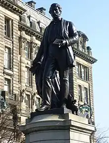
| |||
| 72 Clyde Street And 135 Bridgegate, Old Fish Market Known As The Briggait | 55°51′16″N 4°14′58″W | Category A | 32664 | 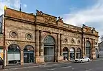
| |||
| Clyde Street And South Portland Street, Suspension Bridge | 55°51′18″N 4°15′20″W | Category A | 32668 | 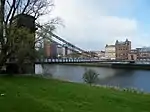
| |||
| 7-13 (Odd Nos) Duke Street | 55°51′37″N 4°14′20″W | Category B | 32677 | 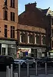
| |||
| 15-31 (Odd Nos) Duke Street | 55°51′37″N 4°14′19″W | Category B | 32678 | Upload Photo | |||
| 7 Garth Street | 55°51′33″N 4°14′54″W | Category C(S) | 32683 | Upload Photo | |||
| 24 George Square And 12-16 (Even Nos) Anchor Lane | 55°51′41″N 4°15′07″W | Category A | 32688 | 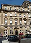
| |||
| George Square, William Ewart Gladstone Statue | 55°51′41″N 4°15′00″W | Category B | 32695 | 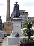
| |||
| George Square, Sir John Moore Statue | 55°51′39″N 4°14′58″W | Category A | 32698 | 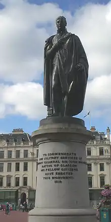
| |||
| 280 George Street And 24 North Frederick Street | 55°51′42″N 4°14′55″W | Category B | 32710 | Upload Photo | |||
| 33-39 (Odd Nos) Greendyke Street, Former Hide, Skin And Tallow Market | 55°51′14″N 4°14′38″W | Category B | 32716 | Upload Photo | |||
| High Street Glasgow Cross The Tolbooth Steeple | 55°51′25″N 4°14′37″W | Category A | 32717 | .jpg.webp)
| |||
| 15-55 (0Dd Nos) High Street And 84-88 (Even Nos) Bell Street | 55°51′27″N 4°14′36″W | Category B | 32718 | Upload Photo | |||
| 42-47 (Inclusive Nos) Westbourne Gardens | 55°52′49″N 4°18′13″W | Category B | 32603 | Upload Photo | |||
| 52 Westbourne Gardens, Belhaven - Westbourne Church And Hall, Church Of Scotland | 55°52′53″N 4°18′12″W | Category A | 32605 | Upload Photo | |||
| 50 Argyle Street With 3 Miller Street | 55°51′29″N 4°15′06″W | Category B | 32611 | Upload Photo | |||
| 98-102 (Even Nos) Argyle Street | 55°51′30″N 4°15′13″W | Category B | 32612 | Upload Photo | |||
| Argyle Street, Argyll Arcade (Through 98-102 Argyle Street) 3-66 (Inclusive Nos, Leading To Buchanan Street) | 55°51′30″N 4°15′12″W | Category A | 32613 | Upload Photo | |||
| 62 Argyll Arcade, 108 Argyle Street, Morrison Court, David Sloan's Arcade Cafe | 55°51′31″N 4°15′13″W | Category A | 32614 | 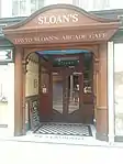
| |||
| 17 Parson Street, Martyr's School With Retaining Walls And Gates | 55°51′55″N 4°14′15″W | Category A | 32619 | .jpg.webp)
| |||
| 28-32 (Even Nos) Buchanan Street, Argyll Chambers | 55°51′32″N 4°15′16″W | Category B | 32633 | 
| |||
| 78-90 (Even Nos) Buchanan Street With 9-17 (Odd Nos) Exchange Place | 55°51′36″N 4°15′14″W | Category B | 32638 | Upload Photo | |||
| 106-112 (Even Nos) Buchanan Street With 1 Royal Bank Place | 55°51′38″N 4°15′13″W | Category B | 32640 | 
| |||
| 109-123 (Odd Nos) Candleriggs | 55°51′33″N 4°14′44″W | Category B | 32645 | Upload Photo | |||
| 60-106 (Even Nos) Candleriggs 3-31 (Odd Nos) Bell Street And 69-97 (Odd Nos) Albion Street Candleriggs City Hall And Bazaar | 55°51′32″N 4°14′43″W | Category A | 32647 | 
| |||
| 1-15 (Inclusive Nos) Princes Gardens | 55°52′34″N 4°18′18″W | Category B | 32575 | 
| |||
| Nos 1,5,6,7,8 Queens Gardens, With Gatepiers And Rear Boundary Railings | 55°52′36″N 4°17′59″W | Category B | 32578 | Upload Photo | |||
| 5-9 (Odd Nos) Redlands Road And Retaining Walls | 55°52′53″N 4°17′51″W | Category B | 32580 | Upload Photo | |||
| 1-16A (Inclusive Nos) Rosslyn Terrace | 55°52′45″N 4°17′48″W | Category B | 32581 | Upload Photo | |||
| 17-19 (Inclusive Nos) Rosslyn Terrace, And Gatepiers | 55°52′47″N 4°17′52″W | Category C(S) | 32582 | Upload Photo | |||
| 6, 6A And 6B Victoria Circus, (Kensington Tower), With Boundary Walls And Gatepiers | 55°52′44″N 4°18′04″W | Category B | 32593 | Upload Photo | |||
| 10 Victoria Circus, (Ramoyle), With Walls And Gatepiers | 55°52′41″N 4°18′06″W | Category B | 32594 | Upload Photo | |||
| 6-34 (Even Nos) Victoria Crescent Road With Walls To Crescent Lane | 55°52′34″N 4°17′49″W | Category B | 32598 | Upload Photo | |||
| 38-52A (Even Nos) Victoria Crescent Road | 55°52′37″N 4°17′55″W | Category B | 32599 | Upload Photo | |||
| 1A And 2-18A (Inclusive Nos) Westbourne Gardens | 55°52′52″N 4°18′09″W | Category B | 32600 | Upload Photo | |||
| 20-27 (Inclusive Nos) Westbourne Gardens | 55°52′49″N 4°18′03″W | Category B | 32601 | Upload Photo | |||
| 28-41 (Inclusive Nos) Westbourne Gardens | 55°52′49″N 4°18′05″W | Category B | 32602 | Upload Photo | |||
| 22-38 (Even Nos) Kingsborough Gardens | 55°52′44″N 4°18′15″W | Category B | 32544 | Upload Photo | |||
| 42-54 (Even Nos) Kingsborough Gardens | 55°52′42″N 4°18′15″W | Category B | 32546 | Upload Photo | |||
| 3 Kirklee Road And 1 Redlands Road | 55°52′52″N 4°17′50″W | Category A | 32550 | Upload Photo | |||
| 7-23 (Odd Nos) Kirklee Road And 2 Redlands Road, With Walls, Gatepiers And Railings | 55°52′54″N 4°17′48″W | Category A | 32551 | Upload Photo |
Key
The scheme for classifying buildings in Scotland is:
- Category A: "buildings of national or international importance, either architectural or historic; or fine, little-altered examples of some particular period, style or building type."[1]
- Category B: "buildings of regional or more than local importance; or major examples of some particular period, style or building type, which may have been altered."[1]
- Category C: "buildings of local importance; lesser examples of any period, style, or building type, as originally constructed or moderately altered; and simple traditional buildings which group well with other listed buildings."[1]
In March 2016 there were 47,288 listed buildings in Scotland. Of these, 8% were Category A, and 50% were Category B, with the remaining 42% being Category C.[2]
See also
Notes
- Sometimes known as OSGB36, the grid reference (where provided) is based on the British national grid reference system used by the Ordnance Survey.
• "Guide to National Grid". Ordnance Survey. Retrieved 12 December 2007.
• "Get-a-map". Ordnance Survey. Retrieved 17 December 2007. - Historic Environment Scotland assign a unique alphanumeric identifier to each designated site in Scotland, for listed buildings this always begins with "LB", for example "LB12345".
References
- All entries, addresses and coordinates are based on data from Historic Scotland. This data falls under the Open Government Licence
- "What is Listing?". Historic Environment Scotland. Retrieved 29 May 2018.
- Scotland's Historic Environment Audit 2016 (PDF). Historic Environment Scotland and the Built Environment Forum Scotland. pp. 15–16. Retrieved 29 May 2018.
This article is issued from Wikipedia. The text is licensed under Creative Commons - Attribution - Sharealike. Additional terms may apply for the media files.