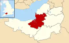
List of scheduled monuments in Sedgemoor
Sedgemoor is a low-lying area of land in Somerset, England. It lies close to sea level south of the Polden Hills, forming a large part of the Somerset Levels and Moors, a wetland area between the Mendips and the Blackdown Hills.[1] The Neolithic people exploited the reed swamps for their natural resources and started to construct wooden trackways, including the world's oldest known timber trackway, the Post Track, dating to the 3800s BC.[2] The Levels were the location of the Iron Age Glastonbury Lake Village as well as two lake villages at Meare Lake.[3][4] Several settlements and hill forts were built on the natural "islands" of slightly raised land, including Brent Knoll and Glastonbury.[5][6] In the Roman period sea salt was extracted and a string of settlements were set up along the Polden Hills.[7]
A scheduled monument is a nationally important archaeological site or monument which is given legal protection by being placed on a list (or "schedule") by the Secretary of State for Culture, Media and Sport; English Heritage takes the leading role in identifying such sites. The legislation governing this is the Ancient Monuments and Archaeological Areas Act 1979. The term "monument" can apply to the whole range of archaeological sites, and they are not always visible above ground. Such sites have to have been deliberately constructed by human activity. They range from prehistoric standing stones and burial sites, through Roman remains and medieval structures such as castles and monasteries, to later structures such as industrial sites and buildings constructed for the World Wars or the Cold War.[8]
There are 79 scheduled monuments in Sedgemoor. The oldest are Neolithic, Bronze Age or Iron Age including hill forts, bowl barrows and occupied caves including several in Cheddar Gorge. Cannington Camp (which is also known as Cynwit Castle) dates from the Bronze Age,[9] while Brent Knoll Camp between the Somerset Levels and Brean Down is Iron Age (although there are some Bronze Age artefacts) and it was reused in the Roman period.[10][11] The Romano-British period is represented with several sites. Medieval sites include several motte-and-bailey castles and church or village crosses. Industrial development, particularly in Bridgwater, are represented by brick and tile kilns and a telescopic railway bridge.[12][13] The most recent monuments are World War II bunkers and bombing decoys on Black Down. The monuments are listed below using the titles given in the English Heritage data sheets.
Monuments
| Name | Location | Type | Completed [note 1] | Grid ref.[note 2] Geo-coordinates | Notes | Entry number [note 3] | Image | Ref. |
|---|---|---|---|---|---|---|---|---|
| Alstone lake settlement site | West Huntspill | Earthworks | Iron Age | ST 31297 46794 51°12′58″N 2°59′06″W | The site was used in the Iron Age and again during the Romano-British and Medieval periods. It was at the edge of an inland lake which is now dry land. | 1012311 |  Upload Photo | [14] |
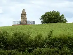
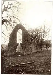
| Anglo-Saxon occupation site and site of Athelney Abbey on Athelney Hill | Lyng | Earthworks | 9th century | ST 34330 29271 51°03′33″N 2°56′04″W | Athelney Abbey was founded by King Alfred in 888, after he stayed there before the Battle of Edington, as a religious house for monks of the Order of St. Benedict. Originally Athelney was a small island in swampland. Following the dissolution it was acquired for use as a private residence by Lord Audley who had the church demolished. With the church demolished and other buildings fallen into disrepair, nothing visible remains at the site today. The site of the Abbey is marked by King Alfred's Monument which is a Grade II listed building. | 1019099 | [15][16] [17] [18][19] | |
| Anglo-Saxon burh at East Lyng | Lyng | Earthworks | 9th century | ST 33312 29034 51°03′24″N 2°57′10″W | Earthworks remain of a burh which was important during the reign of Alfred the Great. It was surrounded by defensive banks and connected to Athelney Abbey by a causeway across marshland of the Somerset Levels. | 1019100 | Upload Photo | [20] |
| Balt Moor Wall | Lyng | Earthworks | Middle Ages | ST 33826 29095 51°03′27″N 2°56′44″W | Balt Moor Wall is an earthwork situated on the Somerset Levels to the northwest of the River Tone. The site contains the remains of a section of medieval causeway, which now forms a raised embankment between 6 metres (20 ft) and 10 metres (33 ft) wide and up to 2 metres (6 ft 7 in) high. The structure, which English Heritage refers to as "a rare example of medieval engineering", appears to have been built to protect the Salt Moor from the flooding of the River Tone in the Athelney-Lyng gap. | 1018952 | Upload Photo | [21][22] [23][24] |
| Barrow at Wilmot's Pool and a cairn 45 m to the north | Over Stowey | Bowl barrow and cairn | Bronze Age | ST1530838148 51°08′11″N 3°12′43″W | The bowl barrow next to Wilmot's pool is 22 metres (72 ft) in diameter. The cairn, which is 45 millimetres (1.8 in) from the barrow, is approximately 4.5 metres (15 ft) in diameter and 0.6 metres (2 ft 0 in) high. | 1417361 | Upload Photo | [25] |
| Blackford Manor House Moat | Blackford | Earthworks | 14th century | ST 41022 47891 51°13′38″N 2°50′46″W | Earthworks from a complex of buildings, including a hall and chapel, surrounded by a moat. The site is believed to have been a bishops palace demolished by John Harewell, the Bishop of Bath and Wells, in the 1380s. | 1006135 | Upload Photo | [26] |
| Bowl barrow 75 m south west of Long House Barn | Cheddar | Bowl barrow | Neolithic to Bronze Age | ST 47777 56015 51°18′03″N 2°45′02″W | A bowl barrow approximately 12 metres (39 ft) in diameter. | 1014712 | Upload Photo | [27] |
| Bowl barrow 91 m south of Piney Sleight Farm | Cheddar | Bowl barrow | Bronze Age | ST 47589 55263 51°17′39″N 2°45′11″W | A bowl barrow approximately 9 metres (30 ft) in diameter. | 1010922 | Upload Photo | [28] |
| Bowl barrow 190 m south west of Tyning's Farm: part of the Tyning's Farm round barrow cemetery | Cheddar | Bowl barrow | Bronze Age | ST 46849 56376 51°18′14″N 2°45′50″W | A bowl barrow approximately 14 metres (46 ft) in diameter. | 1012593 | Upload Photo | [29] |
| Bowl barrow 250 m south east of Tyning's Farm: part of the Tyning's Farm round barrow cemetery | Cheddar | Bowl barrow | Bronze Age | ST 47085 56283 51°18′12″N 2°45′37″W | A bowl barrow approximately 15 metres (49 ft) in diameter. | 1015815 | 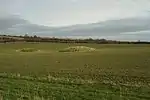 Bowl barrow 250 m south east of Tyning's Farm: part of the Tyning's Farm round barrow cemetery | [30] |
| Bowl barrow 250 m south west of Ashridge Farm | Cheddar | Bowl barrow | Bronze Age | ST 46472 55781 51°17′55″N 2°46′09″W | A bowl barrow approximately 20 metres (66 ft) in diameter. | 1012592 | Upload Photo | [31] |
| Bowl barrow 300 m east of Batts Coombe Quarry | Cheddar | Bowl barrow | Bronze Age | ST 46612 55154 51°17′35″N 2°46′01″W | A bowl barrow approximately 14 metres (46 ft) in diameter. | 1010800 | 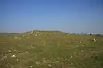 Bowl barrow 300 m east of Batts Coombe Quarry | [32] |
| Bowl barrow 300 m north east of Tyning's Farm | Cheddar | Bowl barrow | Bronze Age | ST 47248 56680 51°18′24″N 2°45′29″W | A bowl barrow approximately 18 metres (59 ft) in diameter. | 1011584 | Upload Photo | [33] |
| Bowl barrow 330 m east of Batts Coombe Quarry | Cheddar | Bowl barrow | Bronze Age | ST 46539 55021 51°17′30″N 2°46′05″W | A bowl barrow approximately 15 metres (49 ft) in diameter. | 1010753 | Upload Photo | [34] |
| Bowl barrow 350 m east of Batts Coombe Quarry | Cheddar | Bowl barrow | Bronze Age | ST 46585 55059 51°17′32″N 2°46′03″W | A bowl barrow approximately 18 metres (59 ft) in diameter. | 1010921 | Upload Photo | [35] |
| Bowl barrow 400 m southeast of Wellington Farm | Cheddar | Bowl barrow | Bronze Age | ST 49457 53390 51°16′39″N 2°43′34″W | A bowl barrow approximately 18 metres (59 ft) in diameter. | 1011533 | Upload Photo | [36] |
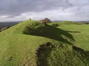
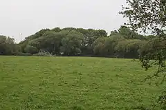
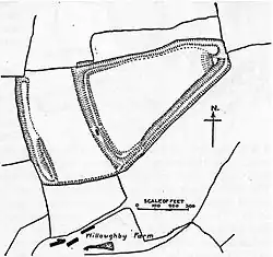
| Brent Knoll hillfort and associated field system | Brent Knoll | Hill fort | Iron Age | ST 34124 51021 51°15′15″N 2°56′44″W | Brent Knoll Camp is at the summit of a 137-metre (449 ft) high hill which dominates the low surrounding landscape of the Somerset Levels. Brent Knoll has seen human settlement since at least the Bronze Age, becoming an Iron Age Fort about 2,000 B.C., which covers an area of 1.6 hectares (4.0 acres). It is defended by a single wall around 10 metres (33 ft) high and by a single ditch. The Romans used its summit as a fortification. The fort has been claimed as the site of Mons Badonicus. | 1008248 | [37][38] | |
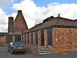
| Brick and tile kiln west of East Quay, 200 m east of Bridgwater Dock lock | Bridgwater | Kiln | 19th century | ST 29997 37635 51°07′43″N 2°59′38″W | The Somerset Brick and Tile Museum incorporates the last surviving 'pinnacle kiln' in Bridgwater, which dates from the 19th century. It is 21 metres (69 ft) high and the circular base is 4 metres (13 ft) in diameter. | 1019900 | [39][40] [41] | |
| Bronze Age and Iron Age trackways 600 m north east of Northbrook Farm | Shapwick | Timber trackway | Bronze Age and Iron Age | ST 43666 39241 51°08′59″N 2°48′24″W | The site of Bronze and Iron Age trackways in the peaty soil of the Somerset Levels close to the base of the Polden Hills. | 1014444 | Upload Photo | [42] |
| Bronze Age and Iron Age timber trackways, 700 m north west of Coppice Gate Farm | Shapwick | Timber trackway | Bronze Age and Iron Age | ST 42679 39790 51°09′16″N 2°49′16″W | The site of Bronze and Iron Age trackways in the peaty soil of the Shapwick Heath area of the Somerset Levels. | 1014431 | Upload Photo | [43] |
| Cairn 500 m north west of Quantock Farm | Over Stowey | Cairn | Bronze Age | ST 15423 37164 51°07′39″N 3°12′36″W | A cairn mound which is approximately 12.5 metres (41 ft) in diameter surrounded by a bank and ditch. | 1019801 | Upload Photo | [44] |
| Chandos Glass Cone, at the junction of Northgate and Valetta Place | Bridgwater | Kiln | 1725 | ST 29852 37396 51°07′53″N 3°00′14″W | The remains of a kiln built in 1725 as part of a glassworks. The kiln was originally 33 metres (108 ft) high. The remaining brickwork is between 2.4 metres (7 ft 10 in) and 0.6 metres (2 ft 0 in) high and up to 1.2 metres (3 ft 11 in) thick. | 1019899 | [45] | |
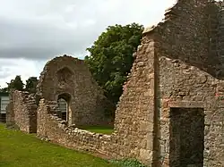
| Chapel Chapel E of Adscombe Farm | Over Stowey | Chapel | 13th century | ST 18414 37782 51°08′01″N 3°10′03″W | The remains of walls of a 13th-century chapel which as 13 metres (42 ft) long and 6.1 metres (20 ft) wide. | 1006133 | [46][47] | |
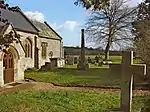
| Churchyard cross in St George's churchyard | Wembdon | Cross | 15th century | ST 28938 37942 51°08′11″N 3°01′02″W | A 15th-century churchyard cross on an octagonal base. The shaft is approximately 1.9 metres (6 ft 3 in) high; however the head of the cross is missing. | 1015454 | Upload Photo | [48] |
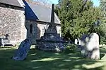
| Churchyard cross in St Mary the Virgin's churchyard | North Petherton | Cross | 15th century | ST 29027 33052 51°05′33″N 3°00′53″W | A restored churchyard cross. The octagonal base is original; however the shaft was removed as unsafe and replaced in 1962. | 1015455 | Upload Photo | [49] |
| Churchyard cross in All Saints' churchyard | Broomfield | Cross | 13th century | ST 22431 32009 51°04′56″N 3°06′32″W | A 13th-century churchyard cross. The shaft is 2.5 metres (8 ft 2 in) high; however the head of the cross is missing. | 1015456 | [50] | |
| Churchyard cross in St Michael's churchyard | Enmore | Cross | 15th century | ST 23987 35193 51°06′39″N 3°05′14″W | A 15th-century churchyard cross. The shaft is 1.5 metres (4 ft 11 in) high; however, the head of the cross is missing. | 1015457 | [51] | |
| Churchyard cross in St Margaret's churchyard | Spaxton | Cross | 14th century | ST 22531 37018 51°07′38″N 3°06′30″W | A 14th-century churchyard cross. The shaft is 2.5 metres (8 ft 2 in) high, with a round moulding and square cross head. | 1015458 | [52] | |
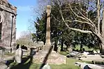
| Churchyard cross in St Mary's churchyard | Nether Stowey | Cross | 14th century | ST 19678 39614 51°09′00″N 3°08′59″W | A 14th-century churchyard cross. The broken shaft is 0.2 metres (7.9 in) high. | 1015452 | Upload Photo | [53] |
| Churchyard cross 5.6 m south east of the porch of St Martin's Church | Fiddington | Cross | 14th century | ST 21578 40581 51°09′32″N 3°07′22″W | A 14th-century churchyard cross. The shaft is 1.7 metres (5 ft 7 in) high; however, the head is missing. | 1015453 | [54] | |
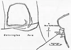
| Cynwit Castle | Cannington | Hill fort | Bronze Age and Iron Age | ST 24682 40489 51°09′33″N 3°04′51″W | A Bronze Age and Iron Age hill fort. The small hill rises to 80 metres (260 ft) above low lying land about 1.5 kilometres (0.93 mi) west of the tidal estuary of the River Parrett, near the ancient port and ford at Combwich. The hill fort is roughly square in shape, with a single rampart (univallate) enclosing 5 hectares (12 acres), and the main entrance to the south-east. The north side of the hill has been destroyed by quarrying during the 19th and 20th centuries. Minor excavations were carried out in 1905, 1913 (Bezell), and 1963 (Rahtz). Flint tools, scrapers and flakes have been found on or near the hill, indicating Mesolithic occupation. Bronze Age finds include an axe head and a knife. The area destroyed by quarrying was a late Roman and Saxon cemetery, with several hundred E-W (Christian) graves, and various grave goods such as coins and pottery from the period 350-800 AD. | 1006225 | [55][56] | |
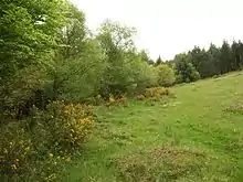
| Dead Woman's Ditch cross-dyke, Robin Upright's Hill | Over Stowey | Earthworks | Bronze Age | ST 16040 38477 51°08′22″N 3°12′05″W | The remains of a 1 kilometre (0.62 mi) long cross dyke over the Quantock Hills. The bank is 1 metre (3 ft 3 in) high and has a ditch on its western side. The name Dead Woman's Ditch was thought to relate to a woman murdered in 1789, although it is now known to have earlier usage. | 1008254 | .jpg.webp) Dead Woman's Ditch cross-dyke, Robin Upright's Hill | [57] |
| Duck decoy, west of Nyland Hill | Cheddar | Duck decoy | 17th century | ST 45260 50294 51°14′57″N 2°47′09″W | A six pipe duck decoy on a low lying area in the valley of the River Axe. It was constructed before 1668 but redug in 1762 and fell out of use after 1813. | 1014452 | Upload Photo | [58] |
| Duck decoy, 770 m SSE of Gold Corner Bridge | Cossington | Duck decoy | 18th or 19th century | ST 37036 42486 51°10′41″N 2°54′08″W | A four pipe duck decoy with two small islands in the pool. | 1014858 | Upload Photo | [59][60] |
| Duck decoy 175 m south west of Parson's Farm | Cheddar | Duck decoy | 17th century | ST 43481 52403 51°16′05″N 2°48′41″W | A three pipe duck decoy with an infilled pool which is 60 metres (200 ft) by 55 metres (180 ft). It was built before 1673 and fell out of use by 1788. | 1014445 | Upload Photo | [61] |
| Gorsey Bigbury earth circle and round barrow near Longwood | Cheddar | Henge | Neolithic | ST 48427 55846 51°17′58″N 2°44′28″W | Gorsey Bigbury is an earth henge about 22 metres (72 ft) in diameter. The nearby Longwood Barrow may be a long barrow or a misshapen round barrow. | 1006221 | Upload Photo | [62][63] [64] |
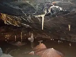
| Gough's Cave, Cheddar Gorge | Cheddar | Cave | Palaeolithic | ST 46714 53917 51°16′53″N 2°45′51″W | Gough's Cave is located in Cheddar Gorge on the Mendip Hills. The cave is 90 metres (295 ft) deep and is 2.135 kilometres (1.33 mi) long, and contains a variety of large chambers and rock formations. It contains the Cheddar Yeo, the largest underground river system in Britain. The cave contained skeletal remains of both humans and animals, all showing cut-marks and breakage consistent with de-fleshing and eating. In 1903 the remains of a human male, since named Cheddar Man, were found a short distance inside Gough's Cave. He is Britain’s oldest complete human skeleton, having been dated to approximately 7150 B.C. A Skull cup dating from 14,700 B.C. has been uncovered at the site. The first 820 metres (2,690 ft) of the cave are open to the public as a show cave, and this stretch contains most of the more spectacular formations. The greater part of the cave's length is made up of the river passage, which is accessible only by cave diving. | 1011925 | [65][66][67] | |
| Gough's Old Cave | Cheddar | Cave | Palaeolithic | ST 46688 53886 51°16′54″N 2°45′57″W | A series of caves in Cheddar Gorge from which Iron Age and Romano-British artefacts have been found overlying cut marked horse bone dating from approximately 12,500 years ago. | 1012064 | Upload Photo | [68] |
| Great Oone's Hole | Cheddar | Cave | Palaeolithic | ST 46796 53936 51°16′56″N 2°45′51″W | A cave in Cheddar Gorge from which flint artefacts from the Late Upper Palaeolithic have been recovered. | 1010906 | Upload Photo | [69] |
| Group of three bowl barrows 180 m south of Tyning's Farm: part of the Tyning's Farm round barrow cemetery | Cheddar | Bowl barrow | Bronze Age | ST 46995 56339 51°18′13″N 2°45′42″W | A round barrow cemetery consisting of three barrows from which bones and a ceramic urn have been recovered. | 1012594 | Upload Photo | [70] |
| Horsey medieval settlement immediately north of Board's Farm | Horsey | Earthworks | Middle Ages | ST 31929 39272 51°08′55″N 2°58′29″W | Earthworks from a medieval settlement and surrounding fields. The platforms of several buildings survive at, or just below, ground level. | 1020438 | Upload Photo | [71] |
| Longbottom Farm earthwork | Shipham | Earthworks | Unknown | ST 45748 56837 51°18′29″N 2°46′47″W | An enclosure surrounded by a bank and ditch. | 1003028 | Upload Photo | [72] |
| Manor house at Mudgley | Wedmore | Earthworks | Middle Ages | ST 44310 45626 51°12′26″N 2°47′55″W | Earthworks from several houses and associated fields. | 1006136 | Upload Photo | [73][74] [75] |
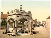
| Market cross at the junction of Bath Street, Union Street and Church Street | Cheddar | Market cross | 15th century | ST4592153202 51°16′31″N 2°46′36″W | The first part of the market cross was built in the 15th and included a central octagonal pillar. In the 16th or 17th century it was enclosed with a hexagonal arch structure. The cross head was added in 1877. | 1019033 | [76] | |
| Medieval estate boundary earthwork on Shute Shelve Hill | Axbridge | Earthworks | Middle Ages | ST 42768 56077 51°18′03″N 2°49′20″W | Earthworks from a bank and ditch which may have marked the boundary of the Compton Bishop estate according to a 1067 charter. In the 13th century it was associated with the boundary of the Royal Forest of Mendip. | 1015495 | Upload Photo | [77] |
| Medieval settlement 160 m south and 240 m south west of Sandford Farm | Cannington | Earthworks | Middle Ages | ST 26957 37771 51°08′04″N 3°02′43″W | Earthworks from a medieval village which had a population of 40 to 45 people. | 1020016 | Upload Photo | [78] |
| Moated site at Edithmead | Edithmead | Motte-and-bailey castle | Middle Ages | ST 32916 49302 51°14′20″N 2°57′44″W | Earthworks from a site occupied in the Middle Ages. Pottery from the 14th century has been found at the site. | 1006134 | Upload Photo | [79][80] |
| Motte with two baileys immediately east of Bristol Road, Down End | Puriton | Motte-and-bailey castle | c. 1100 | ST 30896 41366 51°10′03″N 2°59′32″W | The remains of Down End Castle consist of earthworks from a Motte-and-bailey castle. | 1019291 | [81][82] [83][84] | |
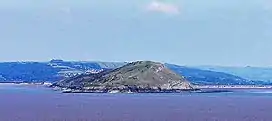
| Multi-period site on Brean Down | Bridgwater Bay | Earthworks, Fort | Neolithic, Bronze Age, Iron Age, Romano-British, Middle Ages, Victorian era, World War II | ST 28790 58958 51°19′32″N 3°01′44″W | Brean Down is a promontory off the coast, standing 97 metres (318 ft) high and extending 2 kilometres (1.5 mi) into the Bristol Channel at the eastern end of Bridgwater Bay between Weston-super-Mare and Burnham-on-Sea. Made of Carboniferous Limestone, it is a continuation of the Mendip Hills. Two further continuations are the small islands of Steep Holm and Flat Holm. The cliffs on the northern and southern flanks of Brean Down have large quantities of fossils laid down in the marine deposits about 320–350 million years ago. The site has been occupied by humans since the late Bronze Age and includes the remains of a Romano-Celtic Temple. At the seaward end is Brean Down Fort which was built in 1865 and then re-armed in the Second World War. Brean Down is now owned by the National Trust, and is rich in wildlife, history and archaeology. It is a Site of Special Scientific Interest due to both the geology and presence of nationally rare plants including the white rock-rose. It has also been scheduled as an ancient monument.[85] | 1008211 | [86][87] [88] | |
| Picken's Hole | Compton Bishop | Cave | Palaeolithic | ST 39680 55004 51°17′28″N 2°51′59″W | A small cave from which a large number of Middle Palaeolithic artefacts, and two Neanderthal teeth dated to about 55,000 years BP, have been recovered. | 1010715 | Upload Photo | [89][90] |
| Plainsfield Camp slight univallate hillfort | Aisholt | Hill fort | Iron Age | ST181363 51°07′11″N 3°10′12″W | Plainsfield Camp (or Park Plantation or Cockercombe Castle) is a possible Iron Age earthwork on the Quantock Hills, but may have been an animal enclosure. | 1007669 | [91] | |
| Platform cairn, 180 m east of Wilmot's Pool | Over Stowey | Cairn | Bronze Age | ST1548538136 51°08′10″N 3°12′33″W | A platform cairn on the Quantock Hills. | 1417363 | Upload Photo | [92] |
| Prehistoric timber trackways, 670 m SSE of Parchey Bridge | Stawell | Timber trackway | Neolithic to Iron Age | ST 35497 37162 51°07′48″N 2°55′24″W | The remains of several prehistoric trackways in the peaty soil of the Somerset Levels. | 1014430 | Upload Photo | [93] |
| Roman briquetage mounds on Burtle Moor | Burtle | Briquetage mounds | Romano-British | ST 39461 44433 51°11′45″N 2°52′04″W | The remains of salt mounds used in Roman times. The largest is approximately 10.5 metres (34 ft) in diameter. | 1006148 | Upload Photo | [94][95] |
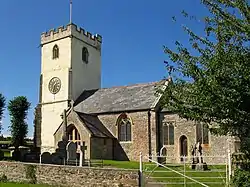
| Roman settlement site, Anglo-Saxon and Norman royal palace, and St Columbanus' Chapel | Cheddar | Ruined palace | Romano-British, Anglo-Saxon and Norman | ST456531 51°16′29″N 2°46′44″W | Cheddar Palace was established in the 9th century. It was a royal hunting lodge in the Anglo-Saxon and medieval periods and hosted the Witenagemot in the 10th century. Nearby are the ruins of the 14th-century St Columbanus Chapel. Roman artifacts and a burial have also been discovered. The site of the palace is now marked by concrete slabs within the grounds of The Kings of Wessex Academy. | 1017290 | [96][97] | |
| Romano-British settlement on Stoke Moor | Cheddar | Earthworks | Romano-British | ST 45999 48984 51°14′15″N 2°46′30″W | Earthworks including roadways and courtyards from a Roman settlement covering 18.5 hectares (46 acres). Artefacts from the site have included coins and pottery. | 1011125 | Upload Photo | [98] |
| Round barrows 600yds (550m) NW of Longbottom Farm | Shipham | Round barrow | Bronze Age | ST 45319 57012 51°18′35″N 2°47′09″W | A pair of probable round barrows | 1006223 | Upload Photo | [99][100] |
| Rowberrow Cavern, Mendip Forest | Rowberrow | Cave | Palaeolithic | ST 45954 58022 51°19′07″N 2°46′37″W | The cave includes a Palaeolithic hearth floor. Iron Age and Roman remains have also been uncovered. | 1011926 | Upload Photo | [101] |
| Rowberrow Camp: an Iron Age defended settlement north west of Tynings Farm | Rowberrow | Earthworks | Iron Age | ST 46442 56836 51°18′29″N 2°46′11″W | Rowberrow Camp was an Iron Age defended settlement covering 0.36 hectares (0.89 acres) and surrounded by a bank and ditch. | 1008806 | Upload Photo | [102] |
| Ruborough Camp large univallate hillfort | Broomfield | Hill fort | Iron Age | ST226336 51°05′46″N 3°06′18″W | The Ruborough Camp hill fort is on an easterly spur from the main Quantock ridge, with steep natural slopes to the north and south-east. The fort is triangular in shape, with a single rampart and ditch (univallate), enclosing 1.8 hectares (4.4 acres). There is a linear outer work about 120 m away, parallel to the westerly rampart, enclosing another 1.8 ha. There was a tunnel, which has now been filed in, which gave the camp safe access to a nearby spring for water. The site is on the Heritage at Risk Register. | 1007670 | [103][104] | |
| Saye's Hole, Cheddar Gorge | Cheddar | Cave | Iron Age | ST 46637 53897 51°16′54″N 2°45′59″W | A small cave occupied during the Iron Age. Excavation has found pottery and other artefacts from that period. | 1011916 | Upload Photo | [105] |
| Sections of the Sweet Track and Post Track, 650 m east of Canada Farm | Shapwick | Timber trackway | 3807 or 3806 B.C. | ST 42355 40466 51°09′38″N 2°49′33″W | A section of the Sweet Track, an ancient causeway in the Somerset Levels. Construction was of crossed wooden poles, driven into the waterlogged soil to support a walkway that consisted mainly of planks of oak, laid end-to-end. The track was only used for a period of around 10 years and was then abandoned, probably due to rising water levels. The specific date of construction is a result of Dendrochronology of the timbers recovered. Following its discovery in 1970, most of the track has been left in its original location, with active conservation measures taken, including a water pumping and distribution system to maintain the wood in its damp condition. | 1014439 | Upload Photo | [106] |
| Soldier's Hole, Cheddar Gorge | Cheddar | Cave | Late Upper Palaeolithic | ST 46862 54008 51°16′58″N 2°45′48″W | Artefacts from the cave demonstrate occupation during the Late Upper Palaeolithic. The faunal remains have been Radiocarbon dated to 35,000 years ago to c.10,000 years ago. | 1011914 | Upload Photo | [107] |
| Sections of the Sweet Track, the Post Track and associated remains 500 m north east of Moorgate Farm | Shapwick | Timber trackway | 3807 or 3806 B.C. | ST420401 51°09′25″N 2°49′44″W | A section of the Sweet Track, an ancient causeway in the Somerset Levels. Construction was of crossed wooden poles, driven into the waterlogged soil to support a walkway that consisted mainly of planks of oak, laid end-to-end. The track was only used for a period of around 10 years and was then abandoned, probably due to rising water levels. Following its discovery in 1970, most of the track has been left in its original location, with active conservation measures taken, including a water pumping and distribution system to maintain the wood in its damp condition. | 1014438 | [108] | |
| Settlement SE of Cannington Park | Cannington | Earthworks | Possibly Iron Age, Romano-British or later | ST 24570 40268 51°09′24″N 3°04′48″W | Earthworks of uncertain date which may show the site of a settlement or field system. | 1002958 | Upload Photo | [109] |
| Star Roman villa, 275 m north east of Wimblestone | Shipham | Roman villa | Romano-British | ST 43534 58685 51°19′28″N 2°48′42″W | Earthworks from a small Roman villa and associated buildings arranged around a courtyard, which were built on a previously occupied site. | 1015499 | Upload Photo | [110] |
| Stowey Castle, the site of St Michael's Chapel and a medieval kiln site | Nether Stowey | Motte-and-bailey | 11th century | ST186396 51°08′58″N 3°09′47″W | Stowey Castle (or Nether Stowey Castle known locally as The Mount) was a Norman motte-and-bailey castle, built in the 11th century, in the village of Nether Stowey on the Quantock Hills. | 1019421 | [111][112] | |
| Sun Hole, Cheddar Gorge | Cheddar | Cave | Palaeolithic | ST 46737 54080 51°17′00″N 2°45′54″W | Artefacts from the cave demonstrate occupation during the Palaeolithic. | 1011915 | Upload Photo | [113] |
| Telescopic rail bridge over the River Parrett, 270 m south east of Bridgwater Dock lock | Bridgwater | Bridge | 1871 | ST 30020 37423 51°07′54″N 3°00′05″W | The retractable bridge was built in 1871 for the Bristol and Exeter Railway. It carried a railway siding over the river at the coal yard and docks in the Port of Bridgwater, but had to be movable, to allow boats to proceed upriver to the Town Bridge. The bridge was temporarily immobilised during World War II and last opened in 1953, and the traverser section was demolished in 1974. | 1020624 | [114][115] | |
| The Chapel, Shearston | North Petherton | Possible chapel | Middle Ages or post-medieval | ST 28179 30581 51°04′12″N 3°01′35″W | The possible site of chapel which may also have been a homestead surrounded by a moat. | 1006166 | Upload Photo | [116] |
| Timber trackways at Moor Drove, 800 m east of Brentsfield Bridge | Chedzoy | Timber trackway | Neolithic | ST 34840 36180 51°07′16″N 2°55′57″W | Two pieces of a timber trackway which were identified when water levels fell, as the site is waterlogged or under water normally. | 1014872 | Upload Photo | [117] |
| Timber trackways 850 m east of Catcott Burtle Farm | Burtle | Timber trackway | Neolithic | ST 41142 43152 51°11′05″N 2°50′37″W | Sections of several timber trackways including the Honeygore, Honeycat and Honeybee Tracks which were constructed between 3650 and 2870 B.C. | 1014433 | Upload Photo | [118] |
| Twin round barrows 750 yd (696 m) N of Bowpit Farm | Cheddar | Round barrows | Bronze Age | ST 45822 55799 51°17′55″N 2°46′43″W | Possibly two round barrows or one bowl barrow on an oval mound. | 1006222 | Upload Photo | [119] |
| Village cross | Wedmore | Cross | 14th century | ST 43656 47849 51°13′37″N 2°48′30″W | A stone cross on a five step base which supports a 2.2-metre (7 ft 3 in) high shaft with a lantern head. | 1015450 | Upload Photo | [120] |
| Wayside cross at Stoughton Cross | Wedmore | Wayside Cross | 15th century | ST4247849658 51°14′35″N 2°49′32″W | The cross is 1.9 metres (6 ft 3 in) high and stands on a three-step base. It was moved approximately 15 metres (49 ft) from its original 15th-century position. | 1015451 | 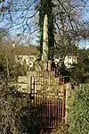 Wayside cross at Stoughton Cross | [121] |
| Wimblestone standing stone | Shipham | Standing stone | Unknown | ST 43345 58475 51°19′21″N 2°48′52″W | A 1.5-metre (5 ft) high stone slab. | 1006137 | 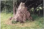 Wimblestone standing stone | [122][123] |
| Wooden trackways on Chilton Moor, 300 m west of Station Farm | Burtle | Timber trackway | Neolithic | ST 38800 42639 51°10′47″N 2°52′37″W | The remains of several brushwood trackways dating from the Neolithic period. | 1014437 | Upload Photo | [124] |
| World War II anti-aircraft rocket battery and bombing decoy control building 265 m north east of Ashridge Farm | Black Down | Earthworks | World War II | ST 46852 56110 51°18′06″N 2°45′49″W | The remains of a Z Battery, a short range anti-aircraft weapon system, which launched 3-inch (76 mm) diameter rockets from ground-based single and multiple launchers, for air defence. Most of the battery has been removed; however the control building survives. | 1020994 | [125] | |
| World War II bombing decoy complex, anti-aircraft obstructions and Beacon Batch round barrow cemetery on Black Down | Black Down | Earthworks | World War II | ST 47960 57110 51°18′39″N 2°44′53″W | The remains of bombing decoys and anti-aircraft obstructions in the form of earth and stone mounds. They are in the same area as prehistoric round barrows. | 1020995 | Upload Photo | [126] |
.jpg.webp)
.jpg.webp)
See also
Notes
- The date given is the date used by Historic England as significant for the initial building or that of an important part in the structure's description.
- Sometimes known as OSGB36, the grid reference is based on the British national grid reference system used by the Ordnance Survey.
- The "List Entry Number" is a unique number assigned to each listed building and scheduled monument by Historic England.
References
- Robert Dunning, ed. (2004). "Introduction". A History of the County of Somerset: Volume 8: The Poldens and the Levels. Institute of Historical Research. Retrieved 1 August 2011.
- Brunning, Richard (2006). "A window on the past - The prehistoric archaeology of the Somerset Moors". In Hill-Cottingham, Pat; Briggs, Derek; Brunning, Richard; King, Andy; Rix, Graham (eds.). The Somerset Wetlands: An ever changing environment. Wellington, Somerset: Somerset Books. pp. 40–41. ISBN 978-0-86183-432-7.
- Historic England. "Glastonbury Lake Village (194156)". Research records (formerly PastScape). Retrieved 16 March 2011.
- Historic England. "Meare Lake Villages (194185)". Research records (formerly PastScape). Retrieved 24 March 2011.
- Brunning, Richard (2006). Wet and Wonderful: The Heritage of the Avalon Marshes. Somerset Heritage Service. pp. 1–3. ISBN 978-0861833801.
- Minnitt, Stephen; Coles, John (2006). The Lake Villages of Somerset. Glastonbury Antiquarian Society. p. 7. ISBN 978-0950712239.
- Gathercole, Clare. "Burnham on Sea and Highbridge" (PDF). Archaeological Assessments. South West Heritage Trust. p. 7. Archived from the original (PDF) on 17 July 2011. Retrieved 3 January 2011.
- "Scheduled Monuments". English Heritage. Retrieved 9 September 2014.
- Historic England. "Cannington Park Camp (191244)". Research records (formerly PastScape). Retrieved 16 March 2011.
- Adkins, Lesley and Roy (1992). A field Guide to Somerset Archaeology. Dovecote press. pp. 29–30. ISBN 0-946159-94-7.
- "Brent Knoll hill fort, Brent Knoll". Somerset Historic Environment Record. South West Heritage Trust. Retrieved 19 January 2011.
- Historic England. "Brick kiln East Quay (1206110)". National Heritage List for England. Retrieved 30 October 2007.
- Otter, R. A. (1994). Civil Engineering Heritage: Southern England. Thomas Telford. pp. 95–97. ISBN 0-7277-1971-8.
- Historic England. "Alstone lake settlement site (1012311)". National Heritage List for England. Retrieved 6 December 2014.
- "The abbey of Athelney". British History Online. Retrieved 12 August 2008.
- Havinden, Michael (1981). The Somerset Landscape. The making of the English landscape. London: Hodder and Stoughton. p. 94. ISBN 0-340-20116-9.
- "Athelney Abbey". Somerset Historic Environment Record. South West Heritage Trust. Retrieved 12 August 2008.
- Historic England. "King Alfred's Monument with railings (1173838)". National Heritage List for England. Retrieved 9 February 2007.
- "King Alfred's Monument". Listed Buildings Online. English Heritage. Retrieved 2 January 2011.
- Historic England. "Anglo-Saxon burh at East Lyng (1019100)". National Heritage List for England. Retrieved 6 December 2014.
- Williams, Michael (2009). The Draining of the Somerset Levels. CUP Archive. p. 60. ISBN 978-0521106856.
- Historic England. "Balt Moor Wall (1018952)". National Heritage List for England. Retrieved 15 November 2014.
- "Balt Moor Wall, between East Lyng and Athelney, Lyng". Somerset Historic Environment Record. South West Heritage Trust. Retrieved 15 November 2014.
- Historic England. "Bath Moor Wall (191938)". Research records (formerly PastScape). Retrieved 15 November 2014.
- Historic England. "Barrow at Wilmot's Pool and a cairn 45 m to the north (1417361)". National Heritage List for England. Retrieved 6 December 2014.
- "Blackford Manor House Moat, Blackford". Somerset Historic Environment Record. South West Heritage Trust. Retrieved 6 December 2014.
- Historic England. "Bowl barrow 75 m south west of Long House Barn (1014712)". National Heritage List for England. Retrieved 6 December 2014.
- Historic England. "Bowl barrow 91 m south of Piney Sleight Farm (1010922)". National Heritage List for England. Retrieved 6 December 2014.
- Historic England. "Bowl barrow 190 m south west of Tyning's Farm: part of the Tyning's Farm round barrow cemetery (1012593)". National Heritage List for England. Retrieved 6 December 2014.
- Historic England. "Bowl barrow 250 m south east of Tyning's Farm: part of the Tyning's Farm round barrow cemetery (1015815)". National Heritage List for England. Retrieved 6 December 2014.
- Historic England. "Bowl barrow 250 m south west of Ashridge Farm (1012592)". National Heritage List for England. Retrieved 6 December 2014.
- Historic England. "Bowl barrow 300 m east of Batts Coombe Quarry (1010800)". National Heritage List for England. Retrieved 6 December 2014.
- Historic England. "Bowl barrow 300m north east of Tyning's Farm (1011584)". National Heritage List for England. Retrieved 23 February 2015.
- Historic England. "Bowl barrow 300 m north east of Tyning's Farm (1011584)". National Heritage List for England. Retrieved 6 December 2014.
- Historic England. "Bowl barrow 350 m east of Batts Coombe Quarry (1010921)". National Heritage List for England. Retrieved 6 December 2014.
- Historic England. "Bowl barrow 400 m southeast of Wellington Farm (1011533)". National Heritage List for England. Retrieved 6 December 2014.
- Adkins, Lesley and Roy (1992). A field Guide to Somerset Archeology. Stanbridge: Dovecote press. pp. 29–30. ISBN 0-946159-94-7.
- "Brent Knoll hillfort, Brent Knoll". Somerset Historic Environment Record. South West Heritage Trust. Retrieved 19 January 2011.
- Historic England. "Brick kiln East Quay (1206110)". National Heritage List for England. Retrieved 30 October 2007.
- Historic England. "Brick and tile kiln west of East Quay, 200 m east of Bridgwater Dock lock (1019900)". National Heritage List for England. Retrieved 6 December 2014.
- "Somerset Brick and Tile Museum". South West Heritage Trust. Archived from the original on 8 December 2014. Retrieved 6 December 2014.
- Historic England. "Bronze Age and Iron Age trackways 600 m north east of Northbrook Farm (1014444)". National Heritage List for England. Retrieved 12 December 2014.
- Historic England. "Bronze Age and Iron Age timber trackways, 700 m north west of Coppice Gate Farm (1014431)". National Heritage List for England. Retrieved 12 December 2014.
- Historic England. "Cairn 500 m north west of Quantock Farm (1019801)". National Heritage List for England. Retrieved 12 December 2014.
- Historic England. "Chandos Glass Cone, at the junction of Northgate and Valetta Place (1019899)". National Heritage List for England. Retrieved 12 December 2014.
- Historic England. "Adscombe Chapel (189492)". Research records (formerly PastScape). Retrieved 27 September 2014.
- "Chapel, E of Adscombe Farm, Adscombe". Somerset Historic Environment Record. South West Heritage Trust. Retrieved 12 December 2014.
- Historic England. "Churchyard cross in St George's churchyard (1015454)". National Heritage List for England. Retrieved 12 December 2014.
- Historic England. "Churchyard cross in St Mary the Virgin's churchyard (1015455)". National Heritage List for England. Retrieved 12 December 2014.
- Historic England. "Churchyard cross in All Saints' churchyard (1015456)". National Heritage List for England. Retrieved 12 December 2014.
- Historic England. "Churchyard cross in St Michael's churchyard (1015457)". National Heritage List for England. Retrieved 12 December 2014.
- Historic England. "Churchyard cross in St Margaret's churchyard (1015458)". National Heritage List for England. Retrieved 12 December 2014.
- Historic England. "Churchyard cross in St Mary's churchyard (1015452)". National Heritage List for England. Retrieved 12 December 2014.
- Historic England. "Churchyard cross 5.6 m south east of the porch of St Martin's Church (1015453)". National Heritage List for England. Retrieved 12 December 2014.
- Historic England. "Cannington Park Camp (191244)". Research records (formerly PastScape). Retrieved 16 March 2011.
- "Cynwit Hillfort (Cannington Camp)". Digital Digging. 25 November 2013. Retrieved 7 January 2015.
- Historic England. "Dead Woman's Ditch cross-dyke, Robin Upright's Hill (1008254)". National Heritage List for England. Retrieved 12 December 2014.
- Historic England. "Duck decoy, west of Nyland Hill (1014452)". National Heritage List for England. Retrieved 12 December 2014.
- "Duck decoy pool, Decoy rhyne, Cossington". Somerset Historic Environment Record. South West Heritage Trust. Retrieved 27 September 2014.
- Historic England. "Monument No. 1044765". Research records (formerly PastScape). Retrieved 27 September 2014.
- Historic England. "Duck decoy 175 m south west of Parson's Farm (1014445)". National Heritage List for England. Retrieved 12 December 2014.
- Historic England. "Gorsey Bigbury (194311)". Research records (formerly PastScape). Retrieved 27 September 2014.
- "Barrow, Long Wood, Cheddar". Somerset Historic Environment Record. South West Heritage Trust.
- Apsimon, A.M.; Musgrave, J.H.; Sheldon, J.; Tratman, E.K.; Van Wijngaarden-Bakker, L.H. (1976). "Gorsey Bigbury, Cheddar, Somerset" (PDF). Proceedings of the University of Bristol Spelaeoligal Society. 14 (2): 155–183.
- "Gough's Cave excavation site". Natural History Museum. Archived from the original on 2 April 2015. Retrieved 6 March 2015.
- "Mendip". UK and Ireland Cave Lengths and Depths. Retrieved 15 January 2007.
- Bello, Silvia M.; Parfitt, Simon A.; Stringer, Chris B. (2011). "Earliest Directly-Dated Human Skull-Cups". PLOS ONE. 6 (2): e17026. Bibcode:2011PLoSO...617026B. doi:10.1371/journal.pone.0017026. PMC 3040189. PMID 21359211.
- Historic England. "Gough's Old Cave (1012064)". National Heritage List for England. Retrieved 13 December 2014.
- Historic England. "Great Oone's Hole (1010906)". National Heritage List for England. Retrieved 13 December 2014.
- Historic England. "Group of three bowl barrows 180 m south of Tyning's Farm: part of the Tyning's Farm round barrow cemetery (1012594)". National Heritage List for England. Retrieved 13 December 2014.
- Historic England. "Group of three bowl barrows 180 m south of Tyning's Farm: part of the Tyning's Farm round barrow cemetery (1020438)". National Heritage List for England. Retrieved 13 December 2014.
- "Longbottom Camp, 100 m NW of Longbottom Farm, Shipham". Somerset Historic Environment Record. South West Heritage Trust. Retrieved 27 September 2014.
- "Abandoned settlement, Mudgley 11235 Mudgley Ancient Mediaeval Village & Earthworks". 466 AD. Archived from the original on 27 September 2014. Retrieved 27 September 2014.
- HUdson, Hazel. "The Search for King Alfred's Palace at Mudgley". Theale. Retrieved 27 September 2014.
- "Mudgley Manor House, Court Garden, Mudgley". Somerset Historic Environment Record. South West Heritage Trust. Retrieved 13 December 2014.
- Historic England. "Market Cross (1173642)". National Heritage List for England. Retrieved 13 July 2013.
- Historic England. "Medieval estate boundary earthwork on Shute Shelve Hill (1015495)". National Heritage List for England. Retrieved 13 December 2014.
- Historic England. "Medieval settlement 160 m south and 240 m south west of Sandford Farm (1020016)". National Heritage List for England. Retrieved 13 December 2014.
- Historic England. "Edithmead (192231)". Research records (formerly PastScape). Retrieved 27 September 2014.
- "Moated site, Edithmead". Somerset Historic Environment Record. South West Heritage Trust. Retrieved 27 September 2014.
- "Chisley Mount, Down End". Castle Facts. Retrieved 7 January 2015.
- Historic England. "Down End earthworks (192333)". Research records (formerly PastScape). Retrieved 23 July 2011.
- "Motte and Bailey castle, Down End". Somerset Historic Environment Record. South West Heritage Trust. Retrieved 23 July 2011.
- Prior, Stuart (2006). A Few Well-Positioned Castles: The Norman Art of War. The History Press. pp. 88–89. ISBN 978-0752436517.
- Historic England. "Multi-period site on Brean Down (1008211)". National Heritage List for England. Retrieved 7 June 2014.
- "Hillfort, Brean Down". Somerset Historic Environment Record. South West Heritage Trust. Retrieved 7 July 2011.
- van der Bijl, Nicholas (2000). Brean Down Fort: Its History and the Defences of the Bristol Channel. Cossington: Hawk Editions. pp. 119–123. ISBN 978-0-9529081-7-3.
- Historic England. "Multi-period site on Brean Down (1008211)". National Heritage List for England. Retrieved 7 June 2014.
- Historic England. "Picken's Hole (1010715)". National Heritage List for England. Retrieved 13 December 2014.
- Pettitt, Paul; White, Mark (2012). The British Palaeolithic: Human Societies at the Edge of the Pleistocene World. Abingdon, UK: Routledge. pp. 364–65. ISBN 978-0-415-67455-3.
- Historic England. "Plainsfield Camp slight univallate hillfort (1007669)". National Heritage List for England. Retrieved 24 August 2014.
- Historic England. "Platform cairn, 180 m east of Wilmot's Pool (1417363)". National Heritage List for England. Retrieved 13 December 2014.
- Historic England. "Prehistoric timber trackways, 670 m SSE of Parchey Bridge (1014430)". National Heritage List for England. Retrieved 13 December 2014.
- Robert Dunning, ed. (2004). "Edington". A History of the County of Somerset: Volume 8: The Poldens and the Levels. Institute of Historical Research. Retrieved 28 September 2014.
- "Roman briquetage mounds, Burtle Moor, Burtle". Somerset Heritage. South West Heritage Trust. Archived from the original on 28 September 2014. Retrieved 28 September 2014.
- Emery, Anthony (2007). Discovering Medieval Houses. Osprey Publishing. p. 21. ISBN 9780747806554.
- Historic England. "Roman settlement site, Anglo-Saxon and Norman royal palace, and St Columbanus' Chapel (1017290)". National Heritage List for England. Retrieved 26 May 2014.
- Historic England. "Romano-British settlement on Stoke Moor (1011125)". National Heritage List for England. Retrieved 14 December 2014.
- Historic England. "Monument No. 194358". Research records (formerly PastScape). Retrieved 24 February 2015.
- Historic England. "Monument No. 194352". Research records (formerly PastScape). Retrieved 24 February 2015.
- Historic England. "Rowberrow Cavern, Mendip Forest (1011926)". National Heritage List for England. Retrieved 14 December 2014.
- Historic England. "Rowberrow Camp: an Iron Age defended settlement north west of Tynings Farm (1008806)". National Heritage List for England. Retrieved 14 December 2014.
- "Ruborough Camp large univallate hillfort, Broomfield — Sedgemoor". Heritage at Risk. English Heritage. Retrieved 28 October 2015.
- Waite, Vincent (1964). Portrait of the Quantocks. London: Robert Hale. ISBN 0-7091-1158-4.
- Historic England. "Saye's Hole, Cheddar Gorge (1011916)". National Heritage List for England. Retrieved 5 January 2015.
- Historic England. "Sections of the Sweet Track and Post Track, 650 m east of Canada Farm (1014439)". National Heritage List for England. Retrieved 5 January 2015.
- Historic England. "Soldier's Hole, Cheddar Gorge (1011914)". National Heritage List for England. Retrieved 5 January 2015.
- Historic England. "Sections of the Sweet Track, the Post Track and associated remains 500 m north east of Moorgate Farm (1014438)". National Heritage List for England. Retrieved 5 January 2015.
- Historic England. "Monument No. 191284". Research records (formerly PastScape). Retrieved 5 January 2015.
- Historic England. "Star Roman villa, 275 m north east of Wimblestone (1015499)". National Heritage List for England. Retrieved 5 January 2015.
- Historic England. "Stowey Castle (189462)". Research records (formerly PastScape). Retrieved 24 July 2011.
- "Nether Stowey". Quantock Online. Retrieved 10 March 2008.
- Historic England. "Sun Hole, Cheddar Gorge (1011915)". National Heritage List for England. Retrieved 5 January 2015.
- Otter, R. A. (1994). Civil Engineering Heritage: Southern England. Thomas Telford. ISBN 0-7277-1971-8.
- "Rail bridge over River Parrett, Bridgwater". Somerset Historic Environment Record. South West Heritage Trust. Retrieved 21 December 2009.
- Historic England. "The Chapel (191092)". Research records (formerly PastScape). Retrieved 5 January 2015.
- Historic England. "Timber trackways at Moor Drove, 800 m east of Brentsfield Bridge (1014872)". National Heritage List for England. Retrieved 5 January 2015.
- Historic England. "Timber trackways 850 m east of Catcott Burtle Farm (1014433)". National Heritage List for England. Retrieved 5 January 2015.
- Historic England. "Monument No. 194419". Research records (formerly PastScape). Retrieved 5 January 2015.
- Historic England. "Village cross (1015450)". National Heritage List for England. Retrieved 5 January 2015.
- Historic England. "Roadside Cross At Ngr St 4248 4966 (1252914)". National Heritage List for England. Retrieved 13 July 2013.
- Historic England. "Wimblestone (194539)". Research records (formerly PastScape). Retrieved 5 January 2015.
- "Wimblestone Standing Stone, Star". Somerset Historic Environment Record. South West Heritage Trust. Retrieved 5 January 2015.
- Historic England. "Wooden trackways on Chilton Moor, 300 m west of Station Farm (1014437)". National Heritage List for England. Retrieved 5 January 2015.
- Historic England. "World War II anti-aircraft rocket battery and bombing decoy control building 265 m north east of Ashridge Farm (1020994)". National Heritage List for England. Retrieved 5 January 2015.
- Historic England. "World War II bombing decoy complex, anti-aircraft obstructions and Beacon Batch round barrow cemetery on Black Down (1020995)". National Heritage List for England. Retrieved 5 January 2015.