List of islands of the British Isles
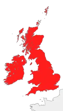
This article is a list of some of the islands that form the British Isles that have an area of one kilometre squared (247 acres) or larger, listing area and population data. The total area of the islands is 314,965 km2 (121,608 sq. mi.).[1] Great Britain accounts for the larger part of this area at 66%,[2] with Ireland accounting for 26%,[3] leaving the remaining 8%—an area of 23,996 km2 (9265 sq mi)—consisting of thousands of smaller islands. The largest of the other islands are to be found in the Hebrides and the Northern Isles to the north, and Anglesey and the Isle of Man between Great Britain and Ireland. Not included are the Channel Islands which, positioned off the coast of France, are not part of the archipelago.
There are 188 permanently inhabited islands in total:
- Isle of Man: 1
- Republic of Ireland: 62 and a part of Ireland
- United Kingdom: 123 plus Great Britain and a part of Ireland
- England: 19 and a part of Great Britain
- Northern Ireland: 1 and a part of Ireland
- Scotland: 97 and a part of Great Britain
- Wales: 6 and a part of Great Britain
List of islands by area
| Name | Area (km2) | Area rank | Population[4] | Population rank | Location | Country |
|---|---|---|---|---|---|---|
| Great Britain | 209,331[2] | 01 | 60,800,000[5] | 01 | — | England, Scotland and Wales, United Kingdom |
| Ireland | 81,638[3] | 02 | 6,378,000[6] | 02 | — |
|
| Lewis and Harris[7] | 2,179 | 03 | 19,918 | 09 | Outer Hebrides | Scotland, United Kingdom |
| Isle of Skye[7] | 1,656 | 04 | 9,232 | 16 | Inner Hebrides | Scotland, United Kingdom |
| Mainland (Shetland)[7] | 969 | 05 | 17,550 | 10 | Shetland Islands | Scotland, United Kingdom |
| Isle of Mull[7] | 875 | 06 | 2,667 | 21 | Inner Hebrides | Scotland, United Kingdom |
| Anglesey (including Holy Island) | 714 | 07 | 69,000 | 06 | Irish Sea | Wales, United Kingdom |
| Islay[7] | 620 | 08 | 3,457 | 20 | Inner Hebrides | Scotland, United Kingdom |
| Isle of Man[8] | 572 | 09 | 80,056 | 05 | Irish Sea | Isle of Man |
| Mainland (Orkney)[7] | 523 | 10 | 15,315 | 12 | Orkney Islands | Scotland, United Kingdom |
| Isle of Arran[7] | 432 | 11 | 5,045 | 19 | Firth of Clyde | Scotland, United Kingdom |
| Isle of Wight[9] | 381 | 12 | 132,731 | 04 | English Channel | England, United Kingdom |
| Jura | 367 | 13 | 188 | 53 | Inner Hebrides | Scotland, United Kingdom |
| South Uist[7] | 320 | 14 | 1,818 | 23 | Outer Hebrides | Scotland, United Kingdom |
| North Uist[7] | 303 | 15 | 1,271 | 26 | Outer Hebrides | Scotland, United Kingdom |
| Yell | 212 | 16 | 957 | 32 | Shetland Islands | Scotland, United Kingdom |
| Achill Island[10] | 147 | 17 | 2,620 | 22 | County Mayo | Republic of Ireland |
| Hoy | 143 | 18 | 272 | 46 | Orkney Islands | Scotland, United Kingdom |
| Isle of Bute[7] | 122 | 19 | 7,228 | 17 | Firth of Clyde | Scotland, United Kingdom |
| Unst | 121 | 20 | 720 | 35 | Shetland Islands | Scotland, United Kingdom |
| Rùm | 105 | 21 | 22 | 73 | Small Isles | Scotland, United Kingdom |
| Isle of Sheppey[11] | 94 | 22 | 37,852 | 07 | Kent | England, United Kingdom |
| Benbecula[7] | 82 | 23 | 1,219 | 27 | Outer Hebrides | Scotland, United Kingdom |
| Tiree | 78 | 24 | 770 | 34 | Inner Hebrides | Scotland, United Kingdom |
| Coll | 77 | 25 | 164 | 58 | Inner Hebrides | Scotland, United Kingdom |
| Raasay | 64 | 26 | 192 | 52 | Inner Hebrides | Scotland, United Kingdom |
| Great Island | 61 | 27 | >13,000[12] | 13 or 14 | Cork | Republic of Ireland |
| Barra[7] | 59 | 28 | 1,078 | 29 | Outer Hebrides | Scotland, United Kingdom |
| Sanday | 50 | 29 | 478 | 38 | Orkney Islands | Scotland, United Kingdom |
| South Ronaldsay | 50 | 29 | 458 | 40 | Orkney Islands | Scotland, United Kingdom |
| Rousay | 49 | 31 | 212 | 50 | Orkney Islands | Scotland, United Kingdom |
| Westray | 47 | 32 | 563 | 37 | Orkney Islands | Scotland, United Kingdom |
| Fetlar | 41 | 33 | 86 | 68 | Shetland Islands | Scotland, United Kingdom |
| Colonsay | 41 | 33 | 108 | 63 | Inner Hebrides | Scotland, United Kingdom |
| Holy Island | 39 | 35 | 13,579 | 13 or 14 | Anglesey | Wales, United Kingdom |
| Stronsay | 33 | 36 | 343 | 43 | Orkney Islands | Scotland, United Kingdom |
| Inishmore | 31 | 37 | 824 | 33 | Aran Islands | Republic of Ireland |
| Eigg | 30 | 38 | 67 | 70 | Small Isles | Scotland, United Kingdom |
| Shapinsay | 30 | 38 | 300 | 45 | Orkney Islands | Scotland, United Kingdom |
| Bressay | 28 | 40 | 384 | 42 | Shetland Islands | Scotland, United Kingdom |
| Eday | 27 | 41 | 121 | 62 | Orkney Islands | Scotland, United Kingdom |
| Hayling Island[13] | 27 | 41 | 16,887 | 11 | Hampshire | England, United Kingdom |
| Foulness Island | 26 | 43 | 212 | 50 | Essex | England, United Kingdom |
| Valentia Island | 26 | 43 | 665 | 36 | County Kerry | Republic of Ireland |
| Scalpay | 25 | 45 | 10 | 75 | Inner Hebrides | Scotland, United Kingdom |
| Gorumna[10] | 24 | 46 | 1,010 | 31 | County Galway | Republic of Ireland |
| Portsea Island | 24 | 46 | 147,088 | 03 | Hampshire | England, United Kingdom |
| Lismore | 24 | 46 | 146 | 60 | Inner Hebrides | Scotland, United Kingdom |
| Great Bernera | 21 | 49 | 233 | 47 | Outer Hebrides | Scotland, United Kingdom |
| Ulva | 20 | 50 | 16 | 74 | Inner Hebrides | Scotland, United Kingdom |
| Whalsay[7] | 20 | 50 | 1,034 | 30 | Shetland Islands | Scotland, United Kingdom |
| Canvey Island[14] | 19 | 52 | 37,479 | 08 | Essex | England, United Kingdom |
| Mersea Island[15] | 18 | 53 | 7,182 | 18 | Essex | England, United Kingdom |
| Muckle Roe | 18 | 53 | 104 | 64 | Shetland Islands | Scotland, United Kingdom |
| Bere Island or Bear Island | 17 | 55 | 218[16] | 48 | Cork | Republic of Ireland |
| Arranmore or Aran Island | 17 | 55 | 478[16] | 39 | County Donegal | Republic of Ireland |
| Rathlin Island | 14 | 57 | 100 | 65 | Antrim | Northern Ireland, United Kingdom |
| Inch Island | 14 | 57 | 396[16] | 41 | County Donegal | Republic of Ireland |
| Walney Island[17] | 13 | 59 | 11,388 | 15 | Furness | England, United Kingdom |
| Foula | 13 | 59 | 38 | 71 | Shetland Islands | Scotland, United Kingdom |
| Inishbofin | 13 | 59 | 184[16] | 54 | Galway | Republic of Ireland |
| Great Cumbrae[7] | 12 | 62 | 1,434 | 25 | Firth of Clyde | Scotland, United Kingdom |
| Inishmaan | 10 | 63 | 157 | 59 | Aran Islands | Republic of Ireland |
| Papa Westray | 9 | 64 | 90 | 67 | Orkney Islands | Scotland, United Kingdom |
| Lettermore | 9 | 64 | 184[16] | 54 | Galway | Republic of Ireland |
| St Mary's[18] | 6 | 66 | 1,666 | 24 | Isles of Scilly | England, United Kingdom |
| Inisheer or Inishere | 6 | 66 | 343[16] | 43 | Galway | Republic of Ireland |
| Lindisfarne | 4 | 68 | 180 | 56 | Northumberland | England, United Kingdom |
| Lundy | 4 | 68 | 28 | 72 | Devon | England, United Kingdom |
| Tresco | 3 | 70 | 180 | 56 | Isles of Scilly | England, United Kingdom |
| Lambay Island | 3 | 70 | 7 | 76 | County Dublin | Republic of Ireland |
| Calf of Man | 3 | 70 | 2 (seasonal) | 78 | Irish Sea | Isle of Man |
| Lettermullen or Lettermullan | 3 | 70 | 214[16] | 49 | Galway | Republic of Ireland |
| Thorney Island[19] | 2 | 74 | 1,079 | 28 | West Sussex | England, United Kingdom |
| Bardsey Island[20] | 2 | 74 | 4 | 77 | Gwynedd | Wales, United Kingdom |
| St Martin's | 2 | 74 | 142 | 61 | Isles of Scilly | England, United Kingdom |
| St Agnes | 1 | 77 | 73 | 69 | Isles of Scilly | England, United Kingdom |
| Bryher | 1 | 77 | 92 | 66 | Isles of Scilly | England, United Kingdom |
See also
References
- COUNTRY/TERRITORY INDEX, ISLAND DIRECTORY Archived 13 December 2018 at the Wayback Machine, United Nations Environment Programme. Retrieved 9 August 2015.
Island Facts Archived 4 March 2016 at the Wayback Machine, Isle of Man Government. Retrieved 9 August 2015.
According to the UNEP, the Republic of Ireland has a land area of 70,282 km2, and the United Kingdom has a land area of 244,111 km2. According to the Isle of Man Government, the Isle of Man has a land area of 572 km2. Therefore, the overall land area of the British Isles is 315,159 km2 - Great Britain, ISLAND DIRECTORY Archived 8 August 2017 at the Wayback Machine, United Nations Environment Programme. Retrieved 9 August 2015. According to the UNEP, Great Britain has an area of 209,331 km2.
- Ireland, ISLAND DIRECTORY Archived 4 March 2016 at the Wayback Machine, United Nations Environment Programme. Retrieved 9 August 2015. According to the UNEP, Ireland has an area of 81,638 km2.
- Population figures are from 2001 Census, except: Great Britain and Ireland both from 2011; Isle of Portland from 2005; Achill, Gorumna, Isle of Man, Jersey all from 2006.
- 2011 Census: Population Estimates for the United Kingdom. In the 2011 census, the population of England, Wales and Scotland was estimated to be approximately 61,370,000, composed of 60,800,000 on Great Britain and 570,000 on other islands. Retrieved 9 August 2015.
- "Historical Population Trends – 1841 – 2011, NISRA" (PDF). Archived from the original (PDF) on 10 October 2013. Retrieved 9 August 2015. In 2011, the population of the Republic of Ireland and Northern Ireland was 6,399,115, composed of approximately 6,378,000 on Ireland and 21,000 on other islands.
- General Register Office for Scotland – Statistics for Inhabited Islands Archived 21 April 2008 at the Wayback Machine
- Isle of Man Census 2006 Archived 17 January 2013 at the Wayback Machine (excluding the population of 2 living on the Calf of Man)
- National Statistics – Isle of Wight (Local Authority). Neighbourhood.statistics.gov.uk. Retrieved on 2012-05-22.
- Census 2006 – Table 11 – Population of Inhabited Islands off the Coast (PDF)
- National Statistics – Leysdown and Warden (Ward) Archived 15 September 2016 at the Wayback Machine, Minster Cliffs (Ward) Archived 16 September 2016 at the Wayback Machine, Queenborough and Halfway (Ward), Sheerness East (Ward) Archived 15 September 2016 at the Wayback Machine, Sheerness West (Ward) Archived 16 September 2016 at the Wayback Machine and Sheppey Central (Ward)
- 2011 Census gives 6500 for Cobh Town and 7534 for Cobh Rural ED; most were on Great Island but 148 were on Haulbowline and some on Fota Island.
- National Statistics – Hayling East (Ward) Archived 16 September 2016 at the Wayback Machine and Hayling West (Ward) Archived 16 September 2016 at the Wayback Machine
- National Statistics – Canvey Island Central (Ward) Archived 15 September 2016 at the Wayback Machine, East (Ward), North (Ward) Archived 16 September 2016 at the Wayback Machine, South (Ward), West (Ward) and Winter Gardens (Ward) Archived 15 September 2016 at the Wayback Machine
- National Statistics – West Mersea CP (Parish) Archived 16 September 2016 at the Wayback Machine and East Mersea CP (Parish) Archived 16 September 2016 at the Wayback Machine
- Population of Inhabited Islands Off the Coast (Report). Central Statistics Office. 2023. Retrieved 29 June 2023.
- National Statistics – Walney North (Ward) Archived 14 July 2014 at the Wayback Machine and Walney South (Ward)
- National Statistics – St. Mary's (Ward) Archived 6 April 2017 at the Wayback Machine. Neighbourhood.statistics.gov.uk. Retrieved on 2012-05-22.
- National Statistics – West Thorney CP (Parish). Neighbourhood.statistics.gov.uk. Retrieved on 2012-05-22.
- Article on Bardsey Island residents. Guardian. Retrieved on 2012-05-22.