Little River (Withlacoochee River tributary)
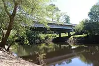
The Little River is a 105-mile-long (169 km)[1] tributary of the Withlacoochee River in the U.S. state of Georgia. Via the Withlacoochee and the Suwannee River its waters flow to the Gulf of Mexico. The Little River was also known historically as the Ockolocoochee River.
| Little River | |
|---|---|
 | |
| Location | |
| Country | United States |
| Physical characteristics | |
| Source | |
| • location | Georgia |
The Little River rises in northwestern Turner County, Georgia, 7 miles (11 km) northwest of Ashburn. The river flows southeast into Tift County, passing west of Tifton, then turns more southerly as it becomes the boundary between Colquitt and Cook counties. The river subsequently becomes the boundary between Cook and Brooks counties, then between Brooks and Lowndes counties. It flows into the Withlacoochee River 4 miles (6 km) west of the center of Valdosta near the now abandoned town of Troupville, Georgia.
Recreation

Reed Bingham State Park is a recreational area along the Little River. It includes a 375-acre (1.52 km2) lake created by a dam built in 1965 across the river.
Tributaries
Some named tributaries to the Little River include:
Crossings


See also
References
- U.S. Geological Survey. National Hydrography Dataset high-resolution flowline data. The National Map Archived 2012-03-29 at the Wayback Machine, accessed April 18, 2011
- Krakow, Kenneth K. (1975). Georgia Place-Names: Their History and Origins (PDF). Macon, GA: Winship Press. p. 247. ISBN 0-915430-00-2.
- U.S. Geological Survey Geographic Names Information System: Little River
- USGS Hydrologic Unit Map - State of Georgia (1974)


