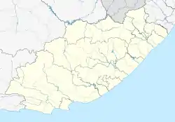
Loerie, South Africa
Loerie (Loerieheuwel is a township situated in Loerie) is a town in Sarah Baartman District Municipality in the Eastern Cape province of South Africa.
Loerie | |
|---|---|
 Loerie  Loerie | |
| Coordinates: 33.873°S 25.030°E | |
| Country | South Africa |
| Province | Eastern Cape |
| District | Sarah Baartman |
| Municipality | Kouga |
| Area | |
| • Total | 2.77 km2 (1.07 sq mi) |
| Population (2011)[1] | |
| • Total | 2,787 |
| • Density | 1,000/km2 (2,600/sq mi) |
| Racial makeup (2011) | |
| • Black African | 37.7% |
| • Coloured | 59.1% |
| • Indian/Asian | 0.8% |
| • White | 1.7% |
| • Other | 0.8% |
| First languages (2011) | |
| • Afrikaans | 67.0% |
| • Xhosa | 28.2% |
| • English | 2.3% |
| • Other | 2.4% |
| Time zone | UTC+2 (SAST) |
| Postal code (street) | 6370 |
| PO box | 6370 |
| Area code | 042 |
Settlement some 25 km north-east of Jeffreys Bay and 11 km north-north-west of the mouth of the Gamtoos River. Said to take its name from the loeries or louries, a turaco species (Tauraco corythaix) occurring here.[2]
Loerie had a railway station on the Avontuur Railway which closed in 2011.
In 1930, the Eastern Province Cement Company opened a limestone quarry and built a 14 km cableway to transport the stone to the Loerie railway station where it was transhipped to the Avontuur Railway to be processed in a cement factory near Port Elizabeth.[3]
References
- "Main Place Loerie". Census 2011.
- "Dictionary of Southern African Place Names (Public Domain)". Human Science Research Council. p. 279.
- http://www.baviaans.net/index.php?page=information®ion_id=3&town_id=4 Loerie history
- Loerie Quo Vadis, 'n Kultuur Historiese Oorsig, deur Theo Vosloo. p. 5
This article is issued from Wikipedia. The text is licensed under Creative Commons - Attribution - Sharealike. Additional terms may apply for the media files.
.svg.png.webp)