Saskatchewan Highway 219
Highway 219 is a provincial highway in the Canadian province of Saskatchewan. Saskatchewan's 200-series highways primarily service its recreational areas. The highway runs from Gardiner Dam at the north end of Lake Diefenbaker north to the city Saskatoon. It is about 96 kilometres (60 mi) long.
Highway 219 | ||||
|---|---|---|---|---|
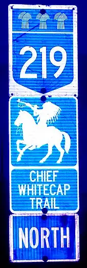
| Chief Whitecap Trail Lorne Avenue | ||||
| Route information | ||||
| Maintained by Ministry of Highways and Infrastructure & Transport Canada | ||||
| Length | 96.4 km[1] (59.9 mi) | |||
| Major junctions | ||||
| South end | ||||
| North end | ||||
| Location | ||||
| Country | Canada | |||
| Province | Saskatchewan | |||
| Rural municipalities | Loreburn, Rudy, Dundurn, Corman Park | |||
| Major cities | Saskatoon | |||
| Highway system | ||||
|
| ||||
| ||||
.svg.png.webp)
Route description
Highway 219 starts at Highway 44 near Danielson Provincial Park[2] and Cutbank and travels north, passing through the hamlet of Glenside, intersecting Highway 15 east of the town of Outlook, before passing through Whitecap Dakota First Nation. North of the First Nation, the highway passes through bedroom communities of Grasswood and Furdale before entering Saskatoon as Lorne Avenue. It intersects Circle Drive before ending at Idylwyld Drive.[3]
Parks accessed from Highway 219 include Cranberry Flats Conservation Area,[4] Beaver Creek Conservation Area,[5] and Danielson Provincial Park.[6]
The province and First Nations groups are looking at upgrading the highway, which is reportedly in need of major repairs, in the near future to improve access to the Dakota Dunes Casino located approximately 30 kilometres (19 mi) south of Saskatoon that opened in 2007.
Lorne Avenue
Lorne Avenue is a road serving the city of Saskatoon, Saskatchewan, and functions as the division between the East and West addresses on the east side of the South Saskatchewan River. It begins as a continuation of Highway 219 to its intersections of Circle Drive and Idylwyld Drive. North of Adelaide Street, a roadway that connects with northbound Idylwyld Drive, Lorne Avenue downgrades to a collector road, where heavy trucks are prohibited,[7] through the residential neighbourhood of Buena Vista (with some small retail development). North of the intersection of 8th Street, Lorne Avenue rejoins Idylwyld Drive south of the Senator Sid Buckwold Bridge.
In the mid-2000s, the Government of Canada agreed to contribute $20 million for two new interchanges in Saskatoon, one of them being at the SK Hwy 219 / Lorne Ave intersection with Circle Drive. This is part of the Asia-Pacific Gateway and Corridor Initiative to improve access to the Canadian National Railway's intermodal freight terminal thereby increasing Asia-Pacific trade.[8] The interchange, part of the final phase of the Circle Drive South extension, was completed in 2013.
Major intersections
From south to north:[3]
| Rural municipality | Location | km[1] | mi | Destinations | Notes |
|---|---|---|---|---|---|
| Loreburn No. 254 | | 0.0 | 0.0 | West of Cutbank; Hwy 219 southern terminus | |
| Rudy No. 284 | Glenside | 20.0 | 12.4 | Railway Avenue | |
| | 25.9 | 16.1 | |||
| | 38.8 | 24.1 | |||
| Dundurn No. 314 | White Cap No. 94 | 65.5– 73.7 | 40.7– 45.8 | Passes through Whitecap Dakota First Nation (including access to Dakota Dunes Casino) | |
| Corman Park No. 344 | Grasswood | 91.4 | 56.8 | Grasswood Road | |
| Furdale | 94.6 | 58.8 | Cartwright Street | ||
| City of Saskatoon | 95.4 | 59.3 | Interchange; no direct access to Circle Drive east | ||
| 96.1 | 59.7 | Ramp to Idylwyld Freeway south; access to Circle Drive east | |||
| 96.2 | 59.8 | Ruth Street | Access from Idylwyld Freeway | ||
| 96.4 | 59.9 | Adelaide Street to Idylwyld Freeway north – City Centre | Hwy 219 northern terminus; no trucks on Lorne Avenue north of Adelaide Street[7] | ||
| 97.8– 98.1 | 60.8– 61.0 | 8th Street | |||
| Idylwyld Drive | Northbound entrance, southbound exit | ||||
1.000 mi = 1.609 km; 1.000 km = 0.621 mi
| |||||
References
- Google (27 September 2017). "Highway 219 in Saskatchewan" (Map). Google Maps. Google. Retrieved 27 September 2017.
- "Danielson Provincial Park". Tourism Saskatchewan. Government of Saskatchewan. Retrieved 23 August 2023.
- Saskatchewan Road Atlas (2007 ed.). Oshawa, ON: MapArt Publishing Corp. 2004. p. 24. ISBN 1-55368-020-0.
- "Cranberry Flats Conservation Area". Tourism Saskatchewan. Government of Saskatchewan. Retrieved 23 August 2023.
- "Beaver Creek Conservation Area". Tourism Saskatchewan. Government of Saskatchewan. Retrieved 23 August 2023.
- "Danielson Provincial Park". Tourism Saskatchewan. Government of Saskatchewan. Retrieved 23 August 2023.
- "Pick Up and Delivery Vehicle Routes" (PDF) (Map). Infrastructure Services Management. City of Saskatoon. 16 April 2013. Retrieved 28 September 2017.
- Hon. Lawrence Cannon, M.P., P.C. Minister of transport, infrastructure and communities (2005–2008). "Statement by Hon. Lawrence Cannon, M.P., P.C. Minister of transport, infrastructure and communities at a news conference of Council of ministers responsible for transportation and highway safety". Media Relations: Communications, Transport Canada, Ottawa. CNW Group. Retrieved 27 April 2008.
{{cite web}}: CS1 maint: multiple names: authors list (link)