Los Angeles's 3rd City Council district
Los Angeles's 3rd City Council district is one of the fifteen districts in the Los Angeles City Council. It is currently represented by Democrat Bob Blumenfield since 2013 after winning an election to succeed Dennis Zine, who termed out and ran for City Controller that year.
Los Angeles's 3rd City Council district | |
|---|---|
 | |
| Government | |
| • Councilmember | . Bob Blumenfield . D–Reseda |
| Population (2020) | |
| • Total | 256,822 |
| Demographics | |
| • White | 44.8% |
| • Asian | 11.7% |
| • Hispanic | 36.4% |
| • Black | 3.9% |
| • Other | 0.31% |
| Website | councildistrict3 |
| Registered voters (2017) 138,309 | |
The district was created in 1925 after a new city charter was passed, which replaced the former "at large" voting system for a nine-member council with a district system with a 15-member council.
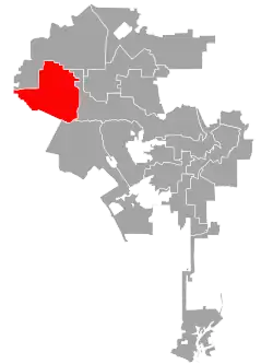
Geography
The Third District extends to the western boundary of both Los Angeles City and Los Angeles County, bordering Ventura County. To the east, it ends at White Oak and Lindley Avenue. It includes the neighborhoods of Woodland Hills, Tarzana, Reseda, Winnetka and Canoga Park.[1]
The district is inside California's 32nd congressional district, 46th State Assembly district, 20th and 27th State Senatorial districts.
Historical boundaries
At its creation, it was mostly south of the Santa Monica Mountains east of Sawtelle, with its eastern boundary at Western Avenue, and its southern boundary running along Washington Boulevard to embrace the Palms area. It included the Los Angeles Country Club and the Sawtelle district, and all the Santa Monica Mountains west of Sawtelle to the Ventura County line, including Pacific Palisades and Topanga Canyon.[2][3] In 1928, the norther boundary was at the "crest of the Santa Monica Mountains and the west boundary the city limits. The Pacific Ocean is the westerly portion of the south boundary of the district, then the line runs southeast along the city limits of Santa Monica to Cambridge Street, south to Pico Boulevard, southeast on Manning avenue and easterly in an irregular line to Eighth Street and Western Avenue. The line runs north on Western avenue to Melrose avenue. . . ."[4] In 1933, due to its size, it lost much of its territory, with the new boundaries south by Pico Boulevard, east by Highland Avenue, north by Hollywood Hills, extending west to the ocean and Santa Monica Canyon."[5][6][7]
In 1940, the district was an irregularly shaped east-west district including the area south of West Hollywood and Beverly Hills, with Westwood, Brentwood and Pacific Palisades, to the coast.[8] By 1951, it had West Hollywood, UCLA and contiguous territory and then ventures over the Santa Monica Mountains to take in a portion of the San Fernando Valley, including Tarzana, Woodland Hills and other communities."[9] In 1960, the district gave up Encino and part of Woodland Hills.[10]
By 1964, the district was reduced in size when the 12th District was transferred from Downtown Los Angeles to the San Fernando Valley, taking over some of the 3rd's area.[11] It included the southwest corner of the Valley, including Woodland Hills, Tarzana and parts of Encino, Canoga Park and Reseda.[12] By 1981, "although the district is largely white and middle class, it is complicated and anything but homogenous. A study in contrasts, it has expensive ranch homes in Woodland Hills that are minutes away from shack-like dwellings in Canoga Park, a largely Hispanic barrio dating from the early 1900s."[13] In 1985, Canoga Park, West Hills were now in District 12, and Reseda, west Van Nuys and parts of Tarzana and Woodland Hills were included in the district.[14]
Officeholders
Eleven men and two women have represented this district.
| Portrait | Name | Term of office |
|---|---|---|
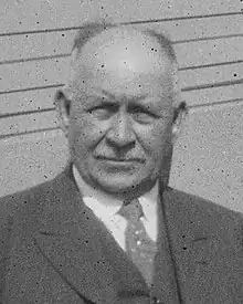 |
Isaac F. Hughes | 1925–1927 |
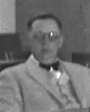 |
Ernest L. Webster | 1927–1931 |
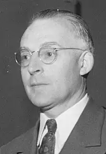 |
James Stuart McKnight | 1931–1933 |
 |
Stephen W. Cunningham | 1933–1941 |
 |
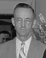
J. Win Austin | 1941–1953 |
 |
Robert M. Wilkinson | 1953–1957 |
 |
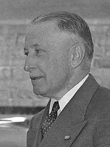
Patrick D. McGee | 1957–1961 |
 |
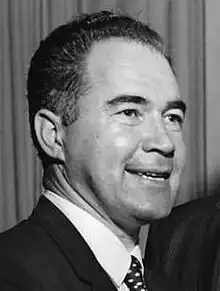
Thomas D. Shepard | 1961–1969 |
 |
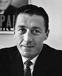
Donald D. Lorenzen | 1969–1977 |
 |
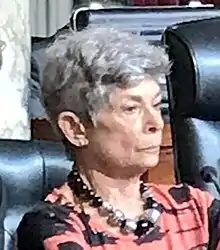
Joy Picus | 1977–1993 |
 |
Laura Chick | 1993–2001 |
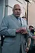 |
Dennis Zine | 2001–2013 |
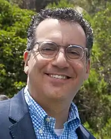 |
Bob Blumenfield | 2013–present |
See also
- Los Angeles City Council districts
References
- Hernández, Caitlin (November 18, 2022). "LA City Council In 2023: Your Guide To Who's Who (And What They Do)". LAist.
- "First Map Showing City Council's Districts," Los Angeles Times, January 16, 1925, page 1 The map shows all 15 council districts. The official boundaries of all 15 as limned by the city clerk are at "Councilmanic Districts Are Traced by Clerk Dominguez," Los Angeles Times, February 12, 1925, page A-2
- "Here Are the Hundred and Twelve Aspirants for the City's Fifteen Councilmanic Seats," Los Angeles Times, May 3, 1925, page 7
- "Council Areas' Lines Changed," Los Angeles Times, December 29, 1928, page A-1
- "District Lines Get Approval," Los Angeles Times, December 24, 1932, page 2
- "City Reapportionment Measure Gets Approval," Los Angeles Times, January 19, 1933 With map of all districts.
- "New Council Zones Defined," Los Angeles Times, January 7, 1937, page A-18
- "Proposed New Alignment for City Voting Precincts" (with map), Los Angeles Times, November 30, 1940, page A-3
- "Outlook in City's Council Contests," Los Angeles Times, April 1, 1951, page 2
- "Council OKs Changes in Its Districts," Los Angeles Times, November 1, 1960, page B-1
- Jack McCurdy, "New Council Districting Voted 14-0," Los Angeles Times, July 16, 1964, page A-1
- "Incumben Councilman One of Three in 3rd District Race," Los Angeles Times, March 28, 1965, page SF-C-4
- Penelope McMillan, "Picus Goes From Novice to Adviser," Los Angeles Times, March 22, 1981, page C-1 With map of district.
- Allan Jalon, "Only Politician Among 12 Honored," Los Angeles Times, December 28, 1985
- Note: Access to most Los Angeles Times reference links requires the use of an LAPL library card.
External links
Members of the Los Angeles City Council | |||||||||||
|---|---|---|---|---|---|---|---|---|---|---|---|
| |||||||||||
 | |||||||||||
_edit1.jpg.webp) | City Council |  | |||||
|---|---|---|---|---|---|---|---|
| Departments |
| ||||||
| Elections |
| ||||||
| Officials |
| ||||||
| School Districts |
| ||||||