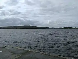
Lough Gara
Lough Gara (Irish: Loch Uí Ghadhra)[3] is a lake in Counties Sligo and Roscommon, Ireland. It is an Important Bird Area protecting 1,788 ha of which most (1,742 ha) is covered by a Ramsar Site.[4]
| Lough Gara | |
|---|---|
 | |
 Location in Ireland | |
| Location | County Sligo, County Roscommon |
| Coordinates | 53°57′N 8°27′W |
| Native name | Loch Uí Ghadhra (Irish) |
| Catchment area | 499.69 km2 (192.93 sq mi) |
| Basin countries | Ireland |
| Max. length | 4 mi (6.4 km) |
| Max. width | 2.5 mi (4.0 km) |
| Surface area | 12.57 km2 (4.85 sq mi) |
| Surface elevation | 66 m (217 ft) |
| Settlements | Monasteraden |
| References | [1] |
| Designated | 7 June 1996 |
| Reference no. | 852[2] |
History
Lough Gara was known in ancient times as Loch Techet, but the O’Garas, during their ownership of the Coolavin district from about the thirteenth century, renamed the lake "Loch Uí Ghadhra". The first documented reference appeared in 1285. Even though the family lost control of all their Coolavin townlands about 1650, their name has remained on the lake to the present day. The area around Lough Gara is referred to as "O'Gara heartland".
Location and size
Lough Gara is situated mainly in south County Sligo with a smaller part of the lake in County Roscommon. From north to south the lake spans about four miles. The widest section is a two and a half mile span. The lake lies south west of the Curlew Mountains with the town of Ballaghaderreen situated almost four miles to the southwest and the town of Boyle positioned just over four miles from its north eastern corner.
Water is supplied to the lake by the Lung River, which enters at the southwestern angle, and the Breedoge River, which enters the lake at the southeastern angle. From the main upper lake the outflow is through the northeastern corner at Cuppanagh, the channel has one wide stretch about a mile long, which is called Lower Lough Gara. From that point the water flow is termed the Boyle River which flows past the town of Boyle into Lough Key and on to the Shannon. The lake has a number of islands. The main upper lake is divided into two sections with a strip of land and Clooncunny Bridge in between.[4]
Iron age crannogs
Many of the islands on Lough Gara are man-made islands called crannógs. An article on Iron Age Crannogs in Lough Gara was published in Archaeology Ireland (Volume 14 No.2 Issue No.52 Summer 2000). The author of the essay, Christina Fredengran, the archaeologist who recently worked on a few of the sites, points out that some of the man-made islands were built over two thousand years ago.
References
- Free, Gary; Little, Ruth; Tierney, Deirdre; Donnelly, Karol & Caroni, Rossana (2006). A Reference Based Typology and Ecological Assessment System for Irish Lakes (PDF) (Report). Environmental Protection Agency (Ireland). p. 11. Retrieved 15 October 2022.
- "Lough Gara". Ramsar Sites Information Service. Retrieved 25 April 2018.
- "Loch Uí Ghadhra/Lough Gara". Placenames Database of Ireland (logainm.ie). Department of Culture, Heritage and the Gaeltacht and Dublin City University. Retrieved 20 March 2020.
- "Important Bird Areas factsheet: Lough Gara". BirdLife International. Retrieved 23 March 2020.
External links
- Christina Fredengren Archaeologist and Archaeology Ireland Ltd., Publishers.