Lujule
Lujule was a county in then Yei River State, South Sudan that existed April 2016 and 22 February 2020. It is located at around 3°41′2.92″N 30°40′41″E, in the elevation of around 1195 metres.[2]
Lujule | |
|---|---|
Payam | |
| Motto: Tru Alo Ba'Ora | |
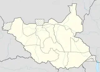 Lujule Location in South Sudan | |
| Coordinates: 3°41′2.92″N 30°40′41″E | |
| County | |
| Region | Equatoria |
| State | Central Equatoria |
| County | Morobo County |
| Number of Bomas 3 | The Bomas of Lujule West Payam
|
| Government | |
| • Type | Payam Administrator |
| • commissioner | Mawa Joseph Okuba |
| Elevation | 3,920.6 ft (1,195 m) |
| Population (2008) | |
| • Total | 16,786[1] |
| Time zone | UTC+3 (South Sudan Standard Time) |
Social Services
Schools
1. kirinya primary school 2. gomonja primary school 3. yugufe primary school
4.Aworo primary school. 5.Ombaci keliko primary school school etc
Churches
1.Aworo parish
2.bodàndi church
3.panyana dioses
History
On 2 October 2015, President Salva Kiir issued a decree establishing 28 states in place of the 10 constitutionally established states. The decree established the new states largely along ethnic lines. A number of opposition parties and civil society groups challenged the constitutionality of the decree. Kiir later resolved to take it to parliament for approval as a constitutional amendment. In November of that year, the South Sudanese parliament empowered President Kiir to create new states. David Lokonga Moses was appointed Governor on 24 December 2015.
After the split up, Yei River State broke down even further for a total of 13 counties in the state (created in April 2016). The 10 counties are part of the 180 counties in South Sudan. The 13counties are consisted of the following:[3]
- Former Kajo-Keji County:
- Kajo-Keji
- ŋepo (Nyepo)
- Kangapo
- Liwolo
- Former Lainya County:
- Lainya
- Kupera
- Former Morobo County
- Morobo
- Lujule
- Former Yei River County:
- Yei
- Otogo
- Tore
- Mugwo
Climate
Lujulo has a Tropical savanna climate (Aw) with dry, warm winters and wet, cooler summers. Due to its elevation, the average temperatures are slightly cooler than many places with this climate.
| Climate data for Lujulo | |||||||||||||
|---|---|---|---|---|---|---|---|---|---|---|---|---|---|
| Month | Jan | Feb | Mar | Apr | May | Jun | Jul | Aug | Sep | Oct | Nov | Dec | Year |
| Average high °C (°F) | 32.2 (90.0) |
32.4 (90.3) |
31.9 (89.4) |
30.5 (86.9) |
29.5 (85.1) |
28.4 (83.1) |
27.2 (81.0) |
27.6 (81.7) |
28.3 (82.9) |
28.7 (83.7) |
29.8 (85.6) |
30.9 (87.6) |
29.8 (85.6) |
| Daily mean °C (°F) | 24.6 (76.3) |
25.2 (77.4) |
25.3 (77.5) |
24.4 (75.9) |
23.6 (74.5) |
23 (73) |
22.2 (72.0) |
22.2 (72.0) |
22.7 (72.9) |
22.8 (73.0) |
23.7 (74.7) |
23.7 (74.7) |
23.6 (74.5) |
| Average low °C (°F) | 17 (63) |
18.1 (64.6) |
18.8 (65.8) |
18.3 (64.9) |
17.8 (64.0) |
17.6 (63.7) |
17.2 (63.0) |
16.9 (62.4) |
17.1 (62.8) |
17 (63) |
17.6 (63.7) |
16.6 (61.9) |
17.5 (63.6) |
| Average precipitation mm (inches) | 16 (0.6) |
32 (1.3) |
93 (3.7) |
154 (6.1) |
176 (6.9) |
170 (6.7) |
181 (7.1) |
224 (8.8) |
188 (7.4) |
197 (7.8) |
88 (3.5) |
27 (1.1) |
1,546 (61) |
| Source: Climate-Data.org[4] | |||||||||||||
References
- "Archived copy" (PDF). ssccse.org. Archived from the original (PDF) on 18 May 2021. Retrieved 30 June 2022.
{{cite web}}: CS1 maint: archived copy as title (link) - "Elevation Finder". freemaptools.com. 2019-04-09. Retrieved 2020-06-16.
- "Yei River state creates 13 counties amid economic struggles". Radio Tamazuj. Retrieved 2022-09-15.
- "Climate: Lujulo". Climate-Data.org. Retrieved August 13, 2019.