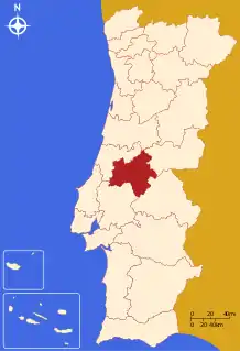
Médio Tejo
The Comunidade Intermunicipal do Médio Tejo (Portuguese pronunciation: [ˈmɛðju ˈtɛʒu]; English: Middle Tagus) is an administrative division in Portugal. It was created in December 2008, replacing the former Comunidade Urbana do Médio Tejo created in 2004.[1] It takes its name from the river Tagus. Médio Tejo is also a NUTS 3 subregion of Centro Region: since January 2015, the NUTS 3 subregion has covered the same area as the intermunicipal community.[2] The seat of the intermunicipal community is Tomar. Médio Tejo comprises parts of the former districts of Santarém and Castelo Branco.
Médio Tejo | |
|---|---|
 | |
| Coordinates: 39°36′N 8°25′W | |
| Country | |
| Region | Centro |
| Established | 2008 |
| Seat | Tomar |
| Municipalities | 13 |
| Area | |
| • Total | 3,344.31 km2 (1,291.25 sq mi) |
| Population (2011) | |
| • Total | 247,331 |
| • Density | 74/km2 (190/sq mi) |
| Time zone | UTC±00:00 (WET) |
| • Summer (DST) | UTC+01:00 (WEST) |
| Website | mediotejo |
The population in 2011 was 247,331,[3] in an area of 3,344.31 square kilometres (1,291.25 sq mi).[4]
Municipalities
The CIM Médio Tejo is composed of 13 municipalities:[5]
| Municipality | Population (2011)[3] | Area (km2)[4] |
|---|---|---|
| Abrantes | 39,325 | 714.69 |
| Alcanena | 13,868 | 127.33 |
| Constância | 4,056 | 80.37 |
| Entroncamento | 20,206 | 13.73 |
| Ferreira do Zêzere | 8,619 | 190.38 |
| Mação | 7,338 | 399.98 |
| Ourém | 45,932 | 416.68 |
| Sardoal | 3,939 | 92.15 |
| Sertã | 15,880 | 446.73 |
| Tomar | 40,677 | 351.20 |
| Torres Novas | 36,717 | 270.00 |
| Vila de Rei | 3,452 | 191.55 |
| Vila Nova da Barquinha | 7,322 | 49.53 |
| Total | 247,331 | 3,344.31 |
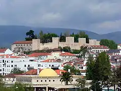
Gallery

.jpg.webp)
.jpg.webp)
.jpg.webp)
.jpg.webp)
References
- "CIM Médio Tejo". Archived from the original on 2015-05-19. Retrieved 2014-08-18.
- Instituto Nacional de Estatística, Adequação dos indicadores à nova organização territorial NUTS III / Entidades Intermunicipais, 18 March 2015
- Instituto Nacional de Estatística
- "Áreas das freguesias, concelhos, distritos e país". Archived from the original on 2018-11-05. Retrieved 2018-11-05.
- "Law nr. 75/2013" (pdf). Diário da República (in Portuguese). Assembly of the Republic (Portugal). Retrieved 18 August 2014.
External links
| North Region |
| ||||
|---|---|---|---|---|---|
| Centro Region |
| ||||
| Lisbon Region |
| ||||
| Alentejo Region |
| ||||
| Algarve Region |
| ||||
| Autonomous Regions | |||||
All these divisions are further subdivided into municipalities and parishes. | |||||
This article is issued from Wikipedia. The text is licensed under Creative Commons - Attribution - Sharealike. Additional terms may apply for the media files.