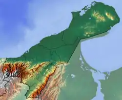
Macarao Formation
The Macarao Formation (Spanish: Formación Macarao, E2m) is a geological formation of the Cocinetas Basin in the northernmost Colombian department of La Guajira. The formation consists of foraminifera-rich fine to medium grained calcareous sandstones intercalated with calcareous siltstones, cross-cut by veins of gypsum. The 253 metres (830 ft) thick Macarao Formation dates to the Paleogene period; Middle to Late Eocene epoch, corresponding to the Divisaderan in the South American land mammal ages (SALMA).
| Macarao Formation | |
|---|---|
| Stratigraphic range: Mid-Late Eocene ~ | |
| Type | Geological formation |
| Unit of | Cocinetas Basin |
| Underlies | Castilletes Fm., Siamaná Fm. |
| Overlies | Guaralamai Fm. Jarara Schist (basement) |
| Thickness | 253 m (830 ft) |
| Lithology | |
| Primary | Calcareous sandstone |
| Other | Siltstone, gypsum |
| Location | |
| Coordinates | 11°50′00″N 71°24′46″W |
| Region | La Guajira Caribbean region |
| Country | |
| Type section | |
| Named by | Rollins |
| Location | Uribia |
| Year defined | 1965 |
| Coordinates | 11°50′00″N 71°24′46″W |
| Region | La Guajira |
| Country | |
 Type locality of the formation in La Guajira | |
Definition
The formation was defined by Rollins in 1965.[1]
Description
Lithologies
The Macarao Formation consists of foraminifera-rich fine to medium grained calcareous sandstones intercalated with calcareous siltstones, cross-cut by veins of gypsum.[2]
Stratigraphy and depositional environment
The Macarao Formation has a maximum thickness of 253 metres (830 ft) and overlies the Cretaceous Guaramalai Formation and the basement (Jarara Schist) and is overlain by the Siamaná and Castilletes Formations with a high angle unconformity. The age has been estimated to be Middle to Late Eocene, corresponding to the Divisaderan in the South American land mammal ages (SALMA). The formation has been deposited in a shallow marine bay environment.[3]
Petroleum geology
The Macarao Formation is a reservoir rock formation in the Guajira Basin.[4]
See also
References
- Moreno et al., 2015, p.7
- Plancha 10bis, 2008
- Rodríguez & Londoño, 2002, p.128
- ANH, 2010
Bibliography
- ANH, .. 2010. Guajira Basin - Colombia Open Round 2010, 1. ANH. Accessed 2017-08-30.
- Moreno, F.; A.J.W. Hendy; L. Quiroz; N. Hoyos; D.S. Jones; V. Zapata; S. Zapata; G.A. Ballen, and Edwin Cadena, A.L. Cárdenas, J.D. Carrillo Briceño, J.D. Carrillo, D. Delgado Sierra, J. Escobar, J.I. Martínez, C. Martínez, C. Montes, J. Moreno, N. Pérez, R. Sánchez, C. Suárez, M.C. Vallejo Pareja, C. Jaramillo. 2015. Revised stratigraphy of Neogene strata in the Cocinetas Basin, La Guajira, Colombia. Swiss Journal of Palaeontology 134. 5–43. Accessed 2017-08-08.
- Rodríguez, Gabriel, and Ana Cristina Londoño. 2002. Mapa geológico del Departamento de La Guajira - 1:250,000, 1–259. INGEOMINAS. Accessed 2017-08-08.
Maps
- Zuluaga, Carlos A.; Alberto Ochoa; Carlos A. Muñoz; Camilo E. Dorado; Nathalia M. Guerrero; Ana M. Martínez; Paula A. Medina; Edgar F. Ocampo, and Alejandro Pinilla and Paula A. Ríos, Bibiana P. Rodríguez, Edward A. Salazar, Vladimir L. Zapata. 2008. Plancha 3 - Puerto Estrella - 1:100,000, 1. INGEOMINAS. Accessed 2017-06-06.
- Zuluaga, Carlos A.; Alberto Ochoa; Carlos A. Muñoz; Camilo E. Dorado; Nathalia M. Guerrero; Ana M. Martínez; Paula A. Medina; Edgar F. Ocampo, and Alejandro Pinilla and Paula A. Ríos, Bibiana P. Rodríguez, Edward A. Salazar, Vladimir L. Zapata. 2008. Plancha 5 - Bahía Portete - 1:100,000, 1. INGEOMINAS. Accessed 2017-06-06.
- Zuluaga, Carlos A.; Alberto Ochoa; Carlos A. Muñoz; Camilo E. Dorado; Nathalia M. Guerrero; Ana M. Martínez; Paula A. Medina; Edgar F. Ocampo, and Alejandro Pinilla and Paula A. Ríos, Bibiana P. Rodríguez, Edward A. Salazar, Vladimir L. Zapata. 2008. Plancha 10 - Rancho Grande - 1:100,000, 1. INGEOMINAS. Accessed 2017-06-06.
- Zuluaga, Carlos A.; Alberto Ochoa; Carlos A. Muñoz; Camilo E. Dorado; Nathalia M. Guerrero; Ana M. Martínez; Paula A. Medina; Edgar F. Ocampo, and Alejandro Pinilla and Paula A. Ríos, Bibiana P. Rodríguez, Edward A. Salazar, Vladimir L. Zapata. 2008. Plancha 10bis - Rancho Grande - 1:100,000, 1. INGEOMINAS. Accessed 2017-06-06.