Madan Bhandari Inner Terai Highway
Madan Bhandari Inner Terai Highway (Nepali: मदन भण्डारी भित्री मधेश राजमार्ग) is an ongoing road project in Nepal, which is thought to be 1,200 kilometres (750 mi) long from east to west. It starts at Shantinagar in Jhapa District of Province No. 1 and runs through Inner Terai (Chure-bhawar) area. It ends at Rupal of Dadeldhura District of Sudurpashchim Province. It is an alternative road to East-west Mahendra Highway (NH-1). The highway will be located 25 to 30 km to the north of Mahendra Highway and 25 to 30 km south of the Pushpalal Highway.[1][2]
| Bhitri Madhes Rajmarg | |
 | |
| Route information | |
|---|---|
| Length | 1,200 km (750 mi) |
| History | Under Construction |
| Major junctions | |
| East end | Bahundangi |
| Dharan, Gaighat, Sindhulimadi, Hetauda, Gaindakot, Shimaltari, Pyuthan, Ghorahi, Surkhet, VP Nagar, Jogbudha | |
| West end | Rupal |
| Location | |
| Country | Nepal |
| Highway system | |
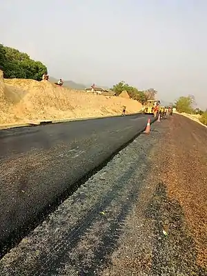
The 315-kilometre-long section of the highway from Dharan to Hetauda had already been awarded and construction works are ongoing.[1][3][2]
References
- "Highway named after late communist leader". www.thehimalayantimes.com. The Himalayan Times. 22 May 2018. Retrieved 31 May 2018.
- "झापादेखि डडेलधुरासम्म मदन भण्डारी राजमार्ग निर्माण गरिने". www.ekhabarnepal.com. 21 May 2018. Retrieved 31 May 2018.
- "मदन भण्डारी राजमार्ग बनाउन साढे चार अर्ब बजेट". www.enayapatrika.com. Naya Patrika. 31 May 2018. Retrieved 31 May 2018.
This article is issued from Wikipedia. The text is licensed under Creative Commons - Attribution - Sharealike. Additional terms may apply for the media files.