Mangaone River (Hawke's Bay)
The Mangaone River is a river of the Hawke's Bay region of New Zealand's North Island. Its source is numerous streams draining the slopes of the Te Waka Range in the Rukumoana Forest area. The river flows southeast then south through rugged hill country until it meets the Tutaekuri River. For most of its course it is deeply incised[1] in the tephra, ignimbrite and lapilli volcanic rocks, which are a bit over 30,000 years old. The deep valleys are partly due to the soft rocks and partly to the rapid rise of the Mohaka Fault, at over 3 mm (0.12 in) a year.[2]
| Mangaone River | |
|---|---|
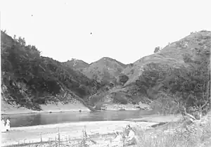 The Mangaone River at Rissington in 1909 | |
| Etymology | Maori meaning "sandy stream" |
| Native name | Mangaone (Māori) |
| Location | |
| Country | New Zealand |
| Region | Hawke's Bay |
| District | Hastings District, New Zealand |
| Settlements | Te Pōhue, Rissington, Dartmoor |
| Physical characteristics | |
| Source | Te Waka Range |
| • location | Kings Stream near Titiokura Summit |
| • coordinates | 39°12′37″S 176°40′51″E |
| • elevation | 50 m (160 ft) |
| Mouth | Tutaekuri River |
• location | Dartmoor, New Zealand |
• coordinates | 39°28′55″S 176°42′10″E |
• elevation | 50 m (160 ft) |
| Length | 51 km (32 mi) |
| Basin features | |
| Progression | Kings Stream → Mangaone River → Tutaekuri River |
| River system | Tutaekuri River |
Totara was being felled along the river in the 1860s.[3][4][5] The river suffers from pollution by nitrogen and phosphorus.[6]
See also
References
- "Mangaone River, Hawke's Bay". NZ Topo Map. Retrieved 7 March 2022.
- Hammond, Andrew Peter (1997). "Late quaternary landscape evolution of western Hawke's Bay, North Island, New Zealand" (PDF).
- "HAWKE'S BAY HERALD". paperspast.natlib.govt.nz. 17 March 1860. Retrieved 8 March 2022.
- "Local Intelligence. HAWKE'S BAY HERALD". paperspast.natlib.govt.nz. 3 January 1863. Retrieved 7 March 2022.
- "HAWKE'S BAY HERALD". paperspast.natlib.govt.nz. 16 July 1864. Retrieved 9 March 2022.
- "Mangaone Rv at Rissington GStn River Quality". Land, Air, Water Aotearoa (LAWA). Retrieved 7 March 2022.
"Place name detail: Mangaone River". New Zealand Gazetteer. New Zealand Geographic Board. Retrieved 24 January 2011.