Mangapu River
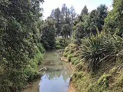
The Mangapu River is a river of the Waikato region of New Zealand's North Island. It has its sources in numerous streams which flow generally northwards from the King Country south of Te Kuiti, the longest of which is the Mangaokewa Stream. These streams join to form the Mangapu close to Te Kuiti, and from here the river flows north, passing close to the east of Waitomo Caves, where the Mangapu caves have the largest entrance in the North Island[1] (about 100 m (330 ft) long and 90 m (300 ft) deep),[2] before flowing into the Waipā River at Ōtorohanga.[3]
| Mangapu River | |
|---|---|
 Mangapu River from Pehitawa bridge | |
| Location | |
| Country | New Zealand |
| Physical characteristics | |
| Mouth | |
• location | Waipā River |
| Length | 48 km (30 mi) |
The New Zealand Ministry for Culture and Heritage gives a translation of "double stream" for Mangapū.[4]
SH3 crosses the river on a 111 m (364 ft) bridge near Ōtorohanga built in 1966[5] and near Hangatiki on a 41 m (135 ft) concrete bridge built in 1977.[6] The railway follows the east bank for about 6 km (3.7 mi), crossing only small tributaries,[7] though it did suffer from flooding, for example in 1905.[8]
The river at Ōtorohanga is classed as being in the worst 25% of similar sites as regards all measured pollutants,[9] though some attempts are being made at restoration.[10]
Pehitawa Kahikatea Forest Reserve

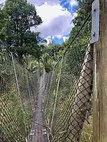
The reserve 18.5 ha (46 acres) of kahikatea forest on the east bank of the river, was purchased by the Native Forests Restoration Trust in 2001. Kahikatea forest once covered 41,000 ha (100,000 acres) in the Waipa Ecological District, now reduced to 158 ha (390 acres), of which 52 ha (130 acres) are in the Mangapu valley, though over 70 ha (170 acres) has been felled since 1975.[11] A major drainage scheme was carried out just upstream from the reserve in the 1930s, including emptying of a lake.[12] The forest floods in winter[13] and flood protection would be uneconomic.[14] Some kahikatea in the reserve are about 120 years old. The reserve also has swamp maire, matai, titoki and pukatea.[11] Te Araroa long-distance walkway passes through the reserve and crosses the river on a suspension bridge.[15]
See also
References
- "CONSERVATION MANAGEMENT STRATEGY WAIKATO 2014–2024" (PDF). Department of Conservation. 29 September 2014.
- "The Flora of the Lost World Cavern, Mangapu Caves System" (PDF).
- "Place name detail: Mangapu River". New Zealand Gazetteer. New Zealand Geographic Board. Retrieved 21 April 2010.
- "1000 Māori place names". New Zealand Ministry for Culture and Heritage. 6 August 2019.
- "Highway Information sheet 003-0057" (PDF).
- "Highway Information sheet 003-0063" (PDF). Archived from the original (PDF) on 5 February 2017.
- "Mangapu River, Waikato - NZ Topo Map". NZ Topo Map. Retrieved 4 February 2017.
- "FLOOD WATERS RUNNING THROUGH A BLOCK CUTTING ON THE RAILWAY BETWEEN HANGATIKI AND OTOROHANGA". www.aucklandcity.govt.nz. 9 November 1905. Retrieved 4 February 2017.
- "Land, Air, Water Aotearoa - Mangapu River at Otorohanga". www.lawa.org.nz. Retrieved 4 February 2017.
- "The Ripple Effect". www.makearipple.co.nz. Retrieved 4 February 2017.
- "Pehitawa Kahikatea Forest - Native Forest Restoration Trust". www.nfrt.org.nz. Retrieved 4 February 2017.
- "BIG DRAINAGE SCHEME (New Zealand Herald, 1932-11-08)". paperspast.natlib.govt.nz. National Library of New Zealand. Retrieved 4 February 2017.
- "2016 Pilot Waikato River Report Card: Methods and Technical Summary" (PDF). Waikato River Authority. March 2016.
- "Waipa Zone Management Plan" (PDF). Waikato Regional Council Policy Series 2011/17. April 2012.
- "Pehitawa Track:Te Araroa - New Zealand's Trail - Waikato / King Country". www.teararoa.org.nz. Retrieved 4 February 2017.
External links
- Flood levels at SH3 bridge near Hangatiki
- Google Street view of the river at SH3 bridge near Ōtorohanga
- Google Street view of the river at SH3 bridge near Hangatiki