Marks Peak
Marks Peak (76°30′S 125°45′W) is the ultimate summit, at 3,325 metres (10,909 ft) high, on the south side of the crater rim of Mount Hampton, in the Executive Committee Range of Marie Byrd Land, Antarctica. It was mapped by the United States Geological Survey from surveys and U.S. Navy trimetrogon photography, 1958–60, and was named by the Advisory Committee on Antarctic Names for Keith E. Marks, an electronics engineer at the National Bureau of Standards, and a member of the Marie Byrd Land Traverse Party, 1959–60.[1]
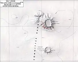
Topographic map of Mount Hampton including Marks Peak
References
![]() This article incorporates public domain material from "Marks Peak". Geographic Names Information System. United States Geological Survey.
This article incorporates public domain material from "Marks Peak". Geographic Names Information System. United States Geological Survey.
This article is issued from Wikipedia. The text is licensed under Creative Commons - Attribution - Sharealike. Additional terms may apply for the media files.