Massif de la Hotte
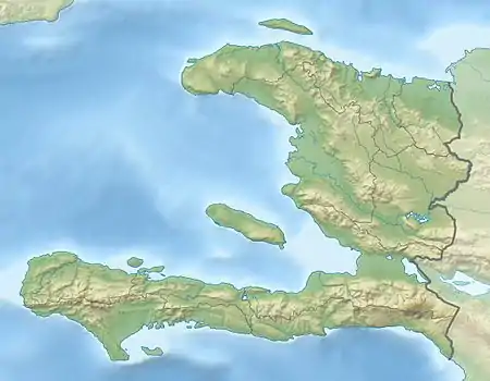
The Massif de la Hotte is a mountain range in southwestern Haiti, on the Tiburon Peninsula.[2] About 2.5 million years ago, Massif de la Hotte was separated from the Massif de la Selle by a deep, wide sea channel, and formed a separate island. This resulted in a hotbed of endemism in la Hottes bird, plant, and reptile communities.[3] The Massif de la Hotte is subdivided into the Oriental la Hotte in the East, the central la Hotte and the Occidental la Hotte on the Western tip of the Tiburon peninsula. The Occidental la Hotte is relatively remote and is one of the most biologically diverse and significant areas of all of Hispaniola. It also supports some of the last stands of Haiti's dense cloud forest on its peaks.
| Massif de la Hotte | |
|---|---|
 Part of the Central Massif de la Hotte , the Tête Bœuf mountain chain seen from Bonnet Carre Haiti. | |
| Highest point | |
| Peak | Pic Macaya |
| Elevation | 2,347 m (7,700 ft) |
| Prominence | 2,097 m (6,880 ft)[1] |
| Coordinates | 18°22′57″N 74°01′30″W[1] |
| Dimensions | |
| Length | 200 km (120 mi) |
| Geography | |
 Massif de la Hotte | |
| Country | Haiti |
| Continent | North America |
Haiti has a World Heritage Site located here.[4] In the wake of the 2010 Haiti earthquake, UNESCO's World Heritage Program is helping Haiti assess the damage.[5]
Biodiversity and conservation
Occidental la Hottes is the highest and biologically most diverse part of Massif de la Hotte. Rising to a peak level of approximately 7700 ft (2347 m) in Pic Macaya; Haiti's second highest peak, the Massif's high and fluctuating elevations supports some of Hispaniola's highest levels of biological diversity and endemism.
Plants endemic to the massif include Samuelssonia verrucosa, Cinnamodendron angustifolium, Miconia revolutifolia, Miconia ayisyena, Miconia tetrazygioides, Pleurothallis atrohiata, Wercklea hottensis, Clavija domingensis, Magnolia ekmanii, Sapium haitiense, Psidium hotteanum, Phyllanthus abditus, Phyllanthus urbanianus, Myrcianthes esnardiana, Alsophila confinis, Eugenia albimarginata, Eugenia crispula, Eugenia goavensis, Eugenia miragoanae, Eugenia perriniana, Tapura haitiensis, Sapium haitiense, Dussia sanguinea, Nectandra caudatoacuminata, Pavonia hotteana, Myrcia calophylla, Myrcia chrysophylloides, Myrcia densifolia, Myrcia neohotteana, Myrcia neoinvolucrata, Myrcia tiburoniana, and Mosiera tiburona.
Endemic orchids include Cranichis galatea, Lepanthes furcatipetala, Lepanthes hotteana, Lepanthes magnipetala, Lepanthes pteroglossa, Lepanthes quadrispatulata, Lepanthes semperflorens, Lepanthopsis aristata, Lepanthopsis micheliae, Lepanthopsis ornipteridion, Malaxis dodii, Pleurothallis atrohiata, Specklinia formondii, Specklinia mitchellii, Specklinia stillsonii, Stelis choriantha, Stelis glacensis, Stelis magnicava, and Tomzanonia filicina.
Conservation International recognizes the region as one of the most conservation-urgent in the world in which 13 of Hispaniola's most critically endangered species (all amphibians) occur.[6] Among the most critically endangered frog species are Eleutherodactylus chlorophenax and Eleutherodactylus parapelates, two frog species endemic to Haiti. The Hispaniolan trogon, Haiti's national bird, has a recognized presence in the region, as well as wintering Bicknell's thrushes.[7]
Notable conservation areas in the Massif de la Hotte include five national parks, five habitat/species management areas, two protected area with sustainable use of natural resources and the largest cave on the Caribbean islands Grotte Marie Jeanne. The national parks are: Pic Macaya National Park, Grande Colline National Park, Deux Mamelles National Park, Grand Bois National Park, and Ile a Vache National Park. The habitat/species management areas are: Grosse Caye / Zone humide d'Aquin, Olivier / Zanglais, Pointe Abacou, Fond de Cayes, la Cahouane. The two protected areas with sustainable use of natural resources are: Jeremie - Abricot and Barcaderes Caymites.
La Hotte Biosphere Reserve
The La Hotte Biosphere Reserve was designated by UNESCO in 2016. The reserve covers an area of 435,193.5 ha (terrestrial and marine), with a core area of 117,119 ha (terrestrial 52,781.5 ha, marine 64,337.5 ha), a buffer zone of 185,027.5 ha (terrestrial 130,074.5 ha, marine: 54,953 ha), and a transition area of 133,047 ha (terrestrial 82,423 ha, marine: 50,624 ha).[8]
See also
- Geography of Haiti
- Mountain ranges of the Caribbean
- World Conservation Monitoring Centre
References
- "Central America and Caribbean Ultra-Prominence Page". peaklist.org. Retrieved 2022-09-26.
- Woodring,Brown,Burbank. "Geology of the Republic of Haiti". Retrieved 2021-10-28.
{{cite web}}: CS1 maint: multiple names: authors list (link) - Andrea Townsend. "Endangered Areas". Retrieved 2007-06-11.
- "National History Park – Citadel, Sans Souci, Ramiers". UNESCO.org. Retrieved 23 January 2010.
- "World Heritage in Haiti". UNESCO.org. 2010-01-20. Retrieved 23 January 2010.
- "Expedition to Pic Macaya uncovers Haitian treasures". Hotspots E-News. Conservation International. 2006. Retrieved 22 September 2014.
- BirdLife International (2020). "Catharus bicknelli". IUCN Red List of Threatened Species. 2020: e.T22728467A180783383. doi:10.2305/IUCN.UK.2020-3.RLTS.T22728467A180783383.en. Retrieved 19 November 2021.
- "La Hotte". UNESCO Man and Biosphere Programme, June 2016. Accessed 30 December 2020.