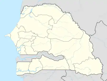
Matam, Senegal
Matam (Hassaniya Arabic: ماتام; Wolof: Mataam) is the capital town of the Matam Region in north-east Senegal, and lies on the Sénégal River on the border with Mauritania. In the census of 2002, Matam had 14,620 inhabitants. In 2007, according to official estimates, the population of the town had increased to 17,324.
Matam
ماتام | |
|---|---|
Town | |
 Matam | |
| Coordinates: 15°37′N 13°20′W | |
| Country | |
| Region | Matam |
| Department | Matam |
| Population (2007) | |
| • Total | 17,324 |
| Time zone | UTC+0 (GMT) |
In 1996, the Upper Senegal River Valley, stretching from Matam to Diamou in Mali was cited as one of the poorest and most inaccessible regions in the western Sahel.[1]
Climate
Matam has a hot desert climate (BWh) with little to no rainfall in all months except July, August and September.
| Climate data for Matam (1961-1990 normals, extremes 1973-present) | |||||||||||||
|---|---|---|---|---|---|---|---|---|---|---|---|---|---|
| Month | Jan | Feb | Mar | Apr | May | Jun | Jul | Aug | Sep | Oct | Nov | Dec | Year |
| Record high °C (°F) | 45.4 (113.7) |
48.4 (119.1) |
46.2 (115.2) |
48.5 (119.3) |
48.5 (119.3) |
49.0 (120.2) |
48.2 (118.8) |
45.6 (114.1) |
47.0 (116.6) |
45.0 (113.0) |
46.0 (114.8) |
42.5 (108.5) |
49.0 (120.2) |
| Average high °C (°F) | 32.8 (91.0) |
36.0 (96.8) |
39.1 (102.4) |
41.6 (106.9) |
42.8 (109.0) |
40.4 (104.7) |
36.8 (98.2) |
34.8 (94.6) |
35.1 (95.2) |
38.0 (100.4) |
37.0 (98.6) |
33.2 (91.8) |
37.3 (99.1) |
| Daily mean °C (°F) | 24.2 (75.6) |
26.8 (80.2) |
29.8 (85.6) |
32.6 (90.7) |
34.8 (94.6) |
33.9 (93.0) |
31.3 (88.3) |
29.9 (85.8) |
29.9 (85.8) |
31.2 (88.2) |
28.6 (83.5) |
24.8 (76.6) |
29.8 (85.7) |
| Average low °C (°F) | 15.5 (59.9) |
17.6 (63.7) |
20.5 (68.9) |
23.6 (74.5) |
26.8 (80.2) |
27.3 (81.1) |
25.7 (78.3) |
24.9 (76.8) |
24.7 (76.5) |
24.3 (75.7) |
20.1 (68.2) |
16.3 (61.3) |
22.3 (72.1) |
| Record low °C (°F) | 10.0 (50.0) |
10.0 (50.0) |
12.0 (53.6) |
16.0 (60.8) |
19.0 (66.2) |
17.0 (62.6) |
18.5 (65.3) |
17.4 (63.3) |
14.8 (58.6) |
18.8 (65.8) |
14.0 (57.2) |
11.0 (51.8) |
10.0 (50.0) |
| Average precipitation mm (inches) | 0.2 (0.01) |
1.3 (0.05) |
0.1 (0.00) |
1.3 (0.05) |
1.0 (0.04) |
25.1 (0.99) |
85.2 (3.35) |
133.4 (5.25) |
94.6 (3.72) |
21.1 (0.83) |
2.5 (0.10) |
1.0 (0.04) |
366.8 (14.43) |
| Mean monthly sunshine hours | 266.6 | 252.0 | 291.4 | 297.0 | 297.6 | 270.0 | 272.8 | 257.3 | 252.0 | 275.9 | 270.0 | 176.7 | 3,179.3 |
| Percent possible sunshine | 77 | 78 | 79 | 80 | 75 | 70 | 69 | 66 | 70 | 77 | 80 | 51 | 73 |
| Source: NOAA[3][4] | |||||||||||||
Notable people
References
Wikimedia Commons has media related to Matam.
- Causes of International Migration. Diane Publishing Company. 1996. p. 195. ISBN 9780788126840.
- "Phosphate mining in Matam, Ndiendouri-Ouali Diala deposits, SOMIVA (SERPM), Senegal". Ejatlas.org. Retrieved 14 November 2018.
- "Matam Normals 1961-1990". National Oceanic and Atmospheric Administration. Retrieved February 17, 2022.
- "SGM00061630". National Oceanic and Atmospheric Administration. Retrieved February 17, 2022.
This article is issued from Wikipedia. The text is licensed under Creative Commons - Attribution - Sharealike. Additional terms may apply for the media files.