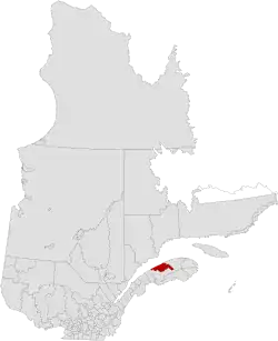
La Matanie Regional County Municipality
La Matanie is a regional county municipality, located in the Bas-Saint-Laurent region of Quebec, in Canada. From January 1, 1982, to March 9, 2013, it was known as Matane.[4]
La Matanie | |
|---|---|
 | |
| Coordinates: 48°51′N 67°17′W[1] | |
| Country | |
| Province | |
| Region | Bas-Saint-Laurent |
| Effective | January 1, 1982 |
| County seat | Matane |
| Government | |
| • Type | Prefecture |
| • Prefect | Pierre Thibodeau |
| Area | |
| • Total | 3,380.00 km2 (1,305.03 sq mi) |
| • Land | 3,318.34 km2 (1,281.22 sq mi) |
| Population (2016)[3] | |
| • Total | 21,301 |
| • Density | 6.4/km2 (17/sq mi) |
| • Change 2011-2016 | |
| • Dwellings | 11,948 |
| Time zone | UTC−5 (EST) |
| • Summer (DST) | UTC−4 (EDT) |
| Area code(s) | 418 and 581 |
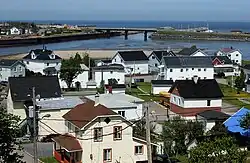
The county seat is the city of Matane.
Subdivisions
There are 12 subdivisions within the RCM:[2]
|
|
|
|
Demographics
Population
Canada census – La Matanie community profile
| 2021 | 2016 | 2011 | |
|---|---|---|---|
| Population | 20,883 (-2.0% from 2016) | 21,301 (-2.2% from 2011) | 21,786 (-2.1% from 2006) |
| Land area | 3,315.74 km2 (1,280.21 sq mi) | 3,318.34 km2 (1,281.22 sq mi) | 3,319.08 km2 (1,281.50 sq mi) |
| Population density | 6.3/km2 (16/sq mi) | 6.4/km2 (17/sq mi) | 6.6/km2 (17/sq mi) |
| Median age | 54 (M: 52.8, F: 54.8) | 52.8 (M: 52.0, F: 53.5) | 50.0 (M: 49.2, F: 50.7) |
| Private dwellings | 10,385 (total) | 11,948 (total) | 11,656 (total) |
| Median household income | $47,821 | $42,212 |
|
| ||||||||||||||||||||||||
| [10][3] | |||||||||||||||||||||||||
Language
| Canada Census Mother Tongue - La Matanie Regional County Municipality, Quebec[10][3] | ||||||||||||||||||
|---|---|---|---|---|---|---|---|---|---|---|---|---|---|---|---|---|---|---|
| Census | Total | French |
English |
French & English |
Other | |||||||||||||
| Year | Responses | Count | Trend | Pop % | Count | Trend | Pop % | Count | Trend | Pop % | Count | Trend | Pop % | |||||
2016 |
21,040 |
20,800 | 98.86% | 95 | 0.45% | 60 | 0.29% | 85 | 0.40% | |||||||||
2011 |
21,640 |
21,405 | 98.91% | 95 | 0.44% | 70 | 0.32% | 70 | 0.32% | |||||||||
2006 |
21,880 |
21,525 | 98.38% | 125 | 0.57% | 35 | 0.16% | 195 | 0.89% | |||||||||
2001 |
22,065 |
21,900 | 99.25% | 65 | 0.29% | 55 | 0.25% | 45 | 0.20% | |||||||||
1996 |
23,355 |
23,175 | n/a | 99.23% | 115 | n/a | 0.49% | 40 | n/a | 0.17% | 25 | n/a | 0.11% | |||||
Personalities

- Isabelle Boulay, born 6 at Sainte-Félicité
- Yves Sirois, born at Matane
- Josélito Michaud, born in 1965 at Matane
- Alain Côté, born at Matane
- Claude Picher, born at Québec died in 1998 at Saint-Léandre
Transportation
References
- "Reference number 416974 in Banque de noms de lieux du Québec". toponymie.gouv.qc.ca (in French). Commission de toponymie du Québec.
- "Geographic code 080 in the official Répertoire des municipalités". www.mamh.gouv.qc.ca (in French). Ministère des Affaires municipales et de l'Habitation.
- "Census Profile, 2016 Census: Matane, Municipalité régionale de comté [Census division], Quebec". Statistics Canada. 8 February 2017. Retrieved December 18, 2019.
- "Modification aux municipalités du Québec" (PDF). Modifications Aux Municipalités du Québec. Institut de la statistique du Québec. March 2013. ISSN 1715-6408.
- "2021 Community Profiles". 2021 Canadian Census. Statistics Canada. February 4, 2022. Retrieved 2022-04-27.
- "2016 Community Profiles". 2016 Canadian Census. Statistics Canada. August 12, 2021. Retrieved 2019-12-18.
- "2011 Community Profiles". 2011 Canadian Census. Statistics Canada. March 21, 2019. Retrieved 2014-01-27.
- "2006 Community Profiles". 2006 Canadian Census. Statistics Canada. August 20, 2019.
- "2001 Community Profiles". 2001 Canadian Census. Statistics Canada. July 18, 2021.
- Statistics Canada: 1996, 2001, 2006, 2011 census
- Official Transport Quebec Road Map
Adjacent Counties & Equivalent Territories | |
|---|---|
| Regional county municipalities and equivalent territories | |
|---|---|
| Municipalities | |
This article is issued from Wikipedia. The text is licensed under Creative Commons - Attribution - Sharealike. Additional terms may apply for the media files.