McDade, Texas
McDade is an unincorporated community and census-designated place in northern Bastrop County, Texas, located along U.S. Route 290.[2] As of the 2020 census, it had a population of 720.[3] It is 9 miles (14 km) east of Elgin and 34 miles (55 km) east of Austin. It is 21 miles (34 km) west of Giddings.
McDade, Texas | |
|---|---|
.jpg.webp) McDade Baptist Church | |
 Location within the state of Texas  McDade, Texas (the United States) | |
| Coordinates: 30°17′02″N 97°14′16″W | |
| Country | United States |
| State | Texas |
| County | Bastrop |
| Area | |
| • Total | 4.0 sq mi (10 km2) |
| • Land | 4.0 sq mi (10 km2) |
| • Water | 0.0 sq mi (0 km2) |
| Elevation | 551 ft (168 m) |
| Population (2020) | |
| • Total | 720 |
| • Density | 180/sq mi (69/km2) |
| Time zone | UTC-6 (Central (CST)) |
| • Summer (DST) | UTC-5 (CDT) |
| ZIP code | 78650 |
| FIPS code | 48-45564[1] |
| GNIS feature ID | 1341178[2] |
Census Designated Place history
This was a new CDP for the 2010 census.[4]
The community is named for James W. McDade, a major stockholder in the Houston and Texas Central Railroad in 1869.
The McDade Independent School District serves area students.
McDade was, for several years, the childhood home of 1950s television and recording star Gale Storm, as her mother owned a millinery shop in McDade.
Geography
According to the United States Census Bureau, the CDP has a total area of 4.0 square miles (10 km2), all land.[5]
Demographics
| Race | Number | Percentage |
|---|---|---|
| White (NH) | 394 | 54.72% |
| Black or African American (NH) | 4 | 0.56% |
| Native American or Alaska Native (NH) | 2 | 0.28% |
| Some Other Race (NH) | 2 | 0.28% |
| Mixed/Multi-Racial (NH) | 28 | 3.89% |
| Hispanic or Latino | 290 | 40.28% |
| Total | 720 |
As of the 2020 United States census, there were 720 people, 368 households, and 268 families residing in the CDP.
References
- "U.S. Census website". United States Census Bureau. Retrieved January 31, 2008.
- U.S. Geological Survey Geographic Names Information System: McDade
- "Geographic Identifiers: 2010 Demographic Profile Data (G001): McDade CDP, Texas". U.S. Census Bureau, American Factfinder. Archived from the original on February 12, 2020. Retrieved April 9, 2014.
- "Population and Housing Unit Counts, 2010 Census of Population and Housing" (PDF). Texas: 2010. Retrieved January 12, 2017.
- "US Gazetteer Files 2016-Places-Texas". US Census. Retrieved January 12, 2017.
- "Explore Census Data". data.census.gov. Retrieved May 24, 2022.
- https://www.census.gov/
- "About the Hispanic Population and its Origin". www.census.gov. Retrieved May 18, 2022.
External links
Municipalities and communities of Bastrop County, Texas, United States | ||
|---|---|---|
| Cities | 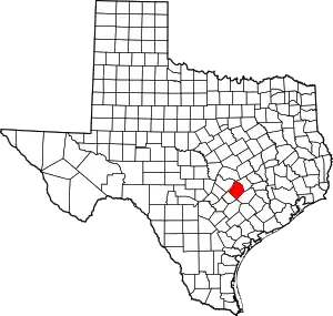 Bastrop County map | |
| CDPs | ||
| Other communities | ||
| Ghost towns | ||
| Footnotes | ‡This populated place also has portions in an adjacent county or counties | |