McDonald Creek (Salt Fork Brazos River tributary)
McDonald Creek is an intermittent stream, about 25 mi (40 km) long, heading about 10 mi (16 km) south-southwest of Crosbyton, Texas, and trending generally southeast to join the Salt Fork Brazos River near the community of Verbena, Texas.[1]
| McDonald Creek | |
|---|---|
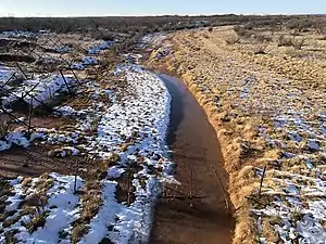 Melting snow at McDonald Creek | |
| Location | |
| Country | United States |
| Physical characteristics | |
| Source | |
| • location | Crosby County, Texas |
| • elevation | 2,969 ft (905 m) |
| Mouth | |
• location | Garza County, Texas |
• elevation | 2,270 ft (690 m) |
| Length | 25 mi (40 km) |
Geography
McDonald Creek rises along the eastern edge of the Caprock Escarpment of the Llano Estacado.[1] The stream channel initially runs southeast then curves to the southwest where it merges with Turkey Creek about 5 mi (8.0 km) west-northwest of Kalgary, Texas. It then runs south to join Lake Creek about 1 mi (1.6 km) upstream of Farm to Market Road 651. The stream then runs southeast where it merges with the Salt Fork Brazos River at a low-water crossing on Farm to Market Road 2008, near the sparsely populated community of Verbena.
Overall, McDonald Creek descends about 700 ft (210 m) from its source to its mouth, passing through highly eroded and moderately steep terrain along its course.[2]
See also
References
- "MCDONALD CREEK (CROSBY COUNTY)". Handbook of Texas Online. Texas State Historical Association. June 15, 2010. Retrieved February 17, 2021.
- U.S. Geological Survey Geographic Names Information System: McDonald Creek
External links
- U.S. Geological Survey Geographic Names Information System: McDonald Creek
- McDonald Creek from the Handbook of Texas Online
- Public domain images of the Llano Estacado and West Texas