The Meadows, Edmonton
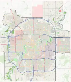
The Meadows is a residential district in the city of Edmonton, Alberta, Canada. Located in southeast Edmonton, the Meadows is bounded by Whitemud Drive (Highway 14) to the north, 34 Street to the west, and Anthony Henday Drive (Highway 216) to the east and south. The residential district of Mill Woods is immediately west of the Meadows across 34 Street, while Strathcona County is located to the east across Anthony Henday Drive.
The Meadows | |
|---|---|
Area | |
 The Meadows Location of the Meadows in Edmonton | |
| Coordinates: 53.467°N 113.372°W | |
| Country | Canada |
| Province | Alberta |
| City | Edmonton |
| Quadrant[1] | NW |
| Ward[1] | Sspomitapi |
| Sector[1] | Southeast |
| Government | |
| • Mayor | Amarjeet Sohi |
| • Administrative body | Edmonton City Council |
| • Councillor | Jo-Anne Wright |
| Elevation | 714 m (2,343 ft) |
The community is represented by the Meadows Community League, established in 1987.[3][4]
Neighbourhoods
The Meadows area structure plan includes seven separate neighbourhoods.[5] The Meadows area includes the following:[6]
The naming theme applied to neighbourhoods within the Meadows area are trees, flowers, and plants native to Alberta.[7]
Land use plans
In addition to the area structure plan, the following plans were adopted to further guide development of certain portions of the Meadows area:
- the Aster neighbourhood structure plan (NSP) in 2016,[8] which applies to the Aster neighbourhood;[6]
- the Larkspur NSP in 1987,[9] which applies to the Larkspur neighbourhood;[6]
- the Laurel NSP in 2007,[10] which applies to the Laurel neighbourhood;[6]
- the Maple NSP in 2010,[11] which applies to the Maple neighbourhood;[6]
- the Silver Berry NSP in 1994,[12] which applies to the Silver Berry neighbourhood;[6]
- the Tamarack NSP in 2006,[13] which applies to the Tamarack neighbourhood;[6] and
- the Wild Rose NSP in 1998,[14] which applies to the Wild Rose neighbourhood.[6]
Schools
The Meadows is home to the following five schools.
- Velma E. Baker Elementary School (kindergarten through grade 6 in Larkspur)[15]
- Father Michael Troy Catholic Junior High School (grades 7-9 in Wild Rose)[16]
- A. Blair McPherson School (kindergarten through grade 9 in Tamarack)[17]
- Svend Hansen School (kindergarten through grade 9 in Laurel) [18]
- Thelma Chalifoux School (grade 7 through 9 in Larkspur)
- Edmonton Public Schools plans on building a senior high school near the Meadows Recreation Centre.
Amenities
RioCan Meadows is a commercial development at the southwest corner of Whitemud Drive and 17 Street on the northern edge of The Meadows. It features retailers of varying sizes and includes anchors such as Value Village, Home Depot, and Real Canadian Superstore. A smaller commercial development is located in the central portion of The Meadows on 23 Avenue. It includes a Save-On-Foods and numerous small retailers.[19] Directly east of RioCan Meadows is another similar sized commercial development under Dream Centres.[20] It is being developed in three sections, Edmonton Tamarack SE,[21] Edmonton Tamarack NE,[22] and Edmonton Tamarack N.[23] The largest store include, GoodLife Fitness, Walmart Super Center, and a Shoppers Drug Mart. With many smaller stores within the same area[20]
Southeast of Silver Berry in Meadows District Park, The Meadows Community Recreation Centre & The Meadows Library[24] opened on December 5, 2014.[25] The Meadows Community Recreation Centre amenities include, Aquatic Centre, Fitness Centre, Gymnasium, 2 NHL-sized arenas, and Outdoor Sport Fields along with program's corresponding to them.[26]
Meadows Transit Centre
Meadows Transit Centre | |
|---|---|
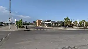
 Meadows Transit Centre in 2020. | |
| General information | |
| Platforms | 13 bus bays[27] |
| Construction | |
| Parking | Yes |
| Bicycle facilities | Yes |
| Accessible | Yes |
| Other information | |
| Website | Meadows Transit Centre |
| History | |
| Opened | April 2010[28] |
The Meadows Transit Centre is located on 17 street and Tamarack Way. This transit centre has many amenities including park & ride, a drop off area, public washrooms, a large shelter, vending machines and a pay phone.[29] The transit centre was opened in April 2010 at a construction cost of $12 million.[28]
The following bus routes serve the transit centre:[30]
| To/from | Routes |
|---|---|
| Bonnie Doon | 500X |
| Davies Transit Centre | 506 |
| Downtown | 500X |
| Laurel | 516 |
| MacEwan University | 500X |
| Maple Ridge | 504 |
| Mill Woods Transit Centre | 515, 516 |
| Silver Berry | 515 |
| Southgate Transit Centre | 55, 507 |
| Tamarack | 507, 508 |
| West Edmonton Mall Transit Centre | 55 |
References
- "Edmonton Low Density Residential Land Supply Developing and Planned Neighbourhoods 2013" (PDF). The City of Edmonton. Archived from the original (PDF) on 13 March 2016. Retrieved 23 January 2016.
- "Mayor and City Council". City of Edmonton. Retrieved November 12, 2017.
- "The Meadows Community League". The Meadows Community League. Retrieved October 13, 2017.
- Kuban, Ron (2005). Edmonton's Urban Villages: The Community League Movement. University of Alberta Press. ISBN 9781459303249.
- "The Meadows Area Structure Plan (Office Consolidation September 2013)" (PDF). City of Edmonton. Retrieved 2016-01-23.
- "Welcome to Edmonton Maps". City of Edmonton. Retrieved 2012-05-26.
- "Naming Committee: Naming Announcements (Neighbourhood Naming Complete for Big Lake and Meadows)". City of Edmonton. Archived from the original on November 14, 2013. Retrieved February 22, 2015.
The final neighbourhood within the Meadows ASP has been named Aster. The theme for this ASP is "Trees, Flowers, and Plants Native to Alberta".
- "Aster Neighbourhood Structure Plan (Office Consolidation)" (PDF). City of Edmonton. August 2020. Retrieved 2020-01-02.
- "Larkspur Neighbourhood Structure Plan (Office Consolidation)" (PDF). City of Edmonton. December 2006. Retrieved 2012-06-09.
- "Laurel Neighbourhood Structure Plan (Office Consolidation)" (PDF). City of Edmonton. June 2011. Archived from the original (PDF) on 2011-06-16. Retrieved 2012-06-09.
- "Maple Neighbourhood Structure Plan (Office Consolidation)" (PDF). City of Edmonton. August 2010. Retrieved 2012-06-09.
- "Silver Berry Neighbourhood Structure Plan (Office Consolidation)" (PDF). City of Edmonton. June 2007. Retrieved 2012-06-09.
- "Tamarack Neighbourhood Structure Plan (Office Consolidation)" (PDF). City of Edmonton. June 2010. Retrieved 2012-06-09.
- "Wild Rose Neighbourhood Structure Plan (Office Consolidation)" (PDF). City of Edmonton. April 2011. Retrieved 2012-06-09.
- "Getting Here". Edmonton Public Schools. Retrieved 14 November 2012.
- "Three Year Capital Plan 2013-2016" (PDF). Edmonton Catholic Schools. Retrieved 14 November 2012.
- "Getting Here". Edmonton Public Schools. Retrieved 14 November 2012.
- "Contact Information". Edmonton Public Schools. Retrieved May 28, 2019.
- "RioCan Meadows" (PDF). RioCan Real Estate Investment Trust. RioCan. Retrieved 23 January 2016.
- "Current Projects". Dream Centres. Retrieved 23 January 2016.
- "Edmonton Tamarack SE" (PDF). Dream Centres. Retrieved 23 January 2016.
- "Edmonton Tamarack NE" (PDF). Dream Centres. Retrieved 23 January 2016.
- "Edmonton Tamarack N" (PDF). Dream Centres. Retrieved 23 January 2016.
- "The Meadows Community Recreation Centre & The Meadows Library". The City of Edmonton. Retrieved 23 January 2016.
- Edwards, Bruce (5 December 2015). "Photos: The Meadows rec centre and library opens in south Edmonton". Edmonton Journal. Retrieved 23 January 2016.
- "Amenities". The City of Edmonton. Retrieved 23 January 2016.
- "Meadows Transit Centre Map" (PDF). City of Edmonton. Retrieved October 1, 2017.
- "City opens new Meadows Transit Centre". CBC News. 2 September 2010. Retrieved 14 March 2018.
- "Meadows Transit Centre". City of Edmonton. Retrieved October 1, 2017.
- "Brochures in PDF". City of Edmonton. Retrieved 7 November 2019.