Meiji-jingumae Station
Meiji-jingumae Station (明治神宮前駅, Meiji-Jingūmae-eki) is a subway station located in Shibuya, Tokyo, Japan. It is a part of the Tokyo Metro subway network, and is served by the Chiyoda Line and the Fukutoshin Line.
C03 F15 Meiji-jingumae 'Harajuku' Station 明治神宮前<原宿>駅 | |||||||||||||||||||||||||
|---|---|---|---|---|---|---|---|---|---|---|---|---|---|---|---|---|---|---|---|---|---|---|---|---|---|
 Exit No. 7 of Meiji-jingumae Station | |||||||||||||||||||||||||
| General information | |||||||||||||||||||||||||
| Location | Shibuya, Tokyo Japan | ||||||||||||||||||||||||
| Operated by | |||||||||||||||||||||||||
| Line(s) | |||||||||||||||||||||||||
| Platforms | 2 island platforms (1 for each line) | ||||||||||||||||||||||||
| Tracks | 4 (2 for each line) | ||||||||||||||||||||||||
| Connections |
| ||||||||||||||||||||||||
| Construction | |||||||||||||||||||||||||
| Structure type | Underground | ||||||||||||||||||||||||
| Other information | |||||||||||||||||||||||||
| Station code | C-03 F-15 | ||||||||||||||||||||||||
| History | |||||||||||||||||||||||||
| Opened | 20 October 1972 | ||||||||||||||||||||||||
| Services | |||||||||||||||||||||||||
| |||||||||||||||||||||||||
Harajuku Station on the Yamanote Line is immediately adjacent to Meiji-jingumae Station and is marked as an interchange on most route maps. Due to this proximity and to encourage use of the station by visitors, Tokyo Metro changed station signboards to read "Meiji-jingumae 'Harajuku' Station" (明治神宮前〈原宿〉駅) on 6 March 2010.[1]
Station layout
Platforms
| 1 | C Chiyoda Line | for Yoyogi-uehara |
| 2 | C Chiyoda Line | for Otemachi, Kita-senju, Ayase, and Kita-ayase JL Joban Line (Local) for Matsudo, Kashiwa and Toride (via Ayase) |
| 3 | F Fukutoshin Line |
|
| 4 | F Fukutoshin Line | for Shinjuku-sanchome, Ikebukuro, and Wakoshi TJ Tobu Tojo Line for Shinrin-kōen |
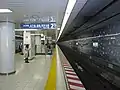 Chiyoda Line platforms, 2018
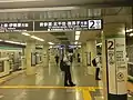 Chiyoda Line platforms, 2022
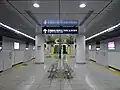 Fukutoshin Line platforms, 2009
History
The Chiyoda Line station opened on 20 October 1972; the Fukutoshin Line station opened on 14 June 2008.
The station facilities were inherited by Tokyo Metro after the privatization of the Teito Rapid Transit Authority (TRTA) in 2004.[2]
PASMO smart card coverage at this station began operation on 18 March 2007.[3]
Surrounding area
Points of interest include:
References
- 3月6日(土)有楽町線・副都心線のダイヤ改正 3 February 2010. Accessed 8 March 2010.
- "「営団地下鉄」から「東京メトロ」へ" [From "Teito Rapid Transit Authority" to "Tokyo Metro"]. Tokyo Metro Online (in Japanese). 2006-07-08. Archived from the original on 16 May 2012. Retrieved 29 May 2022.
- "PASMOは 3月18日(日)サービスを開始します" [PASMO - The service will start on Sunday, March 18th.] (pdf) (in Japanese). 21 December 2006. Archived (PDF) from the original on 1 May 2020. Retrieved 5 March 2022.
External links
- Meiji-jingumae Station (Tokyo Metro) (in Japanese)