Minamioguni, Kumamoto
Minamioguni (南小国町, Minamioguni-machi) is a town located in Aso District, Kumamoto Prefecture, Japan.
Minamioguni
南小国町 | |
|---|---|
Town | |
 Flag  Chapter | |
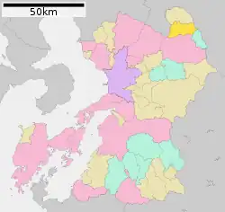
Location of Minamioguni in Kumamoto Prefecture | |
 | |
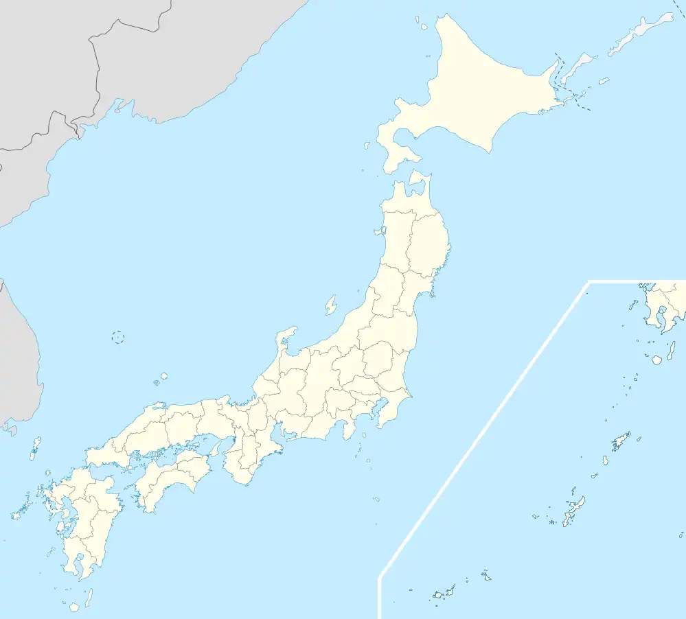 Minamioguni Location in Japan | |
| Coordinates: 33°05′N 131°05′E | |
| Country | Japan |
| Region | Kyushu |
| Prefecture | Kumamoto Prefecture |
| District | Aso |
| Area | |
| • Total | 115.86 km2 (44.73 sq mi) |
| Population (October 1, 2016) | |
| • Total | 3,977 |
| • Density | 34/km2 (89/sq mi) |
| Time zone | UTC+09:00 (JST) |
| Climate | Cfa |
| Website | www |
As of October 2016, the town has an estimated population of 3,977 and a density of 34 persons per km². The total area is 115.86 km².
Geography
Climate
Minamioguni has a humid subtropical climate (Köppen climate classification Cfa) with hot, humid summers and cool winters. There is significant precipitation throughout the year, especially during June and July. The average annual temperature in Minamioguni is 13.2 °C (55.8 °F). The average annual rainfall is 2,421.5 mm (95.33 in) with June as the wettest month. The temperatures are highest on average in August, at around 24.5 °C (76.1 °F), and lowest in January, at around 1.8 °C (35.2 °F).[1] The highest temperature ever recorded in Minamioguni was 36.5 °C (97.7 °F) on 19 August 2020; the coldest temperature ever recorded was −13.8 °C (7.2 °F) on 10 February 1984.[2]
| Climate data for Minamioguni (1991−2020 normals, extremes 1977−present) | |||||||||||||
|---|---|---|---|---|---|---|---|---|---|---|---|---|---|
| Month | Jan | Feb | Mar | Apr | May | Jun | Jul | Aug | Sep | Oct | Nov | Dec | Year |
| Record high °C (°F) | 18.8 (65.8) |
22.7 (72.9) |
24.6 (76.3) |
30.1 (86.2) |
32.5 (90.5) |
33.4 (92.1) |
36.1 (97.0) |
36.5 (97.7) |
33.7 (92.7) |
31.4 (88.5) |
25.5 (77.9) |
21.7 (71.1) |
36.5 (97.7) |
| Average high °C (°F) | 7.6 (45.7) |
9.6 (49.3) |
13.5 (56.3) |
19.2 (66.6) |
23.9 (75.0) |
25.8 (78.4) |
29.4 (84.9) |
30.5 (86.9) |
26.9 (80.4) |
21.8 (71.2) |
16.0 (60.8) |
10.0 (50.0) |
19.5 (67.1) |
| Daily mean °C (°F) | 1.8 (35.2) |
3.2 (37.8) |
6.8 (44.2) |
12.0 (53.6) |
16.9 (62.4) |
20.5 (68.9) |
24.2 (75.6) |
24.5 (76.1) |
20.9 (69.6) |
14.8 (58.6) |
9.0 (48.2) |
3.6 (38.5) |
13.2 (55.7) |
| Average low °C (°F) | −2.8 (27.0) |
−2.1 (28.2) |
0.9 (33.6) |
5.3 (41.5) |
10.7 (51.3) |
16.2 (61.2) |
20.3 (68.5) |
20.3 (68.5) |
16.3 (61.3) |
9.4 (48.9) |
3.5 (38.3) |
−1.3 (29.7) |
8.1 (46.5) |
| Record low °C (°F) | −12.9 (8.8) |
−13.8 (7.2) |
−8.9 (16.0) |
−5.1 (22.8) |
−0.6 (30.9) |
5.0 (41.0) |
10.1 (50.2) |
12.5 (54.5) |
2.9 (37.2) |
−2.4 (27.7) |
−5.4 (22.3) |
−9.7 (14.5) |
−13.8 (7.2) |
| Average precipitation mm (inches) | 73.8 (2.91) |
107.6 (4.24) |
161.8 (6.37) |
165.8 (6.53) |
197.5 (7.78) |
518.2 (20.40) |
490.5 (19.31) |
235.0 (9.25) |
206.0 (8.11) |
102.0 (4.02) |
92.8 (3.65) |
70.7 (2.78) |
2,421.5 (95.33) |
| Average precipitation days (≥ 1.0 mm) | 8.4 | 9.5 | 12.1 | 11.1 | 10.7 | 15.5 | 15.6 | 12.6 | 10.9 | 8.3 | 8.5 | 8.3 | 131.5 |
| Mean monthly sunshine hours | 111.8 | 120.9 | 148.8 | 168.0 | 175.3 | 107.8 | 135.9 | 156.7 | 131.7 | 159.7 | 135.8 | 118.2 | 1,672.6 |
| Source: Japan Meteorological Agency[2][1] | |||||||||||||
Demographics
Per Japanese census data, the population of Minamioguni in 2020 is 3,750 people.[3] Minamioguni has been conducting censuses since 1920.
| Year | Pop. | ±% |
|---|---|---|
| 1920 | 6,052 | — |
| 1925 | 6,359 | +5.1% |
| 1930 | 6,539 | +2.8% |
| 1935 | 6,389 | −2.3% |
| 1940 | 6,065 | −5.1% |
| 1945 | 7,177 | +18.3% |
| 1950 | 7,389 | +3.0% |
| 1955 | 7,761 | +5.0% |
| 1960 | 7,616 | −1.9% |
| 1965 | 6,913 | −9.2% |
| 1970 | 6,029 | −12.8% |
| 1975 | 5,462 | −9.4% |
| 1980 | 5,319 | −2.6% |
| 1985 | 5,221 | −1.8% |
| 1990 | 4,973 | −4.8% |
| 1995 | 4,818 | −3.1% |
| 2000 | 4,657 | −3.3% |
| 2005 | 4,687 | +0.6% |
| 2010 | 4,429 | −5.5% |
| 2015 | 4,048 | −8.6% |
| 2020 | 3,750 | −7.4% |
| Minamioguni population statistics[3] | ||
References
- 気象庁 / 平年値(年・月ごとの値). JMA. Retrieved April 15, 2022.
- 観測史上1~10位の値(年間を通じての値). JMA. Retrieved April 15, 2022.
- Minamioguni population statistics
External links
 Media related to Minamioguni, Kumamoto at Wikimedia Commons
 Geographic data related to Minamioguni, Kumamoto at OpenStreetMap
- Minamioguni official website (in Japanese)
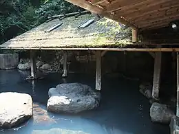
- kurokawa onsen