Mjóifjörður
Mjóifjörður (Icelandic pronunciation: [ˈmjouːɪˌfjœrðʏr̥], "narrow fjord") is a village of 7 people in East Iceland, sitting on a fjord of the same name. It is part of the municipality of Fjarðabyggð.
Mjóifjörður | |
|---|---|
Village | |
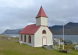 The church Mjóafjarðarkirkja in Mjóifjörður | |
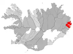 Location of the Municipality of Fjarðabyggð | |
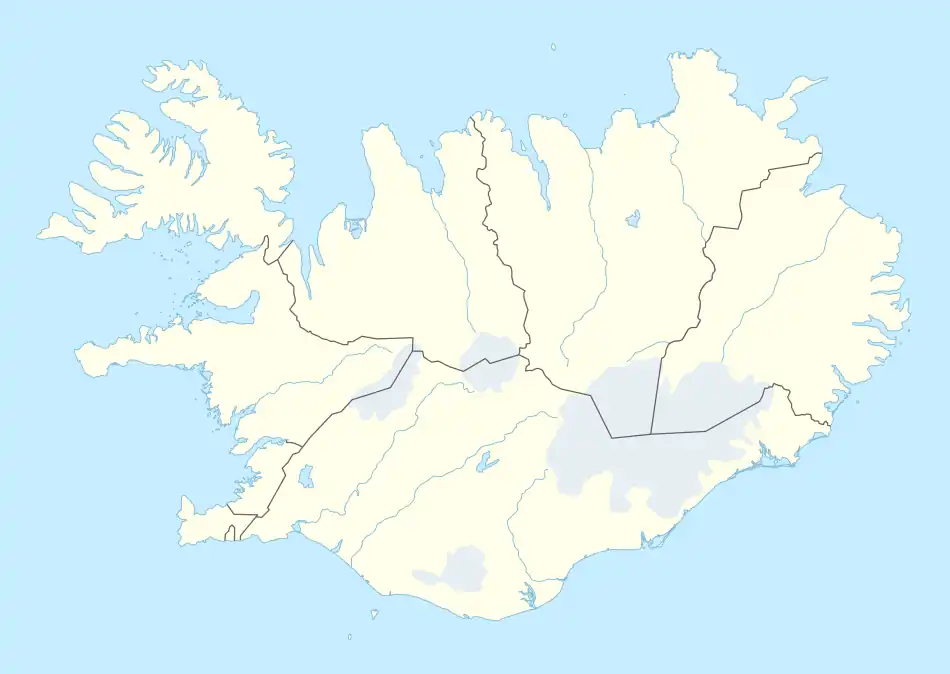 Mjóifjörður Location in Iceland | |
| Coordinates: 65°11′43″N 13°47′32″W | |
| Country | |
| Constituency | Northeast Constituency |
| Region | Eastern Region |
| Municipality | |
| Time zone | UTC+0 (GMT) |
| Website | Official website |
History
In the early 20th century, the village was a Norwegian whaling station. The village also hosted the Dalatangi light. It is often referred as the smallest village in the country, and one of the most diverse.
Geography and climate
The other villages composing the municipality are: Eskifjörður (1,068 inh.), Fáskrúðsfjörður (611 inh.), Neskaupstaður (1,400 inh.),[1] Reyðarfjörður (2,238 inh.) and Stöðvarfjörður (231 inh.).[2]
There is an automatic weather station called Dalatangi near Mjóifjörður. Mjóifjörður has a typical tundra climate (Köppen: ETf), as no month has an average temperature above 10 °C (50 °F), although the coldest months all have average temperatures above 1 °C (34 °F). It is very humid throughout the year, with the average precipitation greater than 100 millimetres (3.9 in) in every month except June, and October being the wettest month with an average precipitation of 205.3 millimetres (8.08 in).
| Climate data for Mjóifjörður, 1991–2020 normals | |||||||||||||
|---|---|---|---|---|---|---|---|---|---|---|---|---|---|
| Month | Jan | Feb | Mar | Apr | May | Jun | Jul | Aug | Sep | Oct | Nov | Dec | Year |
| Record high °C (°F) | 18.8 (65.8) |
18.1 (64.6) |
15.0 (59.0) |
19.1 (66.4) |
18.7 (65.7) |
21.4 (70.5) |
22.8 (73.0) |
23.6 (74.5) |
23.8 (74.8) |
22.1 (71.8) |
22.7 (72.9) |
15.8 (60.4) |
23.8 (74.8) |
| Average high °C (°F) | 4.1 (39.4) |
3.8 (38.8) |
3.7 (38.7) |
4.5 (40.1) |
6.7 (44.1) |
9.1 (48.4) |
11.0 (51.8) |
11.4 (52.5) |
10.3 (50.5) |
7.2 (45.0) |
5.3 (41.5) |
4.1 (39.4) |
6.8 (44.2) |
| Daily mean °C (°F) | 1.7 (35.1) |
1.3 (34.3) |
1.2 (34.2) |
2.1 (35.8) |
4.2 (39.6) |
6.7 (44.1) |
8.7 (47.7) |
9.2 (48.6) |
8.0 (46.4) |
5.1 (41.2) |
3.1 (37.6) |
1.8 (35.2) |
4.4 (39.9) |
| Average low °C (°F) | −0.7 (30.7) |
−1.0 (30.2) |
−0.9 (30.4) |
0.1 (32.2) |
2.3 (36.1) |
4.8 (40.6) |
6.9 (44.4) |
7.5 (45.5) |
6.2 (43.2) |
3.2 (37.8) |
1.0 (33.8) |
−0.5 (31.1) |
2.4 (36.3) |
| Record low °C (°F) | −15.5 (4.1) |
−12.0 (10.4) |
−16.3 (2.7) |
−9.3 (15.3) |
−4.9 (23.2) |
−1.4 (29.5) |
3.2 (37.8) |
3.0 (37.4) |
−1.4 (29.5) |
−7.0 (19.4) |
−8.7 (16.3) |
−12.1 (10.2) |
−16.3 (2.7) |
| Average precipitation mm (inches) | 152.1 (5.99) |
116.2 (4.57) |
115.5 (4.55) |
111.5 (4.39) |
104.9 (4.13) |
91.5 (3.60) |
123.3 (4.85) |
131.3 (5.17) |
167.5 (6.59) |
205.3 (8.08) |
179.3 (7.06) |
157.8 (6.21) |
1,656.2 (65.20) |
| Average precipitation days (≥ 1.0 mm) | 16.4 | 13.8 | 13.6 | 12.6 | 11.0 | 8.9 | 10.7 | 10.8 | 13.5 | 16.6 | 16.7 | 16.7 | 161.3 |
| Average snowy days (≥ 0 cm) | 13.5 | 14.1 | 15.8 | 10.2 | 2.5 | 0.1 | 0.0 | 0.0 | 0.0 | 2.1 | 8.3 | 13.9 | 80.5 |
| Average dew point °C (°F) | −2.8 (27.0) |
−3.3 (26.1) |
−3.3 (26.1) |
−1.7 (28.9) |
0.9 (33.6) |
4.0 (39.2) |
6.4 (43.5) |
6.6 (43.9) |
4.5 (40.1) |
1.4 (34.5) |
−1.2 (29.8) |
−2.7 (27.1) |
0.7 (33.3) |
| Source: NOAA[3] | |||||||||||||
Sights
Mjóafjarðarkirkja, a wooden church in the hamlet Brekka, was built in 1892 with about 100 seats and a ridge turret. The retable dates from 1871. The church was renovated in 1992. The church of Mjóifjörður was already mentioned in a document dating from 1092.[4]
Infrastructure
Mjóifjörður has a primary school, a camping site and a hotel with a café.[5]
References
- Located in the Norðfjörður
- (in Icelandic) Infos on Fjarðabyggð municipal website Archived 2011-03-25 at the Wayback Machine
- "Dalatangi Climate Normals 1991-2020". National Oceanic and Atmospheric Administration. Archived from the original on 17 August 2023. Retrieved 17 August 2023.
- "Mjóafjarðarkirkja - NAT ferðavísir". 12 July 2020.
- Name * First Last. "Heim - home". Mjoifjordur.weebly.com. Retrieved 21 May 2023.
External links
![]() Media related to Mjóifjörður at Wikimedia Commons
Media related to Mjóifjörður at Wikimedia Commons
- (in Icelandic) Mjóifjörður page on Fjarðabyggð municipal website