Mohanyal Rural Municipality
Mohanyal is a former village development committee that is now a rural municipality in Kailali District in Sudurpashchim Province of western Nepal. At the time of the 1991 Nepal census it had a population of 3917 living in 614 individual households.[1]
Mohanyal
मोहनयाल | |
|---|---|
 Mohanyal Location in Nepal  Mohanyal Mohanyal (Nepal) | |
| Coordinates: 28.88°N 80.89°E | |
| Country | |
| Province | Sudurpashchim Province |
| District | Kailali District |
| Government | |
| • Chairperson | Nawalsingh Rawal (NCP) |
| • Vice-chairperson | Puja Buda (CPN (US)) |
| Population (1991) | |
| • Total | 3,917 |
| Time zone | UTC+5:45 (Nepal Time) |
Demographics
At the time of the 2011 Nepal census, Mohanyal Rural Municipality had a population of 22,053. Of these, 74.5% spoke Nepali, 14.8% Magar, 4.8% Achhami, 1.9% Doteli, 1.6% Kham, 1.1% Dailekhi, 0.5% Raji, 0.3% Jumli, 0.2% Maithili, 0.1% Tharu and 0.1% other languages as their first language.[2]
In terms of ethnicity/caste, 28.8% were Magar, 24.9% Chhetri, 16.7% Kami, 12.9% Hill Brahmin, 4.6% Thakuri, 4.1% Damai/Dholi, 2.5% Sarki, 1.3% Sanyasi/Dasnami, 1.2% other Dalit, 0.6% Raji, 0.5% Tharu, 0.4% Badi, 0.4% Newar, 0.3% Lohar, 0.2% Gurung, 0.2% Majhi, 0.1% Dom, 0.1% Kumal, 0.1% Tamang, 0.1% Teli and 0.2% others.[3]
In terms of religion, 80.0% were Hindu, 17.3% Buddhist, 1.3% Christian, 0.9% Prakriti and 0.4% others.[4]
In terms of literacy, 58.8% could read and write, 3.0% could only read and 38.1% could neither read nor write.[5]
References
- "Nepal Census 2001", Nepal's Village Development Committees, Digital Himalaya, retrieved 15 November 2009.
- NepalMap Language
- NepalMap Caste
- NepalMap Religion
- NepalMap Literacy
External links
Headquarters: Dhangadhi | ||
| Sub-metropolitan cities | 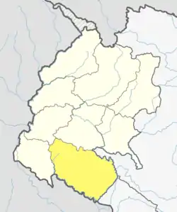 | |
| Municipalities | ||
| Rural municipalities | ||
| Former VDCs | ||
List of municipalities and rural municipalities of Nepal | ||