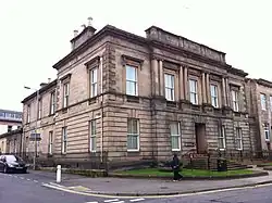
County of Moray
Moray; (Scottish Gaelic: Moireibh [ˈmɤɾʲəv]) or Morayshire,[1] called Elginshire until 1919,[2] is a historic county, registration county and lieutenancy area of Scotland, bordering Nairnshire to the west, Inverness-shire to the south, and Banffshire to the east.[3][4] It was a local government county, with Elgin the county town, until 1975. The county was officially called Elginshire, sharing the name of the Elginshire parliamentary constituency, so named since 1708.[5]
Moray | |
|---|---|
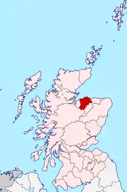 | |
| Coordinates: 57.3°N 3.3°W | |
| Country | Scotland |
| County town | Elgin |
| Area | |
| • Total | 476 sq mi (1,233 km2) |
| Ranked 17th of 34 | |
| Chapman code | MOR |
The registration county, for property, is, 'County of Moray', and the Lieutenancy area, for ceremonial purposes is 'Moray' or 'Morayshire'. The lieutenancy area contains a slightly smaller area than the historic county.
History
Before 1889 there were two large exclaves of Moray situated within Inverness-shire, and an exclave of Inverness-shire situated within Moray. The Local Government (Scotland) Act 1889 transferred these exclaves to the counties which surrounded them. The Local Government (Scotland) Act 1889 established a uniform system of county councils in Scotland and realigned the boundaries of many of Scotland's counties. Subsequently, Moray County Council was created in 1890. Moray County Council was originally based in the current Elgin Sheriff Court building and moved to "County Buildings" just to the west of the courthouse after the Second World War.[6] Historically, 'Murrayshire' and 'Morrowshire' have been alternate spellings. [7] [8][9][10]
In 1975, under the Local Government (Scotland) Act 1973, most of the county was combined with the Aberlour, Buckie, Cullen, Dufftown, Findochty, Keith and Portknockie areas of the county of Banffshire to form the Moray district of the Grampian region. The Grantown-on-Spey and Cromdale areas were combined with the Kingussie and Badenoch areas of the county of Inverness-shire to form the Badenoch and Strathspey district of the Highland region. In 1996 the Moray district was superseded by the council area of Moray 1996, under the provisions of the Local Government etc. (Scotland) Act 1994.
Coat of arms
Granted in 1927 by the Lord Lyon, Moray's coat-of-arms was: Quarterly: 1st and 4th Azure, three mullets argent; 2nd and 3rd Argent, three cushions gules within a tressure flory-counter-flory of the last. The motto was SUB SPE, Latin for "In Hope", a pun on the River Spey, which flows through the county. The coat of arms, described by Thomas Innes of Learney, a future Lord Lyon, in the Elgin Courant of 6 May 1927 as "the most beautiful county arms in Scotland", represented the clan Murray and Randolph, Earl of Moray, the two main landowners.[11]
Geography
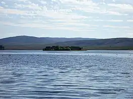
Moray consists of a flattish coastal section, containing the main towns, with a hilly interior, extending into the Grampian Mountains in the far south. Notable features of the coast are Findhorn Bay and the broad arc of Burghead Bay. The coast around Lossiemouth is somewhat rockier, and contains the Covesea Skerries and Halliman Skerries offshore. The chief lochs are Loch Dallas, Loch Noir, the Lochs of Little Benshalag, Loch of the Cowlatt, Lochanan a' Ghiubhais, Loch an Salich, Loch Trevie, Loch Tutach, Loch Allan, Loch Stuart, Loch Mhic Leòid, Loch Ille Mhòr, Lochan Dubh, Loch nan Stuirteag, Loch an t-Sithein and Lochindorb.
Settlements
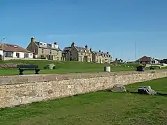 Burghead
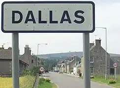 Dallas
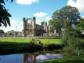 Elgin
Elgin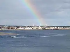 Findhorn
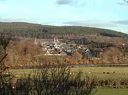 Fochabers
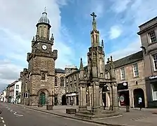 Forres
Civil parishes
_%2526_NAIRNSHIRE.jpg.webp)
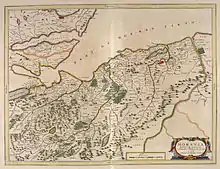

Civil parishes are still used for some statistical purposes, and separate census figures are published for them. As their areas have been largely unchanged since the 19th century this allows for comparison of population figures over an extended period of time.[12] From 1845 to 1930, parishes formed part of the local government system of Scotland, having parochial boards from 1845 to 1894.
In 1861 there were 15 civil parishes entirely in Moray:[13]
- Alves
- Birnie
- Dallas
- Drainie[14]
- Duffus
- Edinkillie (see List of listed buildings in Edinkillie, Moray)
- Elgin
- Forres
- Kinloss
- Knockando
- Lhanbryde
- Rafford
- Speymouth
- Spynie
- Urquhart
In 1861 Morayshire shared various civil parishes with three surrounding counties. Five with Banffshire:
three with Inverness-shire:
- Abernethy
- Cromdale
- Duthill
and one with Nairnshire:
References
- "Morayshire County". Scotland's Places. Historic Environment Scotland, the National Records of Scotland and the National Library of Scotland. Retrieved 25 June 2021.
- "1.3 History of Counties". Scottish Counties and Parishes: their history and boundaries on maps. National Library of Scotland. Retrieved 25 June 2021.
- Registers of Scotland. Publications, leaflets, Land Register Counties Archived 2 February 2010 at the Wayback Machine
- "Map of Parishes in the North-East Counties of Aberdeen, Banff, Kincardine, Moray and Nairn". Scotland's family. Archived from the original on 2 June 2021. Retrieved 2 June 2021.
- L.Shaw, 1882
- Historic Environment Scotland. "Elgin Sheriff Court including boundary wall and railings, High Street and Glover Street, Elgin (LB30778)". Retrieved 18 July 2021.
- Memorial Stone to Elizabeth Parker. Accessed 21st May, 2023: https://bristol-cathedral.co.uk/the-cathedral/search-the-collection/collection-item/indexd2d4.html?id=1240479&page=3
- The McWillie Diaries. The Diary of a Scottish Tenant Farmer (1826 to 1876). As compiled and researched by Robert McWillie, 1999. Access: https://kadhg.org.uk/d/wp-content/uploads/2014/07/George_McWillie_Diary_1826-1876.pdf
- Allowances to Wives and Family of Militiamen Elgin 1810 - 1812, Douglas G. J. Stewart. Access: http://www.morayandnairnfhs.co.uk/pdfs/allowances.pdf
- Gravestone of John Ross, in Woodstock Presbyterian Cemetery, Ontario, Canada. Access: https://freepages.rootsweb.com/~clifford/history/OxfordCounty/OxfordWoodstockPresCM/WoodstockPresCM_002.jpg
- Urquhart, R.M. Scottish Burgh and County Heraldry (1973 ed.). Heraldry Today. pp. 77–78. consulted 20 December 2013.
- "Elginshire: Old and New Statistical Accounts". Old Roads of Scotland. Archived from the original on 2 June 2021.
- Wilson, John Marius (1854–1857). The Imperial gazetteer of Scotland; or, Dictionary of Scottish topography. Edinburgh: A. Fullarton. p. 460 – via Archive.org.
- "Map of the Parish of Drainie in the Historical County of Moray". Gazetteer for Scotland.
- "Map of the Parish of Inveravon in the Historical County of Banff". Gazetteer for Scotland.
Further reading
- Lachlan Shaw and James Frederick Skinner Gordon (1882) The History of the Province of Moray: Comprising the Counties of Elgin and Nairn, the Greater Part of the County of Inverness and a Portion of the County of Banff, Published by Hamilton, Adams & co.,
- Hogan, C. Michael (2008). "The Modern Antiquarian". Longman Hill.
- R.M. Urquhart (1973) Scottish Burgh and County Heraldry, published by Heraldry Today.
