Whareama
Whareama is a rural area in the Wellington Region of New Zealand's North Island. The Whareama River flows through the area.[3]
Whareama | |
|---|---|
Locality | |
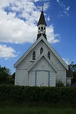 19th century Anglican Church at Whareama | |
| Coordinates: 40.858°S 176.034°E | |
| Country | New Zealand |
| Region | Wellington Region |
| Territorial authority | Masterton District |
| Ward |
|
| Electorates | |
| Government | |
| • Territorial Authority | Masterton District Council |
| • Regional council | Greater Wellington Regional Council |
| • Mayor of Masterton | Gary Caffell |
| • Wairarapa MP | Mike Butterick |
| • Ikaroa-Rāwhiti MP | Cushla Tangaere-Manuel |
| Area | |
| • Total | 1,596.03 km2 (616.23 sq mi) |
| Population (June 2022)[2] | |
| • Total | 1,640 |
| • Density | 1.0/km2 (2.7/sq mi) |
Marae
The community has two marae affiliated with the Ngāti Kahungunu hapū of Ngāi Tumapuhia-a-Rangi: Motuwairaka Marae, which lost its meeting house to fire in 2017, and Ngāi Tumapuhia a Rangi ki Okautete Marae, which is still constructing its meeting house by 2020.[4][5]
In October 2020, the Government committed $2,179,654 from the Provincial Growth Fund to upgrade both marae, alongside Pāpāwai, Kohunui, Hurunui o Rangi and Te Oreore marae. Together, the upgrades were expected to create 19.8 full time jobs.[6]
Demographics
Whareama statistical area covers 1,596.03 km2 (616.23 sq mi)[1] and also includes Bideford, Castlepoint, Riversdale Beach, Tauweru, Tīnui and Wainuioru. It had an estimated population of 1,640 as of June 2022,[2] with a population density of 1.03 people per km2.
| Year | Pop. | ±% p.a. |
|---|---|---|
| 2006 | 1,290 | — |
| 2013 | 1,281 | −0.10% |
| 2018 | 1,410 | +1.94% |
| Source: [7] | ||
Whareama had a population of 1,410 at the 2018 New Zealand census, an increase of 129 people (10.1%) since the 2013 census, and an increase of 120 people (9.3%) since the 2006 census. There were 555 households, comprising 729 males and 681 females, giving a sex ratio of 1.07 males per female. The median age was 43.6 years (compared with 37.4 years nationally), with 291 people (20.6%) aged under 15 years, 204 (14.5%) aged 15 to 29, 726 (51.5%) aged 30 to 64, and 189 (13.4%) aged 65 or older.
Ethnicities were 93.0% European/Pākehā, 17.4% Māori, 1.7% Pasifika, 0.6% Asian, and 1.1% other ethnicities. People may identify with more than one ethnicity.
The percentage of people born overseas was 10.0, compared with 27.1% nationally.
Although some people chose not to answer the census's question about religious affiliation, 56.0% had no religion, 35.5% were Christian, 1.1% had Māori religious beliefs, 0.2% were Buddhist and 0.9% had other religions.
Of those at least 15 years old, 192 (17.2%) people had a bachelor's or higher degree, and 204 (18.2%) people had no formal qualifications. The median income was $34,000, compared with $31,800 nationally. 153 people (13.7%) earned over $70,000 compared to 17.2% nationally. The employment status of those at least 15 was that 612 (54.7%) people were employed full-time, 231 (20.6%) were part-time, and 30 (2.7%) were unemployed.[7]
Education
Whareama School is a co-educational state primary school for Year 1 to 8 students,[8][9] with a roll of 45 as of April 2023.[10]
References
- "ArcGIS Web Application". statsnz.maps.arcgis.com. Retrieved 8 July 2021.
- "Population estimate tables - NZ.Stat". Statistics New Zealand. Retrieved 25 October 2022.
- "Place name detail: Whareama River". New Zealand Gazetteer. New Zealand Geographic Board. Retrieved 12 July 2009.
- "Te Kāhui Māngai directory". tkm.govt.nz. Te Puni Kōkiri.
- "Māori Maps". maorimaps.com. Te Potiki National Trust.
- "Marae Announcements" (Excel). growregions.govt.nz. Provincial Growth Fund. 9 October 2020.
- "Statistical area 1 dataset for 2018 Census". Statistics New Zealand. March 2020. Whareama (256500). 2018 Census place summary: Whareama
- "Whareama School Official School Website". whareama.school.nz.
- "Whareama School Ministry of Education School Profile". educationcounts.govt.nz. Ministry of Education.
- "Whareama School Education Review Office Report". ero.govt.nz. Education Review Office.