Mount Lyndhurst Important Bird Area
Mount Lyndhurst Important Bird Area comprises a 93 km2 part of Mount Lyndhurst Station, a pastoral lease lying on the north-west margin of the Flinders Ranges, about 30 km east of the town of Lyndhurst, South Australia. It is accessible via the Strzelecki Track.


Description
The extent of the Important Bird Area (IBA) is defined as all habitat suitable for chestnut-breasted whitefaces on Mount Lyndhurst Station. The habitat consists of low hills covered by gibber and shingle rock, forming a bare, stony surface dissected by numerous drainage lines. It also supports patches of low, open shrubland, mainly of low bluebush, bladder saltbush and other chenopods, with a sparse scattering of larger emu bushes and wattles. The climate is arid with hot summers and mild, dry winters. Mean maximum temperatures range from 35.5 °C in January to 17.3 °C in July. Mean minimum temperatures range from 20 °C in February to 4.1 °C in July. Mean annual rainfall is 165.6 mm.[1][2]
Criteria for nomination as an IBA
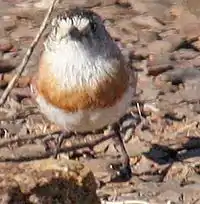
The site has been identified by BirdLife International as an IBA because it contains the largest known population of the chestnut-breasted whitefaces within the eastern part of its range. It also supports populations of inland dotterels, thick-billed grasswrens, banded whitefaces, black and pied honeyeaters, gibberbirds, chirruping wedgebills and cinnamon quail-thrushes.[3]
See also
References
- BirdLife International. (2011). Important Bird Areas factsheet: Mount Lyndhurst. Downloaded from http://www.birdlife.org on 22/08/2011.
- Bureau of Meteorology (2007) Climate statistics for Marree (Farina). Accessed via http://www.bom.gov.au/climate/averages/tables/cw_017024.shtml on 2023/10/24
- "IBA: Mount Lyndhurst". Birdata. Birds Australia. Retrieved 21 August 2011.