Mount Marapi
The Marapi (ماراڤي), or Mount Marapi (Minangkabau: ڬونوواڠ ماراڤي, romanized: Gunuang Marapi) is a complex volcano in West Sumatra, Indonesia. Its name means Mountain of Fire, and it is the most active volcano in Sumatra. Its elevation is 2,891.3 metres (9,485.9 ft). A number of cities and towns are situated around the mountain, including Bukittinggi, Padang Panjang and Batusangkar.
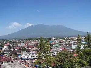
Mount Marapi and Bukittinggi.
| Marapi | |
|---|---|
.jpg.webp) Marapi in 2017 | |
| Highest point | |
| Elevation | 2,891 m (9,485 ft)[1] |
| Prominence | 2,116 m (6,942 ft) |
| Listing | Ultra Ribu |
| Coordinates | 00°22′51.59″S 100°28′22.79″E[1] |
| Geography | |
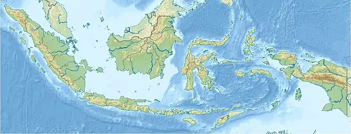 Marapi West Sumatra, Indonesia | |
| Parent range | Barisan Mountains |
| Geology | |
| Mountain type | Complex volcano |
| Last eruption | Ongoing |
According to legend, the mountain is the site first settled by the Minangkabau people after their ship landed on the mountain when it was the size of an egg and surrounded by water.[2] There are large numbers of upright burial stones in the region which are oriented in the direction of the mountain, indicating its cultural significance.[3]
See also
References
- "Marapi". Global Volcanism Program. Smithsonian Institution. Retrieved 2013-12-24.
- Summerfield, Anne; Summerfield, John (1999). Walk in Splendor: Ceremonial Dress and the Minangkabau. UCLA. ISBN 0-930741-73-0.
- Miksic, John (2004). "From megaliths to tombstones: the transition from pre-history to early Islamic period in highland West Sumatra". Indonesia and the Malay World. 32 (93): 191. doi:10.1080/1363981042000320134.
This article is issued from Wikipedia. The text is licensed under Creative Commons - Attribution - Sharealike. Additional terms may apply for the media files.