Mount Oliver, Pennsylvania
Mount Oliver is a borough in Allegheny County, Pennsylvania, United States. The population was 3,394 at the 2020 census.[4] It is a largely residential area situated atop a crest about 3 miles (5 km) west of the Monongahela River. The borough is surrounded entirely by the city of Pittsburgh, having resisted annexation attempts by the city.[5]
Mount Oliver, Pennsylvania | |
|---|---|
 Brownsville Road commercial district in Mount Oliver | |
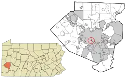 Location in Allegheny County and the U.S. state of Pennsylvania. | |
| Coordinates: 40°24′41″N 79°59′12″W | |
| Country | United States |
| State | Pennsylvania |
| County | Allegheny |
| Area | |
| • Total | 0.34 sq mi (0.88 km2) |
| • Land | 0.34 sq mi (0.88 km2) |
| • Water | 0.00 sq mi (0.00 km2) |
| Population | |
| • Total | 3,394 |
| • Density | 10,011.80/sq mi (3,860.12/km2) |
| Time zone | UTC-5 (Eastern (EST)) |
| • Summer (DST) | UTC-4 (EDT) |
| ZIP code | 15210[3] |
| Area code | 412 |
| FIPS code | 42-51744 |
| Website | www |
It is named for Oliver Ormsby, son of John Ormsby, who held the original land grant for the area from George III.
Geography
Mount Oliver is located at 40°24′41″N 79°59′12″W (40.411319, −79.986571).[6] According to the U.S. Census Bureau, the borough has a total area of 0.3 square miles (0.9 km2), all land.
Surrounding neighborhoods
Mount Oliver is completely surrounded by six Pittsburgh neighborhoods, including the South Side Slopes to the north, Arlington to the northeast, Mt. Oliver to the southeast, Carrick to the south, Knoxville to the west, and Allentown in the northwest corner.
| Year | Republican | Democratic | Third parties |
|---|---|---|---|
| 2020 | 29% 391 | 69% 924 | 1% 17 |
| 2016 | 26% 342 | 72% 946 | 2% 21 |
| 2012 | 22% 298 | 77% 1,044 | 1% 18 |
Demographics
| Census | Pop. | Note | %± |
|---|---|---|---|
| 1880 | 1,883 | — | |
| 1900 | 2,295 | — | |
| 1910 | 4,241 | 84.8% | |
| 1920 | 5,575 | 31.5% | |
| 1930 | 7,071 | 26.8% | |
| 1940 | 6,981 | −1.3% | |
| 1950 | 6,646 | −4.8% | |
| 1960 | 5,980 | −10.0% | |
| 1970 | 5,509 | −7.9% | |
| 1980 | 4,576 | −16.9% | |
| 1990 | 4,160 | −9.1% | |
| 2000 | 3,970 | −4.6% | |
| 2010 | 3,403 | −14.3% | |
| 2020 | 3,394 | −0.3% | |
| Sources:[10][11][12][13][14][15][2] | |||
As of the 2000 census,[14] there were 3,970 people, 1,681 households, and 983 families residing in the borough. The population density was 11,720.0 inhabitants per square mile (4,525.1/km2). There were 1,864 housing units at an average density of 5,502.8 per square mile (2,124.6/km2). The racial makeup of the borough was 83.75% White, 11.74% African American, 0.23% Native American, 1.64% Asian, 0.03% Pacific Islander, 0.68% from other races, and 1.94% from two or more races. Hispanic or Latino of any race were 1.08% of the population.
There were 1,681 households, out of which 28.2% had children under the age of 18 living with them, 33.8% were married couples living together, 18.3% had a female householder with no husband present, and 41.5% were non-families. 34.0% of all households were made up of individuals, and 12.4% had someone living alone who was 65 years of age or older. The average household size was 2.36 and the average family size was 3.04.
In the borough the population was spread out, with 24.0% under the age of 18, 10.0% from 18 to 24, 30.0% from 25 to 44, 21.9% from 45 to 64, and 14.1% who were 65 years of age or older. The median age was 36 years. For every 100 females, there were 91.3 males. For every 100 females age 18 and over, there were 85.8 males.
The median income for a household in the borough was $27,990, and the median income for a family was $32,388. Males had a median income of $30,394 versus $25,255 for females. The per capita income for the borough was $15,104. About 14.7% of families and 19.3% of the population were below the poverty line, including 34.5% of those under age 18 and 12.2% of those age 65 or over.
Taxation
Residents of Mount Oliver Borough pay a 2% tax on earned income to the Pittsburgh Public Schools district and 1% tax on earned income to the Borough of Mount Oliver. This means that Mount Oliver residents with earned income must file two different local tax forms for two different municipalities, and have two different due dates. The City of Pittsburgh gives residents until April 15 (or the first business day afterwards) to file, but the Borough of Mount Oliver imposes delinquent fees and penalties after January 31.
References
- "ArcGIS REST Services Directory". United States Census Bureau. Retrieved October 12, 2022.
- "Census Population API". United States Census Bureau. Retrieved October 12, 2022.
- "Mount Oliver PA ZIP Code". zipdatamaps.com. 2023. Retrieved May 13, 2023.
- "Explore Census Data".
- Flohr, Jeffrey (1999). "Why Is Mt. Oliver Not Part of the City of Pittsburgh". Western Pennsylvania History. 82 (3): 143. Archived from the original on June 12, 2015. Retrieved February 28, 2017.
- "US Gazetteer files: 2010, 2000, and 1990". United States Census Bureau. February 12, 2011. Retrieved April 23, 2011.
- EL. "2012 Allegheny County election". Pittsburgh Tribune-Review. Retrieved October 15, 2017.
- EL. "2016 Pennsylvania general election..." Pittsburgh Post-Gazette. Retrieved October 15, 2017.
- "Election Night Reporting".
- "Population-Pennsylvania" (PDF). U.S. Census 1910. U.S. Census Bureau. Retrieved November 22, 2013.
- "Number and Distribution of Inhabitants:Pennsylvania-Tennessee" (PDF). Fifteenth Census. U.S. Census Bureau.
- "Number of Inhabitants: Pennsylvania" (PDF). 18th Census of the United States. U.S. Census Bureau. Retrieved November 22, 2013.
- "Pennsylvania: Population and Housing Unit Counts" (PDF). U.S. Census Bureau. Retrieved November 22, 2013.
- "U.S. Census website". United States Census Bureau. Retrieved January 31, 2008.
- "Annual Estimates of the Resident Population". U.S. Census Bureau. Archived from the original on November 20, 2013. Retrieved November 22, 2013.
