Mount Roland Conservation Area
Mount Roland is a locality, a mountain, and a conservation area in the north west coast region of Tasmania, Australia.[3]
| Mount Roland | |
|---|---|
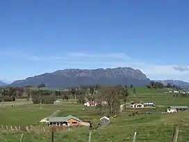
 Mount Roland from the lookout at Sheffield | |
| Highest point | |
| Elevation | 1,234 m (4,049 ft)AHD [1] |
| Prominence | 563 m (1,847 ft)[1] |
| Listing | List of highest mountains of Tasmania |
| Coordinates | 41°27′35″S 146°15′35″E[2] |
| Geography | |
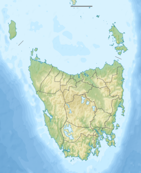
 Mount Roland Location in Tasmania | |
| Location | North West Tasmania, Australia |
| Geology | |
| Age of rock | Jurassic |
| Mountain type | Dolerite |
The mountain is near the town of Sheffield. The peak rises to 1,234 metres (4,049 ft) above sea level[1] and there are a number of well-marked bushwalks suitable for a day of pleasant exercise. There are long established walking tracks from both Claude Road and Gowrie Park to the summit.[4][5][6][7]
A Mount Roland cable car has been proposed for the mountain on several occasions.[8] The local community remains divided over the suitability or desirability of a cable car.[9]
The locality of Mount Roland is a rural locality in the local government areas of Meander Valley and Kentish in the Launceston and North and north-west regions of Tasmania. The locality is about 75 kilometres (47 mi) west of the town of Westbury. The 2016 census has a population of nil for the state suburb of Mount Roland.[10] Mount Roland is a confirmed locality.[11]
The Mersey River forms part of the southern boundary. The Mount Roland Conservation Area occupies a small area in the north of the locality.[12] Route C136 (Claude Road) runs through the north-east corner of the locality. Route C138 (Olivers Road) enters from the north-west and runs south until it exits.[11][13]
There was a death near the summit in 2015; a senior South Australian health official is alleged to have murdered his wife. The official later killed himself while he was in the Risdon jail.[14]
References
- "Mount Roland, Australia". Peakbagger.com. Retrieved 7 June 2015.
- "Mount Roland (TAS)". Gazetteer of Australia online. Geoscience Australia, Australian Government.
- University of Tasmania. Institute for Regional Development; Mount Roland Steering Committee (Tas.) (2011), Mount Roland developing a destination, University of Tasmania, archived from the original on 1 May 2012, retrieved 12 July 2012
- "ON MOUNT ROLAND". The Examiner (DAILY ed.). Launceston, Tasmania. 11 January 1910. p. 4. Retrieved 12 July 2012 – via National Library of Australia.
- Tasmania. Dept. of Parks, Wildlife and Heritage (1990), Mount Roland day walk map, Tasmap, retrieved 12 July 2012
- Mount Roland day walk map, Tasmap, 1986, retrieved 12 July 2012
- Mount Roland bushwalk, Hiking the World (published 2020), 7 March 2018, retrieved 17 December 2020
- "Cable car tourism push for Sheffield's Mt Roland". The Mercury. 27 April 2014. Archived from the original on 23 January 2015. Retrieved 23 January 2015.
- "Archived copy" (PDF). Archived (PDF) from the original on 23 January 2015. Retrieved 20 April 2015.
{{cite web}}: CS1 maint: archived copy as title (link) - "2016 Census Quick Stats Mount Roland (Tas.)". quickstats.censusdata.abs.gov.au. Australian Bureau of Statistics. 23 October 2017. Retrieved 13 September 2020.
- "Placenames Tasmania – Mount Roland". Placenames Tasmania. Select “Search”, enter "38115E", click “Search”, select row, map is displayed, click “Details”. Retrieved 13 September 2020.
- Google (13 September 2020). "Mount Roland, Tasmania" (Map). Google Maps. Google. Retrieved 13 September 2020.
- "Tasmanian Road Route Codes" (PDF). Department of Primary Industries, Parks, Water & Environment. May 2017. Archived from the original (PDF) on 1 August 2017. Retrieved 13 September 2020.
- "Alleged SA wife-killer takes own life". adelaidenow. 29 June 2015. Retrieved 12 June 2023.