Mulberry, Florida
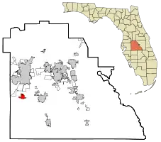
Mulberry is a city in Polk County, Florida, United States. The population was 3,817 at the 2010 census. Mulberry is home to Badcock Home Furniture. It is part of the Lakeland–Winter Haven Metropolitan Statistical Area, with parts of unincorporated Lakeland on its northern boundary. Mulberry is home to the 334-acre Alafia River Reserve.
Mulberry, Florida | |
|---|---|
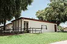
 Mulberry City Hall | |
 Flag | |
 Location in Polk County and the state of Florida | |
| Coordinates: 27°54′35″N 81°58′09″W | |
| Country | United States |
| State | Florida |
| County | Polk |
| Area | |
| • Total | 6.88 sq mi (17.83 km2) |
| • Land | 6.18 sq mi (16.01 km2) |
| • Water | 0.70 sq mi (1.81 km2) |
| Elevation | 112 ft (34 m) |
| Population (2020) | |
| • Total | 3,952 |
| • Density | 639.17/sq mi (246.79/km2) |
| Time zone | UTC-5 (Eastern (EST)) |
| • Summer (DST) | UTC-4 (EDT) |
| ZIP code | 33860 |
| Area code | 863 |
| FIPS code | 12-47200[3] |
| GNIS feature ID | 2404336[2] |
| Website | www |
History
The first white settlers appeared in the Mulberry area in the 1840s.[4] The first industry in Mulberry was logging the longleaf yellow pine which dominated the area.[4]
The town had no official name, but the railroad which came through town stopped at a mulberry tree to let off passengers and drop off the mail.[5] The old mulberry tree became the de facto meeting place in town, and eventually gave the town its name. Several lynchings and hangings took place from this mulberry tree.[4] In 1886, phosphate rock was discovered in the Peace River, and the dominant logging industry gave way to mining operations. The phosphate industry gave the town stability, leading to Mulberry's incorporation in 1901. In 1910, Mulberry's Masonic lodge was established and remains operational today.
Florida Pebble Strike
By 1919, many miners had joined the International Union of Mine, Mill, and Smelter Workers. In April of that year, the union called a strike asking for a minimum wage and an eight-hour work day, after which the mining companies brought in strikebreakers from Georgia. Electricity was cut off from both Mulberry and Fort Meade. On the evening of August 21, 1919, four mine guards for the Prairie Pebble Phosphate Company opened fire upon the town in an apparent attempt to break the strike, claiming that a man had shot at the power house in which they were sheltered. During the indiscriminate shooting, two adults were wounded and a two-year-old child was killed after being shot through the heart. Later that night, another black man was killed when the guards continued firing in Mulberry's black neighborhood. The sheriff's investigation found no evidence of a firearm in the accused man's possession nor at the location from which it was claimed he had fired. After quelling the rage of the townspeople, who wanted to attack the power house and mine guards, the sheriff arrested the four mine guards shortly after midnight.[6][7]
Lynchings
The Ku Klux Klan maintained a presence in Mulberry, with the last public march occurring in 1979. At least six black people were lynched in the early 1900s, as well as at least one white man.[8][9]
Geography and climate

Mulberry is located within the Central Florida Highlands area of the Atlantic coastal plain with a terrain consisting of flatland interspersed with gently rolling hills.[10]
According to the United States Census Bureau, the city has a total area of 3.2 square miles (8.3 km2), of which 3.1 square miles (8.0 km2) is land and 0.1 square mile (0.4 km2) (4.36%) is water.
Mulberry is located at the junction of state roads 60 and 37.
Mulberry is located in the humid subtropical zone of the (Köppen climate classification: Cfa).[11]
Demographics
| Census | Pop. | Note | %± |
|---|---|---|---|
| 1910 | 1,418 | — | |
| 1920 | 1,499 | 5.7% | |
| 1930 | 2,029 | 35.4% | |
| 1940 | 1,502 | −26.0% | |
| 1950 | 2,024 | 34.8% | |
| 1960 | 2,922 | 44.4% | |
| 1970 | 2,701 | −7.6% | |
| 1980 | 2,932 | 8.6% | |
| 1990 | 2,988 | 1.9% | |
| 2000 | 3,230 | 8.1% | |
| 2010 | 3,817 | 18.2% | |
| 2020 | 3,952 | 3.5% | |
| U.S. Decennial Census[12] | |||
As of the census[3] of 2000, there were 3,230 people, 1,328 households, and 925 families residing in the city. The population density was 1,053.3 inhabitants per square mile (406.7/km2). There were 1,611 housing units at an average density of 525.3 per square mile (202.8/km2). The racial makeup of the city was 76.5% White, 20.0% African American, 0.2% Native American, 0.3% Asian, 1.7% other races, and 1.3% from two or more races. Hispanic or Latino of any race were 4.4% of the population.
There were 1,328 households, out of which 25.0% had children under the age of 18 living with them, 50.0% were married couples living together, 15.6% had a female householder with no husband present, and 30.3% were non-families. 25.5% of all households were made up of individuals, and 14.4% had someone living alone who was 65 years of age or older. The average household size was 2.43 and the average family size was 2.87.
In the city, the population was spread out, with 23.3% under the age of 18, 7.6% from 18 to 24, 22.3% from 25 to 44, 21.1% from 45 to 64, and 25.7% who were 65 years of age or older. The median age was 42 years. For every 100 females, there were 92.1 males. For every 100 females age 18 and over, there were 88.9 males.
The median income for a household in the city was $28,247, and the median income for a family was $28,860. Males had a median income of $29,417 versus $20,965 for females. The per capita income for the city was $14,828. About 14.7% of families and 16.6% of the population were below the poverty line, including 32.2% of those under age 18 and 9.4% of those age 65 or over.
Economy
The economy of Mulberry is dominated by phosphate mining. The Bone Valley is the world's most productive phosphate rock mining area. According to the Chamber of Commerce, Mulberry is the "Official Phosphate Capitol of the World."[13] The Mosaic Company operates the Nichols mine approximately two miles east of town. Mulberry is the home of Badcock Home Furniture, whose first store was opened in Mulberry in 1904 and which now extends to 382 stores throughout the southeast United States.[13]
Arts and humanities

The Mulberry Cultural Center opened in the fall of 2015 and featured over 25 different art and humanities exhibits.[14] It also hosts a variety of culturally enriching programs for all ages.
In 2018, the Mulberry Murals Initiative was founded to bring art to people of all backgrounds. These public art displays throughout the city have been commissioned by the City of Mulberry.[15]
Transportation
- State Road 37, which leads north toward Lakeland and south toward Bradley Junction Two rail lines intersect in the middle of the highway about a half mile south of the intersection of SR 37 and SR 60
- State Road 60, leading west toward Brandon and east toward Bartow and Lake Wales.
- Mulberry was served by two railroads. The line running east and west belonged to the Seaboard Airline Railroad while the north-south railroad belonged to the Atlantic Coast Line Railroad. There is a combined yard that belonged to both railroads to the west and north of Mulberry proper and this is where the railroad interchanged traffic rather than at interchanges at the crossing of the two lines south of the downtown area.[16] The crossing of the two railroads is very unusual as it takes place in the middle of a 4-lane divided highway crossing of traffic on State Road 37 at SW 2nd Street. Both of these railroad lines merged into the Seaboard Coastline in 1967 and in turn were folded into the CSX Railroad in 1986. Considerable traffic was and still is generated by the Bone Valley phosphate industry
Education
Public schools in Mulberry are operated by the Polk County School Board. The three elementary schools in the area are Kingsford, Purcell, and Sikes. Mulberry Middle and Mulberry High round out the educational system in Mulberry.[17] Mulberry Christian Academy is a private elementary school where financial aid is available to families who qualify.
Library
The Mulberry Public Library is a member of the Polk County Library Cooperative.[18] The library is located at 905 NE 5th Street, Mulberry, FL 33860.[19] Offers a variety of resource including video games, books, DVDs, audio-books, CDs, and digital materials. The library also hosts a number of programs for the community.[20]
Media
Mulberry is part of the Tampa–St. Pete television market, the 13th largest in the country and part of the local Lakeland-Winter Haven radio market, which is the 94th largest in the country.[21][22]
Sinkholes
On June 15, 1994, a sinkhole appeared in a toxic waste disposal pond near the city of Mulberry. Phosphogypsum, the byproduct of the phosphate fertilizer industry, is highly toxic and mildly radioactive. The 110 feet wide and 200 feet deep sinkhole dumped this toxin into caves that lead to the Floridan Aquifer. Drinking water for over ten million Florida residents comes from this aquifer.[23] The company mining the phosphate, IMC-Agrico, now a part of The Mosaic Company, started the sinkhole remediation process immediately. It has spent over $6 million trying to repair the damage to the Florida water supply. [24][25]
On August 27, 2016, the Mosaic Company discovered a giant sinkhole under a gypsum stack. Over 200 million gallons of water contaminated with phosphogypsum disappeared into its 45-foot wide maw.[26]
See also
References
- "2020 U.S. Gazetteer Files". United States Census Bureau. Retrieved October 31, 2021.
- U.S. Geological Survey Geographic Names Information System: Mulberry, Florida
- "U.S. Census website". United States Census Bureau. Retrieved January 31, 2008.
- "History of Mulberry". Mulberry Chamber of commerce. Retrieved November 20, 2013.
- Whitehead, Bill (August 14, 1960). "First Polk Settlers Had to Build Towns, Then Name Them". Lakeland Ledger. p. 7-A. Retrieved April 22, 2015.
- "The Kissimmee Valley gazette".
- Voogd, Jan (2008). Race Riots and Resistance: The Red Summer of 1919. ISBN 9781433100673.
- Moore, Kimberly C (May 5, 2018). "Lynchings, Klan activity part of Polk's history". Lakeland Ledger. Retrieved September 21, 2020.
- "An example why Florida is looking pretty stupid".
- "Florida's Geological History". University of Florida. Retrieved October 14, 2010.
- "World Map of the Köppen-Geiger climate classification updated". University of Veterinary Medicine Vienna. November 6, 2008. Retrieved September 10, 2010.
- "Census of Population and Housing". Census.gov. Retrieved June 4, 2015.
- "Get to Know Mulberry". Mulberry Chamber of Commerce. Retrieved September 18, 2010.
- Mulberry Cultural Center
- "Mulberry reviving itself through 'power of art'".
- SPV's Comprehensive Railroad Atlas of North America, 1999 p 17, Map FL-12
- "Mulberry Schools". Mulberry Chamber of Commerce. Retrieved September 18, 2010.
- "Online Pre-registration for a Temporary Library Card".
- "Hours & Contact Info | Mulberry Library". mulberrylibrary.com. Archived from the original on November 5, 2014.
- "About | Mulberry Library". mulberrylibrary.com. Archived from the original on October 23, 2014.
- "Top Nielsen Markets". TV By the Numbers. Retrieved October 19, 2010.
- "Arbitron Markets". Arbitron. Retrieved October 19, 2010.
- "Regional Assessment of Groundwater Quality in the Floridan, Biscayne, and Surficial Aquifer Systems". Retrieved May 12, 2016.
- "Polk County Sinkhole near Mulberry".
- "Mulberry, Florida, Sinkhole," National Geographic, June 2010. Retrieved 29 Sept. 2016.
- Lush, Tamara and Jason Dearen, "Neighbors anxious after Florida sinkhole contaminates water," Associated Press in the Orlando Sentinel, 29 Sept. 2016. Retrieved 29 Sept. 2016.
