Nacmine, Alberta
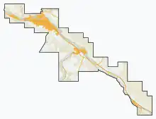
Nacmine is a community within the Town of Drumheller, Alberta, Canada. It was previously a hamlet within the former Municipal District (MD) of Badlands No. 7[2] prior to the MD's amalgamation with the former City of Drumheller on January 1, 1998.[3]
Nacmine | |
|---|---|
 Nacmine  Nacmine | |
| Coordinates: 51.469°N 112.788°W | |
| Country | Canada |
| Province | Alberta |
| Municipality | Town of Drumheller |
| Government | |
| • Mayor | Heather Colberg |
| • Governing body | Drumheller Town Council
|
| Time zone | UTC−7 (MST) |
| • Summer (DST) | UTC−6 (MDT) |
| Area code(s) | 403, 587, 825 |
Nacmine is located within the Red Deer River valley on South Dinosaur Trail (Highway 575), approximately 5 km (3 mi) west of Drumheller's main townsite and 112 km (70 mi) northeast of Calgary. The community is within Census Division No. 5 and in the federal riding of Crowfoot.
See also
References
- "Municipal Officials Search". Alberta Municipal Affairs. May 9, 2019. Retrieved October 1, 2021.
- "Town of Drumheller Municipal Development Plan: Volume 1 Background Study" (PDF). Town of Drumheller and Palliser Regional Municipal Services. April 21, 2008. p. 5. Archived from the original on April 20, 2014. Retrieved October 10, 2013.
- "Location and History Profile: Town of Drumheller". Alberta Municipal Affairs. October 4, 2013. Retrieved October 10, 2013.
- Ninth Census of Canada, 1951 (PDF). Vol. SP-7 (Population: Unincorporated villages and hamlets). Dominion Bureau of Statistics. March 31, 1954. pp. 55–57. Retrieved October 24, 2021.
- Census of Canada, 1956 (PDF). Vol. Population of unincorporated villages and settlements. Dominion Bureau of Statistics. October 25, 1957. pp. 56–59. Retrieved October 24, 2021.
- "Population of unincorporated places of 50 persons and over, Alberta, 1961 and 1956". 1961 Census of Canada: Population (PDF). Series SP: Unincorporated Villages. Vol. Bulletin SP—4. Ottawa: Dominion Bureau of Statistics. April 18, 1963. pp. 63–67. Retrieved October 24, 2021.
- "Population of unincorporated places of 50 persons and over, 1966 and 1961 (Alberta)". Census of Canada 1966: Population (PDF). Special Bulletin: Unincorporated Places. Vol. Bulletin S–3. Ottawa: Dominion Bureau of Statistics. August 1968. pp. 184–187. Retrieved October 24, 2021.
- "Population of Unincorporated Places of 50 persons and over, 1971 and 1966 (Alberta)". 1971 Census of Canada: Population. Special Bulletin: Unincorporated Settlements. Vol. Bulletin SP—1. Ottawa: Statistics Canada. March 1973. pp. 204–207.
- "Geographical Identification and Population for Unincorporated Places of 25 persons and over, 1971 and 1976". 1976 Census of Canada (PDF). Supplementary Bulletins: Geographic and Demographic (Population of Unincorporated Places—Canada). Vol. Bulletin 8SG.1. Ottawa: Statistics Canada. May 1978. Retrieved October 24, 2021.
- 1981 Census of Canada (PDF). Place name reference list. Vol. Western provinces and the Territories. Ottawa: Statistics Canada. May 1983. Retrieved November 14, 2021.
- 1986 Census of Canada (PDF). Population. Vol. Unincorporated Places. Ottawa: Statistics Canada. July 1988. Retrieved November 14, 2021.
- 91 Census (PDF). Population and Dwelling Counts. Vol. Unincorporated Places. Ottawa: Statistics Canada. June 1993. Retrieved November 14, 2021.
- 96 Census (PDF). Population and Dwelling Counts. Vol. A National Overview. Ottawa: Statistics Canada. April 1997. Retrieved November 14, 2021.
- "Population and Dwelling Counts, for Canada, Provinces and Territories, and Census Divisions, 2001 and 1996 Censuses - 100% Data (Alberta)". Statistics Canada. August 15, 2012. Retrieved November 14, 2021.
This article is issued from Wikipedia. The text is licensed under Creative Commons - Attribution - Sharealike. Additional terms may apply for the media files.