Nanyumbu District, Mtwara
Nanyumbu is one of the six districts in the west of the Mtwara Region in southern Tanzania.
Nanyambu District | |
|---|---|
district | |
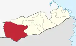 Location in Mtwara District | |
| Coordinates: 10°55′58.97″S 38°22′53.82″E | |
| Country | |
| Region | Mtwara |
| Area | |
| • Total | 5,071 km2 (1,958 sq mi) |
| Population (2012) | |
| • Total | 150,857 |
| ISO 3166 code | TZ-17 |
The 2016 population of Nanyamba was projected at 158,425, from 150,857 in the 2012 census.[1][2]
Subdivisions
The district is divided into 14 wards:[3]
| Name | Population
2002 |
Population
2012 |
|---|---|---|
| Chipupiuta | 9,434 | 9,926 |
| Likokona | 16,079 | 18,629 |
| Lumesule | 7,163 | 7,656 |
| Mangaka | - | 16,494 |
| Maratani | - | 6,668 |
| Masuguru | 3,809 | 5,945 |
| Mikangaula | 14,914 | 16,848 |
| Mkonona | 5,929 | 8,137 |
| Mnanje | - | 7,912 |
| Nandete | 11,953 | 10,067 |
| Nangomba | - | 8,178 |
| Nanyumbu | 8,840 | 10,826 |
| Napacho | 8,270 | 10,092 |
| Sengenya | 11,261 | 13,479 |
References
- 2012 Population and Housing Census - Population Distribution by Administrative Areas (PDF) (Report). Dar es Salaam, Tanzania: National Bureau of Statistics. 2013-03-01. Archived (PDF) from the original on 2022-03-26. Retrieved 2022-07-03.
- 2016 Makadirio ya Idadi ya Watu katika Majimbo ya Uchaguzi kwa Mwaka 2016, Tanzania Bara [Population Estimates in Administrative Areas for the Year 2016, Mainland Tanzania] (PDF) (Report) (in Swahili). Dar es Salaam, Tanzania: National Bureau of Statistics. 2016-04-01. Archived (PDF) from the original on 2021-12-27. Retrieved 2022-07-03.
- "Nanyumbu (District, Tanzania) - Population Statistics, Charts, Map and Location". Retrieved 2019-11-16.
This article is issued from Wikipedia. The text is licensed under Creative Commons - Attribution - Sharealike. Additional terms may apply for the media files.