Narromine Parish, New South Wales
Narromine Parish is a civil parish of Oxley County, New South Wales. It is located in Warren Shire at 31°51′54″S 147°50′04″E. The Parish is some kilometers from the town of Narromine which is in the adjoining Narromine County.

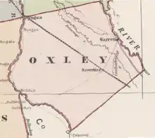
Oxley County John Sands 1886 Map.
| Narromine Parish New South Wales | |
|---|---|
_map2.png.webp) Map of Narromine Parish in the County of Oxley, New South Wales | |
 Narromine Parish | |
| Coordinates | 31°51′S 147°43′E |
| LGA(s) | Warren Shire |
| Region | Central West, New South Wales |
| County | Oxley |
| State electorate(s) | Barwon |
| Federal division(s) | Parkes |
The Parish is located between the Macquarie River and the Main Western railway line, New South Wales just outside the town of Nevertire, New South Wales.
The topography is flat with a Köppen climate classification of BsK (Hot semi arid)[1] and the economy is based on broad acre agriculture.
The traditional owners of the area are the Wiradjuri[2][3] people.
References
- Peel, M. C.; Finlayson, B. L.; McMahon, T. A. (2007). "Updated world map of the Köppen–Geiger climate classification". Hydrol. Earth Syst. Sci. 11: 1633–1644. doi:10.5194/hess-11-1633-2007. ISSN 1027-5606. (direct: Final Revised Paper)
- Norman Tindale's Catalogue of Australian Aboriginal Tribes
- Aboriginal Australia Map, David Horton (ed.), 1994 published in The Encyclopedia of Aboriginal Australia by AIATSIS.
This article is issued from Wikipedia. The text is licensed under Creative Commons - Attribution - Sharealike. Additional terms may apply for the media files.