Natara
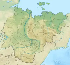
The Natara (Russian: Натара) is a river in Sakha Republic (Yakutia), Russia. It is a tributary of the Lena, having a length of 187 kilometres (116 mi) and a drainage basin area of 5,730 square kilometres (2,210 sq mi).[1] There are no settlements in its basin.
| Natara | |
|---|---|
 Mouth location in Yakutia, Russia | |
| Location | |
| Country | Russia |
| Physical characteristics | |
| Source | |
| • location | Dzhardzhan Range |
| • coordinates | 68°18′54″N 126°54′14″E |
| Mouth | Lena |
• coordinates | 68°23′51″N 123°55′11″E |
• elevation | 17 m (56 ft) |
| Length | 187 km (116 mi) |
| Basin size | 5,730 km2 (2,210 sq mi) |
| Basin features | |
| Progression | Lena→ Laptev Sea |
Course
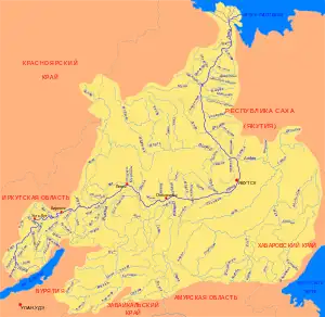
The Natara is a right tributary of the Lena. Its source is located in the northern sector of the Verkhoyansk Range, on the western slope of the Dzhardzhan Range.[2] It flows in a roughly westward direction. After leaving the mountains it descends into the Central Yakutian Lowland until it joins the right bank of the Lena 551 km (342 mi) from its mouth.[3]
Its longest tributary is the 105 km (65 mi) long Seen-Yurekh that joins its left bank just 3 km (1.9 mi) upstream from its confluence with the Lena.[1]
 Basin of the Lena |
See also
References
- "Река Натара in the State Water Register of Russia". textual.ru (in Russian).
- Orulgan (mountains) / Great Soviet Encyclopedia; in 35 vols. / Ch. ed. Yu. S. Osipov. 2004—2017.
- Google Earth