National Military Park
National Military Park, National Battlefield, National Battlefield Park, and National Battlefield Site are four designations for 25 battle sites preserved by the United States federal government because of their national importance. The designation applies to "sites where historic battles were fought on American soil during the armed conflicts that shaped the growth and development of the United States...."[1]


There are eleven National Battlefields (NB), nine National Military Parks (NMP), four National Battlefield Parks (NBP), and one National Battlefield Site (NBS). The National Park Service does not distinguish among the four designations in terms of their preservation or management policies.
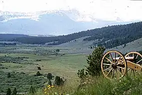
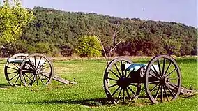
Seventeen sites are from the American Civil War, four from the American Revolutionary War, one from the War of 1812, one from the French and Indian War, and two were attacks on Native Americans. Big Hole is the only site in the Western United States.
In 1890, Chickamauga and Chattanooga National Military Park was the first such site created by Congress. Originally these sites were maintained by the War Department, but were transferred to the National Park Service on August 10, 1933. The different designations appear to represent Congressional attitudes at the time of authorization of each individual site, although "park" appears to be reserved for the larger sites. Only Brices Cross Roads National Battlefield Site, which is small, still bears that designation; others have since been redesignated. Some battlefields are designated as National Monuments, such as Little Bighorn Battlefield National Monument, Mill Springs Battlefield National Monument, and ten forts, several of which saw battle; National Historical Parks, such as Harpers Ferry National Historical Park and Cedar Creek and Belle Grove National Historical Park; or National Historic Sites, such as Sand Creek Massacre National Historic Site.
As with all historic areas in the National Park System, these battle sites are automatically listed on the National Register of Historic Places.
List of areas


.jpg.webp)


.jpg.webp)


Other battlefields in the National Park System
- Mill Springs Battlefield National Monument
- Little Bighorn Battlefield National Monument
- Aleutian Islands World War II National Monument
- Fallen Timbers Battlefield and Fort Miamis National Historic Site (affiliated area)
- Washita Battlefield National Historic Site
- Appomattox Court House National Historical Park
- Cedar Creek and Belle Grove National Historical Park
- Colonial National Historical Park
- Palo Alto Battlefield National Historical Park
- Arkansas Post
- Pecos National Historical Park
- Several forts also saw battle.
Notes
- American Battlefield Protection Act of 1996
- "Park Anniversaries". Retrieved August 13, 2021.
- "National Park Service Acreage Reports". Retrieved August 13, 2021.
External links
- Designation of National Park System Units
- The Origin & Evolution of the National Military Park Idea by Ronald F. Lee (1973)