National Register of Historic Places listings in North Philadelphia
The following properties are listed on the National Register of Historic Places in North Philadelphia.
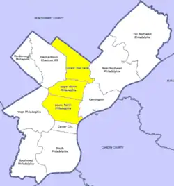
This is intended to be a complete list of the properties and districts on the National Register of Historic Places in North Philadelphia, Pennsylvania, United States. The locations of National Register properties and districts for which the latitude and longitude coordinates are included below, may be seen in an online map.[1]
There are 601 properties and districts listed on the National Register of Historic Places in Philadelphia, including 67 National Historic Landmarks. North Philadelphia includes 168 of these properties and districts, of which 17 are National Historic Landmarks; the city's remaining properties and districts are listed elsewhere. Two sites are split between North Philadelphia and other parts of the city, and are thus included on multiple lists. Two other properties in North Philadelphia were once listed but have been removed.
Current listings
| [2] | Name on the Register | Image | Date listed[3] | Location | Neighborhood[4] | Description |
|---|---|---|---|---|---|---|
| 1 | Adams Avenue Bridge in Philadelphia | 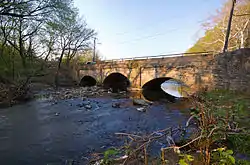 Adams Avenue Bridge in Philadelphia |
June 22, 1988 (#88000851) |
Adams Avenue over Tacony Creek 40°02′31″N 75°06′48″W |
Olney | Extends into Northeast Philadelphia |
| 2 | William Adamson School | 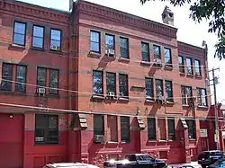 William Adamson School |
November 18, 1988 (#88002224) |
2637-2647 North 4th Street 39°59′28″N 75°08′17″W |
West Kensington | Built 1879-80, designed by Addison Hutton[5] |
| 3 | Ajax Metal Company Plant | 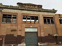 Ajax Metal Company Plant |
July 30, 2014 (#14000470) |
46 Richmond St. 39°57′59″N 75°08′10″W |
||
| 4 | S.L. Allen & Company Building |  S.L. Allen & Company Building |
April 27, 2023 (#100008867) |
459 West Glenwood Ave. 40°00′13″N 75°08′11″W |
||
| 5 | American Railway Express Company Garage |  American Railway Express Company Garage |
August 2, 2006 (#06000664) |
3002-3028 Cecil B. Moore Avenue 39°59′02″N 75°11′03″W |
Strawberry Mansion | |
| 6 | Alexander Dallas Bache School |  Alexander Dallas Bache School |
December 4, 1986 (#86003262) |
801 North 22nd Street 39°58′12″N 75°10′26″W |
Fairmount | |
| 7 | Matthew Baird Mansion |  Matthew Baird Mansion |
December 29, 1983 (#83004241) |
814 North Broad Street 39°58′07″N 75°09′37″W |
Francisville | (1863-64). |
| 8 | Clara Barton School |  Clara Barton School |
November 18, 1988 (#88002242) |
300 East Wyoming Avenue 40°01′13″N 75°07′10″W |
North Hunting Park | |
| 9 | Bergdoll Mansion | .jpg.webp) Bergdoll Mansion |
November 7, 1976 (#76001660) |
2201-2205 Green Street 39°57′56″N 75°10′28″W |
Spring Garden | James H. Windrim, architect (1885-89). |
| 10 | Louis Bergdoll House |  Louis Bergdoll House |
January 3, 1985 (#85000038) |
929 North 29th Street 39°58′26″N 75°11′02″W |
Brewerytown | Otto Charles Wolf, architect (1885). |
| 11 | Biberman Building |  Biberman Building |
September 14, 2007 (#07000951) |
611-619 North 15th Street 39°57′53″N 75°09′46″W |
Spring Garden | |
| 12 | Gen. David B. Birney School |  Gen. David B. Birney School |
November 18, 1988 (#88002246) |
900 West Lindley Street 40°01′45″N 75°08′20″W |
Logan | |
| 13 | Boat House Row | 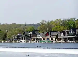 Boat House Row |
February 27, 1987 (#87000821) |
1-15 East River Drive 39°58′14″N 75°11′14″W |
Fairmount Park | |
| 14 | Daniel Boone School | 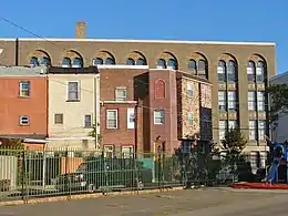 Daniel Boone School |
December 4, 1986 (#86003265) |
Hancock and Wildey Streets 39°58′03″N 75°08′14″W |
Northern Liberties | |
| 15 | Brewerytown Historic District | 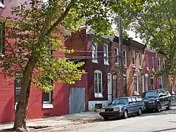 Brewerytown Historic District |
March 1, 1991 (#91000096) |
Roughly bounded by 30th St., Girard Ave., 32nd St. and Glenwood Ave. 39°58′34″N 75°11′12″W |
Brewerytown | |
| 16 | Edward G. Budd Manufacturing Company | 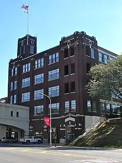 Edward G. Budd Manufacturing Company |
December 27, 2007 (#07001328) |
2450 West Hunting Park Ave. 40°00′32″N 75°10′08″W |
Hunting Park Industrial Area | |
| 17 | Buick Motor Company Building |  Buick Motor Company Building |
April 26, 2018 (#100002372) |
2917-2937 N. 16 St. 39°59′54″N 75°09′25″W |
||
| 18 | Burk Brothers and Company |  Burk Brothers and Company |
November 14, 1985 (#85003493) |
913-916 North Third St. 39°57′54″N 75°08′31″W |
Northern Liberties | |
| 19 | Callowhill Industrial Historic District | 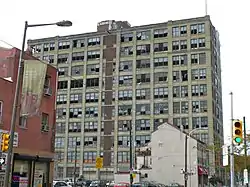 Callowhill Industrial Historic District |
June 28, 2010 (#10000403) |
Roughly bounded by Pearl St., North Broad St., Hamilton St., and the Reading Railroad Viaduct 39°57′35″N 75°09′43″W |
Callowhill | |
| 20 | Central High School |  Central High School |
December 4, 1986 (#86003267) |
Olney and Ogontz Avenues 40°02′14″N 75°08′58″W |
Ogontz | Irwin T. Catharine, architect (1937-39). |
| 21 | George Chandler School |  George Chandler School |
November 18, 1988 (#88002255) |
1050 East Montgomery St. 39°58′12″N 75°07′37″W |
Fishtown | |
| 22 | Church of St. James the Less | 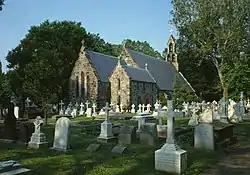 Church of St. James the Less |
November 20, 1974 (#74001801) |
Hunting Park Ave. and Clearfield St. 40°00′13″N 75°10′57″W |
Allegheny West | George Gordon Place & John E. Carver, architects (1846). |
| 23 | City Park Brewery | 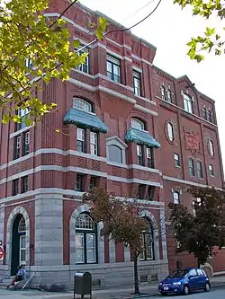 City Park Brewery |
July 18, 1980 (#80003609) |
Roughly bounded by Pennsylvania Ave., 28th, 30th, and Poplar Sts. 39°58′19″N 75°11′03″W |
Fairmount | |
| 24 | Class and Nachod Brewery | 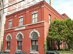 Class and Nachod Brewery |
July 31, 2003 (#03000724) |
1801-1823 North 10th St. 39°58′47″N 75°09′01″W |
Cecil B. Moore | |
| 25 | The Cliffs | 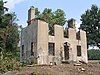 The Cliffs |
March 16, 1972 (#72001147) |
East Fairmount Park near 33rd St. 39°58′46″N 75°11′39″W |
Fairmount Park | |
| 26 | John Coltrane House |  John Coltrane House |
January 20, 1999 (#99000628) |
1511 North 33rd St. 39°58′49″N 75°11′21″W |
Strawberry Mansion | |
| 27 | Jay Cooke Junior High School |  Jay Cooke Junior High School |
November 18, 1988 (#88002259) |
4735 Old York Road 40°01′32″N 75°08′47″W |
Logan | |
| 28 | Lydia Darrah School |  Lydia Darrah School |
December 4, 1986 (#86003269) |
708-732 North 17th St. 39°58′05″N 75°09′58″W |
Francisville | |
| 29 | Murrell Dobbins Vocational School |  Murrell Dobbins Vocational School |
November 18, 1988 (#88002263) |
2100 Lehigh Ave. 39°59′43″N 75°10′02″W |
South Lehigh | |
| 30 | Dobson Mills | 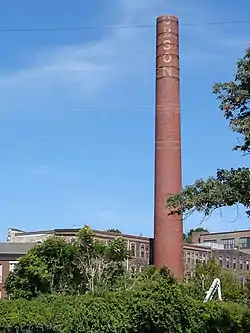 Dobson Mills |
July 28, 1988 (#88001214) |
4001-4041 Ridge Ave.; 3502-3530 Scott's Lane 40°00′28″N 75°11′14″W |
Hunting Park Industrial Area | |
| 31 | Dropsie University Complex |  Dropsie University Complex |
January 17, 1975 (#75001661) |
Broad and York Sts. 39°59′21″N 75°09′18″W |
Cecil B. Moore | |
| 32 | Drueding Brothers Company Building | 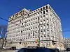 Drueding Brothers Company Building |
December 12, 2012 (#12001043) |
437-441 W. Master St. 39°58′22″N 75°08′39″W |
Olde Kensington | |
| 33 | Paul Lawrence Dunbar School | 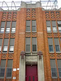 Paul Lawrence Dunbar School |
December 4, 1986 (#86003274) |
Twelfth St. above Columbia Ave. 39°58′43″N 75°09′17″W |
Cecil B. Moore | |
| 34 | Thomas Eakins House | .jpg.webp) Thomas Eakins House |
October 15, 1966 (#66000679) |
1729 Mount Vernon Place 39°57′56″N 75°10′02″W |
Spring Garden | |
| 35 | Eastern State Penitentiary | 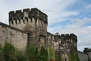 Eastern State Penitentiary |
October 15, 1966 (#66000680) |
21st St. and Fairmount Ave. 39°58′05″N 75°10′23″W |
Fairmount | John Haviland, architect (1821-29). |
| 36 | James Elverson Jr. School |  James Elverson Jr. School |
November 18, 1988 (#88002231) |
1300 Susquehanna Ave. 39°59′09″N 75°09′16″W |
Cecil B. Moore | |
| 37 | The Elverson Building |  The Elverson Building |
July 15, 1996 (#96000716) |
400-440 North Broad St. 39°57′36″N 75°09′44″W |
Callowhill | Rankin, Kellogg & Crane, architects (1923-24). |
| 38 | Engine Company No. 29 |  Engine Company No. 29 |
May 6, 2022 (#100007674) |
1221-1225 North 4th St. 39°58′15″N 75°08′34″W |
||
| 39 | Fair Hill Burial Ground |  Fair Hill Burial Ground |
August 7, 1998 (#98000900) |
Roughly along Germantown and Indiana Aves., 9th, and Cambria Sts. 39°59′49″N 75°08′46″W |
Fairhill | |
| 40 | Fairmount Avenue Historic District |  Fairmount Avenue Historic District |
February 20, 2002 (#02000066) |
Fairmount Ave. and Melon, North, 15th, 16th, and 17th Sts. 39°58′00″N 75°09′44″W |
Spring Garden | |
| 41 | Fairmount Park |  Fairmount Park |
February 7, 1972 (#72001151) |
Both banks of the Schuylkill River and Wissahickon Creek, from Spring Garden St. to Northwestern Ave. 39°58′58″N 75°11′50″W |
Fairmount Park | Extends into Northwest and West Philadelphia |
| 42 | Fairmount Water Works | 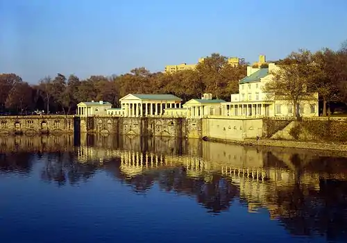 Fairmount Water Works |
May 11, 1976 (#76001662) |
Eastern banks of the Schuylkill River 39°57′59″N 75°11′09″W |
Fairmount Park | Frederick Graff, et al., architects (1812-22). |
| 43 | David Farragut School |  David Farragut School |
December 4, 1986 (#86003280) |
Hancock and Cumberland Sts. 39°59′16″N 75°08′08″W |
West Kensington | |
| 44 | Feltonville School No. 2 |  Feltonville School No. 2 |
November 18, 1988 (#88002269) |
4901 Rising Sun Ave. 40°01′29″N 75°07′21″W |
Feltonville | |
| 45 | Joseph C. Ferguson School |  Joseph C. Ferguson School |
November 18, 1988 (#88002270) |
2000-2046 North 7th St. 39°58′55″N 75°08′48″W |
Cecil B. Moore | |
| 46 | Fidelity Mutual Life Insurance Company Building |  Fidelity Mutual Life Insurance Company Building |
July 2, 1973 (#73001662) |
Fairmount and Pennsylvania Aves. 39°58′03″N 75°10′47″W |
Fairmount | Zantzinger, Borie and Medary, architects (1927). |
| 47 | Thomas K. Finletter School |  Thomas K. Finletter School |
November 18, 1988 (#88002271) |
6101 North Front St. 40°02′37″N 75°07′10″W |
Olney | |
| 48 | Thomas Fitzsimons Junior High School |  Thomas Fitzsimons Junior High School |
November 18, 1988 (#88002272) |
2601 West Cumberland St. 39°59′38″N 75°10′30″W |
Strawberry Mansion | |
| 49 | Helen Fleischer Vocational School |  Helen Fleischer Vocational School |
December 4, 1986 (#86003282) |
13th and Brandywine Sts. 39°57′46″N 75°09′33″W |
Callowhill | |
| 50 | Edwin Forrest House |  Edwin Forrest House |
January 13, 1972 (#72001152) |
1346 North Broad St. 39°58′28″N 75°09′33″W |
Cabot | Also listed as the Philadelphia School of Design for Women |
| 51 | Friends Housing Cooperative | 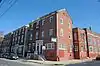 Friends Housing Cooperative |
October 13, 2015 (#15000735) |
Bounded by Fairmount Ave., 8th, Franklin & Brown Sts. 39°57′54″N 75°09′03″W |
||
| 52 | Founder's Hall, Girard College | 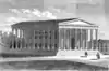 Founder's Hall, Girard College |
August 4, 1969 (#69000158) |
Corinthian St. and Girard Ave. 39°58′26″N 75°10′12″W |
Girard College | Thomas Ustick Walter, architect (1833-48). |
| 53 | Henry S. Frank Memorial Synagogue | 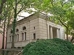 Henry S. Frank Memorial Synagogue |
July 12, 1983 (#83002267) |
Old York and West Tabor Roads 40°02′14″N 75°08′38″W |
Logan | |
| 54 | Joe Frazier's Gym | 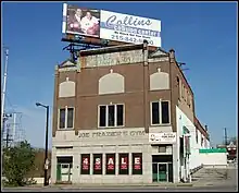 Joe Frazier's Gym |
April 30, 2013 (#13000257) |
2917 N. Broad Street 39°59′51″N 75°09′11″W |
North Central | |
| 55 | General Electric Switchgear Plant |  General Electric Switchgear Plant |
October 31, 1985 (#85003470) |
Seventh and Willow Sts. 39°57′32″N 75°09′00″W |
Callowhill | |
| 56 | German Society of Pennsylvania |  German Society of Pennsylvania |
October 31, 1985 (#92000947) |
611 Spring Garden St. 39°57′39″N 75°09′00″W |
Northern Liberties | |
| 57 | Germantown Junction Station | _elevation%252C_oblique_-_North_Philadelphia_Station.jpg.webp) Germantown Junction Station |
July 8, 1999 (#92000940) |
2900 North Broad St. 39°59′50″N 75°08′16″W |
North Central | Theophilus P. Chandler Jr., architect (1896-1901). |
| 58 | Elizabeth Duane Gillespie Junior High School |  Elizabeth Duane Gillespie Junior High School |
April 10, 1989 (#88002275) |
3901-3961 North 18th St. 40°00′48″N 75°09′22″W |
Nicetown–Tioga | |
| 59 | Girard Avenue Historic District |  Girard Avenue Historic District |
October 31, 1985 (#85003427) |
1415-2028 Girard Avenue and 1700 block of Thompson Street 39°58′21″N 75°09′36″W |
Cabot | |
| 60 | Girard Avenue West Historic District |  Girard Avenue West Historic District |
March 8, 2011 (#10001032) |
West Girard Avenue, between North Taney and North 29th Streets 39°58′28″N 75°10′52″W |
Brewerytown | |
| 61 | Girard College Complex | 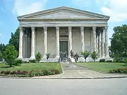 Girard College Complex |
October 29, 1974 (#74001802) |
Bounded by Poplar St., Girard, West College, South College, and Ridge Aves. 39°58′25″N 75°09′22″W |
Girard College | |
| 62 | Goodman Brothers and Hinlein Company |  Goodman Brothers and Hinlein Company |
March 7, 1985 (#85000469) |
1238 Callowhill St. 39°57′33″N 75°09′35″W |
Callowhill | |
| 63 | Gotham Silk Hosiery Company |  Gotham Silk Hosiery Company |
April 17, 2018 (#100002342) |
2000-2034 N 2nd St. 39°58′51″N 75°08′14″W |
West Kensington | |
| 64 | Graham and Laird, Schober and Mitchell Factories |  Graham and Laird, Schober and Mitchell Factories |
July 7, 1978 (#78002448) |
19th St. between Hamilton and Buttonwood Sts. 39°57′44″N 75°10′11″W |
Franklintown | Site now a parking lot. |
| 65 | Simon Gratz High School | 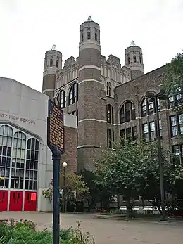 Simon Gratz High School |
April 10, 1989 (#88002276) |
3901-3961 North 18th St. 40°00′50″N 75°09′21″W |
Nicetown–Tioga | |
| 66 | Harrington Machine Shop | 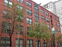 Harrington Machine Shop |
May 6, 1983 (#83002270) |
1640-1666 Callowhill St. 39°57′36″N 75°10′00″W |
Franklintown | |
| 67 | William H. Harrison School | 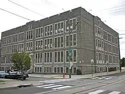 William H. Harrison School |
November 18, 1988 (#88002278) |
1012-1020 West Thompson St. 39°58′21″N 75°09′13″W |
Yorktown | |
| 68 | Hatfield House | 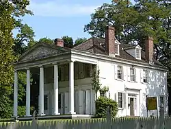 Hatfield House |
March 16, 1972 (#72001157) |
33rd St. near Girard Avenue 39°58′33″N 75°11′18″W |
Fairmount Park | |
| 69 | Houses at 1907–1951 N. 32nd St. | 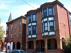 Houses at 1907–1951 N. 32nd St. |
January 11, 1994 (#93001472) |
1907–1951 North 32nd St. 39°59′10″N 75°11′09″W |
Strawberry Mansion | |
| 70 | Julia Ward Howe School | 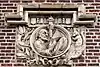 Julia Ward Howe School |
November 18, 1988 (#88002284) |
1301-1331 Grange St. 40°02′29″N 75°08′32″W |
Fern Rock | |
| 71 | Integrity Title Insurance, Trust and Safe Deposit Company | 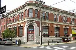 Integrity Title Insurance, Trust and Safe Deposit Company |
November 14, 1982 (#82001548) |
4th and Green Sts. 39°57′42″N 75°08′42″W |
Northern Liberties | |
| 72 | International Harvester Company Building-Philadelphia Branch House | 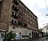 International Harvester Company Building-Philadelphia Branch House |
April 26, 2018 (#100002370) |
2903-2909 N. 16th St. 39°59′52″N 75°09′25″W |
||
| 73 | Thomas Jefferson School | 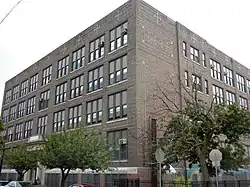 Thomas Jefferson School |
November 18, 1988 (#88002280) |
1101-1125 North 4th St. 39°58′05″N 75°08′36″W |
Northern Liberties | |
| 74 | Harry C. Kahn and Son Warehouse | 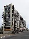 Harry C. Kahn and Son Warehouse |
April 10, 2017 (#100000857) |
3101-27 W. Glenwood Ave. 39°58′50″N 75°11′10″W |
||
| 75 | Kensington Branch of the Philadelphia YWCA | 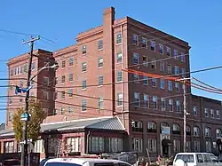 Kensington Branch of the Philadelphia YWCA |
March 9, 1990 (#90000415) |
174 West Allegheny Ave. 39°59′56″N 75°07′57″W |
West Kensington | |
| 76 | John L. Kinsey School | 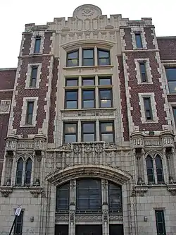 John L. Kinsey School |
December 4, 1986 (#86003297) |
65th Ave. and Limekiln Pike 40°03′13″N 75°09′09″W |
West Oak Lane | |
| 77 | Laurel Hill Cemetery | 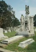 Laurel Hill Cemetery |
October 28, 1977 (#77001185) |
3822 Ridge Ave. 40°00′15″N 75°11′19″W |
Fairmount Park | |
| 78 | Logan Demonstration School | 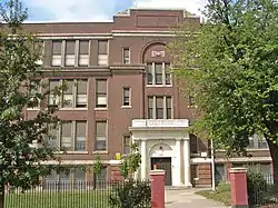 Logan Demonstration School |
November 18, 1988 (#88002293) |
5000 North 17th St. 40°01′52″N 75°09′06″W |
Logan | |
| 79 | Lorraine Apartments | 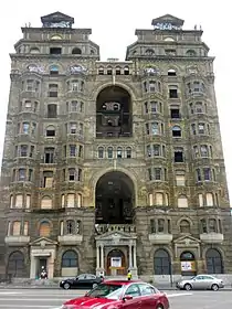 Lorraine Apartments |
November 27, 2002 (#02001427) |
699 North Broad St. 39°58′00″N 75°09′37″W |
Poplar | Willis G. Hale, architect (1892-1893). |
| 80 | James Russell Lowell School | 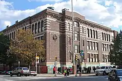 James Russell Lowell School |
November 18, 1988 (#88002295) |
5801-5851 North 5th St. 40°02′27″N 75°07′44″W |
Olney | |
| 81 | Lower North Philadelphia Speculative Housing Historic District |  Lower North Philadelphia Speculative Housing Historic District |
March 12, 1999 (#99000325) |
Roughly bounded by North 15th St., Sydenham St., North 16th St., Montgomery Ave., North 19th St., Jefferson St., and Willington St. 39°58′47″N 75°09′41″W |
North Central | |
| 82 | James R. Ludlow School |  James R. Ludlow School |
November 18, 1988 (#88002296) |
1323-1345 North 6th St. 39°58′21″N 75°08′45″W |
Yorktown | |
| 83 | Martin Orthopedic School |  Martin Orthopedic School |
December 4, 1986 (#86003300) |
800 North 22nd St. 39°58′12″N 75°10′27″W |
Fairmount | |
| 84 | Alexander K. McClure School |  Alexander K. McClure School |
November 18, 1988 (#88002300) |
4139 North 6th St. 40°00′54″N 75°08′15″W |
Hunting Park | |
| 85 | McDowell Memorial Presbyterian Church |  McDowell Memorial Presbyterian Church |
September 18, 2013 (#13000744) |
2040 Cecil B. Moore Avenue 39°58′48″N 75°10′09″W |
North Central | |
| 86 | George Meade School |  George Meade School |
December 4, 1986 (#86003305) |
1801 Oxford St. 39°58′42″N 75°09′54″W |
North Central | |
| 87 | A. Mecky Company Building |  A. Mecky Company Building |
May 8, 2017 (#100000977) |
1705 W. Allegheny Ave. 40°00′08″N 75°09′29″W |
||
| 88 | Metropolitan Opera House |  Metropolitan Opera House |
February 1, 1972 (#72001163) |
858 North Broad St. 39°58′12″N 75°09′36″W |
Francisville | |
| 89 | Middishade Clothing Factory |  Middishade Clothing Factory |
January 6, 1987 (#86003579) |
1600 Callowhill St. 39°57′36″N 75°09′55″W |
Franklintown | |
| 90 | Mifflin School | 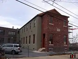 Mifflin School |
December 4, 1986 (#86003308) |
808-818 North 3rd St. 39°57′49″N 75°08′35″W |
Northern Liberties | |
| 91 | Andrew J. Morrison School | 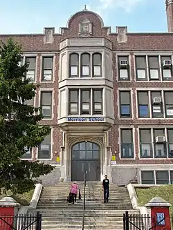 Andrew J. Morrison School |
November 18, 1988 (#88002302) |
300 Duncannon St. 40°01′46″N 75°07′46″W |
Olney | |
| 92 | Most Precious Blood Roman Catholic Church, Rectory and Parochial School |  Most Precious Blood Roman Catholic Church, Rectory and Parochial School |
January 22, 1992 (#91002008) |
2800-2818 Diamond St. 39°59′14″N 75°10′47″W |
Strawberry Mansion | Demolished in 2023[6] |
| 93 | Mount Pleasant | 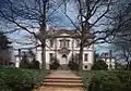 Mount Pleasant |
October 15, 1966 (#66000685) |
East Reservoir Drive 39°59′00″N 75°12′00″W |
Fairmount Park | |
| 94 | Muhlenberg School | 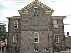 Muhlenberg School |
November 18, 1988 (#88002247) |
1640 Master St. 39°58′30″N 75°09′49″W |
Cabot | |
| 95 | Simon Muhr Work Training School |  Simon Muhr Work Training School |
December 1, 1986 (#86003310) |
12th St. and Allegheny Ave. 40°00′03″N 75°08′55″W |
Nicetown–Tioga | |
| 96 | Mulford Building |  Mulford Building |
August 20, 2004 (#04000882) |
640 North Broad St. 39°57′54″N 75°09′40″W |
Spring Garden | |
| 97 | N. Snellenburg Company Department Store Warehouse |  N. Snellenburg Company Department Store Warehouse |
July 31, 2003 (#03000725) |
1825-1851 North 10th St. 39°58′49″N 75°09′00″W |
Cecil B. Moore | |
| 98 | National Bank of North Philadelphia |  National Bank of North Philadelphia |
May 20, 1985 (#85001131) |
3701 North Broad St. 40°00′36″N 75°09′03″W |
Nicetown–Tioga | |
| 99 | North Broad Street Mansion District | 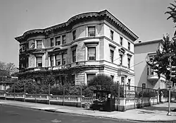 North Broad Street Mansion District |
March 29, 1985 (#85000674) |
Roughly bounded by Broad, Jefferson, Willington, and Oxford Sts. 39°58′37″N 75°09′38″W |
Cecil B. Moore | |
| 100 | North Broad Street Station, Reading Company | 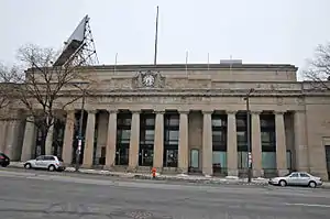 North Broad Street Station, Reading Company |
March 28, 1996 (#96000325) |
2601 North Broad St. 39°59′33″N 75°09′16″W |
Cecil B. Moore | |
| 101 | Northeast Manual Training School | 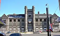 Northeast Manual Training School |
December 4, 1986 (#86003279) |
701 Lehigh Ave. 39°59′35″N 75°08′40″W |
Fairhill | Burned then demolished in 2011.[7] |
| 102 | Northern Liberties Historic District | 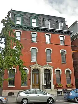 Northern Liberties Historic District |
October 31, 1985 (#85003471) |
Roughly bounded by Brown, Boone and Galloway, Green and Wallace, and 5th and 6th Sts. 39°57′57″N 75°08′48″W |
Northern Liberties | |
| 103 | Northern National Bank | 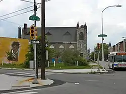 Northern National Bank |
June 27, 1985 (#85001388) |
2300 Germantown Ave. 39°59′12″N 75°08′43″W |
Hartranft | |
| 104 | Northern Saving Fund and Safe Deposit Company | 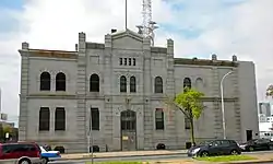 Northern Saving Fund and Safe Deposit Company |
September 28, 1977 (#77001187) |
600 Spring Garden St. 39°57′40″N 75°08′55″W |
Callowhill | |
| 105 | Ogontz Hall | 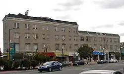 Ogontz Hall |
November 14, 1991 (#91001708) |
7175-7165 Ogontz Ave. 40°03′51″N 75°09′09″W |
West Oak Lane | |
| 106 | Olney Elementary School | 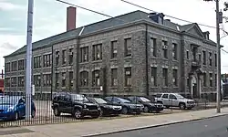 Olney Elementary School |
December 4, 1986 (#86003311) |
Tabor Road and Water St. 40°01′52″N 75°07′14″W |
Olney | |
| 107 | Olney High School | 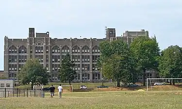 Olney High School |
December 4, 1986 (#86003312) |
Duncannon and Front Sts. 40°01′44″N 75°07′25″W |
Olney | |
| 108 | Henry F. Ortlieb Company Bottling House |  Henry F. Ortlieb Company Bottling House |
August 5, 2014 (#14000475) |
829-51 N. American St. 39°57′49″N 75°08′30″W |
||
| 109 | Park Towne Place |  Park Towne Place |
December 15, 2011 (#11000926) |
2200 Park Towne Place 39°57′40″N 75°10′39″W |
Logan Square | |
| 110 | Charles Willson Peale House | .jpg.webp) Charles Willson Peale House |
October 15, 1966 (#66000687) |
2100 Clarkson Ave. 40°02′17″N 75°09′20″W |
Logan | |
| 111 | William Penn High School for Girls |  William Penn High School for Girls |
December 1, 1986 (#86003316) |
1501 Wallace St. 39°57′54″N 75°09′47″W |
Spring Garden | |
| 112 | Joseph Pennell School |  Joseph Pennell School |
November 18, 1988 (#88002309) |
1800-1856 Nedro Ave. 40°02′37″N 75°09′03″W |
Belfield | |
| 113 | Pennsylvania State Office Building |  Pennsylvania State Office Building |
January 7, 2010 (#09001216) |
1400 Spring Garden St. 39°57′43″N 75°09′44″W |
Hahnemann | |
| 114 | Samuel W. Pennypacker School |  Samuel W. Pennypacker School |
November 18, 1988 (#88002314) |
1800-1850 East Washington Lane 40°03′55″N 75°09′32″W |
West Oak Lane | |
| 115 | Philadelphia High School for Girls |  Philadelphia High School for Girls |
December 4, 1986 (#86003302) |
17th and Spring Garden Sts. 39°57′48″N 75°09′57″W |
Spring Garden | |
| 116 | Philadelphia National Cemetery | 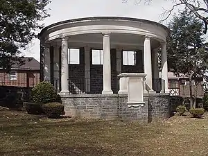 Philadelphia National Cemetery |
July 24, 1997 (#97000775) |
Haines St. and Limekiln Road 40°03′31″N 75°09′18″W |
West Oak Lane | |
| 117 | Philadelphia School of Design for Women | 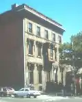 Philadelphia School of Design for Women |
November 4, 1993 (#93001608) |
1346 North Broad St. 39°58′28″N 75°09′33″W |
Cabot | Also listed as the Edwin Forrest House. The school merged into the Moore College of Art and Design. |
| 118 | Philadelphia Wholesale Drug Company Building | 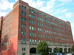 Philadelphia Wholesale Drug Company Building |
September 5, 1990 (#90001410) |
513-525 North Tenth St. 39°57′41″N 75°09′21″W |
Callowhill | |
| 119 | Plaza Apartments | 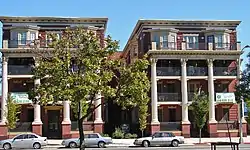 Plaza Apartments |
February 15, 2005 (#05000063) |
1719-1725 North 33rd St., 3226-3228 Clifford St. 39°58′59″N 75°11′18″W |
Strawberry Mansion | |
| 120 | Edgar Allan Poe House, National Historic Site | 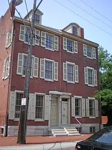 Edgar Allan Poe House, National Historic Site |
October 15, 1966 (#66000689) |
530-532 North Seventh St. 39°57′43″N 75°09′00″W |
Callowhill | |
| 121 | Progress Lighting Manufacturing Company | 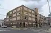 Progress Lighting Manufacturing Company |
August 29, 2016 (#16000572) |
1401-1409 Germantown Ave. 39°58′22″N 75°08′29″W |
||
| 122 | Quaker City Dye Works | 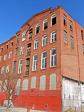 Quaker City Dye Works |
December 12, 2012 (#12001044) |
100-118 W. Oxford St. 39°58′26″N 75°08′06″W |
West Kensington | |
| 123 | Randolph House | 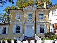 Randolph House |
March 24, 1972 (#72001169) |
Edgeley Drive 39°59′29″N 75°11′42″W |
Fairmount Park | |
| 124 | Reading Company Grain Elevator |  Reading Company Grain Elevator |
March 10, 1982 (#82003813) |
411 North 20th St. 39°57′41″N 75°10′16″W |
Logan Square | |
| 125 | Reyburn Manufacturing Company Building |  Reyburn Manufacturing Company Building |
June 10, 2022 (#100007771) |
3111 West Allegheny Ave. 40°00′19″N 75°10′52″W |
||
| 126 | Gen. John F. Reynolds School | 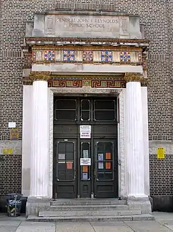 Gen. John F. Reynolds School |
November 18, 1988 (#88002315) |
2300 Jefferson St. 39°58′41″N 75°10′29″W |
North Central | |
| 127 | Ridge Avenue Farmers' Market |  Ridge Avenue Farmers' Market |
March 5, 1984 (#84003547) |
1810 Ridge Ave. 39°58′19″N 75°09′59″W |
Francisville | |
| 128 | Rodeph Shalom Synagogue | 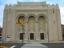 Rodeph Shalom Synagogue |
August 7, 2007 (#07000797) |
607-615 North Broad St. 39°57′50″N 75°09′39″W |
Poplar | |
| 129 | William Rowen School | 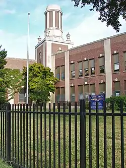 William Rowen School |
November 18, 1988 (#88002318) |
6801 North 19th St. 40°03′31″N 75°08′55″W |
West Oak Lane | |
| 130 | St. John's Church | 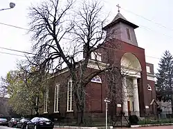 St. John's Church |
February 24, 1983 (#83002278) |
220-230 Brown St. 39°57′47″N 75°08′32″W |
Northern Liberties | |
| 131 | St. Joseph's House for Homeless Industrious Boys | 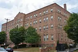 St. Joseph's House for Homeless Industrious Boys |
October 24, 1996 (#96001204) |
1511 and 1515-1527 Allegheny Ave. 40°00′08″N 75°09′20″W |
Nicetown–Tioga | |
| 132 | Frank C. Scherer Wagon Works | 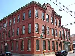 Frank C. Scherer Wagon Works |
December 26, 1985 (#85003160) |
801 North 27th St. 39°58′14″N 75°10′52″W |
Fairmount | |
| 133 | Edwin J. Schoettle Company Building | 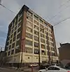 Edwin J. Schoettle Company Building |
December 29, 2014 (#14001105) |
533 North 11th St. 39°57′45″N 75°09′21″W |
Poplar | |
| 134 | Smaltz Building | 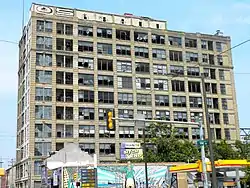 Smaltz Building |
July 27, 2005 (#05000759) |
315 North 12th St. 39°57′30″N 75°09′29″W |
Callowhill | |
| 135 | Snellenburg's Clothing Factory | 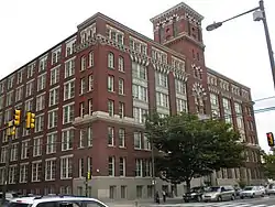 Snellenburg's Clothing Factory |
September 2, 1986 (#86001842) |
642 North Broad St. 39°57′56″N 75°09′40″W |
Spring Garden | |
| 136 | George W. South Memorial Protestant Episcopal Church of the Advocate | 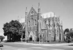 George W. South Memorial Protestant Episcopal Church of the Advocate |
February 8, 1980 (#80003620) |
18th and Diamond Sts. 39°59′09″N 75°09′49″W |
North Central | Charles Marquedant Burns, architect (1887-97). |
| 137 | Special Troops Armory | 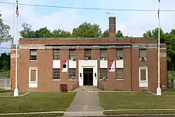 Special Troops Armory |
November 14, 1991 (#91001702) |
5350 Ogontz Ave. 40°02′07″N 75°09′03″W |
Ogontz | |
| 138 | Spring Garden District | 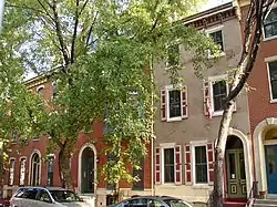 Spring Garden District |
December 21, 1978 (#78002455) |
Roughly bounded by Fairmount Ave. and 15th, 24th, Mount Vernon, and Spring Garden Sts.; also Fairmount Ave. and Mt. Vernon, 15th, and 19th Sts. 39°57′58″N 75°10′11″W |
Spring Garden | Second set of boundaries represents a boundary increase of September 12, 1983 |
| 139 | Spring Garden School No. 1 | 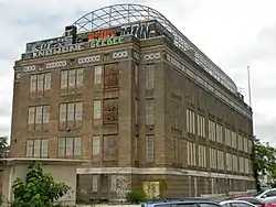 Spring Garden School No. 1 |
December 4, 1986 (#86003332) |
12th and Ogden Sts. 39°58′07″N 75°09′21″W |
Poplar | |
| 140 | Spring Garden School No. 2 | 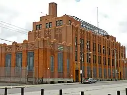 Spring Garden School No. 2 |
December 4, 1986 (#86003333) |
12th and Melon Sts. 39°57′54″N 75°09′22″W |
Poplar | |
| 141 | M. Hall Stanton Public School | 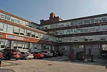 M. Hall Stanton Public School |
September 25, 2018 (#100002987) |
2539 N 16th St. 39°59′31″N 75°09′30″W |
||
| 142 | Steel Heddle Manufacturing Company Complex | 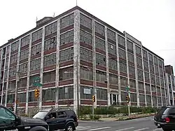 Steel Heddle Manufacturing Company Complex |
June 28, 2010 (#10000404) |
2100 West Allegheny Ave. 40°00′10″N 75°09′54″W |
Allegheny West | |
| 143 | Stenton | 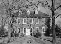 Stenton |
October 15, 1966 (#66000690) |
18th and Courtland Streets 40°01′29″N 75°09′13″W |
Logan | |
| 144 | Thaddeus Stevens School of Observation | 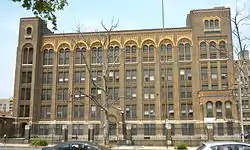 Thaddeus Stevens School of Observation |
December 4, 1986 (#86003335) |
1301 Spring Garden St. 39°57′45″N 75°09′37″W |
Poplar | |
| 145 | Strawbridge and Clothier Department Store Warehouse | 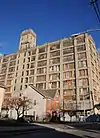 Strawbridge and Clothier Department Store Warehouse |
November 20, 2018 (#100003137) |
901 Poplar St. 39°58′06″N 75°09′06″W |
||
| 146 | Suffolk Manor Apartments | 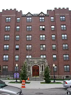 Suffolk Manor Apartments |
December 20, 2002 (#02001567) |
1414-1450 Clearview St. 40°02′26″N 75°08′45″W |
Ogontz | |
| 147 | Sykes Brothers Yarn Mill | 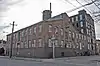 Sykes Brothers Yarn Mill |
November 26, 2019 (#100004701) |
178-180 W. Huntingdon St. 39°59′23″N 75°08′03″W |
West Kensington | |
| 148 | Henry O. Tanner House | .jpg.webp) Henry O. Tanner House |
May 11, 1976 (#76001672) |
2908 West Diamond St. 39°59′16″N 75°10′52″W |
Strawberry Mansion | |
| 149 | Tasty Baking Company Building | 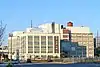 Tasty Baking Company Building |
September 8, 2011 (#11000648) |
2801 West Hunting Park Avenue 40°00′25″N 75°10′31″W |
Hunting Park Industrial Area | |
| 150 | Bayard Taylor School | 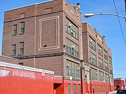 Bayard Taylor School |
November 18, 1988 (#88002329) |
3614-3630 North Randolph St. 40°00′26″N 75°08′18″W |
Hunting Park | |
| 151 | Terminal Commerce Building | 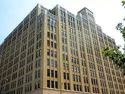 Terminal Commerce Building |
October 24, 1996 (#96001203) |
401 North Broad St. 39°57′36″N 75°09′41″W |
Callowhill | |
| 152 | Thirty-third Street Bridge in Philadelphia | 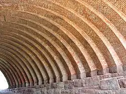 Thirty-third Street Bridge in Philadelphia |
June 22, 1988 (#88000847) |
33rd St. above Master St. 39°58′43″N 75°11′23″W |
Brewerytown | |
| 153 | Union Methodist Episcopal Church |  Union Methodist Episcopal Church |
October 15, 1980 (#80003622) |
2019 West Diamond St. 39°59′11″N 75°10′01″W |
North Central | |
| 154 | Uptown Theater and Office Building |  Uptown Theater and Office Building |
July 22, 1982 (#82003817) |
2240-2248 North Broad St. 39°59′15″N 75°09′22″W |
Cecil B. Moore | Magaziner, Eberhard & Harris, architects (1929). |
| 155 | Roberts Vaux Junior High School |  Roberts Vaux Junior High School |
November 18, 1988 (#88002332) |
2300-2344 West Master St. 39°58′35″N 75°10′27″W |
North Central | |
| 156 | Wagner Free Institute of Science |  Wagner Free Institute of Science |
May 17, 1989 (#89000361) |
17th St. and Montgomery Ave. 39°58′50″N 75°09′46″W |
North Central | John McArthur Jr., architect (1859-65). |
| 157 | Gen. Louis Wagner Junior High School | 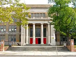 Gen. Louis Wagner Junior High School |
December 4, 1986 (#86003340) |
17th St. and Chelten Ave. 40°03′06″N 75°08′52″W |
West Oak Lane | |
| 158 | Rudolph Walton School | 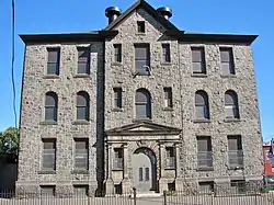 Rudolph Walton School |
December 4, 1986 (#86003341) |
2601-2631 North 28th St. 39°59′43″N 75°10′36″W |
Strawberry Mansion | |
| 159 | West Diamond Street Townhouse Historic District | 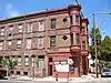 West Diamond Street Townhouse Historic District |
February 21, 1991 (#91000097) |
3008-3146, 3011-3215 Diamond St. 39°59′18″N 75°11′02″W |
Strawberry Mansion | |
| 160 | John Greenleaf Whittier School | 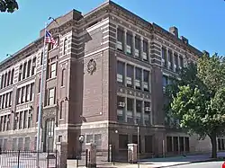 John Greenleaf Whittier School |
November 18, 1988 (#88002334) |
2600 Clearfield St. 40°00′09″N 75°10′26″W |
Allegheny West | |
| 161 | Wills Hospital | 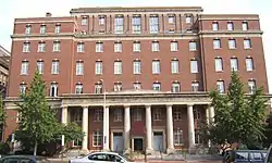 Wills Hospital |
July 12, 1984 (#84003582) |
1601 Spring Garden St. 39°57′48″N 75°09′54″W |
Spring Garden | John T. Windrim, architect (1931-32). |
| 162 | Mary Channing Wister School | 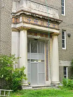 Mary Channing Wister School |
November 18, 1988 (#88002333) |
843-855 North 8th St. 39°58′01″N 75°09′02″W |
Poplar | |
| 163 | Woodford | 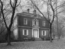 Woodford |
December 24, 1967 (#67000021) |
Dauphin and 33rd Sts. 39°59′33″N 75°11′18″W |
Fairmount Park | |
| 164 | E.A. Wright Bank Note Company Building | 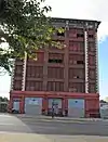 E.A. Wright Bank Note Company Building |
June 13, 2022 (#100007788) |
2527-2537 North Broad St. 39°59′31″N 75°09′17″W |
||
| 165 | Richardson L. Wright School |  Richardson L. Wright School |
December 4, 1986 (#86003348) |
1101 Venango St. 40°00′25″N 75°08′46″W |
Nicetown–Tioga | Lloyd Titus, architect. Built 1905. Destroyed before 2008. |
| 166 | Wyoming Central Office of the Bell Telephone Company |  Wyoming Central Office of the Bell Telephone Company |
May 11, 2015 (#15000219) |
4900 N. Broad St. 40°01′40″N 75°08′51″W |
Wyoming | |
| 167 | Yorktown Historic District |  Yorktown Historic District |
December 12, 2012 (#12001046) |
Roughly bounded by Cecil B. Moore Ave., N. 10th, W. Oxford, N. 11th, W. Stiles, W. Flora, & N. 13th St. 39°58′31″N 75°09′13″W |
Ludlow | Low rise, urban redevelopment 1959-69[8] |
| 168 | Zion Baptist Church and Educational Annex |  Zion Baptist Church and Educational Annex |
February 27, 2023 (#100008647) |
3600 and 3601-07 North Broad St. 40°00′28″N 75°09′06″W |
Former listings
| [2] | Name on the Register | Image | Date listed | Date removed | Location | Neighborhood | Description |
|---|---|---|---|---|---|---|---|
| 1 | Odd Fellow's Hall | June 19, 1973 (#78003440) | February 14, 1978 | 800 N. 3rd St. |
Poplar | ||
| 2 | William J. Stokely School | December 4, 1986 (#86003336) | April 1, 2009 | 1844-1860 North 32nd St. 39°59′07″N 75°11′11″W |
Strawberry Mansion | Also known as the Prince of Peace Baptist Church. Destroyed by fire on April 30, 2008.[9] | |
| 3 | P.A.B. Widener Mansion | 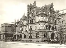 P.A.B. Widener Mansion |
November 20, 1979 (#79002332) | June 27, 1986 | 1200 North Broad St. 39°58′20″N 75°09′33″W |
Yorktown | Willis G. Hale, architect. Destroyed by fire on July 28, 1980.[10] |
See also
References
- The latitude and longitude information provided in this table was derived originally from the National Register Information System, which has been found to be fairly accurate for about 99% of listings. Some locations in this table may have been corrected to current GPS standards.
- Numbers represent an alphabetical ordering by significant words. Various colorings, defined here, differentiate National Historic Landmarks and historic districts from other NRHP buildings, structures, sites or objects.
- The eight-digit number below each date is the number assigned to each location in the National Register Information System database, which can be viewed by clicking the number.
- "The Political and Community Service Boundaries of Philadelphia" (PDF). Philadelphia City Planning Commission. June 2004. Retrieved June 22, 2013.
- Philadelphia Public Schools TR
- https://hiddencityphila.org/2023/07/church-listed-on-the-national-register-razed-for-new-construction/
- Ujifusa, Steven (November 15, 2012). "Gothic Ruins: A Last Glimpse Inside Northeast Manual Training High School". The PhillyHistory Blog. City of Philadelphia. Retrieved April 22, 2013.
- Cooperman, Emily T. "NRHP Nomination" (PDF). City of Philadelphia. Retrieved 15 January 2013.
- "Fire destroys church, claims nearby homes". The Philadelphia Inquirer. May 1, 2008. p. B1. Retrieved August 21, 2022 – via Newspapers.com.
- "Fire gust historic Widener Mansion". The Philadelphia Inquirer. July 29, 1980. p. B1. Retrieved August 21, 2022 – via Newspapers.com.
