National Register of Historic Places listings in the Capital region of Texas: Other
This page is one of two listing the National Register of Historic Places listings in Texas's Capital region.
The Capital region is an area of 10 counties defined by the Texas Comptroller for economic reporting in 2022, as mapped here.
The region included 2020 population of 2.4 million, or 8.3 percent of Texas' population, with Austin-Round Rock-Georgetown MSA having 95 percent of the Capital region's population. Travis County alone has 54 percent.[1]
This page includes the nine counties besides Travis County (which includes Austin).
To see all locations together in a map, click on "Map all coordinates using OpenSourceMap" at right.
Bastrop County
| [2] | Name on the Register[3] | Image | Date listed[4] | Location | City or town | Description |
|---|---|---|---|---|---|---|
| 1 | Allen-Bell House |  Allen-Bell House |
January 25, 1971 (#71000919) |
1408 Church St. 30°06′57″N 97°19′18″W |
Bastrop | Recorded Texas Historic Landmark |
| 2 | August Baron House |  August Baron House |
December 22, 1978 (#78003277) |
1707 Pecan St. 30°07′07″N 97°19′03″W |
Bastrop | |
| 3 | Ed Bastain-Haralson House |  Ed Bastain-Haralson House |
December 22, 1978 (#78003350) |
1006 Chestnut St. 30°06′39″N 97°18′57″W |
Bastrop | Recorded Texas Historic Landmark |
| 4 | Bastrop Commercial District |  Bastrop Commercial District |
December 22, 1978 (#78003262) |
Roughly bounded by Church, Water, Spring, and Walnut Sts. 30°06′38″N 97°19′12″W |
Bastrop | Includes Recorded Texas Historic Landmarks; 32 buildings |
| 5 | Bastrop County Courthouse and Jail Complex | 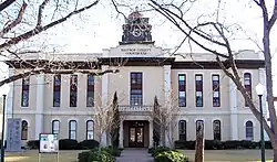 Bastrop County Courthouse and Jail Complex |
November 20, 1975 (#75001947) |
Bounded by Pine, Walnut, Pecan, and Water Sts. 30°06′33″N 97°19′05″W |
Bastrop | State Antiquities Landmark, includes Recorded Texas Historic Landmarks |
| 6 | Bastrop State Park | 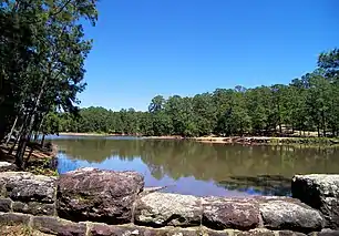 Bastrop State Park |
September 25, 1997 (#97001242) |
East of Bastrop, bet. TX 21 & 71 30°06′31″N 97°16′55″W |
Bastrop | |
| 7 | Judge R. Batts House | 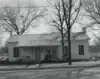 Judge R. Batts House |
December 22, 1978 (#78003336) |
609 Pecan St. 30°06′26″N 97°19′02″W |
Bastrop | Church now stands at the site |
| 8 | S. L. Brannon House | 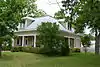 S. L. Brannon House |
December 22, 1978 (#78003264) |
1301 Main St. 30°06′50″N 97°19′11″W |
Bastrop | |
| 9 | R. J. Brieger House | 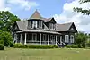 R. J. Brieger House |
December 22, 1978 (#78003278) |
1508 Hill St. 30°07′00″N 97°18′55″W |
Bastrop | Recorded Texas Historic Landmark |
| 10 | Jennie Brooks House |  Jennie Brooks House |
December 22, 1978 (#78003317) |
1009 Walnut St. 30°06′30″N 97°18′55″W |
Bastrop | |
| 11 | Brooks-Wilbarger House |  Brooks-Wilbarger House |
December 22, 1978 (#78003269) |
1403 Main St. 30°06′55″N 97°19′12″W |
Bastrop | Recorded Texas Historic Landmark |
| 12 | J. C. Buchanan House |  J. C. Buchanan House |
December 22, 1978 (#78003326) |
1010 Pecan St. 30°06′41″N 97°19′04″W |
Bastrop | |
| 13 | Casino Hall |  Casino Hall |
December 22, 1978 (#78003291) |
NE corner of Farm and Fayette 30°06′47″N 97°18′45″W |
Bastrop | |
| 14 | Colorado River Bridge at Bastrop |  Colorado River Bridge at Bastrop |
July 19, 1990 (#90001031) |
State Loop 150 over the Colorado River 30°06′36″N 97°19′21″W |
Bastrop | |
| 15 | H. B. Combs House |  H. B. Combs House |
December 22, 1978 (#78003294) |
1208 Church St. 30°06′49″N 97°19′18″W |
Bastrop | |
| 16 | John Cornelson House |  John Cornelson House |
December 22, 1978 (#78003301) |
702 Main St. 30°06′26″N 97°19′11″W |
Bastrop | Recorded Texas Historic Landmark; now the Bastrop County Historical Society Museum |
| 17 | Crocheron-McDowall House |  Crocheron-McDowall House |
April 20, 1978 (#78003357) |
1502 Wilson St. 30°06′58″N 97°19′22″W |
Bastrop | Recorded Texas Historic Landmark |
| 18 | J. T. Crysup House |  J. T. Crysup House |
December 22, 1978 (#78003274) |
1607 Main St. 30°07′03″N 97°19′11″W |
Bastrop | |
| 19 | George W. Davis House |  George W. Davis House |
December 22, 1978 (#78003343) |
1010 Chestnut St. 30°06′39″N 97°18′55″W |
Bastrop | |
| 20 | Dawson House |  Dawson House |
December 22, 1978 (#78003351) |
1002 Chestnut St. 30°06′39″N 97°18′58″W |
Bastrop | |
| 21 | Mary Duval House |  Mary Duval House |
December 22, 1978 (#78003268) |
1502 Pecan St. 30°06′58″N 97°19′04″W |
Bastrop | |
| 22 | Elgin Commercial Historic District | .jpg.webp) Elgin Commercial Historic District |
February 16, 1996 (#96000024) |
Roughly, along Main St., Ave. C, Central and Depot Aves. and 1st and 2nd Sts. 30°20′52″N 97°22′14″W |
Elgin | Includes Recorded Texas Historic Landmark |
| 23 | Elzner House |  Elzner House |
December 22, 1978 (#78003302) |
800 Main St. 30°06′31″N 97°19′12″W |
Bastrop | Recorded Texas Historic Landmark |
| 24 | August Elzner House |  August Elzner House |
December 22, 1978 (#78003273) |
1701 Main St. 30°07′05″N 97°19′11″W |
Bastrop | |
| 25 | Prince Elzner House |  Prince Elzner House |
December 22, 1978 (#78003283) |
1303 Pecan St. 30°06′51″N 97°19′02″W |
Bastrop | |
| 26 | Erhard House |  Erhard House |
December 22, 1978 (#78003280) |
907 Cedar St. 30°07′02″N 97°19′03″W |
Bastrop | |
| 27 | A. A. Erhard House |  A. A. Erhard House |
December 22, 1978 (#78003329) |
1106 Pecan St. 30°06′44″N 97°19′04″W |
Bastrop | |
| 28 | Adolph A. Erhard House |  Adolph A. Erhard House |
December 22, 1978 (#78003284) |
1205 Pecan St. 30°06′48″N 97°19′02″W |
Bastrop | Recorded Texas Historic Landmark |
| 29 | E. C. Erhard House |  E. C. Erhard House |
December 22, 1978 (#78003279) |
1507 Pecan St. 30°07′00″N 97°19′02″W |
Bastrop | |
| 30 | Farm House | December 22, 1978 (#78003334) |
End of Pecan St. 30°06′03″N 97°18′56″W |
Bastrop | Location uncertain | |
| 31 | Fowler House |  Fowler House |
December 22, 1978 (#78003321) |
1404 Wilson St. 30°06′55″N 97°19′22″W |
Bastrop | Recorded Texas Historic Landmark |
| 32 | Fowler-Jenkins House |  Fowler-Jenkins House |
December 22, 1978 (#78003263) |
1302 Pecan St. 30°06′50″N 97°19′04″W |
Bastrop | Recorded Texas Historic Landmark |
| 33 | P. A. Fry House | December 22, 1978 (#78003337) |
1403 Emile St. 30°06′22″N 97°18′38″W |
Bastrop | Moved from original location to current location across from Emilie School Location uncertain | |
| 34 | Rufus A. Green House |  Rufus A. Green House |
December 22, 1978 (#78003347) |
1501 Church St. 30°06′58″N 97°19′16″W |
Bastrop | |
| 35 | Griesenbeck House |  Griesenbeck House |
December 22, 1978 (#78003349) |
805 Pecan St. 30°06′33″N 97°19′02″W |
Bastrop | |
| 36 | Alf Griesenbeck House |  Alf Griesenbeck House |
December 22, 1978 (#78003282) |
1302 Hill St. 30°06′51″N 97°18′56″W |
Bastrop | |
| 37 | Erna Griesenbeck House |  Erna Griesenbeck House |
December 22, 1978 (#78003338) |
908 Pine St. 30°06′35″N 97°19′00″W |
Bastrop | |
| 38 | R. J. Griesenbeck House |  R. J. Griesenbeck House |
December 22, 1978 (#78003308) |
1005 Chestnut St. 30°06′37″N 97°18′57″W |
Bastrop | |
| 39 | Dr. C. A. Grimes House |  Dr. C. A. Grimes House |
December 22, 1978 (#78003355) |
1201 Farm St. 30°06′45″N 97°18′49″W |
Bastrop | |
| 40 | Hall-Sayers-Perkins House |  Hall-Sayers-Perkins House |
December 22, 1978 (#78003293) |
1307 Church St. 30°06′52″N 97°19′16″W |
Bastrop | Recorded Texas Historic Landmark |
| 41 | Eugene Harlson House |  Eugene Harlson House |
December 22, 1978 (#78003344) |
803 Jefferson St. 30°06′32″N 97°18′58″W |
Bastrop | |
| 42 | Emelia Hasler House |  Emelia Hasler House |
December 22, 1978 (#78003307) |
1004 Pine St. 30°06′35″N 97°18′57″W |
Bastrop | |
| 43 | T. A. Hasler House | 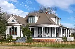 T. A. Hasler House |
December 22, 1978 (#78003330) |
1109 Pecan 30°06′45″N 97°19′02″W |
Bastrop | |
| 44 | Abraham Wiley Hill House |  Abraham Wiley Hill House |
March 11, 1971 (#71000920) |
5 mi (8.0 km). SW of Hills Prairie 30°02′53″N 97°18′28″W |
Hills Prairie | Recorded Texas Historic Landmark |
| 45 | Hopewell School |  Hopewell School |
June 8, 2015 (#15000334) |
690 TX 21 W 30°05′55″N 97°27′41″W |
Cedar Creek | |
| 46 | House at 1002 Pine |  House at 1002 Pine |
December 22, 1978 (#78003304) |
1002 Pine St. 30°06′35″N 97°18′58″W |
Bastrop | |
| 47 | House at 1002 Walnut |  House at 1002 Walnut |
December 22, 1978 (#78003303) |
1002 Walnut St. 30°06′31″N 97°18′58″W |
Bastrop | |
| 48 | House at 1105 Hill |  House at 1105 Hill |
December 22, 1978 (#78003312) |
1105 Hill St. 30°06′45″N 97°18′54″W |
Bastrop | |
| 49 | House at 1108 Hill |  House at 1108 Hill |
December 22, 1978 (#78003306) |
1108 Hill St. 30°06′45″N 97°18′55″W |
Bastrop | |
| 50 | House at 1301 Hill |  House at 1301 Hill |
December 22, 1978 (#78003286) |
1301 Hill St. 30°06′51″N 97°18′53″W |
Bastrop | |
| 51 | House at 1308 Fayette |  House at 1308 Fayette |
December 22, 1978 (#78003285) |
1308 Fayette St. 30°06′53″N 97°18′45″W |
Bastrop | |
| 52 | House at 1316 Farm |  House at 1316 Farm |
December 22, 1978 (#78003290) |
1316 Farm St. 30°06′47″N 97°18′44″W |
Bastrop | |
| 53 | House at 311 Pecan |  House at 311 Pecan |
December 22, 1978 (#78003327) |
311 Pecan St. 30°06′14″N 97°19′02″W |
Bastrop | |
| 54 | House at 604 Elm |  House at 604 Elm |
December 22, 1978 (#78003310) |
604 Elm St. 30°07′09″N 97°19′16″W |
Bastrop | |
| 55 | House at 806 Jefferson |  House at 806 Jefferson |
December 22, 1978 (#78003342) |
806 Jefferson St. 30°06′32″N 97°18′59″W |
Bastrop | Recorded Texas Historic Landmark |
| 56 | Houses at 703 and 704 Austin |  Houses at 703 and 704 Austin |
December 22, 1978 (#78003316) |
703 and 704 Austin 30°06′27″N 97°19′09″W |
Bastrop | |
| 57 | Hubbard-Trigg House |  Hubbard-Trigg House |
December 22, 1978 (#78003266) |
1508 Pecan St. 30°07′00″N 97°19′04″W |
Bastrop | Recorded Texas Historic Landmark |
| 58 | Iron Bridge |  Iron Bridge |
December 22, 1978 (#78003292) |
Over Piney Creek on Main St. 30°07′53″N 97°19′16″W |
Bastrop | |
| 59 | Jenkins House |  Jenkins House |
December 22, 1978 (#78003345) |
801 Pecan St. 30°06′31″N 97°19′02″W |
Bastrop | Recorded Texas Historic Landmark |
| 60 | Jenkins House |  Jenkins House |
December 22, 1978 (#78003299) |
1710 Main St. 30°07′08″N 97°19′14″W |
Bastrop | Recorded Texas Historic Landmark |
| 61 | George Washington Jones House | December 22, 1978 (#78003335) |
Martin Luther King Jr. Dr. and Mill St. (formerly Fayette St. and Mill St.) 30°06′08″N 97°18′41″W |
Bastrop | Location uncertain | |
| 62 | Oliver P. Jones House |  Oliver P. Jones House |
December 22, 1978 (#78003331) |
1009 Pecan St. 30°06′41″N 97°19′02″W |
Bastrop | |
| 63 | Jung Storage Building |  Jung Storage Building |
December 22, 1978 (#78003323) |
801 Emilie (corner of Emilie and Water) 30°06′23″N 97°19′07″W |
Bastrop | |
| 64 | Alf Jung House |  Alf Jung House |
December 22, 1978 (#78003322) |
508 Pecan St. 30°06′22″N 97°19′04″W |
Bastrop | |
| 65 | Joe Jung House |  Joe Jung House |
December 22, 1978 (#78003333) |
909 Pecan St. 30°06′38″N 97°19′02″W |
Bastrop | Recorded Texas Historic Landmark |
| 66 | Kerr Community Center |  Kerr Community Center |
December 22, 1978 (#78003339) |
1308 Walnut 30°06′31″N 97°18′43″W |
Bastrop | |
| 67 | Beverly and Lula Kerr House |  Beverly and Lula Kerr House |
December 22, 1978 (#78003356) |
1305 Pine St. 30°06′34″N 97°18′43″W |
Bastrop | |
| 68 | Kleinert House | December 22, 1978 (#78003288) |
1801 Hill St. 30°07′09″N 97°18′55″W |
Bastrop | Location uncertain | |
| 69 | Kohler-McPhaul House | December 22, 1978 (#78003275) |
1901 Pecan St. 30°07′17″N 97°19′03″W |
Bastrop | House missing. Church located at corner of Pecan and Hawthorne is 1903 Pecan. | |
| 70 | Lower Elgin Road Bridge at Wilbarger Creek |  Lower Elgin Road Bridge at Wilbarger Creek |
April 10, 2017 (#100000860) |
County Road 55 at Wilbarger Creek 30°13′21″N 97°24′34″W |
Utley | |
| 71 | H. P. Luckett House |  H. P. Luckett House |
December 22, 1978 (#78003296) |
1402 Church St. 30°06′54″N 97°19′18″W |
Bastrop | Recorded Texas Historic Landmark |
| 72 | Bartholomew Manlove House |  Bartholomew Manlove House |
December 22, 1978 (#78003311) |
502 Elm St. 30°07′09″N 97°19′20″W |
Bastrop | Recorded Texas Historic Landmark |
| 73 | Powell C. Maynard House |  Powell C. Maynard House |
December 22, 1978 (#78003267) |
1408 Pecan St. 30°06′56″N 97°19′04″W |
Bastrop | |
| 74 | W. E. Maynard House |  W. E. Maynard House |
December 22, 1978 (#78003281) |
1310 Hill St. 30°06′54″N 97°18′55″W |
Bastrop | |
| 75 | Harriet and Charlie McNeil House | December 22, 1978 (#78003276) |
1805 Pecan St. 30°07′08″N 97°19′03″W |
Bastrop | Location uncertain | |
| 76 | Marcellus McNeil House |  Marcellus McNeil House |
December 22, 1978 (#78003298) |
1809 Wilson St. 30°07′14″N 97°19′21″W |
Bastrop | Demolished and replaced with new house |
| 77 | Willis Miley House |  Willis Miley House |
December 22, 1978 (#78003289) |
1320 Farm St. 30°06′47″N 97°18′37″W |
Bastrop | |
| 78 | MKT Depot | December 22, 1978 (#78003354) |
NW Chestnut and Fayette 30°06′40″N 97°18′46″W |
Bastrop | Demolished or moved | |
| 79 | Old Bastrop Co. Pavilion |  Old Bastrop Co. Pavilion |
December 22, 1978 (#78003287) |
1800 block of Hawthorne 30°07′16″N 97°18′47″W |
Bastrop | |
| 80 | L. W. Olive House |  L. W. Olive House |
December 22, 1978 (#78003270) |
1507 Main St. 30°07′00″N 97°19′11″W |
Bastrop | |
| 81 | Elbert S. Orgain House |  Elbert S. Orgain House |
December 22, 1978 (#78003300) |
1704 Main St. 30°07′06″N 97°19′14″W |
Bastrop | |
| 82 | Sarah Jane Orgain House |  Sarah Jane Orgain House |
December 22, 1978 (#78003309) |
602 Cedar St. 30°07′00″N 97°19′16″W |
Bastrop | |
| 83 | Paul D. Page House |  Paul D. Page House |
December 22, 1978 (#78003272) |
1702 Pecan St. 30°07′05″N 97°19′05″W |
Bastrop | |
| 84 | J. H. Pearcy House |  J. H. Pearcy House |
December 22, 1978 (#78003271) |
1602 Pecan St. 30°07′02″N 97°19′05″W |
Bastrop | |
| 85 | Phieffer House |  Phieffer House |
December 22, 1978 (#78003314) |
1802 Main St. 30°07′09″N 97°19′14″W |
Bastrop | Recorded Texas Historic Landmark |
| 86 | J. W. Pledger House |  J. W. Pledger House |
December 22, 1978 (#78003318) |
1704 Wilson St. 30°07′06″N 97°19′22″W |
Bastrop | |
| 87 | Ploeger-Kerr-White House |  Ploeger-Kerr-White House |
December 22, 1978 (#78003346) |
806 Martin Luther King Jr. Dr (formerly Marion St.) 30°06′33″N 97°18′41″W |
Bastrop | |
| 88 | Rabensburg House | 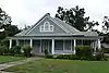 Rabensburg House |
December 22, 1978 (#78003348) |
707 Pecan St. 30°06′30″N 97°19′02″W |
Bastrop | |
| 89 | Mrs. William R. Reding House | 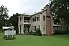 Mrs. William R. Reding House |
December 22, 1978 (#78003340) |
901 Pecan St. 30°06′35″N 97°19′02″W |
Bastrop | |
| 90 | Gov. Joseph Sayers House | 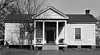 Gov. Joseph Sayers House |
December 22, 1978 (#78003297) |
1703 Wilson St. 30°07′04″N 97°19′20″W |
Bastrop | Recorded Texas Historic Landmark |
| 91 | W. F. Schaeffer House | 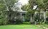 W. F. Schaeffer House |
December 22, 1978 (#78003324) |
608 Pecan St. 30°06′26″N 97°19′04″W |
Bastrop | |
| 92 | Smithville Commercial Historic District | 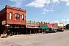 Smithville Commercial Historic District |
June 17, 1982 (#82004489) |
2nd, 3rd, and Main Sts. 30°00′28″N 97°09′35″W |
Smithville | 36 buildings |
| 93 | Smithville Residential Historic District |  Smithville Residential Historic District |
November 29, 1995 (#95001395) |
Roughly bounded by Cleveland, First, Mills, N. 9th, Burleson, Colorado, and the Colorado R. 30°00′33″N 97°09′23″W |
Smithville | Includes Recorded Texas Historic Landmarks; 191 buildings |
| 94 | Richard Starcke House |  Richard Starcke House |
December 22, 1978 (#78003315) |
710 Water St. 30°06′30″N 97°19′08″W |
Bastrop | |
| 95 | Richard Starcke House |  Richard Starcke House |
December 22, 1978 (#78003328) |
703 Main St. 30°06′28″N 97°19′10″W |
Bastrop | |
| 96 | Campbell Taylor and Greenleaf Fisk House |  Campbell Taylor and Greenleaf Fisk House |
December 22, 1978 (#78003353) |
1005 Hill St. 30°06′41″N 97°18′54″W |
Bastrop | Recorded Texas Historic Landmark |
| 97 | Waugh House |  Waugh House |
December 22, 1978 (#78003313) |
1801 Main St. 30°07′09″N 97°19′12″W |
Bastrop | |
| 98 | White House |  White House |
December 22, 1978 (#78003265) |
1307 Main St. 30°06′52″N 97°19′11″W |
Bastrop | Recorded Texas Historic Landmark |
| 99 | Wilke House |  Wilke House |
December 22, 1978 (#78003341) |
807 Pecan St. 30°06′33″N 97°19′02″W |
Bastrop | |
| 100 | Minnie Wilkes House |  Minnie Wilkes House |
December 22, 1978 (#78003352) |
1101 Hill St. 30°06′43″N 97°18′53″W |
Bastrop |
Blanco County
| [2] | Name on the Register | Image | Date listed[4] | Location | City or town | Description |
|---|---|---|---|---|---|---|
| 1 | Blanco Historic District | Blanco Historic District |
July 16, 1991 (#91000890) |
Roughly bounded by Fifth St., Live Oak St., Town Cr. and rear property lines W of Main St. 30°05′52″N 98°25′20″W |
Blanco | Includes State Antiquities Landmark, Recorded Texas Historic Landmarks |
| 2 | Adrian Edwards Conn House |  Adrian Edwards Conn House |
November 19, 1971 (#71000921) |
Jct. of U.S. 281 and SW boundary of courthouse square 30°05′49″N 98°25′22″W |
Blanco | Part of Blanco Historic District; Recorded Texas Historic Landmark |
| 3 | Lyndon B. Johnson National Historical Park |  Lyndon B. Johnson National Historical Park |
December 2, 1969 (#69000202) |
Lyndon B. Johnson National Historical Park 30°16′31″N 98°24′37″W |
Johnson City | Extends into Gillespie County; includes Recorded Texas Historic Landmark |
| 4 | Round Mountain Stage-Coach Inn and Stable | .jpg.webp) Round Mountain Stage-Coach Inn and Stable |
March 31, 1978 (#78002896) |
RM 962 off U.S. 281 30°25′41″N 98°20′23″W |
Round Mountain |
Burnet County
| [2] | Name on the Register | Image | Date listed[4] | Location | City or town | Description |
|---|---|---|---|---|---|---|
| 1 | Austin and Northwestern Railroad Historic District-Fairland to Llano |  Austin and Northwestern Railroad Historic District-Fairland to Llano |
October 6, 1997 (#97001161) |
Roughly along RR tracks from Fairland to Llano 30°38′52″N 98°17′44″W |
Kingsland | Extends into Llano County |
| 2 | Briggs State Bank |  Briggs State Bank |
August 11, 2000 (#00000885) |
176 S. Loop 308 (approx. 0.5 mi. N of jct. with US 183) 30°53′17″N 97°55′28″W |
Briggs | Recorded Texas Historic Landmark |
| 3 | Burnet County Courthouse | %252C_Burnet%252C_TX.jpg.webp) Burnet County Courthouse |
November 15, 2000 (#00001384) |
220 S. Pierce St. 30°45′25″N 98°13′37″W |
Burnet | |
| 4 | Krause Spring Site | 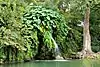 Krause Spring Site |
November 15, 1978 (#78002901) |
Address restricted[5] |
Spicewood | |
| 5 | Louis Page Archeological Site |  Louis Page Archeological Site |
March 30, 1978 (#78002900) |
Address restricted[5] |
Marble Falls | |
| 6 | Park Road 4 Historic District | 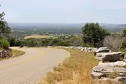 Park Road 4 Historic District |
February 7, 2011 (#10001221) |
Park Road 4 from US 281 to TX 29 & Longhorn Cavern State Park 30°42′18″N 98°20′09″W |
Burnet vicinity | Includes Recorded Texas Historic Landmark |
| 7 | Roper Hotel | 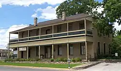 Roper Hotel |
January 8, 1980 (#80004083) |
707 3rd St. 30°34′16″N 98°16′31″W |
Marble Falls | Recorded Texas Historic Landmark |
| 8 | State Highway 29 Bridge at the Colorado River |  State Highway 29 Bridge at the Colorado River |
October 10, 1996 (#96001116) |
TX 29 at the Llano County line 30°44′53″N 98°23′54″W |
Buchanan Dam | Extends into Llano County |
Caldwell County
| [2] | Name on the Register | Image | Date listed[4] | Location | City or town | Description |
|---|---|---|---|---|---|---|
| 1 | Caldwell County Courthouse Historic District | 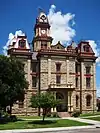 Caldwell County Courthouse Historic District |
January 3, 1978 (#78002902) |
Courthouse Sq. and environs 29°53′03″N 97°40′18″W |
Lockhart | Includes State Antiquities Landmark, several Recorded Texas Historic Landmarks |
| 2 | Emmanuel Episcopal Church |  Emmanuel Episcopal Church |
June 5, 1974 (#74002065) |
SE corner of N. Church and Walnut Sts. 29°53′07″N 97°40′24″W |
Lockhart | Recorded Texas Historic Landmark; part of the Caldwell County Courthouse Historic District |
| 3 | Lockhart Vocational High School |  Lockhart Vocational High School |
November 19, 1998 (#98001416) |
1104 E. Market St. 29°53′09″N 97°39′47″W |
Lockhart | Recorded Texas Historic Landmark |
| 4 | Martindale Central Historic District |  Martindale Central Historic District |
August 13, 2021 (#100006859) |
Roughly bounded by Farm-to-Market Rd. 1979, San Marcos R., Madison Ln., and Crockett St. 29°50′27″N 97°50′41″W |
Martindale | |
| 5 | State Highway 3-A Bridge at Plum Creek |  State Highway 3-A Bridge at Plum Creek |
October 10, 1996 (#96001107) |
US 90-US 183, .5 mi. W of jct. with I-10 29°39′19″N 97°36′03″W |
Luling | |
| 6 | M. A. Withers House |  M. A. Withers House |
August 27, 1976 (#76002013) |
W of Lockhart on Borchert Loop Rd. 29°52′15″N 97°43′37″W |
Lockhart |
Fayette County
| [2] | Name on the Register | Image | Date listed[4] | Location | City or town | Description |
|---|---|---|---|---|---|---|
| 1 | Bedstead Truss Bridge |  Bedstead Truss Bridge |
November 29, 2013 (#13000888) |
0.1 mi. NW. of jct. of Hillje & Kallus Sts. 29°40′27″N 96°54′39″W |
Schulenburg | State Antiquities Landmark, Recorded Texas Historic Landmark; formerly the Mulberry Creek Bridge, originally listed on the National Register in 1975 (listing number 75001976), removed in May 2013 due to relocation. |
| 2 | Bethlehem Lutheran Church | .jpg.webp) Bethlehem Lutheran Church |
August 10, 1978 (#78002928) |
White St. 30°03′46″N 96°41′58″W |
Round Top | Recorded Texas Historic Landmark |
| 3 | Cummins Creek Bridge | 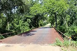 Cummins Creek Bridge |
April 21, 1975 (#75001975) |
2 mi (3.2 km). NW of Round Top over Cummins Creek 30°04′07″N 96°43′09″W |
Round Top | State Antiquities Landmark; replaced in 1996 |
| 4 | Dubina Historic District | 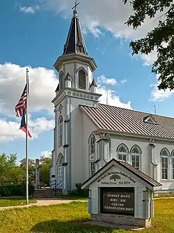 Dubina Historic District |
September 27, 2003 (#03000970) |
Roughly bounded by FM 1383 and Cty Rd. 480 29°43′44″N 96°50′08″W |
Dubina | |
| 5 | East Navidad River Bridge |  East Navidad River Bridge |
August 18, 2014 (#14000497) |
FM 1579 at East Navidad River 29°40′59″N 96°50′47″W |
Schulenburg | |
| 6 | Nathaniel W. Faison House |  Nathaniel W. Faison House |
March 11, 2010 (#08000538) |
822 S. Jefferson 29°53′57″N 96°52′22″W |
La Grange | Recorded Texas Historic Landmark |
| 7 | Fayette County Courthouse and Jail | .jpg.webp) Fayette County Courthouse and Jail |
January 23, 1975 (#75001973) |
Courthouse Sq. and 104 Main St. 29°54′19″N 96°52′43″W |
La Grange | State Antiquities Landmark, includes Recorded Texas Historic Landmark; part of Fayette County Courthouse Square Historic District |
| 8 | Fayette County Courthouse Square Historic District | Fayette County Courthouse Square Historic District |
January 16, 2001 (#00001664) |
Roughly bounded by Main, Lafayette, Franklin, Colorado, Jefferson, Washington, and Crockett Sts. 29°54′17″N 96°52′39″W |
La Grange | Includes Recorded Texas Historic Landmarks |
| 9 | Fayetteville Historic District | .jpg.webp) Fayetteville Historic District |
July 10, 2008 (#08000657) |
Roughly bounded by E. Bell, N. Thompson (FM 1291), E. Fayette, E. Main (SH 159), Post Oak Lane, 29°54′26″N 96°40′26″W |
Fayetteville | Includes Recorded Texas Historic Landmarks |
| 10 | Flatonia Historic District | Flatonia Historic District |
June 26, 2017 (#100001223) |
Roughly bounded by N. Main, 7th, Middle, Market, 6th, Penn, S. Main & Faires Sts. 29°41′15″N 97°06′31″W |
Flatonia | Includes Recorded Texas Historic Landmarks |
| 11 | Mier Expedition and Dawson's Men Monument and Tomb | 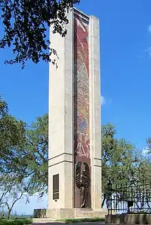 Mier Expedition and Dawson's Men Monument and Tomb |
March 6, 2019 (#100003486) |
414 TX Loop 92, Monument Hill and Kreische Brewery State Historic Sites. 29°53′20″N 96°52′37″W |
La Grange | State Historic Site, State Antiquities Landmark |
| 12 | Henry L. Kreische Brewery and House | 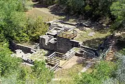 Henry L. Kreische Brewery and House |
April 16, 1975 (#75001974) |
S of La Grange off U.S. 77 on Monument Hill 29°53′23″N 96°52′29″W |
La Grange | State Historic Site, State Antiquities Landmark |
| 13 | Nativity of Mary, Blessed Virgin Catholic Church | 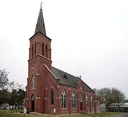 Nativity of Mary, Blessed Virgin Catholic Church |
June 21, 1983 (#83003136) |
FM 2672 29°43′03″N 96°55′40″W |
High Hill | |
| 14 | William Neese Sr. Homestead | .jpg.webp) William Neese Sr. Homestead |
February 18, 1975 (#75001977) |
On TX 237 30°01′06″N 96°43′54″W |
Warrenton | |
| 15 | Sengelmann Hall and City Meat Market Building | .jpg.webp) Sengelmann Hall and City Meat Market Building |
June 18, 2009 (#09000451) |
527 and 529-533 N. Main St. 29°40′47″N 96°54′19″W |
Schulenburg | |
| 16 | Simon Pytlovany House | April 14, 1975 (#75001972) |
1.5 mi (2.4 km). S of Dubina on FR 1383 29°42′45″N 96°50′20″W |
Dubina | ||
| 17 | Schulenburg Cotton Compress | 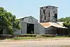 Schulenburg Cotton Compress |
September 13, 1979 (#79002938) |
James and Main Sts. 29°40′43″N 96°54′45″W |
Schulenburg | |
| 18 | St. James Episcopal Church | 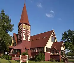 St. James Episcopal Church |
June 18, 1976 (#76002026) |
Monroe and Colorado Sts. 29°54′29″N 96°52′25″W |
La Grange | Recorded Texas Historic Landmark |
| 19 | St. John the Baptist Catholic Church | 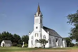 St. John the Baptist Catholic Church |
June 21, 1983 (#83003137) |
FM 1383 29°47′14″N 96°51′32″W |
Ammannsville | |
| 20 | St. Mary's Church of the Assumption |  St. Mary's Church of the Assumption |
June 21, 1983 (#83003138) |
FM 1295 29°40′11″N 97°04′00″W |
Praha | |
| 21 | State Highway 71 Bridge at the Colorado River |  State Highway 71 Bridge at the Colorado River |
October 10, 1996 (#96001120) |
TX 71, .8 mi E of jct. with FM 609 29°54′05″N 96°53′12″W |
La Grange | |
| 22 | Winedale Inn Complex | 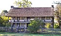 Winedale Inn Complex |
June 22, 1970 (#70000745) |
Off FM 1457 30°05′11″N 96°38′29″W |
Winedale | State Antiquities Landmark, includes Recorded Texas Historic Landmark; now a division of The Center for American History, The University of Texas at Austin |
| 23 | Zapp Building | .jpg.webp) Zapp Building |
June 23, 1983 (#83003139) |
Fayette and Washington Sts. 29°54′15″N 96°40′37″W |
Fayetteville | Recorded Texas Historic Landmark; part of Fayetteville Historic District; brick two-story Romanesque Revival mercantile building and emporium constructed in 1900. |
Hays County
| [2] | Name on the Register[3] | Image | Date listed[4] | Location | City or town | Description |
|---|---|---|---|---|---|---|
| 1 | Barber House |  Barber House |
August 26, 1983 (#83004489) |
1000 Burleson St. 29°52′45″N 97°57′13″W |
San Marcos | Historic Resources of San Marcos MRA |
| 2 | Belger-Cahill Lime Kiln | 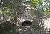 Belger-Cahill Lime Kiln |
August 26, 1983 (#83004490) |
Lime Kiln Rd. 29°53′59″N 97°55′35″W |
San Marcos | Historic Resources of San Marcos MRA |
| 3 | Belvin Street Historic District |  Belvin Street Historic District |
December 1, 1983 (#83003792) |
700, 800, 900 blocks of Belvin St., and 227 Mitchell St. 29°52′44″N 97°57′03″W |
San Marcos | Includes Recorded Texas Historic Landmarks; Historic Resources of San Marcos MRA |
| 4 | Bunton Branch Bridge |  Bunton Branch Bridge |
February 19, 2002 (#02000086) |
Cty. Rd. 210, approx. 0.2 mi (0.32 km). NW of jct. with IH-35 at Bunton Overpass 30°01′05″N 97°51′31″W |
Kyle | State Antiquities Landmark, Recorded Texas Historic Landmark |
| 5 | Burleson-Knispel House | August 3, 1979 (#79002975) |
1.5 mi (2.4 km). N of San Marcos on Lime Kiln Rd 29°54′43″N 97°55′43″W |
San Marcos | Recorded Texas Historic Landmark | |
| 6 | Caldwell House |  Caldwell House |
August 26, 1983 (#83004491) |
619 Maury St. 29°53′00″N 97°57′05″W |
San Marcos | Historic Resources of San Marcos MRA |
| 7 | Camp Ben McCulloch |  Camp Ben McCulloch |
October 12, 2004 (#04001151) |
18301 Ranch Rd. 1826 30°07′45″N 98°00′52″W |
Driftwood | |
| 8 | Cape House |  Cape House |
August 26, 1983 (#83004492) |
316 W. Hopkins St. 29°52′59″N 97°56′40″W |
San Marcos | Recorded Texas Historic Landmark; Historic Resources of San Marcos MRA |
| 9 | Cemetery Chapel, San Marcos Cemetery |  Cemetery Chapel, San Marcos Cemetery |
December 1, 1983 (#83003793) |
TX 12 29°53′12″N 97°57′27″W |
San Marcos | Recorded Texas Historic Landmark; Historic Resources of San Marcos MRA |
| 10 | Cen-Tex Wool Mill Historic District |  Cen-Tex Wool Mill Historic District |
June 1, 2005 (#05000520) |
101 Uhland Rd. 29°54′02″N 97°54′59″W |
San Marcos | |
| 11 | Cock House |  Cock House |
April 2, 1973 (#73001966) |
400 E. Hopkins St. 29°53′00″N 97°56′14″W |
San Marcos | State Antiquities Landmark, Recorded Texas Historic Landmark |
| 12 | John R. Dobie House |  John R. Dobie House |
August 18, 1992 (#92001024) |
282 Old Kyle Rd. 29°59′48″N 98°05′34″W |
Wimberley | Recorded Texas Historic Landmark |
| 13 | Cora Jackman Donalson House |  Cora Jackman Donalson House |
October 28, 2010 (#10000864) |
200 S. Sledge St. 29°59′18″N 97°52′47″W |
Kyle | Recorded Texas Historic Landmark; Rural Properties of Hays County, Texas MPS |
| 14 | Downtown Buda Historic District |  Downtown Buda Historic District |
November 7, 2003 (#03001126) |
Roughly bounded by Elm St., Main St., China St., and Austin St. 30°04′54″N 97°50′36″W |
Buda | |
| 15 | Dripping Springs Downtown Historic District |  Dripping Springs Downtown Historic District |
July 17, 2013 (#13000504) |
100-500 blk. Mercer, 100 blk. Wallace, 100 blk. San Marcos & 101 College Sts., 101-103 Old Fitzhugh Rd. 30°11′34″N 98°05′21″W |
Dripping Springs | Includes Recorded Texas Historic Landmarks |
| 16 | Episcopalian Rectory |  Episcopalian Rectory |
August 26, 1983 (#83004493) |
225 W. Hopkins St. 29°52′57″N 97°56′37″W |
San Marcos | Historic Resources of San Marcos MRA |
| 17 | Farmers Union Gin Company | 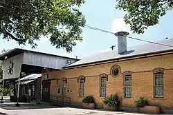 Farmers Union Gin Company |
August 26, 1983 (#83004494) |
120 Grove St. 29°52′33″N 97°56′25″W |
San Marcos | Recorded Texas Historic Landmark; Historic Resources of San Marcos MRA |
| 18 | Fire Station and City Hall | 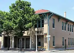 Fire Station and City Hall |
August 26, 1983 (#83004495) |
224 N. Guadalupe St. 29°53′02″N 97°56′28″W |
San Marcos | Historic Resources of San Marcos MRA |
| 19 | First United Methodist Church | 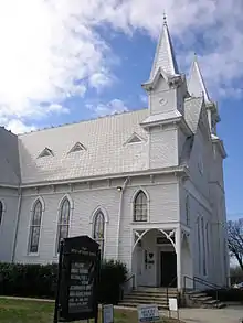 First United Methodist Church |
November 8, 1974 (#74002269) |
129 W. Hutchison 29°53′02″N 97°56′34″W |
San Marcos | Recorded Texas Historic Landmark |
| 20 | Fisher Hall | August 26, 1983 (#83004496) |
1132 Belvin St. 29°52′35″N 97°57′16″W |
San Marcos | Recorded Texas Historic Landmark; Historic Resources of San Marcos MRA; destroyed by fire in 2007[6] | |
| 21 | Fort Street Presbyterian Church | 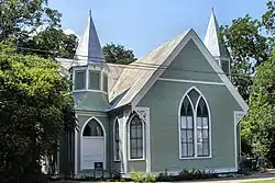 Fort Street Presbyterian Church |
March 23, 1984 (#84001860) |
516 W. Hopkins St. 29°52′55″N 97°56′48″W |
San Marcos | Recorded Texas Historic Landmark; Historic Resources of San Marcos MRA |
| 22 | Four Winns Ranch | May 29, 2018 (#100002472) |
234 & 236 Winn Valley Dr. 29°58′16″N 98°06′29″W |
Wimberley | ||
| 23 | Harry Freeman Site | Harry Freeman Site |
November 7, 1978 (#78002953) |
Address restricted[5] |
San Marcos | |
| 24 | Goforth-Harris House |  Goforth-Harris House |
August 26, 1983 (#83004497) |
401 Comanche St. 29°53′06″N 97°56′40″W |
San Marcos | Recorded Texas Historic Landmark; Historic Resources of San Marcos MRA |
| 25 | Isham Jones Good Homestead |  Isham Jones Good Homestead |
August 20, 2004 (#04000896) |
13401 Evergreen Way 30°10′09″N 97°57′43″W |
Austin | |
| 26 | Green and Faris Buildings |  Green and Faris Buildings |
August 26, 1983 (#83004498) |
136-144 E. San Antonio St. 29°52′56″N 97°56′25″W |
San Marcos | Historic Resources of San Marcos MRA; part of Hays County Courthouse Historic District |
| 27 | Hardy-Williams Building |  Hardy-Williams Building |
August 26, 1983 (#83004499) |
127 E. Hopkins St. 29°53′00″N 97°56′27″W |
San Marcos | Historic Resources of San Marcos MRA; part of Hays County Courthouse Historic District |
| 28 | Hays County Courthouse | %252C_San_Marcos%252C_TX.jpg.webp) Hays County Courthouse |
May 23, 1980 (#80004134) |
Public Sq. 29°52′56″N 97°56′25″W |
San Marcos | State Antiquities Landmark; part of Hays County Courthouse Historic District |
| 29 | Hays County Courthouse Historic District |  Hays County Courthouse Historic District |
September 10, 1992 (#92001233) |
Roughly bounded by the alleys behind N. Guadalupe, E. Hopkins, N. LBJ and E. San Antonio Sts. 29°52′57″N 97°56′25″W |
San Marcos | Historic Resources of San Marcos MRA |
| 30 | Hays County Jail | 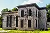 Hays County Jail |
August 26, 1983 (#83004500) |
170 S Fredericksburg St. 29°52′50″N 97°56′33″W |
San Marcos | State Antiquities Landmark; Historic Resources of San Marcos MRA |
| 31 | Heard House |  Heard House |
August 26, 1983 (#83004501) |
620 W. San Antonio St. 29°52′46″N 97°56′48″W |
San Marcos | Recorded Texas Historic Landmark; Historic Resources of San Marcos MRA |
| 32 | Augusta Hofheinz House |  Augusta Hofheinz House |
August 26, 1983 (#83004502) |
1104 W. Hopkins St. 29°52′35″N 97°57′10″W |
San Marcos | Recorded Texas Historic Landmark; Historic Resources of San Marcos MRA |
| 33 | Walter Hofheinz House |  Walter Hofheinz House |
December 1, 1983 (#83003794) |
819 W. Hopkins St. 29°52′42″N 97°57′00″W |
San Marcos | Historic Resources of San Marcos MRA |
| 34 | Hutchison House |  Hutchison House |
August 26, 1983 (#83004503) |
LBJ Dr. and University St. 29°53′08″N 97°56′25″W |
San Marcos | Recorded Texas Historic Landmark; Historic Resources of San Marcos MRA |
| 35 | Johnson House |  Johnson House |
August 26, 1983 (#83004504) |
1030 Belvin St. 29°52′37″N 97°57′12″W |
San Marcos | Recorded Texas Historic Landmark; Historic Resources of San Marcos MRA |
| 36 | Kone-Cliett House |  Kone-Cliett House |
December 1, 1983 (#83003795) |
724 Burleson St. 29°52′52″N 97°57′05″W |
San Marcos | Recorded Texas Historic Landmark; Historic Resources of San Marcos MRA |
| 37 | Kyle City Hall |  Kyle City Hall |
May 22, 2002 (#02000528) |
109 Burleson Rd. 29°59′18″N 97°52′37″W |
Kyle | State Antiquities Landmark; Rural Properties of Hays County, Texas MPS |
| 38 | Claiborne Kyle Log House |  Claiborne Kyle Log House |
May 28, 1981 (#81000630) |
SW of Kyle 29°57′55″N 97°54′08″W |
Kyle vicinity | State Antiquities Landmark, Recorded Texas Historic Landmark |
| 39 | James C. Lane House |  James C. Lane House |
November 29, 2010 (#10000961) |
306 Wimberley Square 29°59′43″N 98°05′51″W |
Wimberley | Recorded Texas Historic Landmark; Rural Properties of Hays County, Texas MPS |
| 40 | Main Building, Southwest Texas Normal School | .jpg.webp) Main Building, Southwest Texas Normal School |
August 26, 1983 (#83004505) |
Old Main St., Texas State University 29°53′21″N 97°56′19″W |
San Marcos | State Antiquities Landmark, Recorded Texas Historic Landmark; Historic Resources of San Marcos MRA; 1903 Victorian Gothic building designed by Edward Northcraft; first building of the Southwest Texas State Normal School (now known as Texas State University)[7] |
| 41 | McKie-Bass Building |  McKie-Bass Building |
December 1, 1983 (#83003797) |
111 N. Guadalupe St. 29°52′57″N 97°56′29″W |
San Marcos | Historic Resources of San Marcos MRA; part of Hays County Courthouse Historic District |
| 42 | M.G. Michaelis Ranch |  M.G. Michaelis Ranch |
March 7, 2003 (#02001212) |
3600 FM 150 West 30°01′42″N 97°55′24″W |
Kyle | Rural Properties of Hays County, Texas MPS |
| 43 | Moore Grocery Company |  Moore Grocery Company |
August 26, 1983 (#83004506) |
101 S. Edward Gary St. 29°52′56″N 97°56′18″W |
San Marcos | Historic Resources of San Marcos MRA |
| 44 | Ruskin C. Norman Site (41 HY 86) | Ruskin C. Norman Site (41 HY 86) |
November 21, 1978 (#78002954) |
Address restricted[5] |
San Marcos | |
| 45 | Onion Creek Post Office and Stagecoach House |  Onion Creek Post Office and Stagecoach House |
October 27, 2002 (#02001211) |
109 N. Loop 4 30°05′23″N 97°50′13″W |
Buda | State Antiquities Landmark, Recorded Texas Historic Landmark; Rural Properties of Hays County, Texas MPS |
| 46 | Pettey House |  Pettey House |
June 20, 2008 (#08000541) |
714 Burleson St. 29°52′53″N 97°57′03″W |
San Marcos | Historic Resources of San Marcos MRA |
| 47 | Katherine Anne Porter House |  Katherine Anne Porter House |
August 20, 2004 (#04000893) |
508 W. Center St. 29°59′22″N 97°52′49″W |
Kyle | Rural Properties of Hays County, Texas MPS |
| 48 | Dr. Joseph M. and Sarah Pound Farmstead |  Dr. Joseph M. and Sarah Pound Farmstead |
July 28, 1995 (#95000929) |
Ranch Rd. 12 N. 30°12′02″N 98°04′50″W |
Dripping Springs | |
| 49 | Ragsdale-Jackman-Yarbough House |  Ragsdale-Jackman-Yarbough House |
August 26, 1983 (#83004507) |
621 W. San Antonio St. 29°52′45″N 97°56′47″W |
San Marcos | Recorded Texas Historic Landmark; Historic Resources of San Marcos MRA |
| 50 | Rylander-Kyle House |  Rylander-Kyle House |
August 26, 1983 (#83004508) |
711 W. San Antonio St. 29°52′43″N 97°56′49″W |
San Marcos | Recorded Texas Historic Landmark; Historic Resources of San Marcos MRA |
| 51 | San Marcos Milling Company |  San Marcos Milling Company |
December 1, 1983 (#83003799) |
Nicola Alley 29°52′33″N 97°56′18″W |
San Marcos | Historic Resources of San Marcos MRA |
| 52 | San Marcos Telephone Company |  San Marcos Telephone Company |
August 26, 1983 (#83004509) |
138 W. San Antonio St. 29°52′56″N 97°56′32″W |
San Marcos | Historic Resources of San Marcos MRA. Demolished in 2019.[8] |
| 53 | Simon Building |  Simon Building |
August 26, 1983 (#83004510) |
124-126 W. Hopkins St. 29°52′59″N 97°56′32″W |
San Marcos | Historic Resources of San Marcos MRA |
| 54 | Smith House |  Smith House |
August 26, 1983 (#83004511) |
322 Scott St. 29°52′53″N 97°56′59″W |
San Marcos | Historic Resources of San Marcos MRA |
| 55 | Williams-Tarbutton House |  Williams-Tarbutton House |
August 26, 1983 (#83004512) |
626 Lindsey St. 29°52′57″N 97°57′04″W |
San Marcos | Historic Resources of San Marcos MRA |
| 56 | Winters-Wimberley House |  Winters-Wimberley House |
May 22, 2002 (#02000527) |
14070 Ranch Road 12 29°59′53″N 98°05′54″W |
Wimberley | Rural Properties of Hays County, Texas MPS |
Lee County
| [2] | Name on the Register | Image | Date listed[4] | Location | City or town | Description |
|---|---|---|---|---|---|---|
| 1 | Droemer Brickyard Site |  Droemer Brickyard Site |
November 7, 1979 (#79002991) |
1 mi (1.6 km). SW of Giddings on Old Serbin Rd 30°10′21″N 96°57′07″W |
Giddings | Kiln and other structures of local brick making business from 1924 to 1940 |
| 2 | Lee County Courthouse | 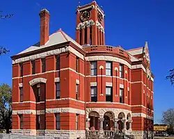 Lee County Courthouse |
May 30, 1975 (#75001998) |
Bounded by Hempstead, Grimes, E. Richmond, and Main Sts. 30°10′53″N 96°56′14″W |
Giddings | State Antiquities Landmark, Recorded Texas Historic Landmark; designed in 1898 by J. Riely Gordon in Richardsonian Romanesque style |
| 3 | Schubert House | 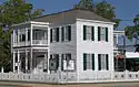 Schubert House |
August 25, 1970 (#70000753) |
183 Hempstead St. 30°10′55″N 96°56′12″W |
Giddings | Recorded Texas Historic Landmark; two-story late Greek Revival house built about 1879; also known as the Fletcher House and now the Lee County Heritage Center |
Llano County
| [2] | Name on the Register | Image | Date listed[4] | Location | City or town | Description |
|---|---|---|---|---|---|---|
| 1 | Austin and Northwestern Railroad Historic District-Fairland to Llano | Austin and Northwestern Railroad Historic District-Fairland to Llano |
October 6, 1997 (#97001161) |
Roughly along RR tracks from Fairland to Llano 30°39′38″N 98°26′12″W |
Kingsland | Includes Recorded Texas Historic Landmark; extends into Burnet County |
| 2 | Badu Building | 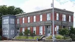 Badu Building |
June 6, 1980 (#80004139) |
601 Bessemer Ave. 30°45′24″N 98°40′34″W |
Llano | Recorded Texas Historic Landmark |
| 3 | Enchanted Rock Archeological District | 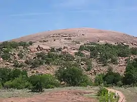 Enchanted Rock Archeological District |
August 29, 1984 (#84001740) |
Off Ranch Rd 965 at the Llano-Gillespie County Line 30°30′16″N 98°49′05″W |
Fredericksburg | National Natural Landmark; extends into Gillespie County |
| 4 | Llano County Courthouse and Jail | 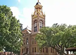 Llano County Courthouse and Jail |
December 2, 1977 (#77001459) |
Public Sq., Oatman and Haynie Sts. 30°44′59″N 98°40′35″W |
Llano | Contains Recorded Texas Historic Landmarks including one State Antiquities Landmark; the courthouse is within the Llano County Courthouse Historic District |
| 5 | Llano County Courthouse Historic District | 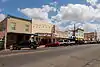 Llano County Courthouse Historic District |
February 10, 1989 (#88002542) |
Roughly bounded by the Llano River, Ford St., Sandstone St., and Berry St. 30°45′05″N 98°40′34″W |
Llano | Contains Recorded Texas Historic Landmarks including one State Antiquities Landmark |
| 6 | Southern Hotel | 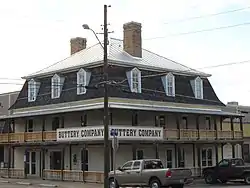 Southern Hotel |
October 10, 1979 (#79002992) |
201 W. Main St 30°45′01″N 98°40′38″W |
Llano | Recorded Texas Historic Landmark |
| 7 | State Highway 29 Bridge at the Colorado River | State Highway 29 Bridge at the Colorado River |
October 10, 1996 (#96001116) |
TX 29 at the Llano County line 30°44′53″N 98°23′54″W |
Buchanan Dam | Extends into Burnet County |
Williamson County
| [2] | Name on the Register | Image | Date listed[4] | Location | City or town | Description |
|---|---|---|---|---|---|---|
| 1 | Martin C. Amos House |  Martin C. Amos House |
April 29, 1986 (#86000989) |
1408 Olive 30°37′53″N 97°40′01″W |
Georgetown | Recorded Texas Historic Landmark; part of Olive Street Historic District; Historic Resources of Georgetown MRA |
| 2 | Arnold-Torbet House | 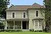 Arnold-Torbet House |
April 29, 1986 (#86000990) |
908 Pine 30°38′07″N 97°40′13″W |
Georgetown | Historic Resources of Georgetown MRA |
| 3 | Atkinson House | .jpg.webp) Atkinson House |
April 29, 1986 (#86000992) |
911 Walnut 30°38′08″N 97°40′13″W |
Georgetown | Recorded Texas Historic Landmark; Historic Resources of Georgetown MRA |
| 4 | Bartlett Commercial Historic District | 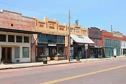 Bartlett Commercial Historic District |
September 30, 1980 (#80004076) |
E. Clark St. 30°47′42″N 97°25′37″W |
Bartlett | Extends into Bell County |
| 5 | Belford Historic District | 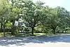 Belford Historic District |
April 29, 1986 (#86000991) |
Roughly bounded by University Ave., Main, E. Eighteenth, and Austin 30°37′48″N 97°40′39″W |
Georgetown | Includes Recorded Texas Historic Landmarks; Historic Resources of Georgetown MRA |
| 6 | Bowlen House | January 14, 1986 (#86000180) |
1405 Forest 30°37′53″N 97°40′44″W |
Georgetown | Historic Resources of Georgetown MRA; house no longer present | |
| 7 | Bryson Stage Coach Stop | 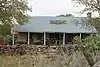 Bryson Stage Coach Stop |
December 1, 1978 (#78003000) |
Northwest of Liberty Hill on TX 29 30°40′40″N 97°56′37″W |
Liberty Hill | Recorded Texas Historic Landmark |
| 8 | Burcham House |  Burcham House |
April 29, 1986 (#86000993) |
1310 College 30°37′54″N 97°40′19″W |
Georgetown | Recorded Texas Historic Landmark; Historic Resources of Georgetown MRA |
| 9 | Casey House | .jpg.webp) Casey House |
January 14, 1986 (#86000184) |
705 E. Third 30°38′27″N 97°40′12″W |
Georgetown | Historic Resources of Georgetown MRA |
| 10 | Caswell House |  Caswell House |
April 29, 1986 (#86000994) |
207 E. Ninth 30°38′09″N 97°40′31″W |
Georgetown | Historic Resources of Georgetown MRA |
| 11 | Chesser-Morgan House |  Chesser-Morgan House |
January 14, 1986 (#86000185) |
1202 E. Fifteenth 30°37′49″N 97°39′56″W |
Georgetown | Part of Olive Street Historic District; Historic Resources of Georgetown MRA |
| 12 | Jesse and Sara Cooper House |  Jesse and Sara Cooper House |
February 16, 1996 (#96000073) |
1.8 mi (2.9 km). east of Georgetown Hwy. 29 30°38′32″N 97°38′48″W |
Georgetown | Recorded Texas Historic Landmark; Historic Resources of Georgetown MRA |
| 13 | E. M. Daughtrey House | April 29, 1986 (#86000984) |
1316 E. University 30°37′58″N 97°39′47″W |
Georgetown | Historic Resources of Georgetown MRA Moved or demolished | |
| 14 | Dr. James L. Dickey House |  Dr. James L. Dickey House |
February 21, 2017 (#100000675) |
500 Burkett Rd. 30°34′20″N 97°24′18″W |
Taylor | Destroyed by fire July 10, 2022 |
| 15 | John J. Dimmitt House |  John J. Dimmitt House |
February 16, 1996 (#96000076) |
W. University (TX 29) 0.5 mi. west of the junction with Austin Highway. 30°38′05″N 97°41′12″W |
Georgetown | Recorded Texas Historic Landmark; Historic Resources of Georgetown MRA |
| 16 | S. A. Easley House |  S. A. Easley House |
April 29, 1986 (#86000983) |
1310 Olive 30°37′55″N 97°40′02″W |
Georgetown | Recorded Texas Historic Landmark; part of Olive Street Historic District; Historic Resources of Georgetown MRA |
| 17 | First Methodist Church | 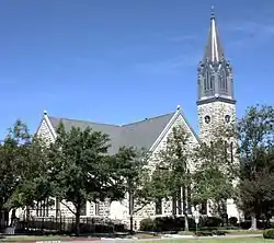 First Methodist Church |
June 17, 1986 (#86001368) |
410 E. University 30°37′58″N 97°40′23″W |
Georgetown | Recorded Texas Historic Landmark; Historic Resources of Georgetown MRA |
| 18 | D. D. Fowler House |  D. D. Fowler House |
April 29, 1986 (#86000985) |
1531 Ash 30°37′45″N 97°40′21″W |
Georgetown | Historic Resources of Georgetown MRA |
| 19 | Georgetown Light and Water Works |  Georgetown Light and Water Works |
February 16, 1996 (#96000074) |
403 W. 9th 30°38′10″N 97°40′49″W |
Georgetown | Historic Resources of Georgetown MRA |
| 20 | Harper-Chesser House |  Harper-Chesser House |
April 29, 1986 (#86000969) |
1309 College 30°37′54″N 97°40′17″W |
Georgetown | Historic Resources of Georgetown MRA |
| 21 | Moses Harrell House |  Moses Harrell House |
January 14, 1986 (#86000169) |
1001 Church 30°38′04″N 97°40′32″W |
Georgetown | Historic Resources of Georgetown MRA |
| 22 | E. M. Harris House |  E. M. Harris House |
January 14, 1986 (#86000168) |
404 E. Seventh 30°38′13″N 97°40′24″W |
Georgetown | Historic Resources of Georgetown MRA |
| 23 | A. W. Hawnen House |  A. W. Hawnen House |
April 29, 1986 (#86000967) |
1409 Olive 30°37′54″N 97°39′59″W |
Georgetown | Part of Olive Street Historic District; Historic Resources of Georgetown MRA |
| 24 | M. S. Hewitt House |  M. S. Hewitt House |
February 16, 1996 (#96000071) |
1019 S. College 30°38′01″N 97°40′24″W |
Georgetown | Historic Resources of Georgetown MRA |
| 25 | House at 214 W. University | 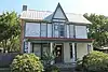 House at 214 W. University |
April 29, 1986 (#86000987) |
214 W. University 30°37′58″N 97°40′41″W |
Georgetown | Historic Resources of Georgetown MRA |
| 26 | House at 801 West | 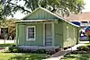 House at 801 West |
January 14, 1986 (#86000172) |
801 West 30°38′10″N 97°40′52″W |
Georgetown | Historic Resources of Georgetown MRA |
| 27 | House at 907 Pine | 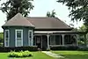 House at 907 Pine |
January 14, 1986 (#86000171) |
907 Pine 30°38′09″N 97°40′11″W |
Georgetown | Historic Resources of Georgetown MRA |
| 28 | Hutto Commercial Historic District | 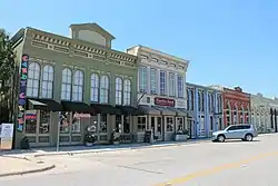 Hutto Commercial Historic District |
August 4, 2011 (#11000515) |
101-205 East St., 202 Farley St. & 204 US 79 30°32′38″N 97°31′50″W |
Hutto | |
| 29 | Dr. Robert Hyer House | .jpg.webp) Dr. Robert Hyer House |
January 14, 1986 (#86000175) |
904 Ash 30°38′07″N 97°40′23″W |
Georgetown | Historic Resources of Georgetown MRA |
| 30 | Imhoff House |  Imhoff House |
January 14, 1986 (#86000176) |
208 Austin 30°38′27″N 97°40′41″W |
Georgetown | Historic Resources of Georgetown MRA |
| 31 | Inn at Brushy Creek |  Inn at Brushy Creek |
October 15, 1970 (#70000777) |
Taylor Exit off U.S. 79, off I-35 30°30′57″N 97°41′22″W |
Round Rock | |
| 32 | George Irvine House |  George Irvine House |
April 29, 1986 (#86000973) |
409 E. University 30°38′00″N 97°40′24″W |
Georgetown | Recorded Texas Historic Landmark; Historic Resources of Georgetown MRA |
| 33 | J. J. Johnson Farm | January 14, 1986 (#86000178) |
Rabbitt Hill Rd. 30°34′59″N 97°40′18″W |
Georgetown | Historic Resources of Georgetown MRA; house no longer present | |
| 34 | Kenney's Fort Site (41WM465) |  Kenney's Fort Site (41WM465) |
April 20, 1987 (#87000565) |
Address restricted[5] |
Round Rock | |
| 35 | Lane-Riley House |  Lane-Riley House |
April 29, 1986 (#86000975) |
1302 College 30°37′55″N 97°40′19″W |
Georgetown | Recorded Texas Historic Landmark; Historic Resources of Georgetown MRA |
| 36 | Will and Mary Leake House |  Will and Mary Leake House |
April 29, 1986 (#86000976) |
313 E. Seventh 30°38′14″N 97°40′26″W |
Georgetown | Historic Resources of Georgetown MRA |
| 37 | John Leavell House |  John Leavell House |
April 29, 1986 (#86000979) |
803 College 30°38′12″N 97°40′18″W |
Georgetown | Historic Resources of Georgetown MRA |
| 38 | M. B. and Annie Lockett House |  M. B. and Annie Lockett House |
April 29, 1986 (#86000981) |
811 E. University 30°38′00″N 97°40′08″W |
Georgetown | Historic Resources of Georgetown MRA |
| 39 | Frank and Mellie Love House |  Frank and Mellie Love House |
April 29, 1986 (#86000977) |
1415 Ash 30°37′50″N 97°40′20″W |
Georgetown | Historic Resources of Georgetown MRA |
| 40 | W. K. and Kate Makemson House |  W. K. and Kate Makemson House |
January 14, 1986 (#86000190) |
1002 Ash 30°38′04″N 97°40′23″W |
Georgetown | Historic Resources of Georgetown MRA |
| 41 | McFadin House |  McFadin House |
April 9, 1980 (#80004160) |
North of Taylor 30°38′18″N 97°25′33″W |
Taylor | Recorded Texas Historic Landmark |
| 42 | McKnight-Ebb House | January 14, 1986 (#86000191) |
502 W. Eighteenth 30°37′34″N 97°40′53″W |
Georgetown | Historic Resources of Georgetown MRA Moved or demolished | |
| 43 | McMurray House |  McMurray House |
January 14, 1986 (#86000192) |
611 Church 30°38′13″N 97°40′30″W |
Georgetown | Historic Resources of Georgetown MRA |
| 44 | Capt. Nelson Merrell House |  Capt. Nelson Merrell House |
October 15, 1970 (#70000778) |
Northeast of Round Rock on U.S. 79 30°31′02″N 97°39′41″W |
Round Rock | |
| 45 | Miller-Ellyson House | 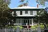 Miller-Ellyson House |
January 14, 1986 (#86000193) |
303 E. Ninth 30°38′09″N 97°40′28″W |
Georgetown | Historic Resources of Georgetown MRA |
| 46 | Old Georgetown High School | 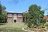 Old Georgetown High School |
January 14, 1986 (#86000195) |
507 E. University 30°38′01″N 97°40′20″W |
Georgetown | Recorded Texas Historic Landmark; Historic Resources of Georgetown MRA |
| 47 | Olive Street Historic District |  Olive Street Historic District |
August 20, 2013 (#13000615) |
Olive St. between E. University Ave. & 17th St. plus a portion of E. 15th St. 30°37′51″N 97°40′01″W |
Georgetown | Includes Recorded Texas Historic Landmarks; Historic Resources of Georgetown MRA |
| 48 | Paige-DeCrow-Weir House | 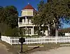 Paige-DeCrow-Weir House |
January 14, 1986 (#86000194) |
I-35 and State Route 2243 30°37′24″N 97°41′30″W |
Georgetown | Recorded Texas Historic Landmark; Historic Resources of Georgetown MRA |
| 49 | Woodson and Margaret Patrick House |  Woodson and Margaret Patrick House |
January 14, 1986 (#86000197) |
211 E. Fifth 30°38′21″N 97°40′31″W |
Georgetown | Historic Resources of Georgetown MRA |
| 50 | Pegues House |  Pegues House |
January 14, 1986 (#86000196) |
904 E. University 30°37′59″N 97°40′07″W |
Georgetown | Historic Resources of Georgetown MRA |
| 51 | Preslar-Hewitt Building |  Preslar-Hewitt Building |
May 1, 2003 (#03000331) |
321-323 N. Main 30°34′13″N 97°24′35″W |
Taylor | Recorded Texas Historic Landmark; part of Taylor Downtown Historic District |
| 52 | R. H. and Martha Price House |  R. H. and Martha Price House |
April 29, 1986 (#86000982) |
209 E. Tenth 30°38′05″N 97°40′31″W |
Georgetown | Historic Resources of Georgetown MRA |
| 53 | Railroad Produce Depot |  Railroad Produce Depot |
November 7, 1979 (#79003024) |
401 W. 6th St. 30°38′18″N 97°40′49″W |
Georgetown | State Antiquities Landmark |
| 54 | J. H. Reedy House |  J. H. Reedy House |
April 29, 1986 (#86000949) |
908 E. University 30°37′59″N 97°40′06″W |
Georgetown | Historic Resources of Georgetown MRA |
| 55 | Round Rock Commercial Historic District |  Round Rock Commercial Historic District |
June 9, 1983 (#83003170) |
100 and 200 blocks of E. Main St. 30°30′30″N 97°40′39″W |
Round Rock | Includes Recorded Texas Historic Landmarks |
| 56 | Round Rock Post Office and William M. Owen House |  Round Rock Post Office and William M. Owen House |
July 7, 1983 (#83003171) |
Chisholm Trail and Emanuel St. 30°30′55″N 97°41′24″W |
Round Rock | Recorded Texas Historic Landmark |
| 57 | Rouser House |  Rouser House |
January 14, 1986 (#86000198) |
602 Myrtle 30°38′16″N 97°40′30″W |
Georgetown | Historic Resources of Georgetown MRA |
| 58 | Saint John's Methodist Church |  Saint John's Methodist Church |
April 29, 1986 (#86000950) |
301 E University Ave 30°38′01″N 97°40′29″W |
Georgetown | Historic Resources of Georgetown MRA |
| 59 | Sansom-Schmalenbeck House | January 14, 1986 (#86000199) |
813 Church 30°38′09″N 97°40′32″W |
Georgetown | Historic Resources of Georgetown MRA Demolished or moved | |
| 60 | Saxon Motor Car Store |  Saxon Motor Car Store |
June 17, 1986 (#86001366) |
316 E. Sixth St. 30°38′17″N 97°40′27″W |
Georgetown | Historic Resources of Georgetown MRA |
| 61 | A. W. Sillure House |  A. W. Sillure House |
April 29, 1986 (#86000951) |
1414 Ash 30°37′50″N 97°40′23″W |
Georgetown | Recorded Texas Historic Landmark; Historic Resources of Georgetown MRA |
| 62 | Southwestern University Administration Building and Mood Hall | 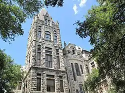 Southwestern University Administration Building and Mood Hall |
April 23, 1975 (#75002013) |
1001 E. University Ave., Southwestern University campus 30°38′00″N 97°40′01″W |
Georgetown | Recorded Texas Historic Landmark |
| 63 | Robert and Lula Stone House | 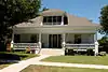 Robert and Lula Stone House |
January 14, 1986 (#86000200) |
1102 Ash 30°38′01″N 97°40′23″W |
Georgetown | Historic Resources of Georgetown MRA |
| 64 | Taylor Downtown Historic District | .jpg.webp) Taylor Downtown Historic District |
October 26, 2005 (#05001193) |
Roughly bounded by 5th, Washburn, 1st & Vance Sts. 30°34′16″N 97°24′36″W |
Taylor | Includes Recorded Texas Historic Landmarks |
| 65 | Taylor High School Campus | 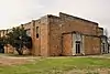 Taylor High School Campus |
May 17, 2018 (#100002437) |
410 W. 7th St. 30°34′07″N 97°24′51″W |
Taylor | |
| 66 | Taylor National Bank | 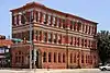 Taylor National Bank |
May 23, 1980 (#80004159) |
200 Main St. 30°34′07″N 97°24′33″W |
Taylor | Recorded Texas Historic Landmark; part of Taylor Downtown Historic District |
| 67 | Taylor-Cooper House |  Taylor-Cooper House |
January 14, 1986 (#86000203) |
105 E 5th 30°38′22″N 97°40′36″W |
Georgetown | Historic Resources of Georgetown MRA |
| 68 | Tinnen House |  Tinnen House |
August 25, 1970 (#70000776) |
1220 Austin St. 30°37′53″N 97°40′37″W |
Georgetown | Part of Belford Historic District |
| 69 | University Avenue-Elm Street Historic District |  University Avenue-Elm Street Historic District |
December 6, 1979 (#79003025) |
E. University and Elm Sts. 30°37′44″N 97°40′18″W |
Georgetown | Includes Recorded Texas Historic Landmarks |
| 70 | W. C. and Kate Vaden House |  W. C. and Kate Vaden House |
April 29, 1986 (#86000952) |
711 E. University 30°38′01″N 97°40′13″W |
Georgetown | Recorded Texas Historic Landmark; Historic Resources of Georgetown MRA |
| 71 | Wesley Chapel A.M.E Church |  Wesley Chapel A.M.E Church |
January 14, 1986 (#86000204) |
508 W. Fourth 30°38′24″N 97°40′53″W |
Georgetown | Recorded Texas Historic Landmark; Historic Resources of Georgetown MRA |
| 72 | D. K. and Inez Wilcox House |  D. K. and Inez Wilcox House |
April 29, 1986 (#86000954) |
1307 Olive 30°37′55″N 97°40′00″W |
Georgetown | Part of Olive Street Historic District; Historic Resources of Georgetown MRA |
| 73 | Wilcox-Graves House |  Wilcox-Graves House |
April 29, 1986 (#86000953) |
1403 Olive 30°37′55″N 97°39′59″W |
Georgetown | Part of Olive Street Historic District; Historic Resources of Georgetown MRA |
| 74 | Williamson County Courthouse Historic District | .jpg.webp) Williamson County Courthouse Historic District |
July 26, 1977 (#77001480) April 29, 1986 boundary increase (#86000955) |
Rock and 9th Sts., Main and 7th Sts. (includes both sides) 30°38′12″N 97°40′39″W |
Georgetown | Includes State Antiquities Landmark, Recorded Texas Historic Landmarks; Historic Resources of Georgetown MRA (boundary increase) |
| 75 | Zidell House |  Zidell House |
May 12, 2009 (#09000308) |
2015 W. Lake Dr. 30°34′33″N 97°25′53″W |
Taylor |
References
- "The Capital Region 2022 Regional Report". Texas Comptroller of Public Accounts. Retrieved April 5, 2023.
- Numbers represent an alphabetical ordering by significant words. Various colorings, defined here, differentiate National Historic Landmarks and historic districts from other NRHP buildings, structures, sites or objects.
- "National Register Information System". National Register of Historic Places. National Park Service. July 9, 2010.
- The eight-digit number below each date is the number assigned to each location in the National Register Information System database, which can be viewed by clicking the number.
- Federal and state laws and practices restrict general public access to information regarding the specific location of this resource. In some cases, this is to protect archeological sites from vandalism, while in other cases it is restricted at the request of the owner. See: Knoerl, John; Miller, Diane; Shrimpton, Rebecca H. (1990), Guidelines for Restricting Information about Historic and Prehistoric Resources, National Register Bulletin, National Park Service, U.S. Department of the Interior, OCLC 20706997.
- "Man who burned old hospital serving eight years probation | San Marcos Mercury | Local News from San Marcos and Hays County, Texas".
- "Old Main". San Marcos, Texas: Texas State University. Retrieved September 3, 2013.
- ""San Marcos is Losing History": Residents React to Building Demolition".
This article is issued from Wikipedia. The text is licensed under Creative Commons - Attribution - Sharealike. Additional terms may apply for the media files.