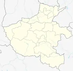
Neixiang County
Neixiang County (simplified Chinese: 内乡县; traditional Chinese: 內鄉縣; pinyin: Nèixiāng Xiàn) is a county under the jurisdiction of Nanyang City, in the southwest of Henan province, China. It has an area of 2,465 km2 (952 sq mi) and a population of 610,000 as of 2002.[3]
Neixiang County
内乡县 Neisiang, Nei-hsiang | |
|---|---|
 Neixiang Location of the seat in Henan | |
| Coordinates: 33°3′0″N 111°49′48″E | |
| Country | People's Republic of China |
| Province | Henan |
| Prefecture-level city | Nanyang |
| Area | |
| • Total | 2,465 km2 (952 sq mi) |
| Population (2019)[2] | |
| • Total | 567,100 |
| • Density | 230/km2 (600/sq mi) |
| Time zone | UTC+8 (China Standard) |
| Postal code | 474350 |
| Area code | 0377 |
| Website | www |
Neixiang is best known because it has China's best preserved Yamen, or county government office. The Yamen in Neixiang was originally built in the Yuan Dynasty and has a history of more than 700 years. It was destroyed and rebuilt several times, and the existing architecture mostly dates to the Qing Dynasty when it was built by Zhang Bingtao in 1882; it took three years to build. It has an area of 20,000 m2 (220,000 sq ft), and there are more than 260 existing rooms. It is currently China's best-preserved feudal county government office.
It is home to Neixiang Air Base.[4]
Administrative divisions
As 2012, this county is divided to 10 towns and 6 townships.[5]
- Towns
|
|
- Townships
|
|
Climate
| Climate data for Neixiang (1991–2020 normals, extremes 1981–2010) | |||||||||||||
|---|---|---|---|---|---|---|---|---|---|---|---|---|---|
| Month | Jan | Feb | Mar | Apr | May | Jun | Jul | Aug | Sep | Oct | Nov | Dec | Year |
| Record high °C (°F) | 21.5 (70.7) |
25.3 (77.5) |
29.4 (84.9) |
35.0 (95.0) |
39.0 (102.2) |
41.1 (106.0) |
40.3 (104.5) |
38.1 (100.6) |
40.0 (104.0) |
34.1 (93.4) |
30.5 (86.9) |
22.4 (72.3) |
41.1 (106.0) |
| Average high °C (°F) | 7.6 (45.7) |
11.0 (51.8) |
15.9 (60.6) |
22.4 (72.3) |
27.6 (81.7) |
31.4 (88.5) |
32.0 (89.6) |
31.1 (88.0) |
27.2 (81.0) |
22.4 (72.3) |
15.7 (60.3) |
9.8 (49.6) |
21.2 (70.1) |
| Daily mean °C (°F) | 1.9 (35.4) |
5.0 (41.0) |
10.0 (50.0) |
16.0 (60.8) |
21.3 (70.3) |
25.7 (78.3) |
27.3 (81.1) |
26.2 (79.2) |
21.8 (71.2) |
16.3 (61.3) |
9.8 (49.6) |
3.9 (39.0) |
15.4 (59.8) |
| Average low °C (°F) | −2.3 (27.9) |
0.3 (32.5) |
5.0 (41.0) |
10.5 (50.9) |
15.8 (60.4) |
20.8 (69.4) |
23.5 (74.3) |
22.6 (72.7) |
17.9 (64.2) |
12.0 (53.6) |
5.3 (41.5) |
−0.5 (31.1) |
10.9 (51.6) |
| Record low °C (°F) | −12.1 (10.2) |
−9.2 (15.4) |
−5.3 (22.5) |
0.1 (32.2) |
3.8 (38.8) |
12.9 (55.2) |
16.4 (61.5) |
14.2 (57.6) |
8.6 (47.5) |
−1.6 (29.1) |
−6.4 (20.5) |
−14.3 (6.3) |
−14.3 (6.3) |
| Average precipitation mm (inches) | 12.6 (0.50) |
14.0 (0.55) |
32.4 (1.28) |
50.1 (1.97) |
78.3 (3.08) |
89.9 (3.54) |
146.8 (5.78) |
127.4 (5.02) |
78.3 (3.08) |
57.0 (2.24) |
33.8 (1.33) |
11.6 (0.46) |
732.2 (28.83) |
| Average precipitation days (≥ 0.1 mm) | 4.8 | 5.2 | 7.1 | 8.4 | 9.2 | 9.1 | 12.0 | 11.5 | 10.3 | 9.3 | 6.8 | 4.6 | 98.3 |
| Average snowy days | 3.8 | 2.9 | 0.9 | 0 | 0 | 0 | 0 | 0 | 0 | 0 | 0.7 | 1.8 | 10.1 |
| Average relative humidity (%) | 70 | 68 | 70 | 72 | 69 | 70 | 82 | 82 | 78 | 75 | 74 | 70 | 73 |
| Mean monthly sunshine hours | 105.3 | 107.1 | 140.7 | 170.8 | 171.5 | 161.0 | 160.0 | 163.9 | 131.9 | 129.8 | 124.4 | 119.4 | 1,685.8 |
| Percent possible sunshine | 33 | 34 | 38 | 44 | 40 | 38 | 37 | 40 | 36 | 37 | 40 | 39 | 38 |
| Source: China Meteorological Administration[6][7] | |||||||||||||
Transport

References
- 最新人口信息 www.hongheiku.com (in Chinese). hongheiku. Retrieved 2021-01-12.
- 最新人口信息 www.hongheiku.com (in Chinese). hongheiku. Retrieved 2021-01-12.
- "Profile of Neixiang County" (in Chinese). Archived from the original on October 13, 2007. Retrieved 2008-06-25.
- Kristensen, Hans M.; Korda, Matt (December 10, 2020). "Chinese nuclear forces, 2020". Bulletin of the Atomic Scientists. 76 (6): 443–457. Bibcode:2020BuAtS..76f.443K. doi:10.1080/00963402.2020.1846432.
One of the first bomber units to get an operational nuclear capability might be the 106th Brigade at Neixiang air base in the south-western part of the Henan province
- 安阳市-行政区划网 www.xzqh.org (in Chinese). XZQH. Retrieved 2012-05-24.
- 中国气象数据网 – WeatherBk Data (in Simplified Chinese). China Meteorological Administration. Retrieved 12 August 2023.
- 中国气象数据网 (in Simplified Chinese). China Meteorological Administration. Retrieved 12 August 2023.