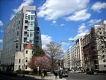
New Hampshire Avenue
New Hampshire Avenue is a diagonal street in Washington, D.C., beginning at the Kennedy Center and extending northeast for about 5 miles (8 km) and then continuing into Maryland where it is designated Maryland Route 650. New Hampshire Avenue, however, is not contiguous. It stops at 15th and W Streets NW and resumes again on the other side of Columbia Heights at Park Road NW, a few blocks from Georgia Avenue. New Hampshire Avenue passes through several Washington neighborhoods including Foggy Bottom, Dupont Circle, Petworth and Lamond-Riggs.
| New Hampshire Avenue NE New Hampshire Avenue NW | |
 | |
| Namesake | The State of New Hampshire |
|---|---|
| Maintained by | DDOT |
| Location | Washington, D.C., U.S. |
| South end | Watergate Complex |
| Major junctions | Virginia Avenue Dupont Circle Grant Circle North Capitol Street |
| North end | |
| Construction | |
| Commissioned | 1907 |
| Construction start | 1908 |
In Maryland, New Hampshire Avenue passes the neighborhoods and towns of Chillum, Takoma Park, Carole Highlands, Langley Park and Silver Spring. Eventually, it feeds into Damascus Road (Maryland Route 108) at Etchison. Many Maryland residents regard New Hampshire Avenue as a convenient access road to Washington's North Capitol Street, a wide road that starts north of the United States Capitol and divides the city into its northwest and northeast quadrants.
History
In 1907, the commissioners of the District of Columbia asked Congress to appropriate funds to extend New Hampshire Avenue northward to the Maryland state line.[1] The northern portion was proposed in 1908.[2] Rock Creek Church requested that New Hampshire Avenue not be extended in a straight line in order to be more direct to the church.[3] Thomas H. Carter of Montana[4] and Jacob Harold Gallinger of New Hampshire submitted the bill to the Senate.[5] The bill passed in late 1908.[6]
In 1911, the commissioners of the District asked Congress to appropriate funds to extend New Hampshire Avenue in a deflected direction, rather than in a straight line, from its end at Buchanan Avenue to the Maryland state line.[7] The House of Representatives passed the bill,[8][9] and the Senate also passed the bill soon thereafter.[10]
Transit service
While no single transit route follows New Hampshire Avenue for very long, it nonetheless runs in proximity of and briefly carries an assortment of transit services.
Metrobus
The following Metrobus routes run along the avenue (listed from south to north):
- H1, L1 (20th St. NW to Washington Circle)
- L2 (18th St. NW to 21st St. NW)
- 64 (Missouri Ave. to Park Rd.)
- 63 (Georgia Ave. to Park Rd.)
- H8 (Georgia Ave. to Park Rd.)
- K6 (White Oak to Fort Totten)
- K9 (Limited-stop service from the DC-Maryland Border to Mahan Rd.)
- R1 (Northbound only from Metzerott Rd. to Adelphi Rd.)
- C8 (Randolph Rd. to Adelphi Rd.)
- Z2 (Olney-Sandy Spring Rd. to Lockwood Dr.)
Ride-On
The following Ride On routes run along the avenue in Montgomery County, Maryland (listed from south to north):
- 16 (Ruatan St. to Ethan Allen Ave.)
- 20, 24 (Schindler Dr. to Northampton Dr., and Southampton Dr. to Piney Branch Rd.)
- 10 (Lockwood Dr. to Powder Mill Rd.)
- 21 (Wolf Dr. to Columbia Pike)
Metrorail
The following Metrorail stations have stops located near New Hampshire Avenue:
References
- "More Money for Street". The Washington Post. January 1, 1908. p. 14. ProQuest 144880986.
- "Would Open New Section: Extension of New Hampshire Avenue Expected from Congress". The Washington Post. May 17, 1908. p. R2. ProQuest 144858888.
- "Ask for Straight Street". The Washington Post. March 18, 1908. p. 14. ProQuest 144860240.
- "For Straight Avenue: New Hampshire Thoroughfare Bill Reported". The Washington Post. March 14, 1908. p. 4. ProQuest 144862979.
- "Senate Adds to Park". The Washington Post. March 22, 1908. p. 8. ProQuest 144850829.
- "District Bills". The Washington Post. December 16, 1908. p. 4. ProQuest 144802071.
- "Highway Bills in House". The Washington Post. May 17, 1911. p. 3. ProQuest 145109581.
- "Extends New Hampshire Avenue". The Washington Post. March 2, 1913. p. 4. ProQuest 145211379.
- "Reject Primary Bill: Senate District Committee Members Return Report". The Washington Post. March 9, 1912. p. 4. ProQuest 145127472.
- "Big Chillum Heights Sale". The Washington Post. April 14, 1912. p. 16. ProQuest 145174742.