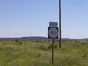
New Mexico State Road 406
State Road 406 (NM 406) is a 35.145-mile-long (56.560 km) state highway in Union County, New Mexico, United States. NM 406's southern terminus is at U.S. Route 56/64/412 near Clayton, and the northern terminus is at NM 456 near the Oklahoma border. The route stays entirely within Union County.
State Road 406 | ||||
|---|---|---|---|---|
NM 406 highlighted in red | ||||
| Route information | ||||
| Maintained by NMDOT | ||||
| Length | 35.145 mi[1] (56.560 km) | |||
| Major junctions | ||||
| South end | ||||
| North end | ||||
| Location | ||||
| Country | United States | |||
| State | New Mexico | |||
| Counties | Union | |||
| Highway system | ||||
| ||||
| ||||

Route description
SR 406 begins at an intersection with US 56, US 64, and US 412 in a concurrency. The road then heads north, passing by a few farms. At an intersection with County Route A055, the route turns right toward the Oklahoma border. The road zigzags north and east again to an intersection with SR 410, which heads east toward Wheeless, Oklahoma. At SR 410, SR 406 again turns back north and hugs the Oklahoma border. The road then winds slightly passing through a mountainous terrain. It terminates at SR 456, which heads east as Oklahoma State Highway 325 toward Kenton.[2]
Major intersections
The entire route is in Union County.
| Location | mi[3] | km | Destinations | Notes | |
|---|---|---|---|---|---|
| | 0.000 | 0.000 | Southern terminus | ||
| | 3.212 | 5.169 | Western terminus of NM 411 | ||
| | 21.489 | 34.583 | Western terminus of NM 410 | ||
| | 35.145 | 56.560 | Northern terminus | ||
| 1.000 mi = 1.609 km; 1.000 km = 0.621 mi | |||||
See also
References
- "Posted Route–Legal Description" (PDF). New Mexico Department of Transportation. March 16, 2010. p. 79. Retrieved December 17, 2013.
- Google (December 1, 2011). "SR 406" (Map). Google Maps. Google. Retrieved December 1, 2011.
- "TIMS Road Segments by Posted Route/Point with AADT Info; NM, NMX-Routes" (PDF). New Mexico Department of Transportation. April 3, 2013. p. 11. Retrieved December 17, 2013.
External links
![]() Geographic data related to New Mexico State Road 406 at OpenStreetMap
Geographic data related to New Mexico State Road 406 at OpenStreetMap
