Newington, Georgia
Newington is a town in Screven County, Georgia, United States. The population was 322 at the 2000 census.
Newington, Georgia | |
|---|---|
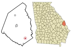 Location in Screven County and the state of Georgia | |
| Coordinates: 32°35′21″N 81°30′16″W | |
| Country | United States |
| State | Georgia |
| County | Screven |
| Area | |
| • Total | 0.81 sq mi (2.10 km2) |
| • Land | 0.81 sq mi (2.10 km2) |
| • Water | 0.00 sq mi (0.00 km2) |
| Elevation | 141 ft (43 m) |
| Population (2020) | |
| • Total | 290 |
| • Density | 357.58/sq mi (138.14/km2) |
| Time zone | UTC-5 (Eastern (EST)) |
| • Summer (DST) | UTC-4 (EDT) |
| ZIP code | 30446 |
| Area code | 912 |
| FIPS code | 13-54992[2] |
| GNIS feature ID | 0332497[3] |
| Website | www |
Geography
Newington is located at 32°35′21″N 81°30′16″W.[4]
Georgia State Routes 21 and 24 are the main routes through the town. GA-21 runs northwest-southeast as a four-lane divided highway to the west of downtown, leading northwest 14 mi (23 km) to Sylvania, the Screven County seat, and southeast 20 mi (32 km) to Springfield. GA-24 runs north-south through the downtown area as Oliver Highway, leading north 28 mi (45 km) to Hiltonia and southwest 23 mi (37 km) to Statesboro.
According to the United States Census Bureau, the town has a total area of 0.8 square miles (2.1 km2), all land.
Demographics
| Census | Pop. | Note | %± |
|---|---|---|---|
| 1920 | 364 | — | |
| 1930 | 366 | 0.5% | |
| 1940 | 366 | 0.0% | |
| 1950 | 429 | 17.2% | |
| 1960 | 399 | −7.0% | |
| 1970 | 402 | 0.8% | |
| 1980 | 402 | 0.0% | |
| 1990 | 319 | −20.6% | |
| 2000 | 322 | 0.9% | |
| 2010 | 274 | −14.9% | |
| 2020 | 290 | 5.8% | |
| U.S. Decennial Census[5] | |||
As of the census[2] of 2000, there were 322 people, 137 households, and 89 families residing in the town. The population density was 394.1 inhabitants per square mile (152.2/km2). There were 154 housing units at an average density of 188.5 per square mile (72.8/km2). The racial makeup of the town was 69.88% White, 25.78% African American, 1.24% from other races, and 3.11% from two or more races. Hispanic or Latino people of any race were 3.11% of the population.
There were 137 households, out of which 26.3% had children under the age of 18 living with them, 46.7% were married couples living together, 15.3% had a female householder with no husband present, and 35.0% were non-families. 32.1% of all households were made up of individuals, and 11.7% had someone living alone who was 65 years of age or older. The average household size was 2.35 and the average family size was 2.98.
The population was spread out, with 23.9% under the age of 18, 10.6% from 18 to 24, 23.6% from 25 to 44, 23.0% from 45 to 64, and 18.9% who were 65 years of age or older. The median age was 39 years. For every 100 females, there were 89.4 males. For every 100 females age 18 and over, there were 81.5 males.
The median income for a household in the town was $22,750, and the median income for a family was $23,125. Males had a median income of $27,917 versus $19,000 for females. Per capita income for the town was $11,326. About 25.2% of families and 33.3% of the population were below the poverty line, including 56.3% of those under age 18 and 10.7% of those age 65 or over.
References
- "2020 U.S. Gazetteer Files". United States Census Bureau. Retrieved December 18, 2021.
- "U.S. Census website". United States Census Bureau. Retrieved January 31, 2008.
- "US Board on Geographic Names". United States Geological Survey. October 25, 2007. Retrieved January 31, 2008.
- "US Gazetteer files: 2010, 2000, and 1990". United States Census Bureau. February 12, 2011. Retrieved April 23, 2011.
- "Census of Population and Housing". Census.gov. Retrieved June 4, 2015.
Municipalities and communities of Screven County, Georgia, United States | ||
|---|---|---|
| Cities | 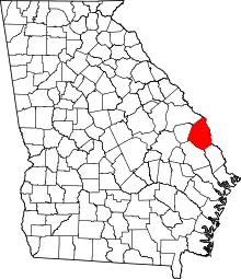 Map of Georgia highlighting Screven County | |
| Towns | ||
| Unincorporated communities | ||
| Ghost town | ||