Niihari Gunga ruins
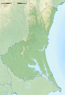
The Niihari Gunga ruins (新治郡衙跡, Niihari Gunga iseki) is an archaeological site with the ruins of a Nara to Heian period government administrative complex located in what is now the city of Chikusei in Ibaraki prefecture in the northern Kantō region of Japan. The site has been protected as a National Historic Site from 1968.[1]
新治郡衙跡 | |
 Niihari Gunga ruins | |
 Niihari Gunga ruins  Niihari Gunga ruins (Japan) | |
| Location | Chikusei, Ibaraki, Japan |
|---|---|
| Region | Kantō region |
| Coordinates | 36°20′30.8″N 140°2′41.3″E |
| Altitude | 27 m (89 ft) |
| Area | 116,615 sq meters |
| History | |
| Founded | 8th century AD |
| Periods | Nara - Heian period |
| Site notes | |
| Public access | No |
Overview
In the late Nara period, after the establishment of a centralized government under the Ritsuryō system and Taika Reforms, local rule over the provinces was standardized under a kokufu (provincial capital), and each province was divided into smaller administrative districts, known as (郡, gun, kōri), composed of 2–20 townships in 715 AD.[3] Each of the units had an administrative complex built on a semi-standardized layout based on contemporary Chinese design.
The Niihari Gunga ruins is located 00 to 300 meters north of the Niihari temple ruins. It was excavated twice, once in 1941 and from 1943 to 1949, and was the first ancient administrative complex to have been excavated in Japan. The ruins cover a 300 square meter area, and contain 52 building ruins in four groups. The northern group had 25 buildings, the western group had nine buildings, the eastern group had 13 building and the southern group had four buildings. Based on the layout, it is estimated that the western group was the actual administrative complex, with a large main hall flanked by side halls in a "U" configuration. The other groups all appear to have been warehouses, with the eastern group mostly granaries for storing tax rice. Each warehouse had a standardized size of 12 by 9 meters, and were arranged in regularly spaced rows of three or four buildings, although there were also a few larger buildings, with dimensions of 44 by 12 meters. The foundations are 20 to 30 centimeters below the current cultivated soil. Many artifacts such as roof tiles, around the periphery, and earthenware shards, roof tile fragments, and iron nails were discovered scattered on the surface. Many of the foundation stones have been lost, or are no longer in their original places.[4]
According to the Nihon Kiryaku, in an entry dated 817 AD, the site was completely destroyed by a fire which originated in its eastern warehouse complex, and which consumed an incredible 9990 koku of grain. This account is supported by a vary large amount of carbonized rice found at the site. The abolition of ancient Niihari County in Hitachi Province is presumed to be due to the fire at this time.[4]
The site was backfilled after excavation, and is now an empty field located about 26 minutes on foot from Shinji Station on the JR East Mito Line.[4]
References
- "新治郡衙跡". Cultural Heritage Online (in Japanese). Agency for Cultural Affairs. Retrieved May 25, 2020.
- 日本国語大辞典,防府市歴史用語集,デジタル大辞泉,世界大百科事典内言及, ブリタニカ国際大百科事典 小項目事典,精選版. "郡衙(ぐんが)とは? 意味や使い方". コトバンク (in Japanese). Retrieved January 24, 2023.
{{cite web}}: CS1 maint: multiple names: authors list (link) - Shively, Donald H.; McCullough, William H. (1999). Cambridge History of Japan vol. II (p.31f.). Cambridge University Press.
- Isomura, Yukio; Sakai, Hideya (2012). (国指定史跡事典) National Historic Site Encyclopedia. 学生社. ISBN 4311750404.(in Japanese)
External links
- Chikusei city official site (in Japanese)
- Ibaraki Prefectural Department of Education (in Japanese)