Norfolk International Airport
Norfolk International Airport (IATA: ORF[2], ICAO: KORF, FAA LID: ORF) is seven miles (11 km) northeast of downtown Norfolk, an independent city in Virginia, United States.[1] It is owned and operated by the Norfolk Airport Authority: a bureau under the municipal government. The airport serves the Hampton Roads metropolitan area of southeast Virginia (along with Newport News/Williamsburg International Airport in Newport News) as well as northeast North Carolina. Despite its name, the airport does not have any international destinations nonstop.[3]
Norfolk International Airport | |||||||||||||||
|---|---|---|---|---|---|---|---|---|---|---|---|---|---|---|---|
 | |||||||||||||||
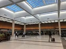
 The Main Departures Building at ORF | |||||||||||||||
| Summary | |||||||||||||||
| Airport type | Public | ||||||||||||||
| Owner | Norfolk Airport Authority | ||||||||||||||
| Operator | Norfolk Airport Authority | ||||||||||||||
| Serves | Hampton Roads, Northeast North Carolina | ||||||||||||||
| Location | Norfolk, Virginia, U.S. | ||||||||||||||
| Operating base for | Breeze Airways | ||||||||||||||
| Elevation AMSL | 26 ft / 8 m | ||||||||||||||
| Coordinates | 36°53′41″N 076°12′04″W | ||||||||||||||
| Website | NorfolkAirport.com | ||||||||||||||
| Maps | |||||||||||||||
 Diagram | |||||||||||||||
| Runways | |||||||||||||||
| |||||||||||||||
| Statistics (2022) | |||||||||||||||
| |||||||||||||||
Source: Norfolk Airport Authority and Federal Aviation Administration[1] | |||||||||||||||
The Federal Aviation Administration (FAA) 2021 categorized it as a medium hub airport.[4]
As of 2021, with a passenger count of 1,658,000 people, Norfolk International was ranked as the 65th-busiest airport in the United States and the third-busiest in Virginia in terms of passengers served annually, behind Dulles International Airport and Reagan National Airport, but just ahead of Richmond International.[4] Delta Air Lines has the largest share of passenger traffic, followed by Southwest Airlines and American Airlines.
History
The airport was first established in 1938 as Norfolk Municipal Airport; from 1942 until 1947 it was run by the United States Army Air Forces. In 1968 its name changed to Norfolk Regional Airport, and in 1976 it was renamed again to the present Norfolk International Airport.[5]
Facilities
The airport covers 1,300 acres (526 ha) at an elevation of 27 feet (8 m). Its main runway, 5–23, is 9,001 by 150 feet (2,744 x 46 m), and crosswind runway 14–32 is 4,875 by 150 feet (1,486 x 46 m).[1][6]


The crosswind runway (14–32) was closed for renovations on December 19, 2009, and reopened in the spring of 2011. The airport's long-term plan calls for this runway to be destroyed to make way for a parallel runway (5R-23L) east of runway 5–23, but the FAA grounded the plan in the summer of 2016 due to diminishing demand, limited space, and environmental impacts.
In 2017 the airport had 67,679 aircraft operations, an average of 185 per day: 39% airline, 27% air taxi, 27% general aviation, and 2% military. In November 2018, 95 aircraft were based at the airport: 52 single-engine, 20 multi-engine, 20 jet, and three helicopters.[1]
General aviation services, or fixed-base operations, are provided by Signature Flight Support with full-service facilities for maintaining and housing private and corporate aircraft. The modern 54,000-square-foot (5,000 m2) terminal facility offers everything from aircraft rental to sightseeing flights and aircraft repair.
Daily scheduled aircraft include ERJ140/145 (United, American,), CRJ200/550/700/900 (Delta, United, American), ERJ170/175/190/195 (American, United, Delta, Breeze), A300 (FedEx), A319/320 (United, Allegiant, American, Frontier, Spirit), B717 (Delta), B737 (Southwest, American, Delta, United), and B757 (UPS and Delta).
FAA control tower
Built in 1995, the FAA Norfolk Air Traffic Control Tower stands 134 feet (41 m) high. Operated and managed by the Federal Aviation Administration, the Norfolk Tower handles about 1,100 aircraft per day, 24 hours per day and 365 days per year. Radar coverage is provided by the ASR-9 terminal system with a six-level weather detection capability. Also available for use is an Enhanced Target Generator (ETG) lab with two radar scopes to accomplish training objectives, as well as the IDS4 system, a specialized microcomputer network system designed to distribute and display both static and real-time data regarding weather and other rapidly changing critical information to air traffic controllers.
Gates
Norfolk International Airport has two passenger concourses: Concourse A (gates A1-A11), and Concourse B (gates B16-B30). American Airlines and Southwest Airlines occupy Concourse A while Allegiant Air, Delta Airlines, Frontier Airlines, and United Airlines occupy Concourse B. International flights are handled at gate A1; however, there are currently no scheduled international flights. Specific gate locations are the following: American A2, A4, A6-A11, Delta B21-B25, Southwest A3 and A5, United B27-B30, with Allegiant and Frontier using common gates of B16, B17, B18, B20. Concourse B gates B22 and B26 are no longer in use and have been converted into passenger seating areas for B21 and B25.
Cargo yard
About 70 million pounds of air cargo are shipped in and out of Norfolk International Airport each year.[7] NIA houses one of the most modern and efficient air cargo facilities in the state. Its two modern air cargo terminals have 88,000 square feet (8,200 m2) of space. A ramp provides direct access from the plane to the warehouse.
Airlines and destinations
Passenger
| Destinations map |
|---|
 Norfolk Destinations from Norfolk International Airport Red = Year-round destination Green = Seasonal destination Blue = Future destination |
Cargo
| Airlines | Destinations |
|---|---|
| FedEx Express | Atlanta, Charlotte, Indianapolis, Manteo, Memphis, Newark, Richmond |
| UPS Airlines | Columbia (SC), Louisville, Raleigh/Durham, Richmond |
| Cargo destinations map |
|---|
Cargo destinations from Norfolk International Airport |
Statistics
Airline market share
| Carrier | Passengers (arriving and departing) |
|---|---|
| Delta | 780,000(17.96%) |
| American | 698,000(16.08%) |
| Southwest | 698,000(16.07%) |
| United | 474,000(10.91%) |
| Republic Airways | 384,000(8.85%) |
| Other | 1,308,000(30.12%) |
Top destinations
| Rank | City | Passengers | Carriers |
|---|---|---|---|
| 1 | 384,000 | Delta | |
| 2 | 239,000 | American | |
| 3 | 183,000 | Southwest | |
| 4 | 127,000 | American | |
| 5 | 126,000 | American, United | |
| 6 | 119,000 | American, Delta | |
| 7 | 99,000 | United | |
| 8 | 98,000 | American, Delta | |
| 9 | 83,000 | Southwest | |
| 10 | 75,000 | United |
Annual traffic
| Year | Passengers | Year | Passengers | ||
|---|---|---|---|---|---|
| 2002 | 3,464,246 | 2012 | 3,299,712 | 2022 | 4,115,537 |
| 2003 | 3,436,391 | 2013 | 3,112,355 | ||
| 2004 | 3,778,216 | 2014 | 2,965,306 | ||
| 2005 | 3,884,422 | 2015 | 3,034,407 | ||
| 2006 | 3,703,664 | 2016 | 3,209,185 | ||
| 2007 | 3,714,323 | 2017 | 3,380,902 | ||
| 2008 | 3,549,204 | 2018 | 3,663,996 | ||
| 2009 | 3,409,456 | 2019 | 3,981,139 | ||
| 2010 | 3,332,466 | 2020 | 1,785,135 | ||
| 2011 | 3,193,388 | 2021 | 3,311,121 | ||
Ground transportation
There are no bus or shuttle services to and from Norfolk International Airport. The nearest bus (HRT Route 15) connection is 1.5 miles (2.4 km) away at the intersection of Military Highway (Route 165) and Norview Avenue (Route 247).[22]
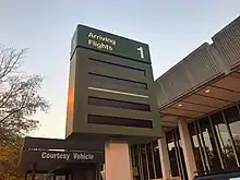
All ground transportation services are located in the arrivals terminal. There are several on-site rental car companies, an authorized shuttle service providing door-to-door service to the entire Hampton Roads area, and taxis available through several companies. Both Uber and Lyft service the airport through an agreement with the airport authority.
Parking

A nine-level parking garage adjacent to the new arrivals terminal opened in July 2002. It provides 2,800 covered spaces for short-term, long-term, and rental parking. Overall, NIA parking facilities can accommodate 7,000 vehicles.[23] In February 2019, the airport announced it would begin construction of a brand new 1.09 million square foot parking garage. Construction started in July 2019. This new parking garage will consolidate all parking lots at ORF. It will also replace the employee shuttle that costs over $600,000 a year to operate.[24]
Accidents and incidents
- On January 19, 1967, a United Airlines Vickers 754D Viscount collided with a snow plow that had entered the runway in the path of the United plane upon landing. All 50 passengers and crew on board the aircraft survived; the aircraft suffered major damage to its airframe and was written off.[25]
- On September 1, 1974 a Martin 4-0-4 which was sitting empty on the ramp caught fire, damaging the airframe beyond repair. The cause of the fire was never determined.[26]
References
- FAA Airport Form 5010 for ORF PDF. Federal Aviation Administration. effective August 11, 2022.
- "IATA Airport Code Search (ORF: Norfolk / International)". International Air Transport Association. Retrieved December 31, 2012.
- "Where We Fly". Norfolk International Airport. Retrieved July 12, 2022.
- "CY 2021 Commercial Service Airports, Rank Order" (PDF). Federal Aviation Administration. September 16, 2022. Retrieved January 20, 2023.
- Norfolk Airport Authority. "Mission & History". Norfolk International Airport. Retrieved August 3, 2022.
- "ORF airport data at skyvector.com". skyvector.com. Retrieved September 1, 2022.
- "Press Room". Norfolk International Airport. Archived from the original on January 17, 2012.
- "Allegiant Air". Archived from the original on February 24, 2011. Retrieved January 7, 2017.
- "Flight schedules and notifications". Retrieved January 7, 2017.
- "Breeze Airways adds seasonal and new routes from Fort Myers". FOX 4 Southwest Florida. July 18, 2023. Retrieved July 18, 2023.
- "Breeze Home Page". Retrieved May 21, 2021.
- "FLIGHT SCHEDULES". Retrieved January 7, 2017.
- "Frontier". Retrieved January 7, 2017.
- "Check Flight Schedules". Retrieved January 7, 2017.
- "Spirit Airlines April 2024 Network Additions – 16OCT23". Aeroroutes. Retrieved October 17, 2023.
- "Spirit Airlines Nov 2023 Florida Network Expansion". Aeroroutes. Retrieved September 6, 2023.
- "New Spirit Service". Retrieved October 4, 2022.
- "Timetable". Archived from the original on January 28, 2017. Retrieved January 7, 2017.
- "Norfolk, VA: Norfolk International (ORF)". Bureau of Transportation Statistics (BTS), Research and Innovative Technology Administration (RITA), U.S. Department of Transportation. September 16, 2023.
- "Passenger Boarding (Enplanement) and All-Cargo Data for U.S. Airports – Airports 2015". www.faa.gov. Retrieved March 5, 2017.
- "Passenger Boarding (Enplanement) and All-Cargo Data for U.S. Airports - Previous Years – Airports Previous Years". www.faa.gov. Retrieved March 5, 2017.
- "Distance from airport to intersection of Route 165 & Route 247". Google Maps.
- "Norfolk Airport, ACS and MasterCard Worldwide Introduce Contactless Payments to Airport Parking". MasterCard.com. June 8, 2009.
- "New Parking Garage coming to Norfolk International". WKTR. March 7, 2019.
- Accident description for N7431 at the Aviation Safety Network. Retrieved on November 19, 2018.
- Accident description for N40427 at the Aviation Safety Network. Retrieved on November 19, 2018.
 This article incorporates public domain material from the Air Force Historical Research Agency.
External links
- Official website

- FAA Airport Diagram (PDF), effective October 5, 2023
- FAA Terminal Procedures for ORF, effective October 5, 2023
- Resources for this airport:
- AirNav airport information for KORF
- ASN accident history for ORF
- FlightAware airport information and live flight tracker
- NOAA/NWS weather observations: current, past three days
- SkyVector aeronautical chart for KORF
- FAA current ORF delay information
- Live webcam image from WAVY-TV
- Airport pictures
.jpg.webp)

.jpg.webp)