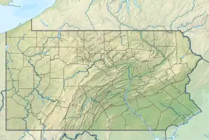
North Branch Neshaminy Creek
North Branch Neshaminy Creek is one of two main branches of the Neshaminy Creek, the other being the West Branch. Rising in Plumstead Township, Bucks County, Pennsylvania, passing through the Peace Valley Park as Lake Galena, then meeting with the West Branch forming the main branch of the Neshaminy.[1]
| North Branch Neshaminy Creek | |
|---|---|
 North Branch Neshaminy Creek | |
| Location | |
| Country | United States |
| State | Pennsylvania |
| County | Bucks |
| Township | New Britain Plumstead |
| Borough | Chalfont |
| Physical characteristics | |
| Source | |
| • coordinates | 40°23′20″N 75°6′13″W |
| • elevation | 400 feet (120 m) |
| Mouth | |
• coordinates | 40°16′56″N 75°12′16″W |
• elevation | 239 feet (73 m) |
| Length | 10.8 miles (17.4 km) |
| Basin size | 31.6 square miles (82 km2) |
| Basin features | |
| Progression | North Branch Neshaminy Creek → Neshaminy Creek → Delaware River → Delaware Bay |
| River system | Delaware River |
| Waterbodies | Peace Valley Reservoir |
| Slope | 14.91 feet per mile (2.824 m/km) |
Statistics
The West Branch has a watershed of 31.60 square miles (81.8 km2) and is part of the Delaware River watershed. The Geographic Name Information System I.D. is 1182546,[2] U.S. Department of the Interior Geological Survey I.D. is 02789.[3]
Course
The North Branch of the Neshaminy Creek rises in Plumstead Township east of Pennsylvania Route 413 north of the village of Gardenville, it flows southwest passing through Lake Galena in Peace Valley Park. Then it turns south to meet with the main branch of the Neshaminy.[4]
Named Tributaries
- Pine Run
Municipalities
Crossings and Bridges
| Crossing | NBI Number | Length | Lanes | Spans | Material/Design | Built | Reconstructed | Latitude | Longitude |
|---|---|---|---|---|---|---|---|---|---|
| Pennsylvania Route 413 (Durham Road) | 7036 | 7 metres (23 ft) | 2 | 1 | Concrete Tee Beam | 1931 | - | 40°22'59"N | 75°6'44.14"W |
| Valley Park Road | 7541 | 10 metres (33 ft) | 2 | 1 | Concrete Tee Beam | 1924 | - | 40°22'29.7"N | 75°7'29.4"W |
| Old Easton Road | 48065 | 9.8 metres (32 ft) | - | - | Concrete Tee Beam, Concrete Cast-in-Place Decking, Bituminous surface | 1922 | - | 40°21'55"N | 75°8'20"W |
| Pennsylvania Route 611 (Easton Road) | 7063 | 7 metres (23 ft) | 2 | 1 | Concrete Tee Beam | 1939 | - | 40°21'46.4"N | 75°8'33.55"W |
| Silo Hill Road | 7535 | 22 metres (72 ft) | 1 | 1 | Steel Truss Through | 1902 | 1934 | 40°21'36"N | 75°8'4939"W |
| Gayman Road | 7527 | 18 metres (59 ft) | 1 | 1 | Steel Truss Through | - | 1934 | 40°21'16.5"N | 75°9'13.7"W |
| Pennsylvania Route 313 (Swamp Road) | 7114 | 49 metres (161 ft) | 2 | 2 | Steel Stringer/Multi-beam or Girder | 1970 | - | 40°17'28.4"N | 75°12'21.26"W |
| North Chapman Road bike trail | 7512 | 31 metres (102 ft) | 1 | 1 | Steel Stringer/Multi-beam or Girder | 1991 | - | 40°20'18"N | 75°10'12"W |
| Peace Valley Reservoir Dam | - | - | - | - | earthen dam | 1974 | - | - | - |
| Callowhill Road | 44413 | 22 metres (72 ft) | 2 | 1 | Prestressed Concrete Box Beam or Girders - Single or Spread | 2005 | - | 40°18'44"N | 75°12'26.93"W |
| Creek Road | 7546 | 20 metres (66 ft) | 2 | 1 | Prestressed concrete Box Beam or Girders - Multiple | 1985 | - | 40°18'18"N | 75°12'42"W |
| Park Avenue | 7114 | 49 metres (161 ft) | 2 | 2 | Steel Stringer/Multi-beam or Girder | 1970 | - | 40°17'28.4"N | 75°12'21.26"W |
| East Butler Avenue | 6915 | 42 metres (138 ft) | 2 | 3 | Concrete Tee Beam | 1948 | - | 40°17'16.4"N | 75°12'19.59"W |
See also
References
- MacReynolds, George, Place Names in Bucks County, Pennsylvania, Doylestown, Bucks County Historical Society, Doylestown, PA, 1942, P256.
- "Domestic Names | U.S. Geological Survey".
- http://www.lycoming.edu/cwi/pdfs/paGazetterOfStreams.pdf, page 104
- "North Branch Neshaminy Creek · Pennsylvania".
- "National Bridge Inventory Database Search". www.nationalbridges.com. Archived from the original on 31 October 2013. Retrieved 7 April 2018.
- Listing at BridgeHunter.com